LoJ: #595 (Pre-LiDAR #603) / 13,064' Mount Owen

Peak Summary
Mount Owen is a Class 2 ascent with a trailhead accessible to most cross-over type vehicles or SUV's. Those in passenger cars can also access the trail, but will need to park farther back. This summit offers a chance to see some of the terrain above Crested Butte. The climb has become complicated in recent years by private property issues that have, as of summer 2019, closed down the easiest and most direct access to this summit. The route we provide here is a partial revision of how we climbed this summit. Lidar added 6 feet of elevation.
Mount Owen South Face Route
-
-
Lake Irwin TH
From CO135 on the east side of Crested Butte, turn west onto Whiterock Ave. and drive west through town. This street becomes CR12. It's a paved road for several miles as it climbs west out of town, then turns to good quality, graded gravel, then returns to paved again, shortly before the turnoff for Lake Irwin. That turnoff will come in a large, open meadow area and about a half mile east of the summit of Kebler Pass. Turn right onto FR826, at a signed intersection that will indicate Lake Irwin is two miles north, up the road. Almost immediately, a road veers off to the right, though it could get you there, we recommend staying left and continuing on CR12E to the lake. It's about 9 miles from town. Drive to Lake Irvin on a graded, gravel road, passable to passenger cars. The road comes to a parking area with a vault toilet and half a dozen picnic tables lower down. From there, passenger cars may continue by driving across the spillway dam. Go on past the entrance to the campground. Drive uphill, veering right at another junction and continue to an open, flat ridge and another intersection with some cabins. Go right and follow the road down through a couple switchbacks and down to cross the drainage. Then continue following the road as it begins to climb up, now heading in a SE direction. Where the road begins to make this upward climb is where some lower clearance passenger vehicles may encounter some rough spots and rocks. This road continues SE to a switchback, then turns nearly north and continues to climb steadily. Soon, the road terminates at an old lodge, no longer in use. Parking right at the lodge is not permitted. You must park farther back down the road, then hike up to the lodge to locate the trailhead on the west side of the lodge. On the last segment of road after the switchback, you will see pull-offs for parking.
A word of explanation: Most of the land above Lake Irwin on this west side and above the campground is privately owned. We visited here in the summer of 2019. There was a man who patrolled the area on an ATV who would stop hikers who appeared to be heading onto the private land and politely inform them that they could not utilize certain roads. He was also polite enough to direct hikers to where they could go and park and those are the directions we are providing here. The man informed us that the land holders and the Forest Service were presently in negotiations regarding access for hikers, bikers, etc., to this area. Since such negotiations can take up to years, this information may or may not be outdated. If you visit this area and find a different situation, please advise us so we can update here on the website. The map we provide should help ascertain how to get to the trailhead.
Camping
Once you turn off from CR12 and along the two mile drive to lake Irwin, there are a couple at-large, primitive sites off the road. At the lake, there is a sizable, National Forest campground. It has both vault toilets and potable water, firewood & trash. Some of the sites may be reserved in advance, others are first-come, first-served. There are 32 sits and just outside the campground, there are a couple other spots where you may be able to set up, but do so at your own risk of being run off. Here is a link to the Gunnison NF website and this particular campground: https://www.fs.usda.gov/recarea/gmug/recarea/?recid=33340.
Campsite Locations
Lake Irwin › N 38° 52' 47.09", W 107° 06' 25.88"Elevation 10,360 ft.
Click thumbnail to view full-size photo + captionRoute Description
Year Climbed: 2009Note: We hiked Mount Owen in 2009. Back at that time, we were able to access the peak from the west side of Lake Irwin via a 4WD road that faded to trail on a bench area below Owen, Ruby and Green Lake. From there, it was easy enough to hike up to Green Lake and then ascend the south face of Owen. Private property issues have closed that access for now, so the following route suggested has not been "fully" hiked by us. The segment from the suggested trailhead up to Pt 12,212, we hiked in 2019. The segment from Green Lake to the summit of Owen and then on to Ruby we hiked in 2009. The section from Pt. 12,212 that follows the ridge west, then turns south dropping into a basin and contouring across that basin, we have not hiked. It's possible there may be private property issues in that area as well. So follow these directions at your own risk. We do have good photos that offer assurance that this route does not have any insurmountable obstacles to overcome.
Another Note: The round-trip mileage and elevation gain assume making the trip over to Ruby Peak. If you don't hike over to Ruby, then the elevation gain can be reduced by a round figure of 400 vertical feet and mileage can be reduced by at least one mile, which is the length of the traverse over to Ruby from Owen.
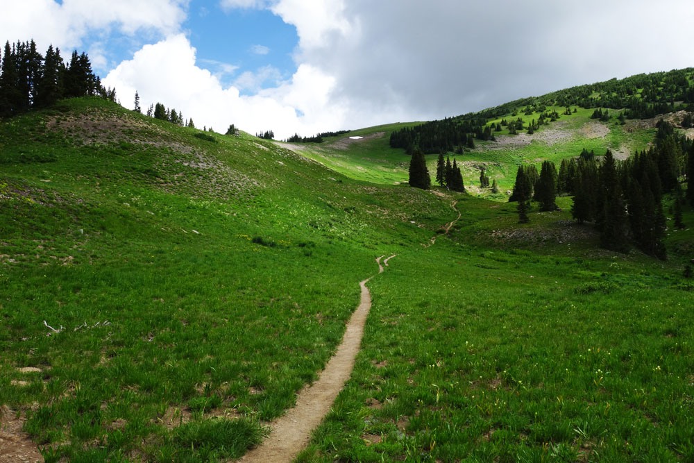
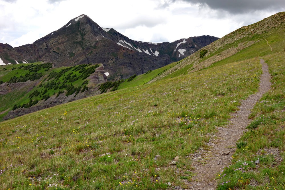
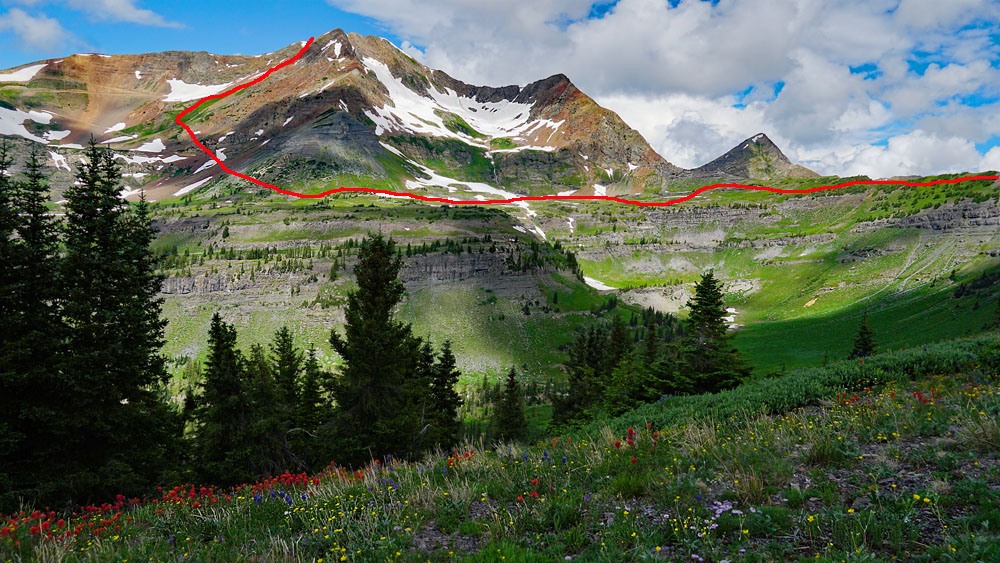
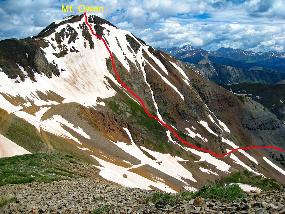
From where vehicles are allowed to park on the road below the old lodge, walk up the road to the lodge and locate the trailhead for #9421 and #9419. The trailhead serves both. #9421 will split off from the other in a fairly short distance. Stay with the left fork. The trail basically climbs through open forest, then open meadow terrain of grass & tundra to a high ridge just above 12,000 feet that overlooks Peeler Basin. The trail is easy to follow and sees quite a few hikers on weekends. Follow this trail all the way to Pt. 12,212. From there, continue making a wide semi-circle following the ridge generally west around the head of Robinson Basin. After Pt. 12,212, there is no definitive trail other than some faint game/usage paths. As the ridge begins to flatten out at the NNW end of Robinson Basin, watch for an old road/trail that leads down onto the shelf that lies above the west end of the basin. Drop south to about 11,500 feet and intersect a couple of old roads. Cross the first road, and then drop a little more downhill to a second old mining road. Turn west onto that road and follow it over to above Green Lake as it gains some elevation. At about 11,775 ft. watch for a tundra slope that heads toward the summit ridge of Owen. For about 600 vertical feet, you can hike steeply up mostly sparse tundra. Eventually it gives way to a talus/scree mix. Utilize either of two gullies on either side or stay on more rocky terrain to reach the summit ridge. Pick your poison.
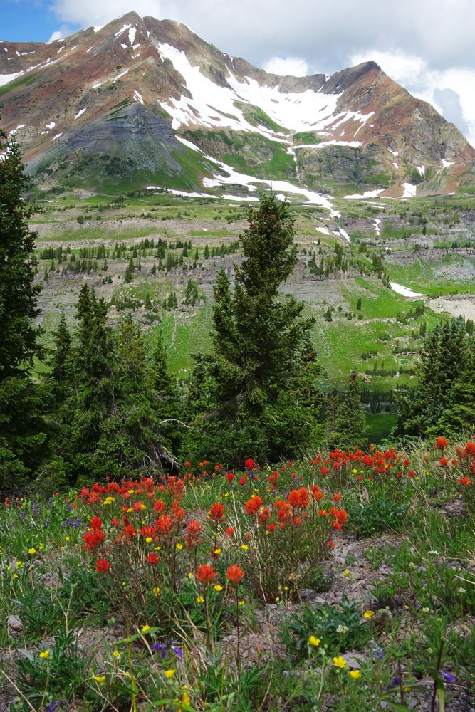
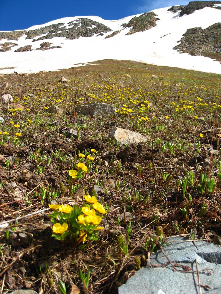
When we hiked up from Green Lake this way, the tundra slope had a nice display of Old-Man-of-the-Mountain, Alpine Poppies and Buttercups. After just a couple hundred feet of gain, we reached snow and put on crampons to continue up one of the gullies. The snow then played out before reaching the summit ridge, so then we had to remove crampons. This part of the ascent could probably have been done without the crampons if you find it snow-covered, but they sure offered a sense of security. If nothing else, some micro-spikes may help and certainly an ice axe.
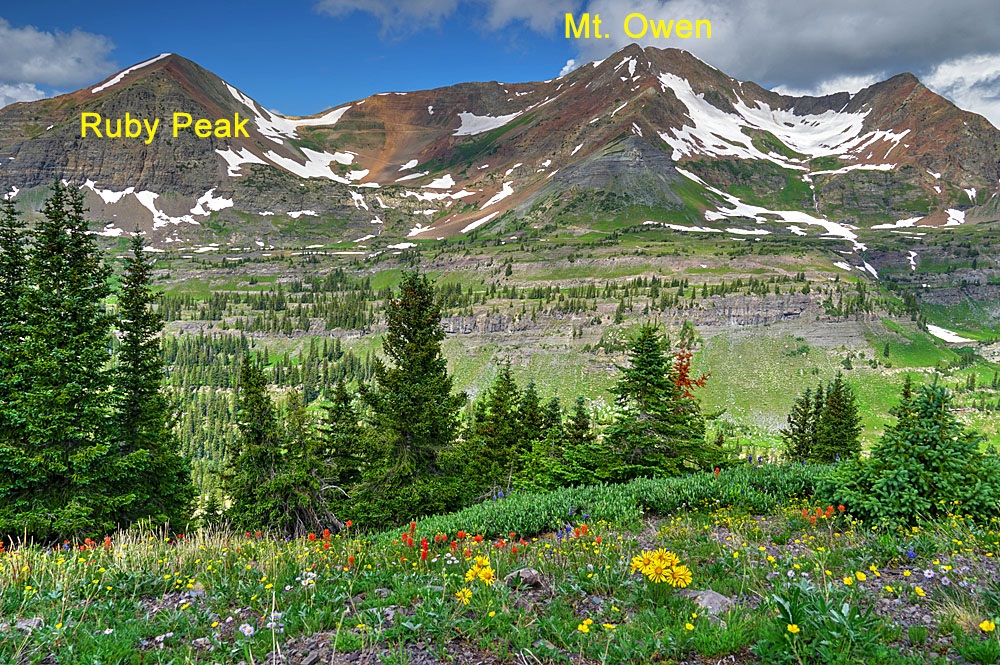
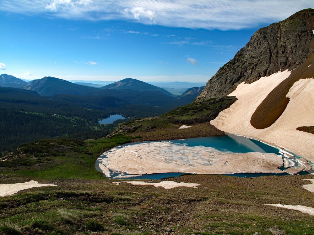
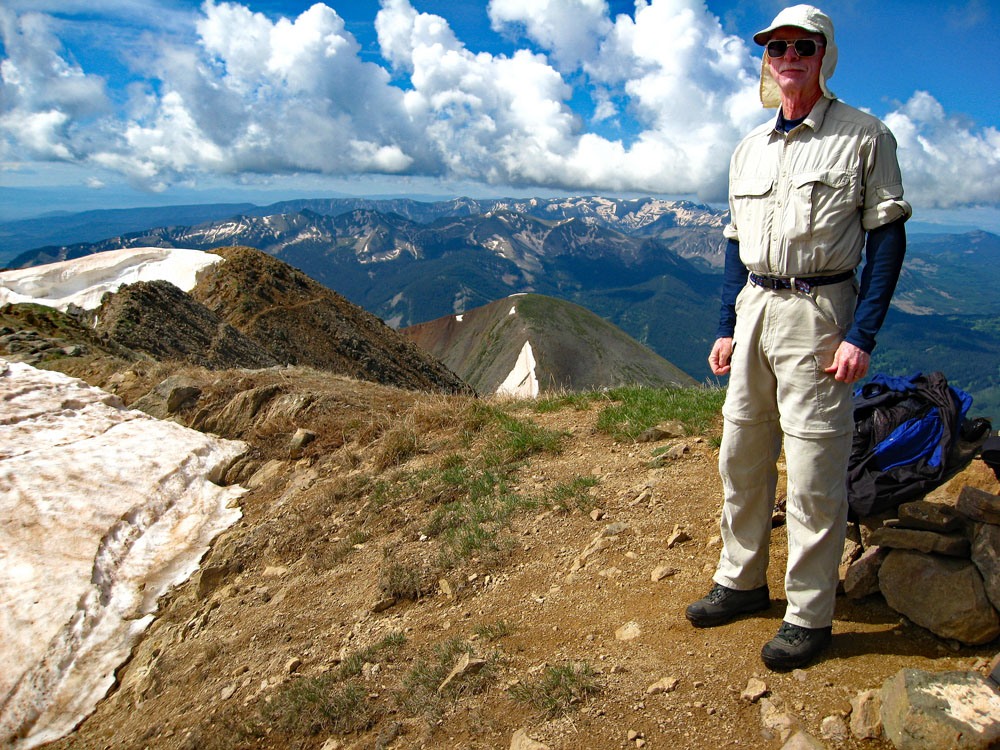
Once you gain the summit ridge, follow it north to the true summit on broken rock and scree. It's still all Class 2. From this summit, there are excellent views of the Ruby Range close to the north, the Elk Mountains farther in the distance, and even the West Elks. This is the only 13er located in this area so enjoy the unique perspective.
Bonus Points: For those who would like to include Ruby Peak, the hike along the ridge presents no difficulties. It is a tundra and rock mix and consist mostly of easy walking. Near the saddle, we found some fresh bear scat. The mile long traverse can be made easily in well under an hour. Enjoy more excellent views of Lake Irwin far below and all the surrounding terrain. From Ruby, walk back down to the Owen/Ruby saddle, then drop east toward Green Lake on mostly scree & rubble. No need to follow the old mining road that makes some long switchbacks. Just drop to that section of road that will lead back to where you began the tundra slope ascent up to Owen. From there, simply reverse route all the way back to the trailhead, which will involved some additional elevation gain to get back to the ridge that leads back to Pt. 12,212.
Additional BETA
Links to other information, routes & trip reports for this peak that may be helpful. -