LoJ: #622 (Pre-LiDAR #630) / 13,026' UN 13026 Formerly UN 13015

Peak Summary
UN 13,026 (formerly UN 13015) is a Class 2 summit that requires a fairly lengthy approach hike that goes up Cochetopa Creek on a portion of the Continental Divide/Colorado Trail, then heads up Canon Diablo. Passenger vehicles, carefully driven can get you to the trailhead, but you'll be driving on nearly 30 miles dirt roads to reach it. We advise crossover type vehicles with better ground clearance to access the trailhead. UN 13,026 is sequenced with UN 13,408, (formerly UN 13402) which sits across the valley to round out a long day of hiking. Much of the forest in this area has been devastated by beetle-kill. By now (2022), expect some major bushwhacking. Lidar added 11 feet in elevation to this summit.
UN 13,026 East Flank-NE Ridge Route
-
-
Eddiesville South - Cochetopa Ck TH
The Eddiesville South - Cochetopa Ck. Trailhead is accessible by driving on many miles of Forest Service maintained gravel roads. As such, any number of basic, passenger type vehicles may be able to access this trailhead, but sometimes road damage from rains, ruts and runoff can create a hazard for lower clearance vehicles, therefore we recommend that this trailhead is best accessed by crossover style vehicles that have a little more clearance.
The most straightforward access to the Eddiesville South TH is from State Highway 114, which turns south from US 50, 7.5 miles east of Gunnison. The route to the TH is the same as for Stewart Creek. SH114 connects to the town of Saguache in the San Luis Valley by way of what is now called "North Pass." If coming from US 50, drive 20 miles south on SH114 and turn right onto NN14, aka: BLM 3083. If coming from Saguache and North Pass, the intersection is about 7.5 miles down from the pass. Once onto NN14, drive seven more miles on a well-maintained gravel road to the southernmost end of the two Dome Lakes and make a right turn at the end of the lake. Measure mileage from here. This will be CR2166, (aka: BLM 3086 or 15Gg). The gravel road circles the end of the lake, turns back north and goes one mile on the west side of the lake where you'll make a left turn to continue on CR2166. At about 4.2 miles, stay right. The road designation technically becomes 14Dd, but is still CR2166. Between miles 6 & 7, enter Forest Service land. The road designation becomes FS794 and the road condition deteriorates some. Remain on FS794 all the way to the Stewart Creek TH. Total mileage is just under 21. The Eddiesville TH is just under a half mile east of the Stewart Creek TH on the same road. There's a vault toilet here. The road makes a sharp turn to the right, then heads south a short distance to it's end at the boundary for the private ranch with limited parking available. The Continental Divide Trail #465 takes off to the SW initially to avoid crossing onto private property, then heads more south, skirting the ranch property for a mile and a half. Please be respectful of the private property.
In some older source books, one access to Stewart Creek/Eddiesville took you to the Old Agency station utilizing FS788 & 790. The route described above goes faster with less confusion. If you need more detail for access to this area, consult either of Roach's book on the 14ers or the high 13ers.
Camping
We managed to sleep in our truck at the trailhead, but you are right by a private ranch. Best to "camp" just back up the road at the Eddiesville TH.
Click thumbnail to view full-size photo + captionRoute Description
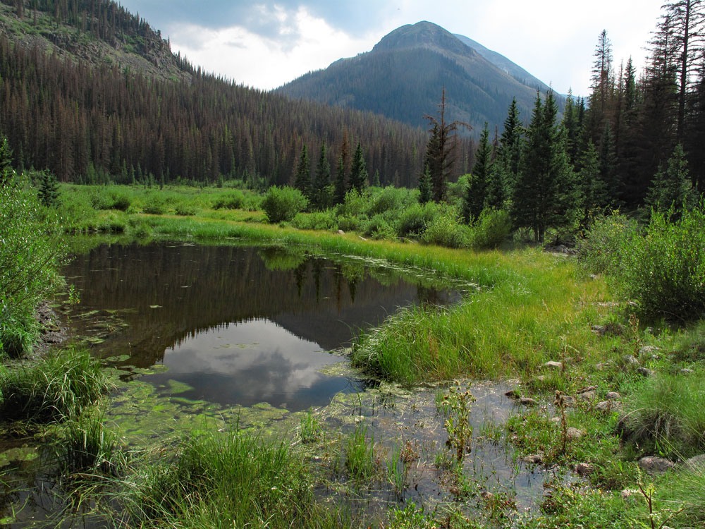
Year Climbed: 2012The trail #465 heads SW from the parking area, then turns more to the south to skirt the private ranch. The first 4.25 miles of trail are uneventful. The actual trail skirts around a private ranch with plenty of cattle, following on the west side of the fence line and near the forest for over a mile before reaching the other end of the property and moving closer to the creek. At one point, some of the cattle seemed to be following us, perhaps expecting some feed. That was about the most excitement we encountered along this stretch and for the next three miles to our departure from the main trail. This first 4.25 miles is actually a portion of the Colorado Trail and Continental Divide Trail you can also obtain good info on the trial by going to either website.
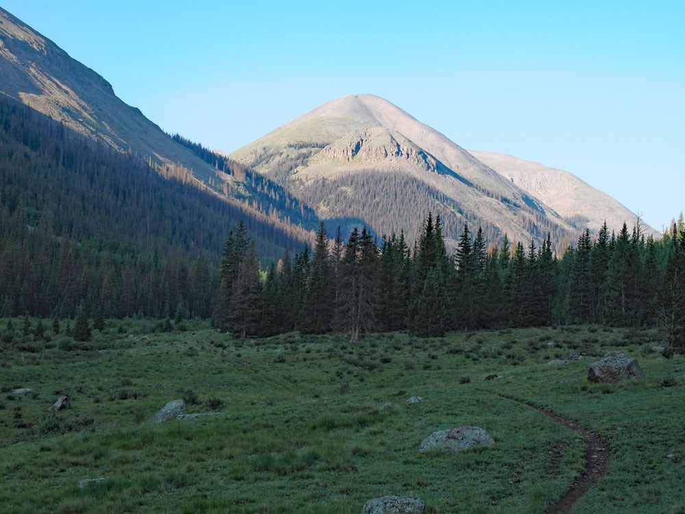
Those early miles go quickly. In 1:30 we were turning off the trail where directed by a friend who had been here several weeks earlier, but not before having gone about 5 minutes too far and having to turn back. In the 4.25 miles, the trail gains no more than about 400 feet in elevation, and stays on the west side of the creek, usually hugging the forest edge. Some camping is available. After the trail turns more to the south, about 2.5 miles in, you will begin to have a view of 13,026, but not of the true summit. We initially crossed Cochetopa Creek at about the place where the open valley pinches down to forest and the creek enters a small gorge. We had to remove boots and wade across and then dry the feet and put our boots back on, so that consumed some time. Approximate coordinates for this crossing are: N 37° 59' 01.24" W 106° 51' 00.89". Once across, follow a faint path that contours up through the dying forest, leading into Canon Diablo. So many trees were dying off here from beetle kill, that the infrequently used trail, a relic from earlier days, was completed covered with the rust covered needles of hundreds, if not thousands of trees that were shedding them in 2012. The trail is difficult to follow at times, but we found enough signs to keep us basically on track. At least, this part of the hike was on a softer cushion instead of scree or rubble. By now (2023) this route is probably obscured with low-growth vegetation filling in among all the dead trees. Expect a bushwhack.
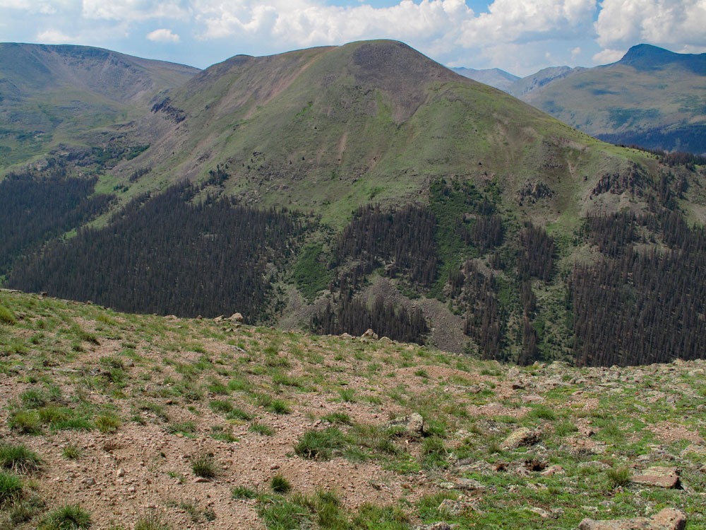
Hike up Canon Diablo, staying on the east side of the creek for about 45 minutes of hiking. The best place to begin an ascent of UN 13,026 is to cross the creek and head for an avalanche gully that climbs steeply toward a somewhat level NE shoulder of the peak at about 12,000 ft. The place where we crossed the creek was about equal distance between the words Canon & Diablo on the survey map. There's more than one chute to choose from on the east face of the peak. The ascent up the chute we used was uneventful. It was mostly open, grassy, steep and climbed for just over 1,000 ft. Once we hit the NE ridge, which was really more of a broad shoulder of the mountain, we continued hiking on more tundra-like terrain and started getting into some rock, but the overall slope was fairly gentle, and we made good time hiking up to the broad and nearly flat summit. It took us 3:30 from the TH to reach this summit.
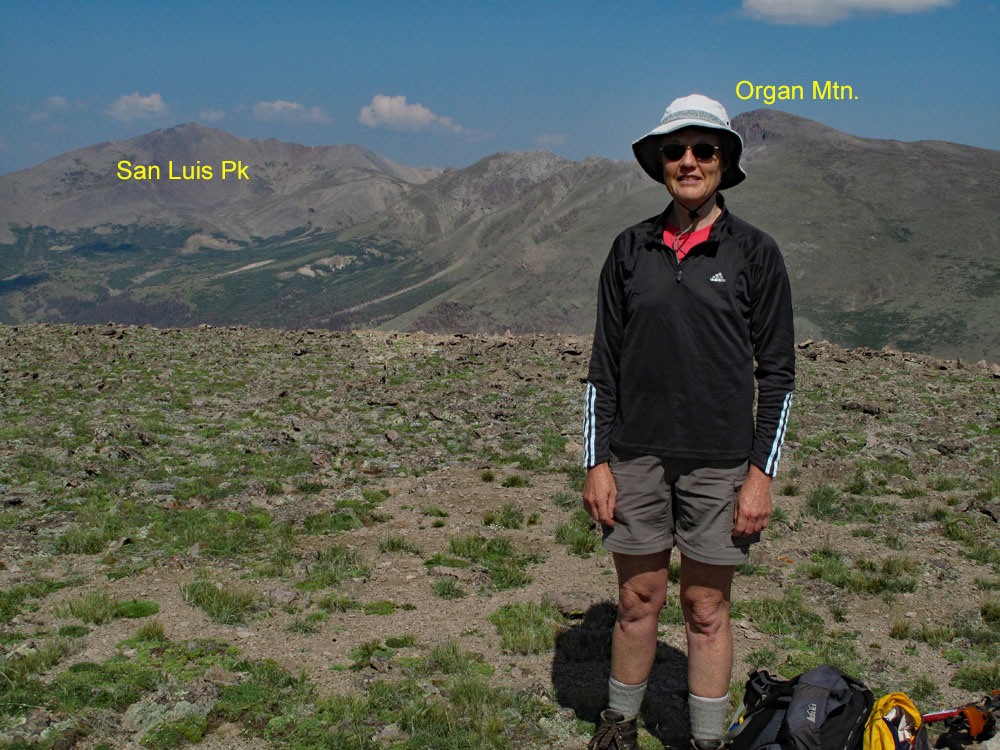
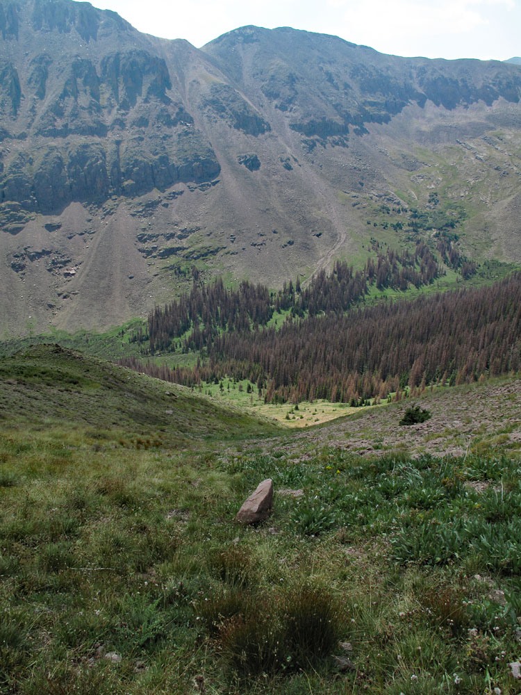
We found a summit register on this peak and signed in and spent a good half hour refueling before moving on. We have sequenced UN 13,026 with UN 13,408, which lies directly southeast across the valley (Canon Diablo). If you wish to continue on to UN 13,408, the question will be whether to walk the entire ridge, first to the SW, then to the SSE, then back to the NE to reach UN 13,408, or to drop into Canon Diablo, losing about 1,500 feet, then having to regain 1,900 feet elevation on rugged terrain. We chose to make the drop and climb back up. See UN 13,408 for the route.
Additional BETA
Links to other information, routes & trip reports for this peak that may be helpful. -