LoJ: #604 (Pre-LiDAR #613) / 13,058' "West Partner Peak" Formerly UN 13041 A
Peak Summary
West Partner Peak (formerly 13, 041) is a mostly Class 2 ascent with a little bit of easy Class 3 boulder/rock scrambling near the summit. The trailhead, located near the town of Vail is easily accessible to any passenger car. Done alone, the peak can be completed in a single day, or even if paired with East Partner, however, a backpack trip up along Pitkin Creek to Pitkin Lake and establishing a base camp can provide access to a total of six, 13er summits in the Gore Range and allow more time to enjoy a beautiful Gore Range setting. Lidar added 17 feet of elevation to this summit.
West Partner SE Face & Ridge Route

-
-
Pitkin Lake TH - Gore Range
Whether coming from the west or east on I-70, take Exit #180 off of I-70, about 4 miles east of the main Vail town exit. Proceed to the north side of the interstate and turn east (right) onto Fall Line Drive. Drive just a short distance past some condo units on your left, cross Pitkin Creek and find a very small trailhead parking area immediately after crossing the creek. Just a few yards further is a cul-de-sac and another condo unit. Do not park there. The trailhead parking offers a total of 10 slots. Obviously, these will fill on weekends. If you can't find a parking spot, try going back to the Exit 180 interchange and drive south on Big Horn Road then SE and there's a parking lot just past the interchange you may be able to use. From there, you'll have to walk back to the trailhead.
Camping
The nearest campground is the Gore Creek Campground, a National Forest Service fee area with vault toilets and water. To get there from the Exit #180, you'll need to drive SE on Big Horn Road past the trailhead parking for the Deluge Lake and Gore Creek TH. Reservations may be made for campsites at reserveamerica.com. Other than that, there is virtually no other place close by with at-large/primitive camping. Your best bet may be to go up to the summit of Vail Pass and drive down the Black Lakes Road where there is a pullout parking area right where the road is barred from vehicular traffic and becomes the Vail Pass bike trail, east end. This is not a primitive camp location but you may be able to sleep in your vehicle.
Campsite Locations
Gore Creek Campground › N 39° 37' 37.14", W 106° 16' 26.33"Fee required. 8750 elevation. Lots of interstate traffic noise.
-
From Pitkin Lake - Gore Range TH via Pitkin Lake
The small parking area for the Pitkin Lake Trail has a sign warning about a 2-day parking limit. If planning on being there longer, call the Vail Police Department - Enforcement Division and ask for permission to park there longer. Be prepared to provide license plate and vehicle description.
The trail begins by ascending gently along the east side of the stream, then crossing on a sturdy bridge. A short distance farther on, it abruptly begins an incredibly steep ascent with well-positioned logs to reduce runoff and provide steps for the arduous climb with full packs. For the next half mile, you might as well be climbing a mountain, but after that, the trail begins to level off, still maintaining some distance from and above the creek. Overall, this trail is in fairly good condition and after the initial section was not too arduous.
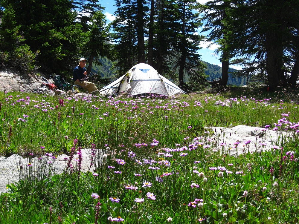
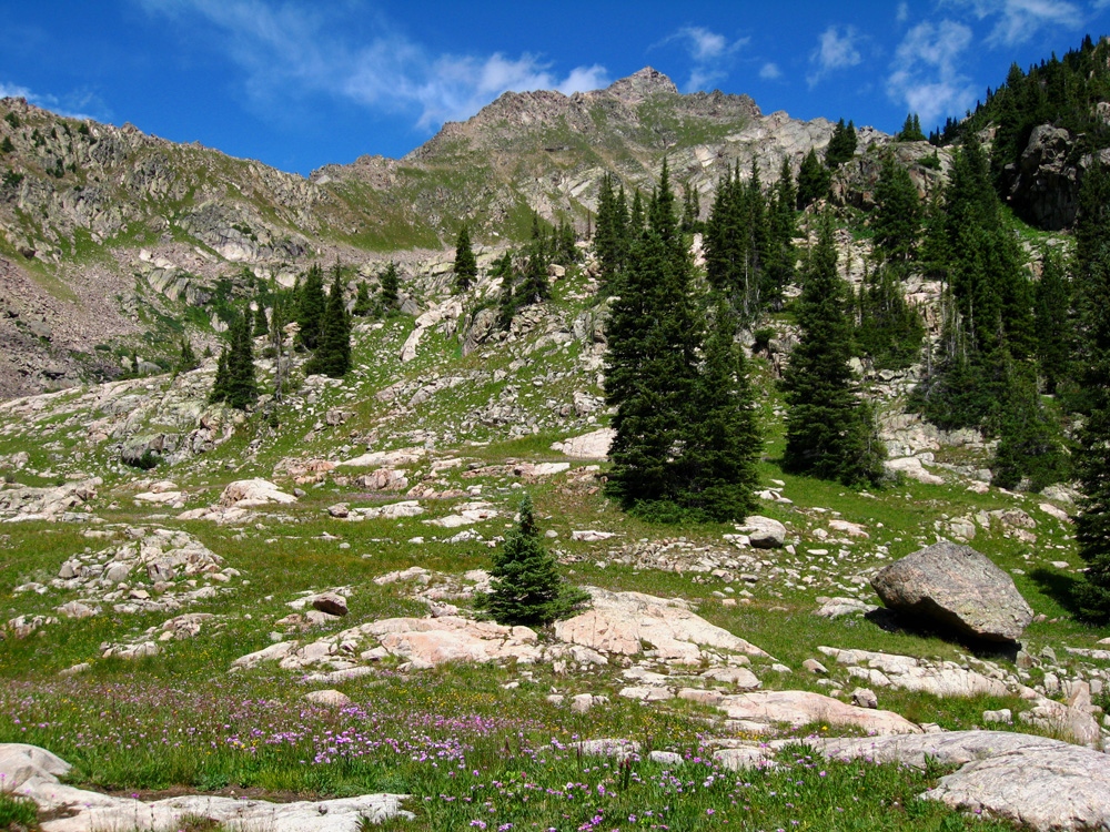
After about two miles up, the trail comes right beside the creek. After the section near the creek, the trail remains very moderate until it crosses an open meadow and then begins climbing up to another bench level. At about 3.75 miles in the trail crosses the west fork of Pitkin Creek and there is a large campsite past that crossing. In 2010, the campsite was not well-used. It's a short distance before the trail makes a left turn to begin a steep ascent out of the valley to Pitkin Lake. We are calling this the "lower campsite." It can be used as a base camp for Mt. Solitude, Peaks X and Z. The waterfall shown on the map is somewhat obscured from here.
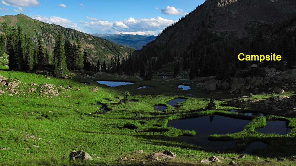
After passing the campsite, the trail begins climbing steeply for about 1/3 mile before leveling off in the upper valley that leads to Pitkin Lake. We arrived in the vicinity of the lake in about three hours from the trailhead. We found a very nice site 100 yards east of the trail and down from the lake by about 150 - 200 yards. It had some nice trees for some shelter, a fire ring and several level spots for tents and was located right at the foot of the prominent south ridge of East Partner. Close by and down a little from the campsite are some scenic ponds with a view down the valley. This is the "upper campsite" and can be used as a base camp for both Partner summits and Peak Q.
Camping
Other campsites can be found in the vicinity of Pitkin Lake that are mostly below the lake in some of the last trees. We also noted some campsites near the lake, but please respect National Forest rules regarding how close you can camp to the lake. As noted above, we have suggested two possible campsites depending on which peaks you want to ascend, an upper and a lower one. See coordinates below. These are only approximate at best and were not field verified.
Campsite Locations
Lower Pitkin Ck Camp N 39° 40' 48.95", W 106° 16' 38.73"Elevation 10,460 Ft.Upper Pitkin Lake Campsite N 39° 41' 34.19", W 106° 17' 10.03"Elevation 11,400 ft.
Open This Approach in a New Window
Click thumbnail to view full-size photo + captionRoute Description
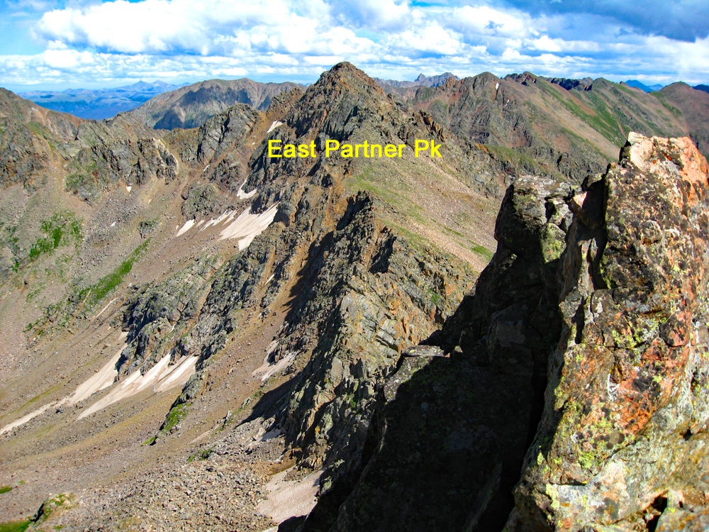
Year Climbed: 2010From our suggested campsite, a little below Pitkin Lake, walk back over to the main trail and hike on up to the lake. Follow the trail on the western shore as it heads toward West Partner, but soon fades in some boulders. As you walk this section, you'll be able to see much of the SE face of the peak and plot a course. With some careful study, you can stay on mostly tundra/grass to within a couple hundred feet of the summit ridge. Once across the boulder field, just simply head directly up the peak generally aiming for the high point, which is not the true summit, but represents the eastern end of the summit ridge. As you hike upward, you can avoid most of the rock & rubble by staying away from the ridge that connects West and East Partner until above 12.600 ft. Above there, that ridge is better. Along the way, there's plenty of opportunity to hike on tundra and encountered all kinds of beautiful flowers, including some unusual shades of maroon paintbrush.
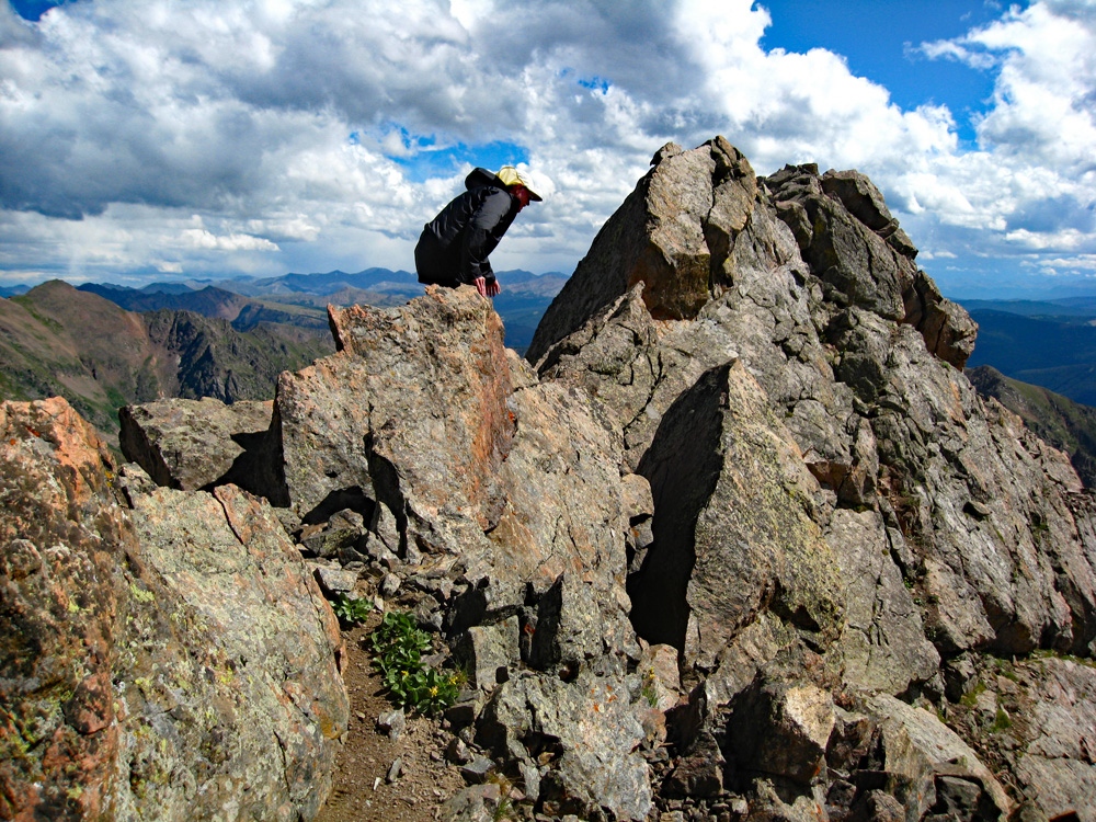
As you approach the summit ridge, there are multiple choices as to route. We came out on the south ridge of the peak near where it connects to the SE-NW running summit ridge. To this point, the hiking has been steep class 2 with much tundra, grass and some rock. But now on the main summit ridge, everything turns to rock – mostly great broken blocks. Some accounts of this ridge make it sound a little difficult, involving at least 3rd class scrambling. That is probably true if you try to stay on the ridge crest. However, you can also work just below the ridge crest on the south side and in our opinion, encounter nothing worse than Class 2+ for the near quarter mile finish to the summit. It only took us about 15 minutes to finish off this last stretch. If we encountered any Class 3, it was very brief and easy. Some people report two summits of seemingly equal height. We just kept hiking NW until the ridge finally began to drop away.
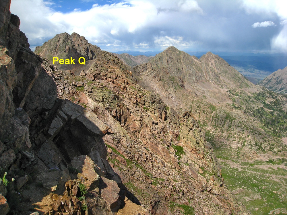
From the summit, you have a good opportunity to study Peak Q off to the north and the ridge that connects West and East Partner Peaks. If considering a trip over to Peak Q, carefully study the West to East Partner ridge to locate the best notch for crossing that ridge to gain access to the Upper Slate Creek Basin. Return as you came or proceed over to East Partner. Weather did not permit us to do so, thus the East Partner route is reported as a separate trip from the same campsite below Pitkin Lake. Nevertheless, we'll offer some insights regarding that ridge traverse.
Additional BETA
Links to other information, routes & trip reports for this peak that may be helpful. -