LoJ: #598 (Pre-LiDAR #613) / 13,063' "Grand Traverse Peak" Formerly UN 13041 B
Peak Summary
UN13,063, aka: Grand Traverse Peak, is an easy Class 2 hike but with a fairly long trail approach in the Gore Range on the Deluge Lake Trail. The often-times crowded trailhead is accessible to any passenger vehicle. Grand Traverse combines easily with Mt. Valhalla (UN13,180) and Snow Peak (UN13,039). If climbing all three, you may want to consider a backpack trip to this scenic location as our description provides. We also include a side trip to Willow BM/Mt. Silverthorne as part of this 3-day excursion. Lidar re-evaluation has added 22 feet of elevation to this summit bumping it up into the Top 600 summits list. Previous elevation was 13,041. New elevation is 13,063 ft.
Grand Traverse PK SE Slope Route
-
-
Deluge Lake/Gore Creek TH
From either direction on I-70, take exit 180 about 4 miles east of the main town exit for Vail. As you exit, go south and onto Big Horn Road. Drive east on that road 2.3 miles through condo and residential village to the trailhead. Big Horn Road will turn NE and cross under the interstate, then make a broad curve to the east and SE. Parking for the trailhead is on that curve. Just a short distance past the trailhead is the entrance to the Gore Creek Campground. There may be some more shoulder parking on the road just beyond the CG. A little more past there, the road is barred from vehicular traffic and becomes the bike trail over Vail Pass. On weekends, the available parking fills beyond capacity. Arrive early if you want to park close to the trailhead.
Camping
Just east of the trailhead parking is the Gore Creek Campground, a National Forest Service fee area with vault toilets and water. Reservations may be made for campsites at www.reserveamerica.com. Other than that, there is virtually no other place close by with at-large/primitive camping. Your best bet may be to go up to the summit of Vail Pass and drive down the Black Lakes Road where there is a pullout parking area right where the road is barred from vehicular traffic and becomes the Vail Pass bike trail, east end. This is not a primitive camp location but you may be able to sleep in your vehicle.
Campsite Locations
Gore Crek CG › N 39° 37' 37.14", W 106° 16' 26.33"Fee required. 8750 elevation. Lots of interstate traffic noise.
-
From Deluge Lake/Gore Creek TH via Deluge Lake
Of the five trails that begin from near Vail and head generally north into the Gore, four are initially very steep as they climb out of the valley. Only the Gore Creek trail avoids this problem, but there are two trails that take off from this trailhead location and they are now joined at one start at the upper end of the parking lot. A short distance up the trail is a register where you should stop to sign in if overnight permits are required. Head up the Deluge Lake Trail, #2014, for an unrelentingly steep hike.
Turning onto the Deluge Lake trail, you will first find yourself heading west and somewhat downhill for a while before the trail turns abruptly to the ENE and begins the long, gruesome, relentless climb. In two miles, the trail gains about 2,300 feet in elevation! With fully loaded packs, there is no way to make this fun or remotely enjoyable. In addition, the highway noise from I-70 far below, carries up the canyon and proves highly annoying until you finally turn out of the main drainage and head up the Deluge Creek drainage. There are a few switchbacks on the lower end of the trail, and then some others near the higher end, just before it starts to level out some. In between, it is extremely steep and it will be a footing problem on your way back down and out with lots of loose dirt & gravel. Hiking back down, as you encounter day-hikers coming up, you will likely not see too many smiling, cheerful faces. Most will have this look of "Why didn't they tell me this trail was so steep?"
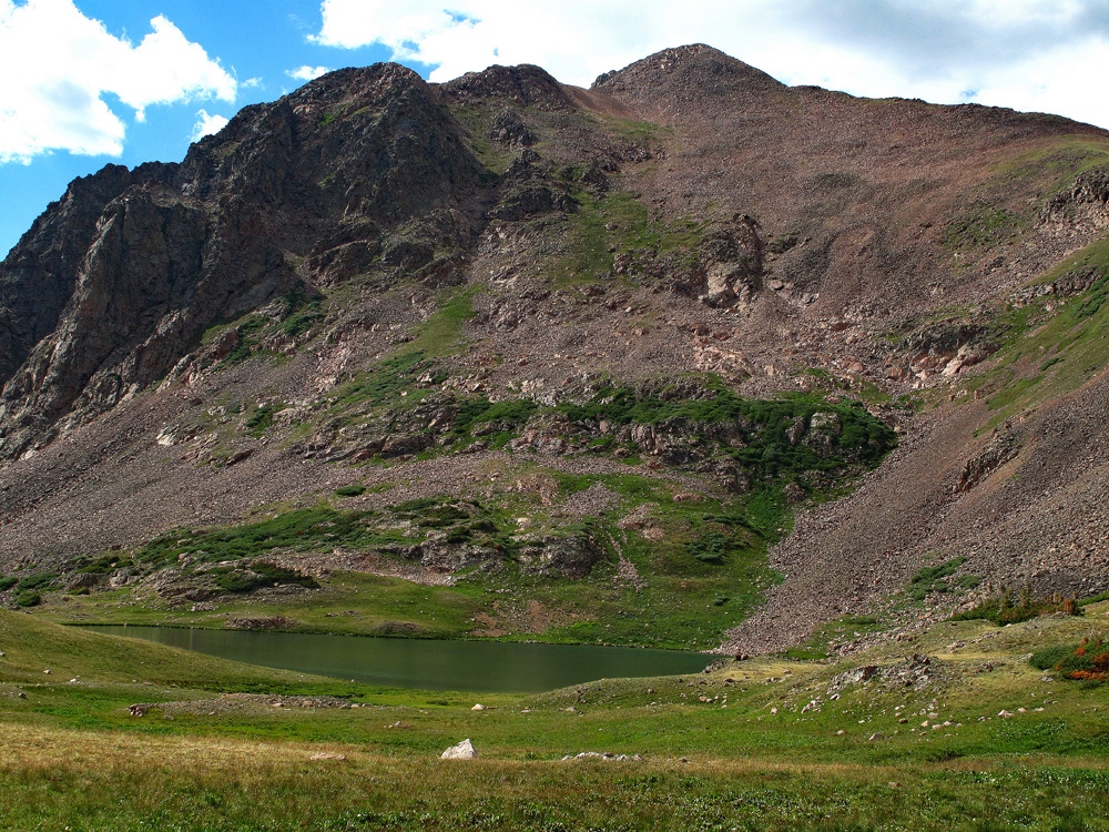
Above the higher switchbacks the trail begins to level out some and takes you across a small creek, through a brief fern forest, across some talus and then on to a nice meadow, still well above the main Deluge Creek. Continue on, passing through more forest and then coming to Deluge Creek, after having crossed a subtle ridge and losing a little elevation. Cross the creek and continued parallel to it, having now broken out into more open meadow. Ahead, you can see the higher bench that harbors Deluge Lake. We had thought we might see a good campsite in this stretch but not seeing one, we found ourselves going all the way to the lake. It took us just over 3 hours with breaks to pack up there. The lake is a beautiful location, half surrounded by Grand Traverse, Mt. Valhalla and Snow Peak, and half by the open tundra of this upper bench. Some nice groups of campanula graced the trail approaching the lake when we packed in in early August. It was blissful solitude there on a weekday.
Camping
We spent extra time trying to locate a good campsite, but at the lake, there is no tree cover, so we had to settle for a somewhat exposed site, down south from the lake a bit, and about 100 yards east of an unoccupied cabin. See our approximate coordinates for that site. There were a few very low conifers there.
Campsite Locations
Deluge Lake Camp N 39° 39' 14.44", W 106° 13' 34.26"Elevation 11,750 ft.
Open This Approach in a New Window
Click thumbnail to view full-size photo + captionRoute Description
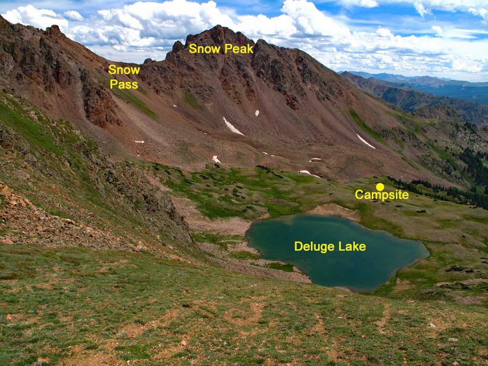
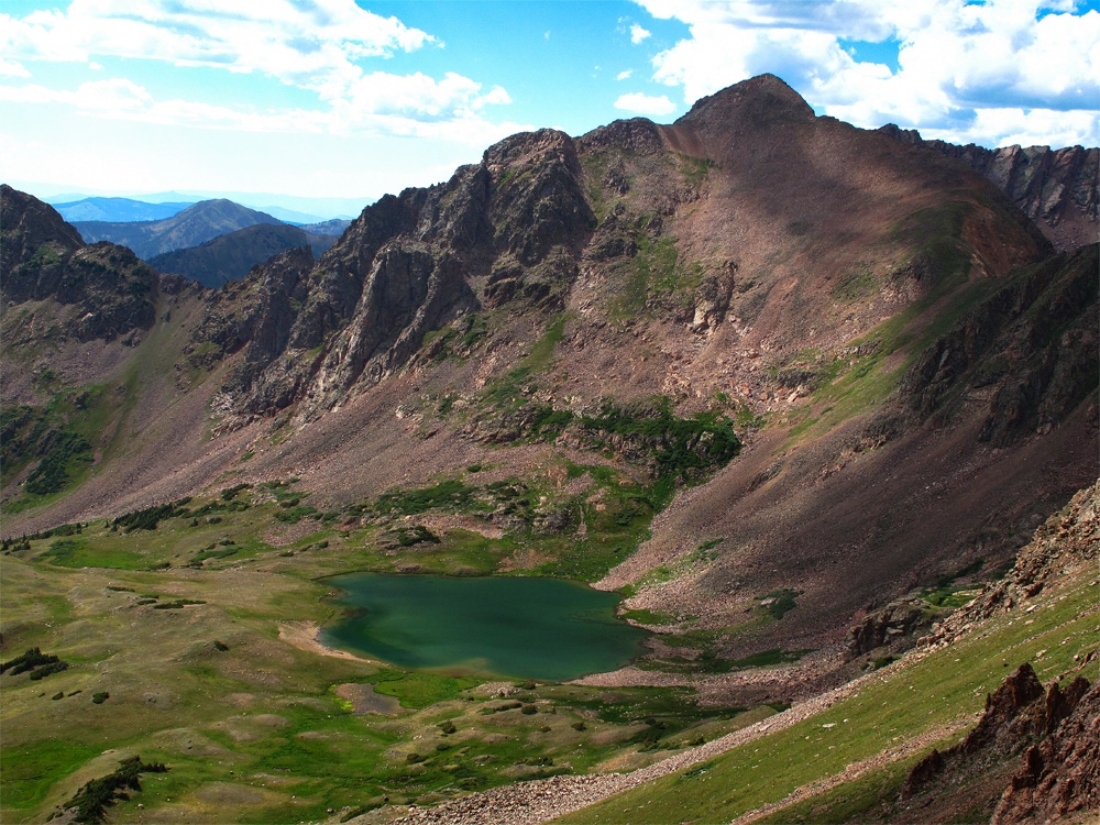
Year Climbed: 2012From Deluge Lake cross the lake outlet to the west side and circle around to the north end of the lake where you begin your ascent on mostly tundra adjacent to some rock/scree, to a saddle, almost directly north of the lake, at 12,420 ft. Though steep, the hike up to the saddle is fairly easy. Lower down, there is clear trail evidence that fades as you hike higher. The trail leads through some lush growth, offering wildflower viewing. At the saddle turn west and continue your ascent on tundra giving way to talus and rock until you arrive at the summit. There's a little bit of rock scrambling along the summit crest. It took us one hour from our camp location at Deluge Lake to gain the summit. We debated that this may have been the easiest Gore summit we had done if you discount the rugged backpack in.
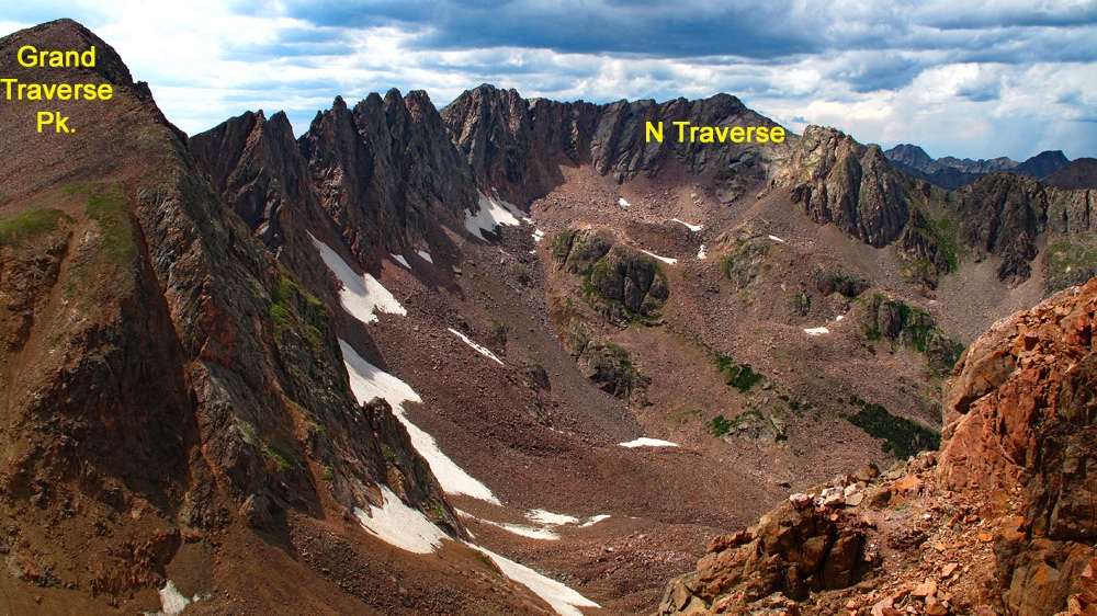
From this summit, and along the hike up, you have very good views of the ridge between Grand Traverse Peak and North Traverse Peak. This ridge is often referred to as "The Grand Traverse" and offers an interesting and challenging route of 3rd and 4th class scrambling. A preferred route for doing this traverse is to hike up Bighorn Creek, ascend N. Traverse first, head south along the ridge to Grand Traverse Peak and then either exit down Deluge Creek where you've stashed another vehicle (or perhaps bike) at the trailhead, or descend back down into the Bighorn Creek drainage and pick up the trail to return to the same start. If interested, be sure and see Gary Neben's report on the Mountain Handbook link provided below. Also, this traverse is written up in Dave Cooper's book, "Colorado Scrambles."
If timing and weather permit, consider proceeding on to Mt. Valhalla, a long mile ridge traverse to the east. Surprisingly, that traverse can be completed in a little over an hour.
Additional BETA
Links to other information, routes & trip reports for this peak that may be helpful. -