LoJ: #581 (Pre-LiDAR #583) / 13,083' Boreas Mountain

Peak Summary
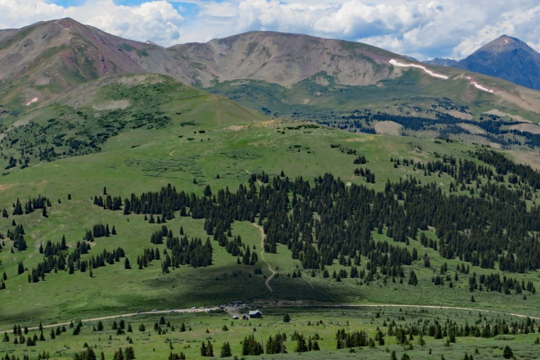
Boreas Mountain has an easy, graded, gravel road access from either Como or Breckenridge by way of the old Boreas Pass Road. This road is accessible to many passenger cars, but something with a little better-than-average clearance is suggested in case of some road damage or rough spots. The hike is Class 2 and begins on tundra with some willows and finishes on a lot of medium talus. Boreas can be easily climbed in the same day with Bald Mountain which lies north along the same ridge. Lidar added 1 foot of elevation.
Boreas Mtn from Boreas Pass Route
-
-
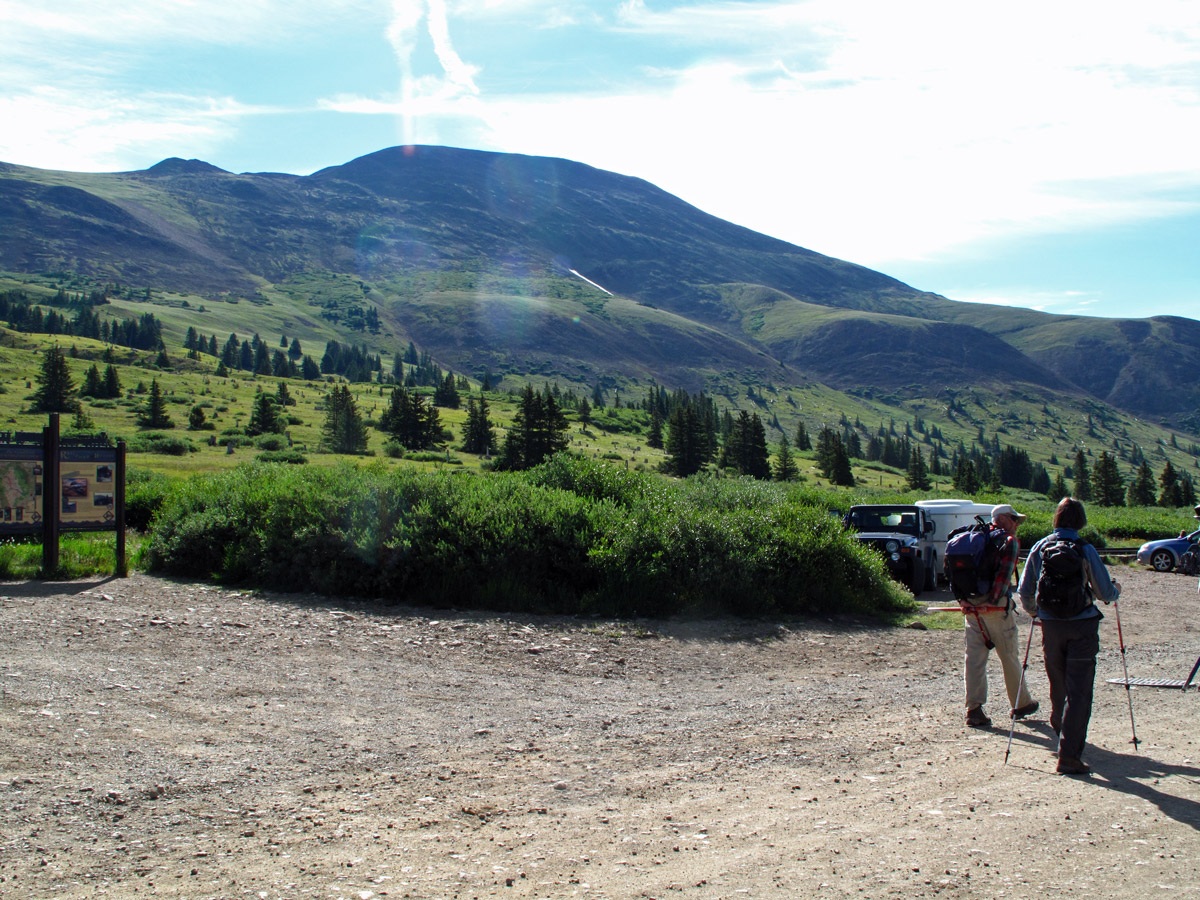
Boreas Pass TH
There are two possible approaches to the summit of Boreas Pass where the routes for Bald and Boreas mountains begin.
1. From US 285, about half way between Kenosha Pass and Fairplay, take the turnoff on the north side of the highway for Como. The Boreas Pass Road follows an old railroad grade that connected Breckenridge and South Park. Como was the south terminus and the railroad roundhouse can still be viewed there. Drive on through Como and take the main road north out of town that follows Tarryall Creek. This is the "Boreas Pass Road" or FR 33. A little under three miles out of town, after the road has crossed Tarryall Creek, watch for a right hand turn that will begin the ascent to Boreas Pass. The graded dirt road slowly winds its way to the top of the pass never exceeding appropriate railroad grade. There is parking at the pass. On weekends, there can be a lot of traffic. Driving up the pass and parking early is helpful.
2. Take State HWY 9 from Frisco south to Breckenridge. When you reach the traffic circle on the north end of town you may either continue straight south onto Main Street or exit the circle on the west onto North Park Avenue. This road serves as a bypass of the downtown area and also as an access to the ski area. It can be followed all the way around to the south end of town where it rejoins Main Street at a "Y" type intersection. Drive on south from that intersection to the next light where you will turn east onto Boreas Pass Road (FR10). The road heads SE up a gulch, then makes two wide left type turns to gain elevation and pull out above the gulch. It then heads briefly north, turns back east, then SE again, passes through more residential areas, and turns to graded gravel after passing the last residences. From there on, its an easy, slow drive to the top of the pass. Again, weekend traffic can be heavy. This is a popular drive for the tourists. Park at the top of the pass to begin the hikes.
Camping
You may be able to get away with an overnight car-camp at the top of the pass but there will likely be no privacy and many cars driving by. There's a single-track type road just north of the pass on the west side of the road that may take you a short distance through willows to a primitive campsite. You are at least on National Forest land, so if you want to pitch your tent somewhere, it's likely allowed.
From Como, there is a designated Forest Service Campground called "Selkirk" that lies up along the north fork of Tarryall Creek. Continue past the turn where the Boreas Pass Road leaves the valley bottom and continue NW on FR 801 to the campground at 10,500 ft. All along Tarryall Creek, either fork, there are short roads that turn off the main road. Almost all of these end at private property. Be careful about trying to camp on such roads.
Coming from Frisco and Breckenridge, there are the five campgrounds located on Lake Dillon. These are "Gold Pan," Heaton Bay, Peninsula, Prospector and Windy Point. Visit this site for more information: http://www.townofdillon.com/visit/camping-info or call the Dillon Ranger District at 970-468-5400 for more information. The site above has information on primitive car-camping as well. Be advised that finding any place to camp in the lake Dillon area on a weekend can be difficult.
Campsite Locations
Selkirk › N 39° 22' 20.14, W 105° 57' 05.13"Elevation 10,500 ft. 15 sites
Click thumbnail to view full-size photo + captionRoute Description
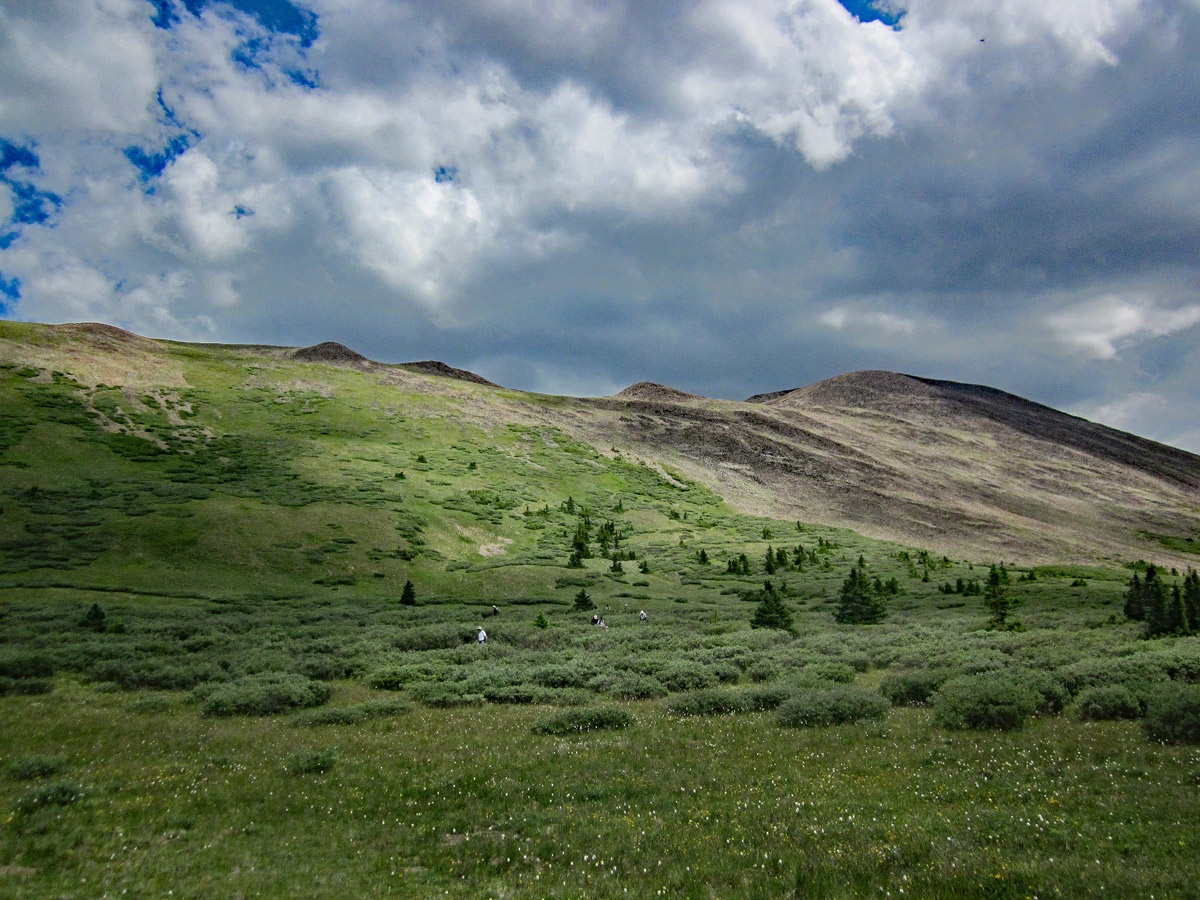
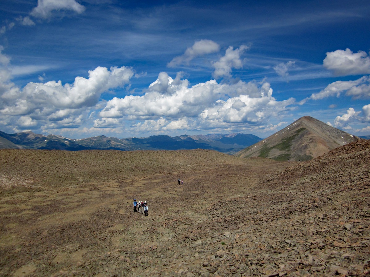
Year Climbed: 2013The route for Boreas Mountain from Boreas Pass is simple and straightforward. From the parking area, head east past the structures and chart a course uphill toward Pt. 12,815. The terrain north of the point will be the easier, but there are many ways to "skin this cat." From the parking area there will be an initial uphill through generally open, grassy slopes to a bench-like area. Then the angle of ascent will begin to increase and you'll have to deal with some willows. At least they are not the man-eating type and a little careful route finding will avoid getting tangled in the willows too badly.
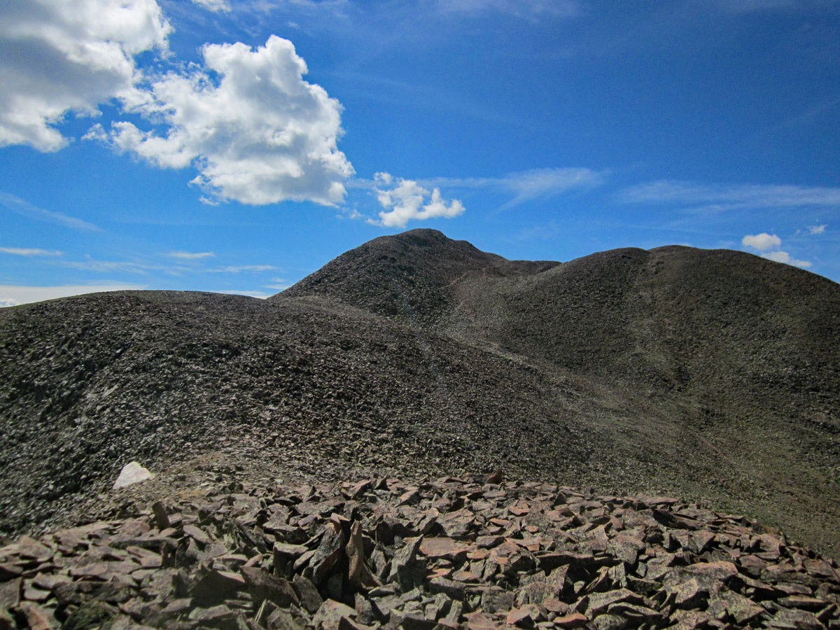
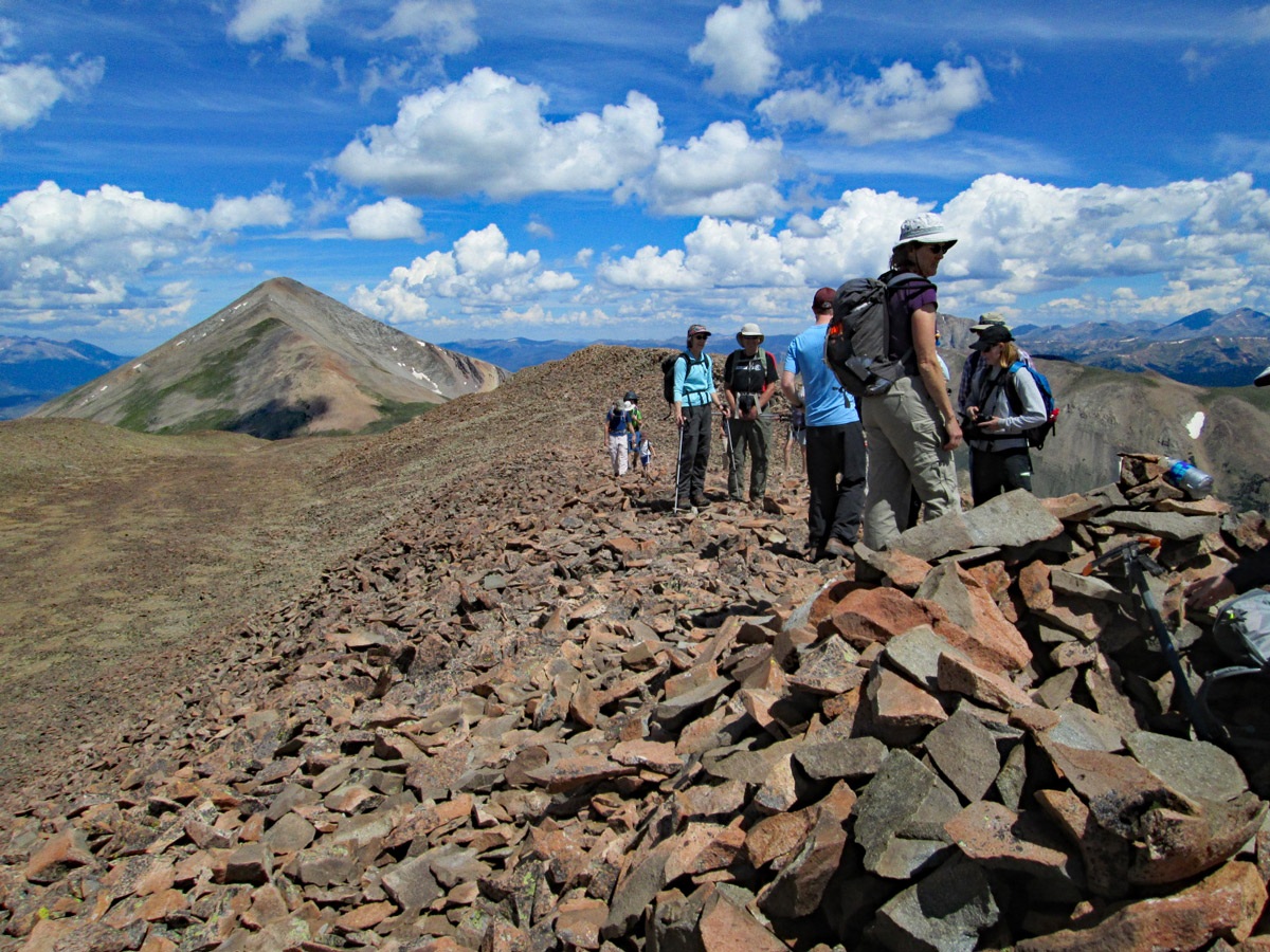
Soon the willows begin to play out as you continue up on a mostly grassy slope. Once you intercept the main ridge, north of the summit, conditions change dramatically. For a brief while, you'll be walking on sparse tundra with chiprock. But as you proceed south toward the summit, you will eventually arrive at a nearly flat plateau area covered in what we call "dinner-plate" talus. There's a well-used trail through all of this that will take you all the way to the summit where you will find a larger rock shelter to break the westerly winds. The highest point of the summit actually lies a few yards farther south.
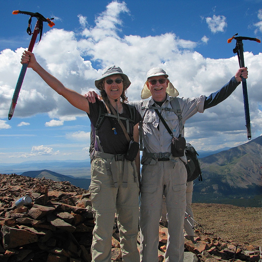
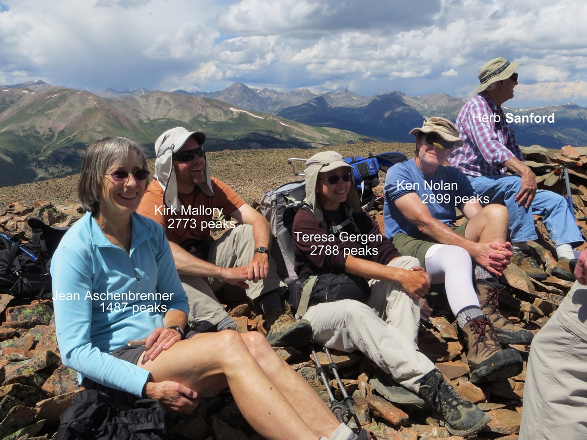
We deliberately saved Boreas Mountain to be our final 13er summit and were accompanied by a group of over 20, including family members, friends and some notable Colorado peakbaggers. Our thanks to all who shared with us on that notable day.
To descend, simply retrace your route back down, or follow the ridge back north to the Boreas-Bald saddle, and then continue on to Bald Mountain, also an easy Class 2 hike.
Additional BETA
Links to other information, routes & trip reports for this peak that may be helpful. -