LoJ: #625 (Pre-LiDAR #631) / 13,019' Chief Mountain
Range ›
San Juan Range
Quadrangle ›
Little Squaw Creek - Knife Edge (Revised name)
Summit Location ›
 N 37° 38' 09.39", W 107° 12' 31.41"
(Not Field Checked)
N 37° 38' 09.39", W 107° 12' 31.41"
(Not Field Checked)
Neighboring Peaks ›
UN 12992 [Formerly UN 13010 B]
Peak Summary
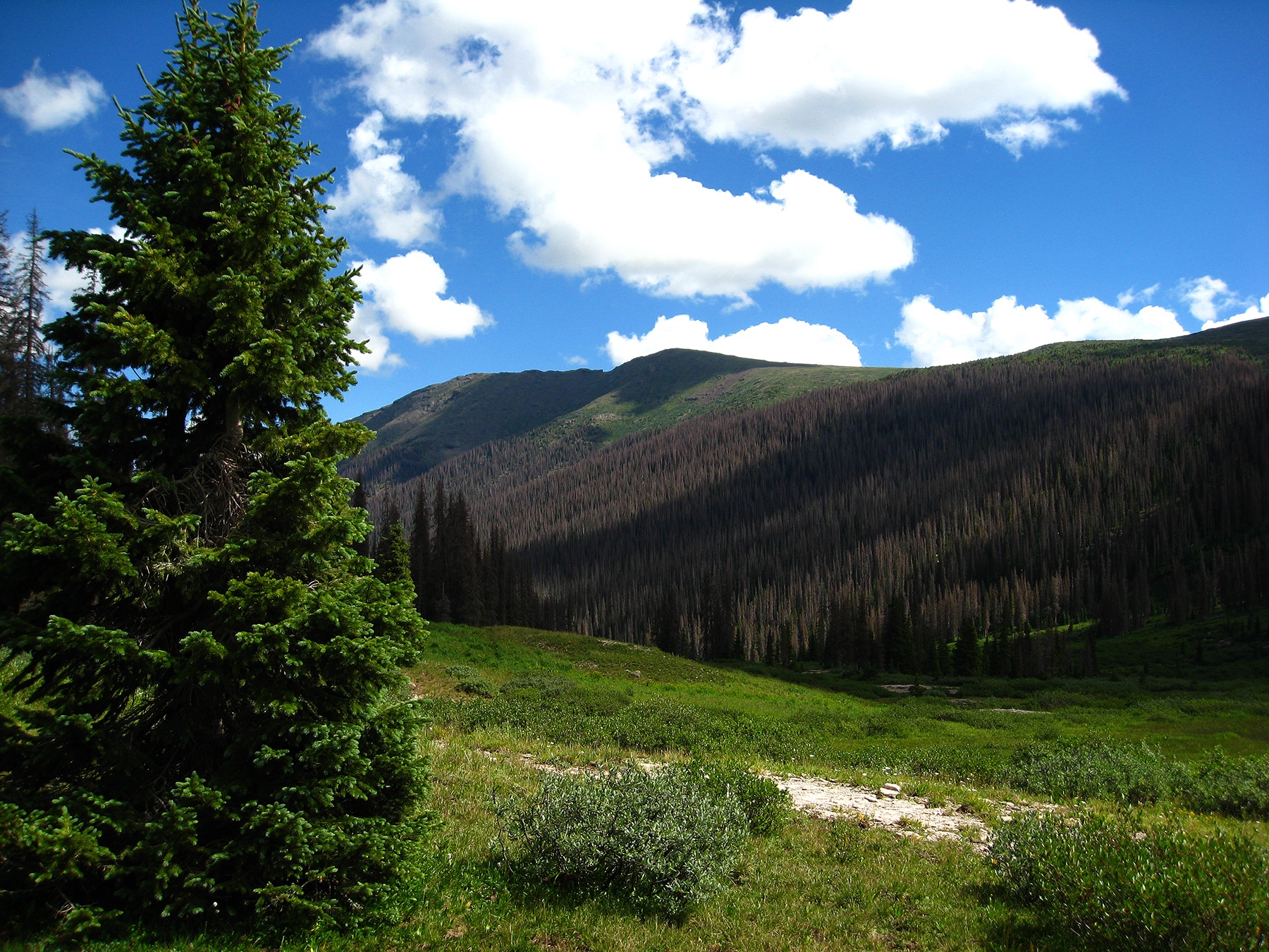
While Chief Mountain could be done as a very long day-hike from Rio Grande Reservoir, we think most mere mortals will opt to reach this summit along with UN 13,010 (now no longer considered a 13er with a revised elevation of 12,992 ft.) by way of a backpack approach. A three-day trip can net both summits and a few 12ers if you have the additional energy. Both are fairly easy Class 2 hikes, but with up to an 11 mile backpack approach. The trailhead is accessible to most any passenger vehicle. The hiking is very remote in a forest largely dead because of beetle-kill. Lidar measurements increased the elevation of this summit by five feet from 13,014.
Chief Mountain SE Ridge Route
Class 2
Short Day // A Wee Little Climb
Climbed with
UN 12992
RT From Thirtymile Campground:
35.85 mi / 5,295'
RT From
Squaw Pass
with
"Formerly UN 13010 B":
12.45 mi / 3,395'
From "Formerly UN 13010 B":
6.25 mi / 1,795' (One-Way)
-
-
Thirtymile Campground TH
The access road to Thirtymile Campground and Rio Grande Reservoir turns off from SH149 either 20.5 miles west from Creede or 32 miles south from Lake City. The turnoff is marked by a road sign. From Lake City, you'll have to drive over Slumgullion Pass and Spring Creek Pass. This remote access for Rio Grande Pyramid and other 13er summits nearby makes these peaks some of the most distant for climbers coming from both the eastern and western slopes of Colorado, requiring multiple hours of driving.
Watch for FR520/CR18 turning off to the west side of highway 149. Initially, the road is paved as it drops down to a small reservoir where it turns NNW and turns to graded dirt. Shortly after that, stay left at an intersection. For the most part, stay on the most well-travelled road to get to Rio Grande Reservoir. Most major intersections are signed. So at about 3.5 miles from the highway, stay left and head south. In the next mile you'll come to Road Canyon Reservoir #1 where there is a National Forest Fee campground along the side of the road at the south end of the reservoir with a vault toilet and a half dozen sites or so. Continue on past the River Hill CG another 3.4 miles SW and then you'll arrive at the Thirtymile CG at 10.8 miles from the highway. Both Thirtymile and River Hill campgrounds are also Forest Service, fee campgrounds with vault toilets, tables, firerings and potable water. Sites can be reserved at www.recreation.gov.
To access the campground, you'll need to drive south across the river on a good bridge. There's a grassy/dirt parking area intended for backpackers and hikers on the north side of the main road into the campground. For the actual trailhead, you'll need to walk south from the parking area, crossing the other side of the road that loops through and then walk a little farther south from there. The trailhead serves as access for both Squaw Creek and Weminuche Creek. There is a kiosk there for registering your activity.
Camping
Camping sites at Thirtymile CG and River Hill CG are available and can even be reserved online at www.recreation.gov. There's also another campground at the far west end of Rio Grande Reservoir called "Lost Trail CG," but you would have to drive back from there to access the Weminuche Creek Trail or the Squaw Creek Trail. On the drive in from the highway, there are not very many primitive sites that show. Several roads that turn off the main road lead to private property.
Campsite Locations
Thirtymile Campground › N 37° 43' 17.62", W 107° 15' 33.40"Campground elevation is 9,330 ft.
-
From Thirtymile Campground TH via Squaw Pass & "Formerly UN 13010 B":
-
UN 12992 SE Ridge & flank Class 2+ / 2.2 mi / 1,600’ One-Way
Click thumbnail to view full-size photo + caption
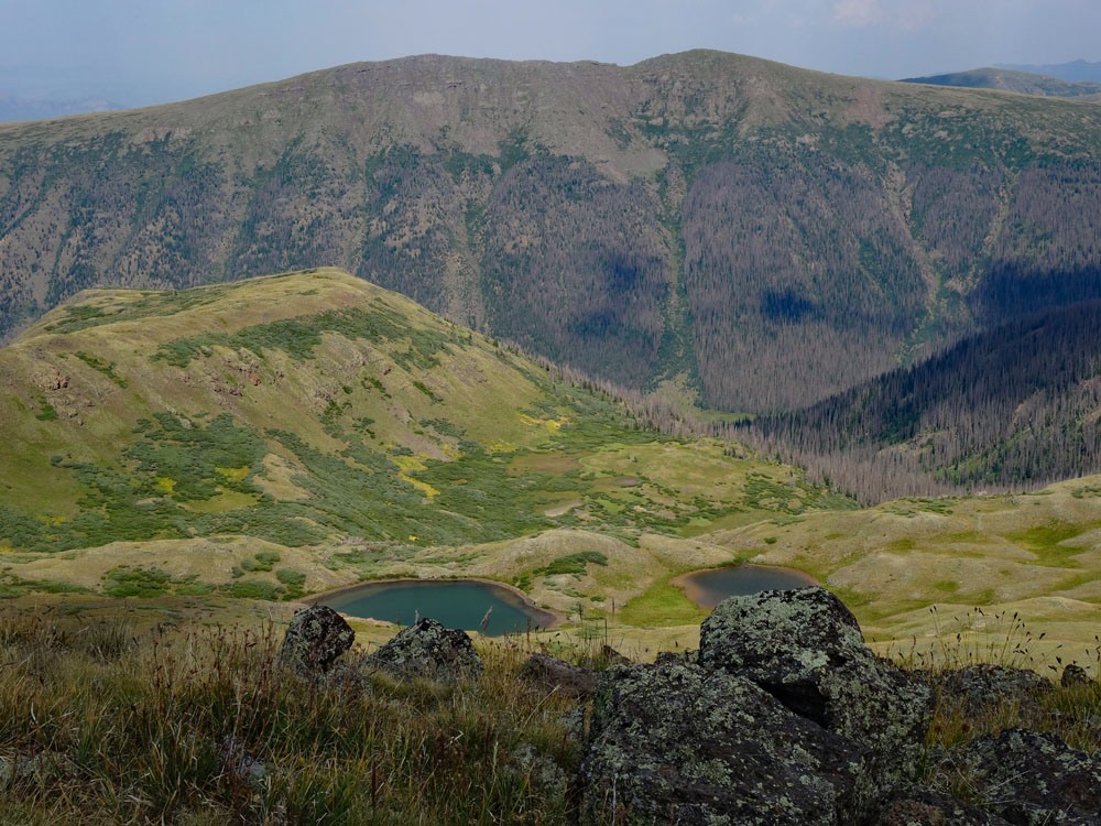
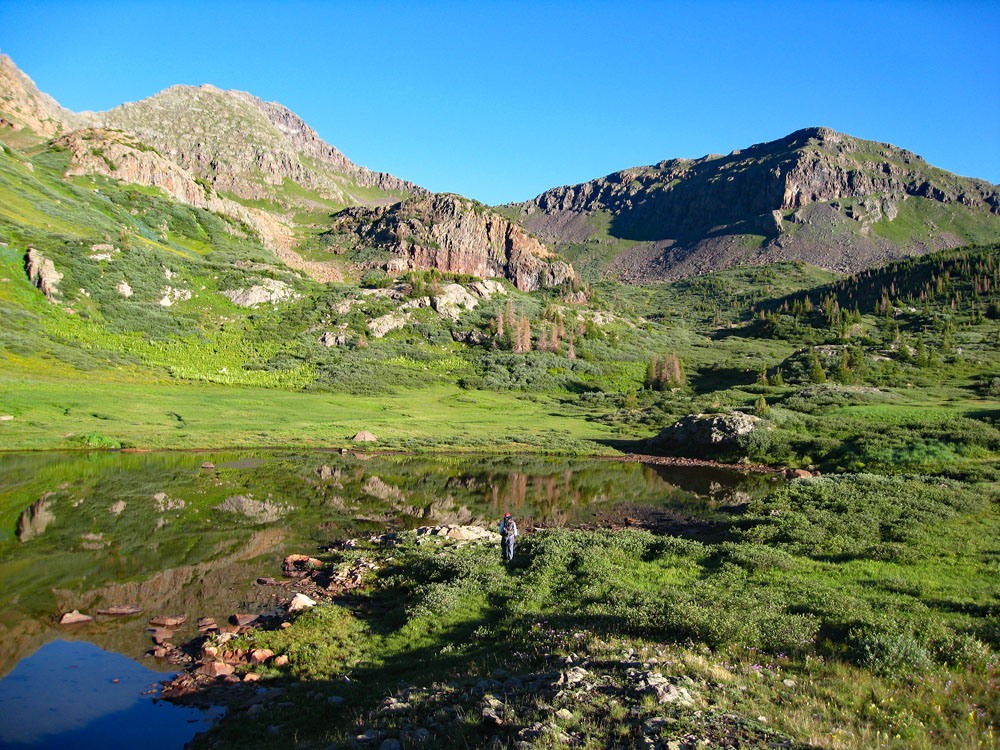
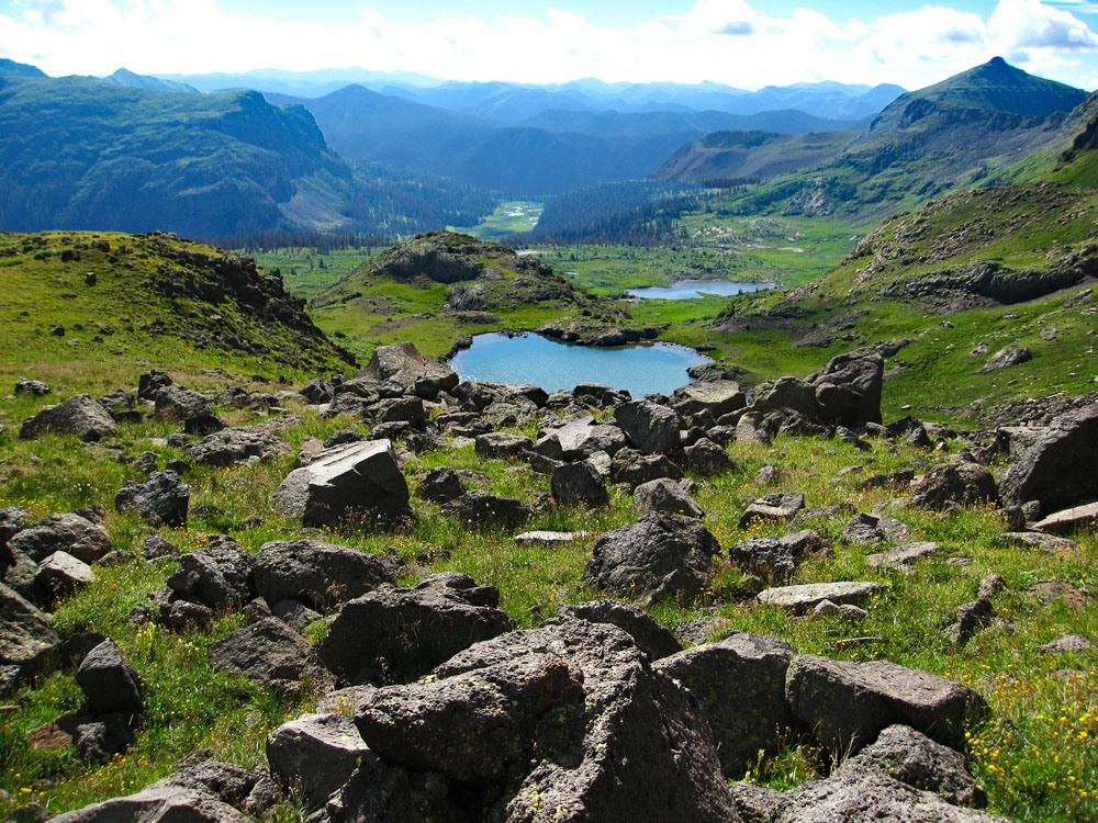
Open This Route in a New WindowFrom Squaw Pass, follow the Continental Divide Trail # 813, first to the west as it gains elevation, then turn northward toward a higher shelf above the valley with a number of lakes. The CD trail will lead past the two most eastern lakes. We recommend breaking off from the trail shortly after the trail levels and head towards the southernmost of the series of three western lakes, still on this higher shelf level. This lake is a beautiful setting and very photogenic. (The CD trail actually connects to Squaw Lake well to the north so it could be used if you decided to camp at Squaw Lake or the lower campsite at the crossing of Squaw Creek.) The basic plan is to hike on the eastern side of the three unnamed lakes and gain a broad east ridge of UN 12992, then to head up that ridge, connect with the main SE ridge and follow it to the summit.
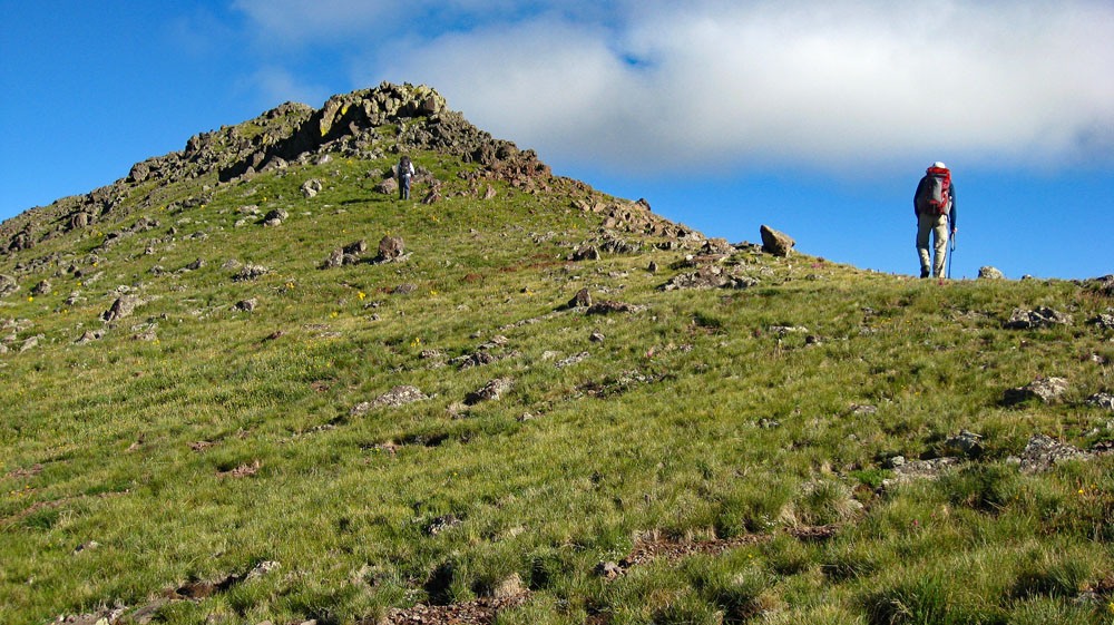
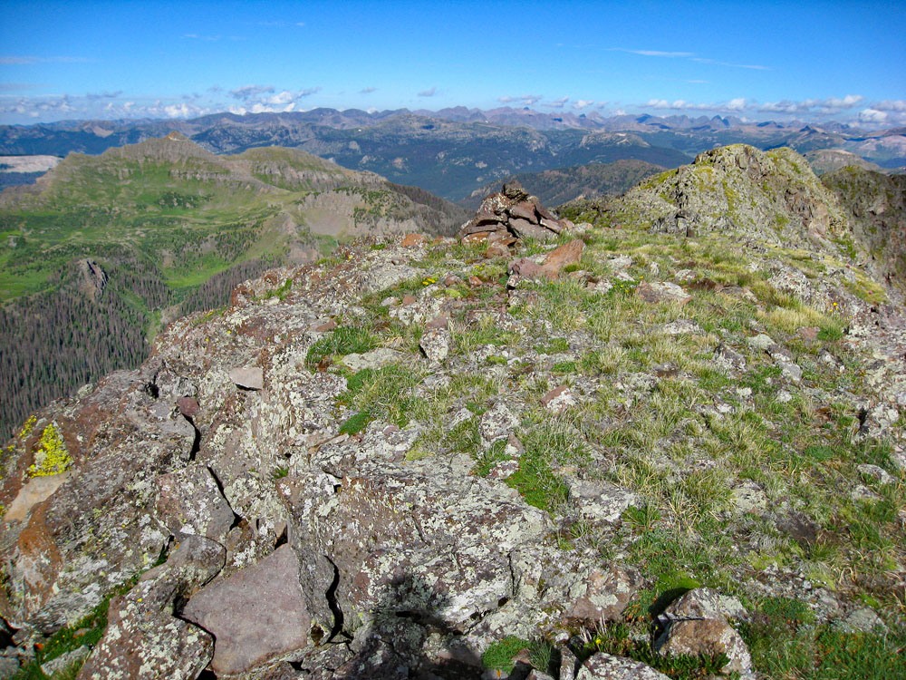
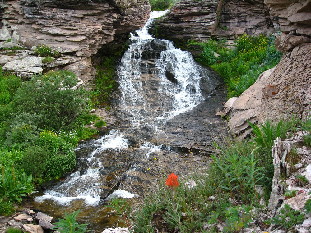
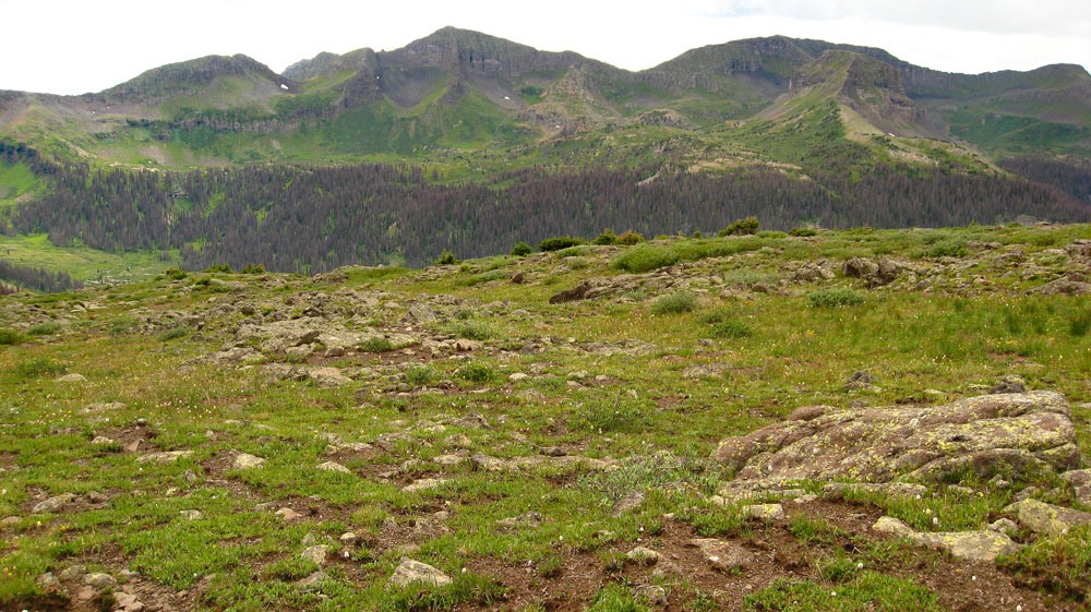
As you hike NW on from the first lake, you will encounter the two others of similar beauty. Wildflowers are abundant affording many photo ops. Getting around the second lake is somewhat problematic in finding a dry route. Some willows also impede your way, but we did find a route through and continued northwest toward the next lake, which is situated in a bowl with flowers filling a west-facing slope above it. Above this lake is the broad, minor east ridge of the peak that we suggest gaining. As the ridge begins to ascend, there is a boulder field with magnificent clumps of columbine whose color stands out brightly among the rocks. We were tempted to venture near for more photos, but felt more compelled to get to the summit at this point. Continue west hiking along this broad ridge and begin ascending on a tundra-covered slope that steepens greatly. We spotted some ptarmigan here. After about 300 – 400 feet in gain, turn in a more southerly direction and begin a traverse across the east face of the peak, to gain the prominent southeast ridge. At times, we had to do a little scrambling (almost 3rd class moves) as we mounted various rock obstacles, but for the most part, this is a class 2+ ascent on mostly tundra/rock mix. We came out on the southeast ridge just a little above and north of the saddle that connects to Hossick BM. From here, just continue hiking northwest along the ridge. This continues to be mostly tundra covered with rocky outcrops to add some interest at various places. Before long, you will stand on the summit where you may enjoy an outstanding view of this wilderness. You are in an almost central point of this vast area of peaks and grand valleys.
-
Click thumbnail to view full-size photo + captionRoute Description
Year Climbed: 2010On our trip into this area, we packed in one day, climbed both UN 13,010, (which has been demoted by Lidar to 12,992 ft, hence no longer a 13er), and Chief Mountain the next day, then backpacked out the third day. Therefore, we are sequencing these two summits with one-way mileage and elevation gain for Chief Mountain being measured from the summit of UN 13,010/12,992 and round-trip mileage assuming completion of the sequence and approach. Some may not want to complete both peaks, which lay across the valley from each other, in the same day and spread this trip out over 4 days. Strong hikers may be able to pack in on day one and climb one of the summits the same day, then climb the other summit the next and pack all the way out. Please also note that the old quad name of "Little Squaw Creek" has been changed to "Knife Edge." We assume that this is because the term "squaw," has been deemed offensive and derogatory, hence we would expect all references to the term "Squaw" on this quad to be eventually changed to something else.
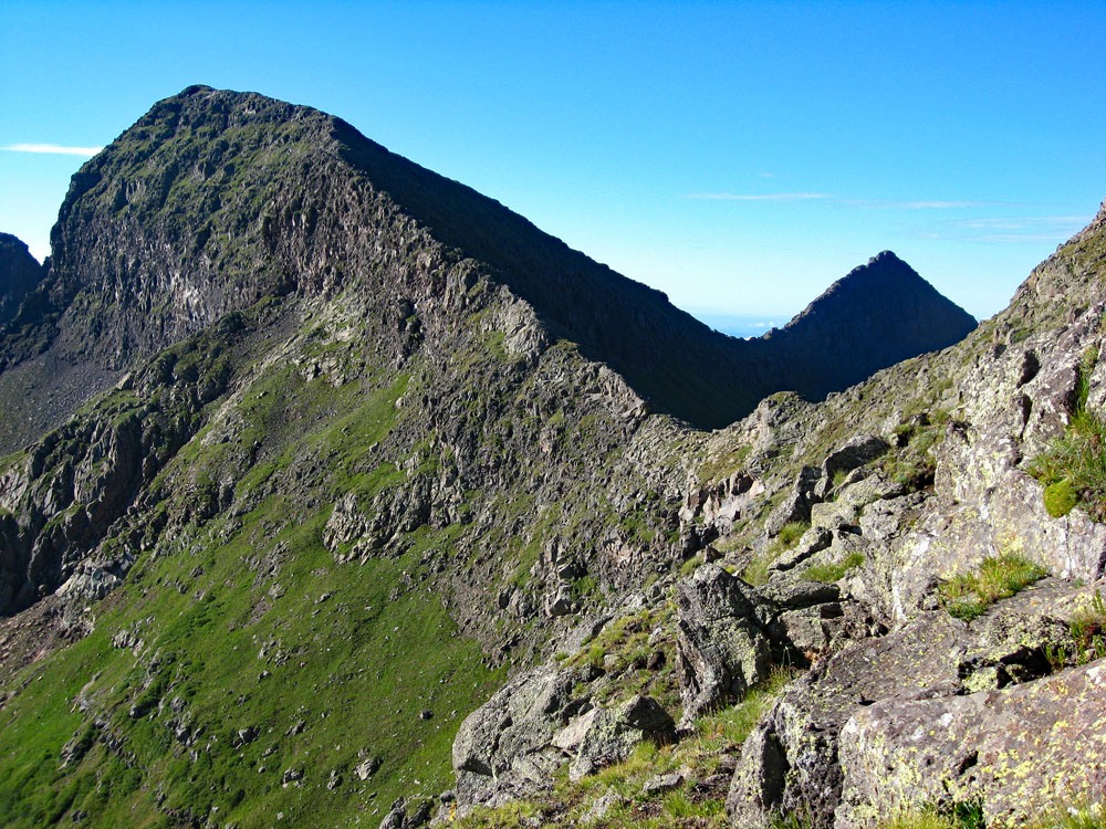
From the summit of UN 13,010/12,992 descend SE back toward the saddle between it and Hossick BM, then contour back to the broad east ridge and retrace your route back to Squaw Pass. (We might mention here that this ridge over to Hossick BM (12,967) and another ridge that leads south to UN 12,760 are spectacular and dramatic ridges. They are both narrow with imposing drop-offs on either side. More list-oriented climbers may want to make sure they include Hossick. Though the ridge looks intimidating, there are no real problems and it goes at a Class 2 level.)
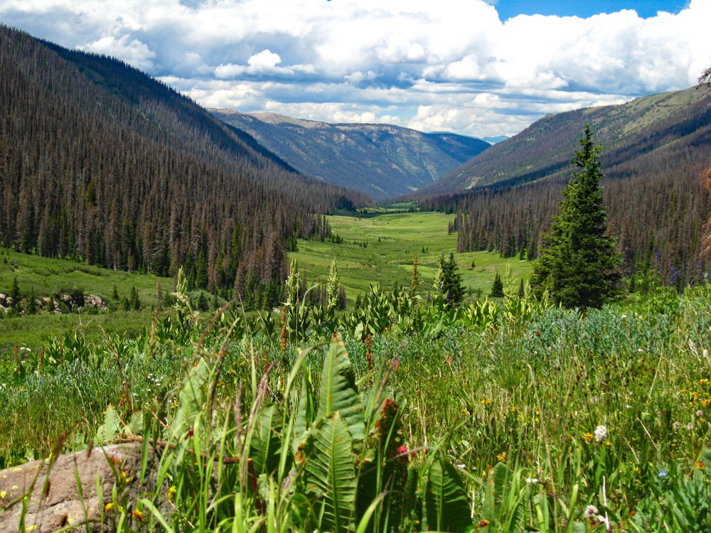
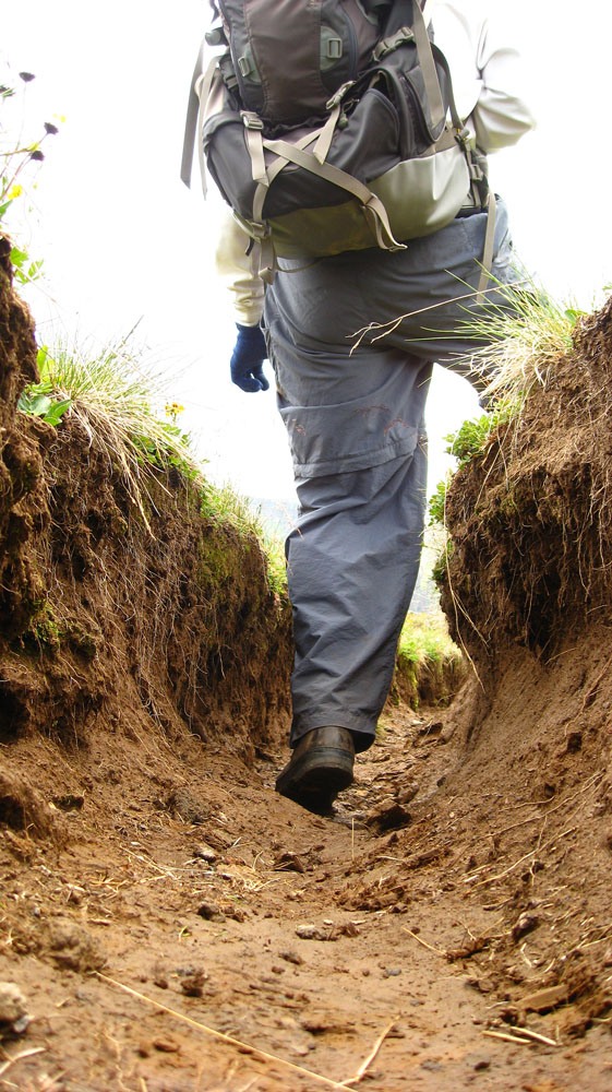
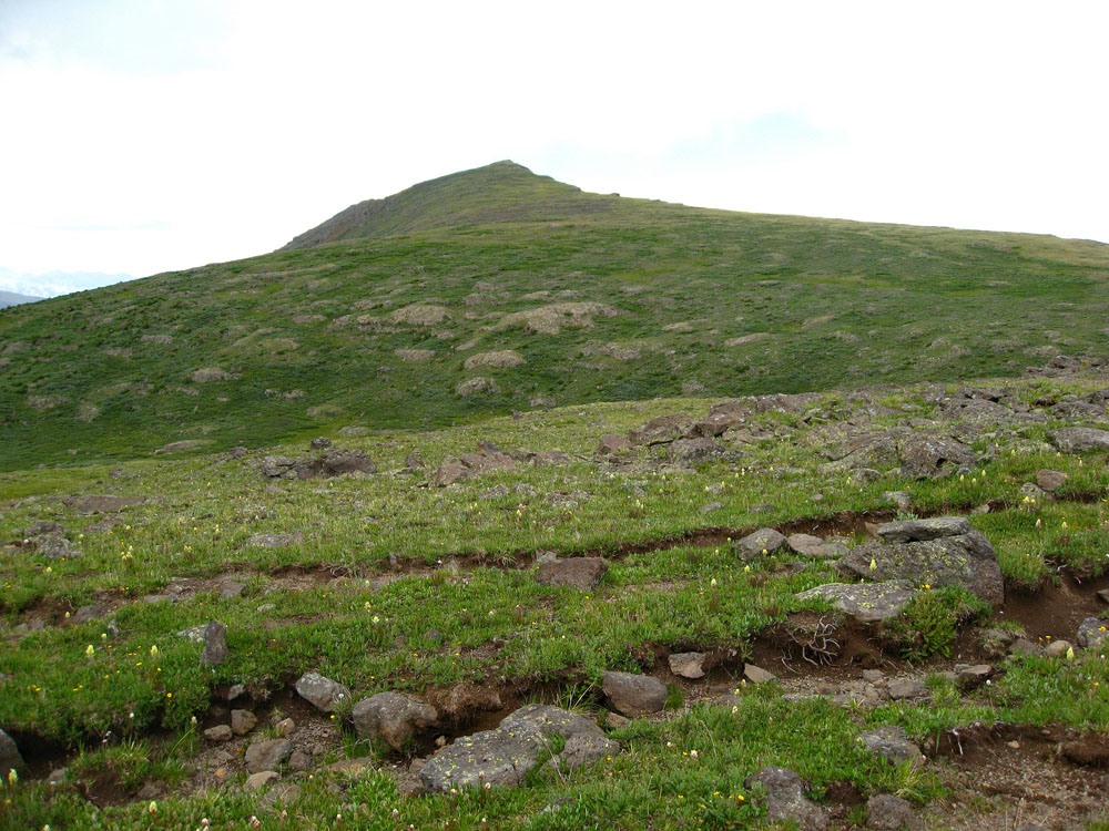
Once back at Squaw Pass, continue eastward on the CD trail back to where it and the Squaw Creek Trail intersect. Continue NE on the CD trail through dead forest. Above timberline, there are portions of the trail that are deeply entrenched. It's about 2.5 miles up the CD trail to the SE ridge of Chief Mountain where you will veer off trail to head for the summit. About a mile up from Squaw Pass you will cross a cascading little stream with flowers covering its banks. Above the stream, the trail climbs on some switchbacks and then passes out of the forest and into the more open area above treeline. This is where sections of the trail are deeply entrenched. The map does not indicate this, but almost all the way to the pass, there are dense willows, so shortcutting off the trail is never a good idea until you are within a quarter mile of the pass. By the time we arrived in that vicinity, the weather was starting to build in and we still had at least another 1.25 miles to go to reach the summit. In fact, about half way up, we began to encounter some light sprinkles. From the pass to the summit, it is virtually all tundra so there is nothing to really impede your progress other than being fairly tired by now if you've already done UN 13,010/12,992. The summit is uneventful. You may be grateful to learn that the northern summit (12,980) which you can see, that appears higher, is not something required to tag. Once you've taken your obligatory summit shots and gazed back across the valley to UN 13,010/12,992, return as you came.
Additional BETA
Links to other information, routes & trip reports for this peak that may be helpful. -

"If you are suffering from a bad man's injustice, forgive him lest there be two bad men." Saint Augustine
Warning!
Climbing peaks can be dangerous! By using this site and the information contained herein, you're agreeing to use common sense, good judgement, and to not hold us liable nor sue us for any reason. Legal Notice & Terms of Use.