LoJ: #498 (Pre-LiDAR #505) / 13,176' Conejos Peak
Peak Summary
Conejos Peak, except for the some of the 13ers located on the Cielo Vista Ranch in the Sangre de Cristo, is one of the southernmost 13ers in Colorado. The summit is approximately 33 miles from the New Mexico Border. Reaching the trailhead involves a fair amount of graded dirt/gravel road driving, but is still passenger car accessible. Getting to this summit, like Montezuma and Summit Peaks, will involve a lot of drive time for most coming from the Front Range. The hike itself is an easy Class 2 that crosses a lot of tundra terrain. Because of cattle grazing in the area, that may be the only "wildlife" you may see, but overall, this is a beautiful area to visit. Lidar added 4 feet in elevation to this summit placing it into the Top 500 summits.
Conejos Peak East Ridge Route
-
-
Saddle Creek - Conejos TH
This is the most direct route to the trailhead: First of all, get yourself to Antonito, CO which is south of Alamosa on US285. This is extreme southern Colorado. About one mile south of Antonito town center, watch for an intersection where US 285 turns off to the left. Stay right here to continue on CO17 which heads SW for Chama, NM and crosses La Manga Pass. The highway heads generally west, and just under 5 miles, crosses the Conejos River. It stays on the north side of the river now for the next several miles. After several more miles it turns to the NW for a short while, then turns back to the SW on a bend where there is a small community. County Road 250 turns off to the right in this community. Just past this community, the highway crosses the Conejos again and begins the climb to the pass. If you have crossed the river, you have missed the turnoff. Coordinates for the turn are: N 37° 07' 58.96 W 106° 21' 01.96". This is known as the "Conejos River Road."
Follow graded dirt CR250 NW for several more miles up along the Conejos River. Turn left onto FR105. This intersection will be .9 mile south of the Lake Fork Campground. If you come to the campground, you've just missed the turn. Coordinates are: N 37° 17' 53.37" W 106° 28' 40.06". Head up FR105 (also known as the Saddle Creek Road) which will begin climbing uphill. At 1.7 mile appx., the road will go through a pair of switchbacks. At 3.1 miles, there will be another pair of switchbacks. At 4.8 miles appx., there will be a road intersection where FR100 turns off on a sharp curve. Remain on FR105 which will turn back to the west. Go 2 more miles to another sharp curve. Park here for the trailhead to Conejos Peak and Saddle Creek.
An alternate way to get to the trailhead if you've completed the Summit - Montezuma Peaks traverse is as follows: From FR380 near the turnoff for the Stunner Campground, take the road to the south for Stunner Pass, which is FR250. Drive the 4 miles up to the pass, then descend to Platora. Continue SE down along the Conejos River to the Lake Fork Campground. Drive another .9 mile to the turnoff for CR105 (Saddle Creek Road).
Camping
The nearest National Forest campground is the Lake Fork CG. This pleasant camp area sits along the banks of the Conejos River and does not receive as much crowding as other campgrounds closer to the larger metro areas. It has vault toilets, but the Forest Service site does not mention water available. The river is easily accessible. Reservations can be made. Here's a link: https://www.fs.usda.gov/recarea/riogrande/recarea/?recid=29546
There are primitive sites located along the Conejos River as you drive along CR250. Along FR105, there's not much to choose from until you arrive at the trailhead. You could probably car-camp here.
Campsite Locations
Lake Fork › N 37° 18' 34.28", W 106° 28' 35.49"Elevation 9,550 ft.
Click thumbnail to view full-size photo + captionRoute Description
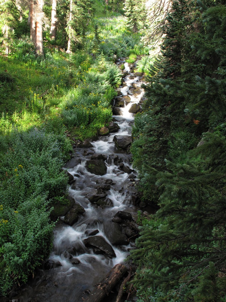
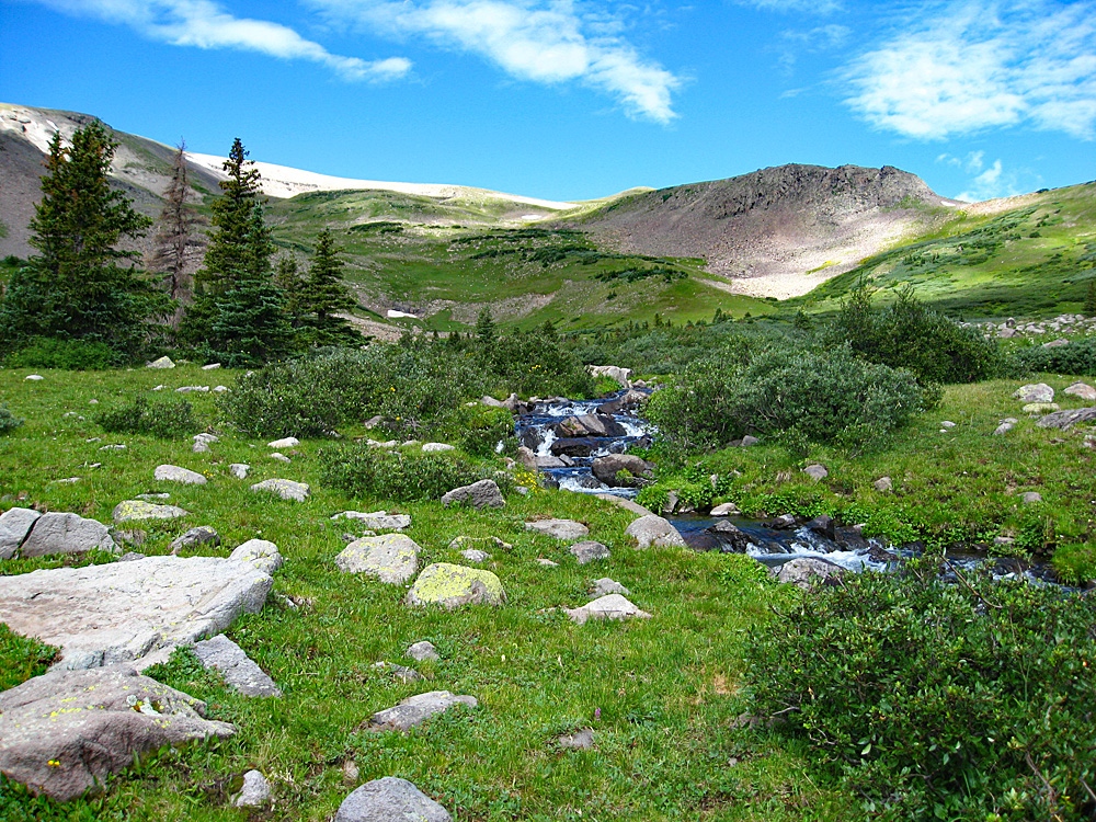
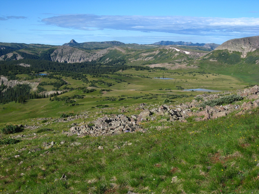
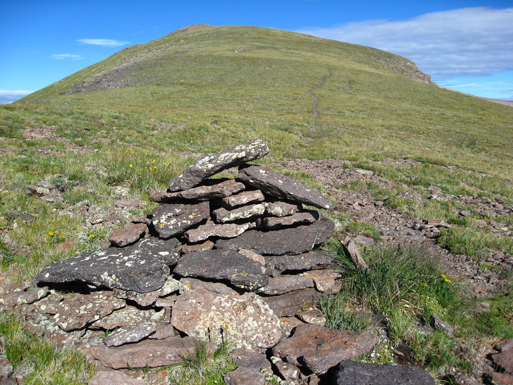
Year Climbed: 2010Begin by hiking westward on the trail that leads off from the 180° curve in the road. While this trail does not show on older version of the Rio Grande national Forest maps, it does show on newer sources which is why we used the FSTopo 2016. Hike uphill on switchbacks, staying on the north side of Saddle Creek. The trail will cross the creek at about 11,400 ft. (no bridge of any sort but not difficult) and will lead south into a minor basin. In this basin, there are two small tarns indicated on the survey map just above 11,520 ft. This is a nice, grass-filled basin, and also filled with cattle and fresh cowpies. On the western slope of the basin, up above a swath of willows and higher than the cattle, we spotted four bucks observing us from above. We tried to circle around the basin to get over to that slope, but decided there was too much muck to cross in the vicinity of the ponds so we dropped back a little and cut over to a group of trees, walked along the edge and then started gaining the slope above the ponds. There was a way to proceed up this slope and avoid most of the willows, but there was one stretch, fairly high up, where we had to punch through the chest high tangle for 20 yards or so before gaining an open tundra/rock and talus slope that then led us on up to the very prominent east ridge of Conejos. We hit this ridge at a kind of flatter section, just below the 12,400 foot contour line.
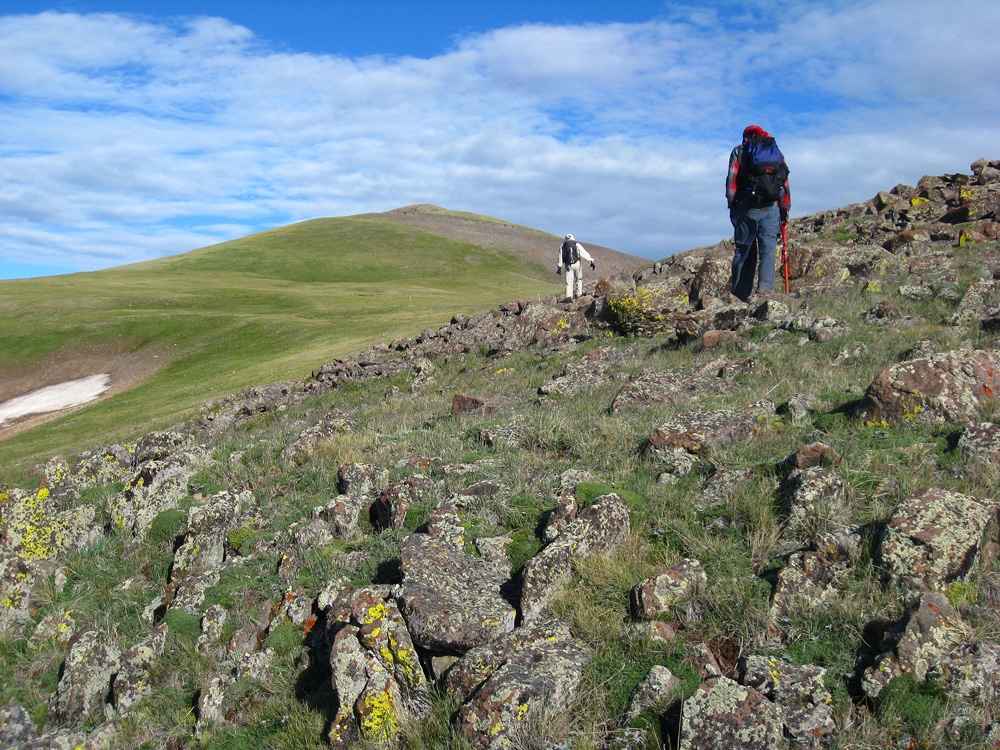
It is also possible to follow the trail all the way to the east ridge, then pick up the trail that remains on the east ridge to the summit. We have drawn this in on the map. The mileage would go up from 2.8 to 4.3 one-way because of the added switchbacks and how the trail swings further east. The trail will gain the east ridge around Pt. 12,160.
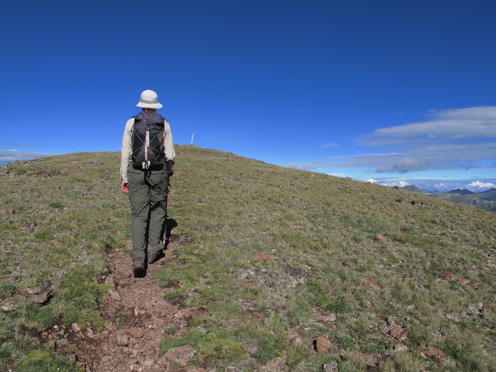
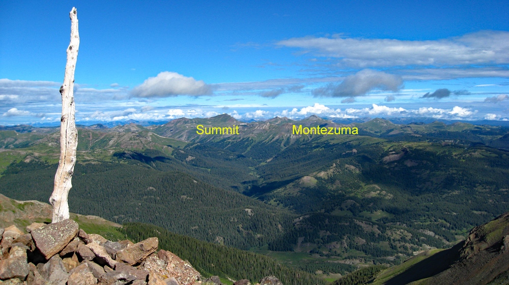
From here, on, it is just a stroll in the park. The survey map indicated a trail going all the way to the summit and we did indeed find that and followed it. The terrain was virtually all tundra with some embedded rock sections. As we approached the main summit mount, we spotted probably the same four bucks bolting away from us. Again, the view is extensive and beautiful. To the south of the summit lay a vast tundra-filled basin of grass and sparse trees. We could hear in the distance, the bleating of domestic sheep and eventually spotted them pouring across a minor ridge into this basin like a wave of white spots all moving in unison. After an appropriate summit visit with final photos of your accomplishment, begin your descent, but lets go back a slightly different way to keep things interesting.
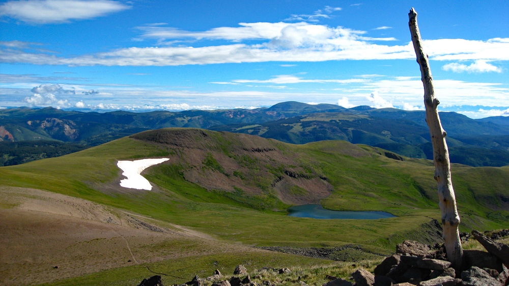
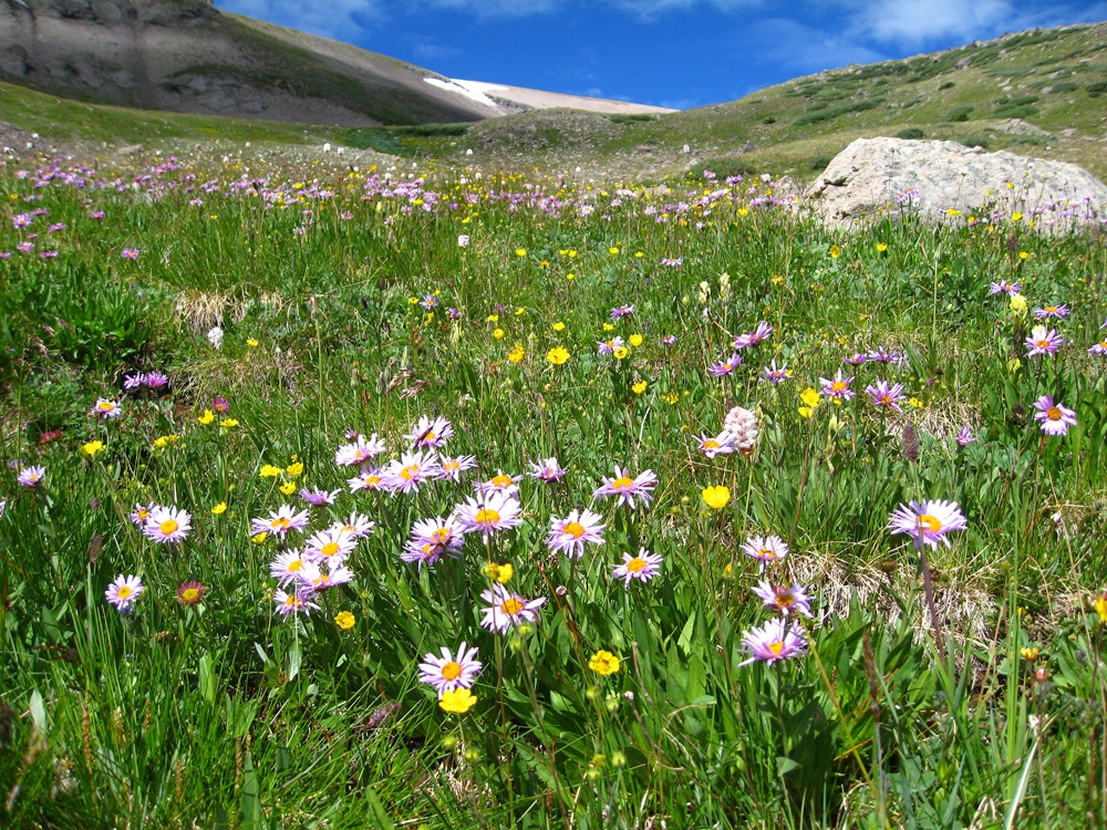
Hike down the north ridge of the peak a ways, then turn east and drop off what may be a late season snowbank and into the huge, Tobacco Lake basin on the northeast side of Conejos. There is some steep talus to negotiate at first, and then you will come into the flower and grass filled section of the basin and the headwaters of Saddle Creek. There may be more cattle grazing here. We found a number of flowers to photograph. We also found some unusually shaped trees to photograph. Back in the forest and on the last section of trail, there were even more flowers that temptingly posed for our cameras. Eventually you can rejoin the approach trail near where it crosses Saddle Creek and return on good trail to your vehicle.
Additional BETA
Links to other information, routes & trip reports for this peak that may be helpful. -