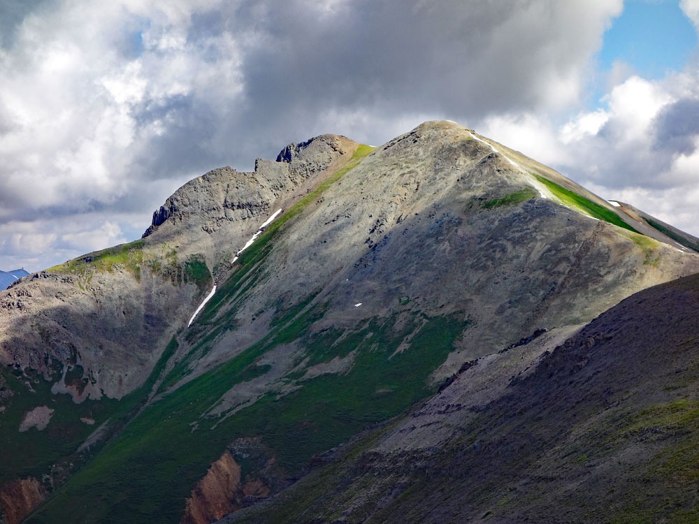
LoJ: #510 (Pre-LiDAR #502) / 13,167' Grand Turk
Peak Summary
Grand Turk is a typical Class 2 climb for this area around Silverton. The trailhead can be reached by any passenger vehicle and the route we provide takes hikers through some beautiful terrain with impressive views of the mountains around Silverton. Grand Turk is sequenced with Sultan Mountain. Lidar evaluation dropped the elevation of Grand Turk by 13 feet to 13,167.
Grand Turk NW Ridge Route
-
-
Sultan - Grand Turk TH
From the "Y" interchange on US550 just west of Silverton, continue south on US550 past the convenience store/gas station. The highway first heads NW to a switchback and thereafter, heads mostly south for Molas Pass. From the aforementioned intersection, it's appx. 4.5 miles to the trailhead parking. It comes just shortly after the terrain around the highway begins to open up and there is no longer a pronounced cliff band on the right hand side. The trailhead is an unofficial, dirt road turnoff on the west (right) side of the highway. There is another 4WD track that turns off in the same direction, just before the one we suggest. The road we suggest leads to some primitive camping sites and continues north as a jeep track for some distance, staying on the edge of the trees and just east of a utility line. When we climbed these summits in 2001, we actually parked farther north along US550 and walked west across the highway and scrambled up through the cliff band. That access has been posted as Private Property in recent years, hence, the access we are now suggesting. Watch for any Private Property signs and respect. If you end up at the turnoff for Molas Lake and the Town of Silverton Campground, you've gone too far. Turn around and drive back 1.3 miles to the trailhead.
If coming from Durango, you will need to drive north on US550 and go over both Coal Bank Pass and Molas Pass. The trailhead is 1.3 miles past the turnoff for Molas Lake and the Town of Silverton Campground at Molas Lake. It is on the west (left) side of the highway.
Camping
There are several camping opportunities in the immediate area. There is a National Forest fee campground at Little Molas Lake with vault toilets but no drinking water or trash service. There's also the Molas Lake Campground Park operated by the Town of Silverton. This facility has about 50 campsites that accommodate campers, trailers and tents. Showers are available for a fee.
In addition to these, farther away is the South Mineral Creek area and campground NW of Silverton. There are also a number of primitive sites in the vicinity of Molas Lake and at the trailhead. Take your pick. Andrews Lake only allows day use.
-
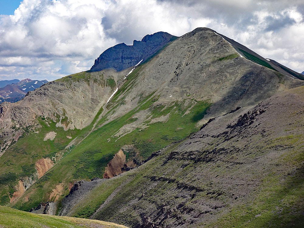
From Sultan Mountain
Click thumbnail to view full-size photo + caption
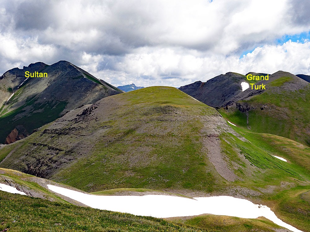
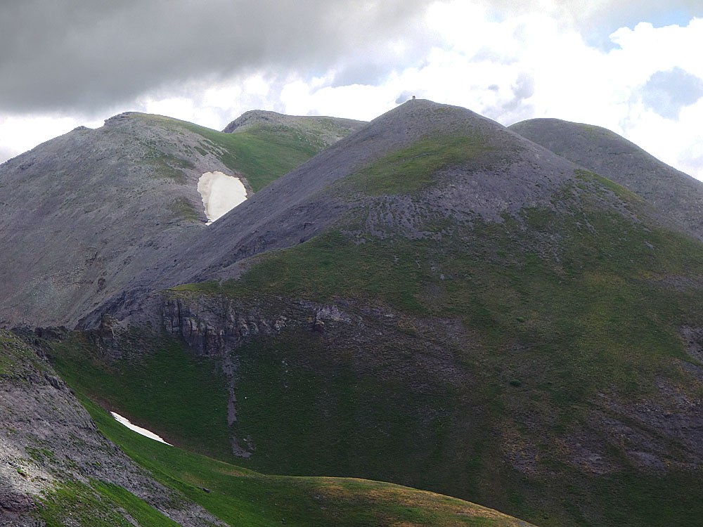
Open This Route in a New WindowFrom the trailhead just off US550, head north following the single-track road along the edge of the trees. There should be a utility line on the left (west) and eventually the road will pass under that line and the line will make a jog to the east. Just shortly past there, a wide avalanche chute comes in from the left. Turn west (left) and gain about 325 vertical feet up that open slope to a higher bench-like area that is also basically open terrain. Walk north along the bench toward Deadwood Gulch and the tumbling stream it holds. Before reaching the gulch, you'll need to keep walking north into the trees. Once you reach a place where you can overlook the gulch, do not cross here and DO NOT ATTEMPT TO HIKE DIRECTLY IN THE GULCH. Turn west and hike steeply along the edge of the forest overlooking the gulch. At one point, we had to do some scrambling on an open scree slope before gaining some easier terrain. Also, according to a 2021 report from someone who used this route description, expect heavy tree-bashing. Where the gulch levels off a little just below 11,600 ft., a very clear game trail leads out of the gulch and to the north. Follow this until you gain the east ridge of Sultan requiring a steeper gain to do so. Once on the east ridge, the remainder of the hike is over mostly tundra with increasing rock as you approach the summit. The summit view offers a nice overlook of Silverton and Kendall Mountain dominates the view immediately to the east. To the west is Bear Mountain, one of the highest 12ers in the state. Then, there's also the Ice Lake Basin group in the distance showing some impressive summits. From this summit we highly recommend continuing on to Grand Turk which we have sequenced with Sultan. Also note: There are alternate route descriptions available on the internet for these summits you may want to consult and/or consider.
Click thumbnail to view full-size photo + captionRoute Description
Year Climbed: 2001Grand Turk is sequenced with Sultan Mountain. One-way mileage and elevation gain are measured from the summit of Sultan Mtn. Round-trip mileage and elevation gain assume completion of the sequence.
From the summit of Sultan Mountain, walk south down the ridge that connects over to Grand Turk. The saddle is indicated on the USGS map to be 12,776 ft. Beyond the saddle, the 372 feet of gain to the summit of Grand Turk is a simple walk-up. The entire traverse can be completed in about a half hour and passes over tundra, scree and rubble. Walking is not difficult. The true summit may not be apparent. We just hit both high points to be safe.
For the descent, here's what we did: For the return to the trailhead, we decided to cover some different ground by heading further south. For good measure, we climbed the 13,087 summit. It only required about an additional 15 minutes to do so and it was only as little as 13 ft. from counting. From the top of this summit, we descended the southeast ridge on small scree for a while until we reached more stable tundra, and then continued down the southeast ridge of the peak. At 12,600 ft., we could have contoured over into the basin just north of this ridge, but did not do so because we could not see clearly if we could descend all the way down the basin without contending with a cliff band. As it turned out, we could have done so with no problem, but instead, we hiked on down the southeast ridge until we dropped off it on the north side at 11,900 ft. This took us into a flat area of a basin that would have been flower-filled earlier in the summer, but now, they were all frostbitten.
From this basin, we skirted one group of trees to the north and hiked east-southeast on the grassy slopes down to Sultan Creek. At 10,500 ft., we contoured north, hiked a little north, then cut through or around the trees to the east, passing under the utility line and located the road used to begin the hike. Walk south on back to your vehicle.
Additional BETA
Links to other information, routes & trip reports for this peak that may be helpful. -