LoJ: #557 (Pre-LiDAR #554) / 13,114' Isolation Peak

Peak Summary
Isolation Peak is a Class 2 hike in the heart of Wild Basin, Rocky Mountain National Park. While this summit could be done as a very long day-hike, (17 miles or more), we did it as part of a backpack trip to a base camp below Bluebird Lake (Upper Ouzel campsite). From there, you can also access Copeland and Ogalalla. The Wild Basin trailhead is accessible to any passenger vehicle. If done as part of a backpack trip, a backcountry campsite permit is required and must be obtained months in advance. This is remote county and you probably won't see too many people once you get beyond the more frequented tourist trails. Lidar removed 4 feet elevation from this summit from 13,118 to 13,114 ft.
Isolation Pk South Ridge Route

-
-
Wild Basin - Bluebird Lake RMNP TH
For Front Range residents, there are several ways the Wild Basin TH can be accessed. Perhaps the most direct and easiest is from Longmont to Lyons on US 36. At Lyons, take CO7 to Allenspark. The Wild Basin turnoff is about 2.4 miles north on CO7 from Allenspark. Watch for signs for the turn to the west off the highway. There are turn lanes at this intersection. You will then be on CR84 West. Follow the paved road to a right hand turn onto the road leading to Wild Basin. The road becomes graded gravel and you immediately come to an entrance station and small parking area for the Sandbeach Lake TH. After the entrance station, the road passes by Copeland Lake. It's about 2 more miles to the parking area for the Wild Basin trails. There is a ranger station here, picnic tables and vault toilets. While there are plenty of parking spots, weekends can see this fill up so earlier arrival is advised. Carpooling is advised.
Other ways to access: From Estes Park, drive south on CO 7 to the same turnoff for Wild Basin. From Nederland, drive north on CO 72 past Ward, Peaceful Valley and Raymond to the intersection with CO 7. Go left on there to Allenspark and then north 2.4 miles form Allenspark for the same turnoff.
Camping
There is no campground at the Wild Basin TH area. There are fee-based campgrounds located at "Olive Ridge," between Allenspark and the Wild Basin turnoff and the "Meeker Park Overflow" north of the Wild Basin turnoff by about a mile and a half. There is little if any at-large camping anywhere close because of all the private property.
-
From Wild Basin - Bluebird Lake RMNP TH via Upper Ouzel Campsite
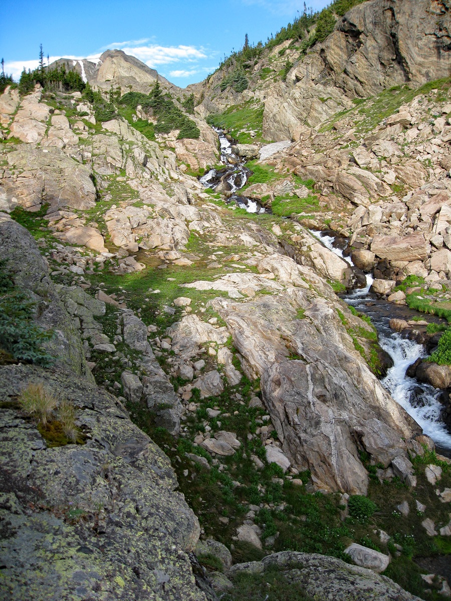
From the Wild Basin parking area, head out west on the trail on the north side of North St. Vrain Creek. The trail passes Copeland Falls after .3 mile and continues another 1.2 mile to an intersection. This first section of trail has little elevation gain on a wide and heavily used trail. At 1.5 mile from the TH, head up left for .4 mile to Calypso Falls and join another trail. This new trail, if taken east will lead back to meet the Finch Lake trail. Instead, head west to Ouzel Falls in .9 mile and continue left at another trail junction in another .4 mile. Now you'll be heading for Ouzel and Bluebird Lakes. The trail switchbacks up the hillside and gains a broad and open ridge. Follow the trail past the turnoff for Ouzel lake (1.4 mile from the last intersection) and continue another 1.8 mile to Bluebird Lake, or 1.4 miles to the Upper Ouzel Campsite, which we treat as the terminus to this approach. Most of the trail after gaining the open ridge gains elevation gradually, but as you approach the last half mile to the lake, you'll have some steeper sections. Copeland Mountain will offer a formidable north flank seen across the valley to the south.
Camping
All camping in the RMNP backcountry is regulated and the campsites are designated and sites are limited. Visit the RMNP website for the most current information on backcountry camping. On the Bluebird Lake trail, there is a designated site near Ouzel Lake and then about a half mile before arriving at Bluebird Lake. Camp locations last time we utilized this system could be made as early as the month of March, preceding the summer of your intended visit. Get your application in as early as possible to have any chance of getting your desired campsite. The following link takes you to a pdf map of all the designated backcountry sites.https://www.nps.gov/romo/planyourvisit/upload/campsite_map_small-2016.pdf
The Bluebird Lake campsite has a few tent spots located on a shelf above a bluff that overlooks the trail. There are low conifers there. There is a sign marking the turnoff for the campsite. Water can be obtained from the nearby Ouzel Creek and there are nice wildflower meadows to visit. The coordinates below are our best guess as to the campsite location using Google Earth.
Campsite Locations
Bluebird Lake N 40° 11' 44.10", W 105° 38' 49.74"
Open This Approach in a New Window
Click thumbnail to view full-size photo + captionRoute Description
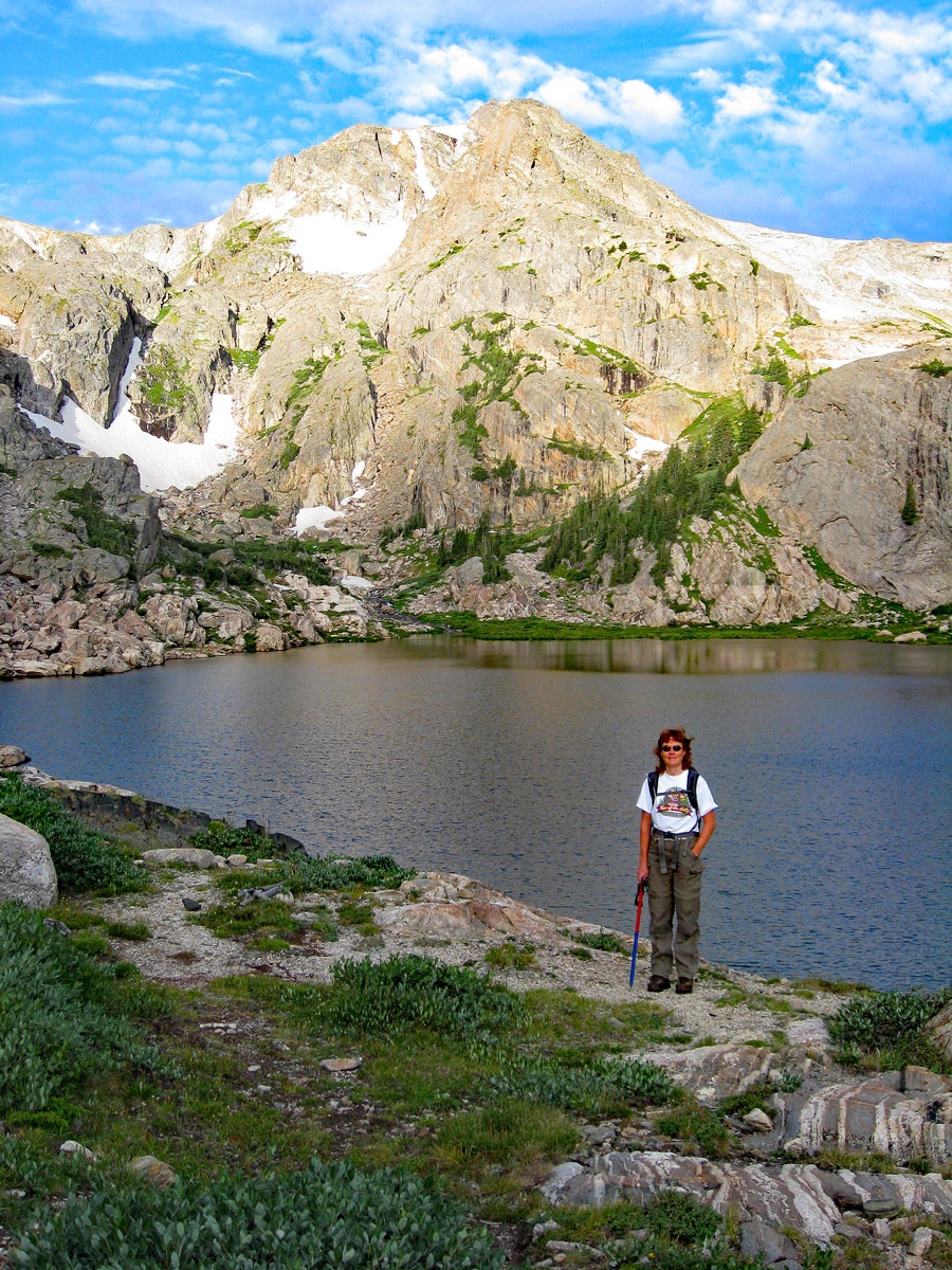
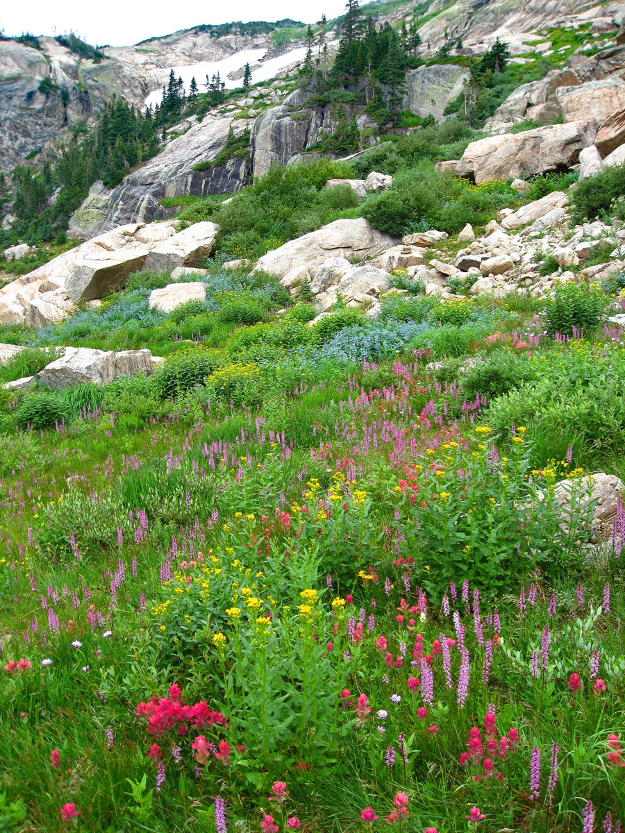
Year Climbed: 2007If camped at the Bluebird Lake designated site, (Upper Ouzel) you'll first need to walk on up to the lake, about a .4 mile away. From the campsite to the lake, there is some steeper trail to navigate. The beautiful lake will greet you with rocky splendor. The backdrop for the lake is Ouzel Peak and a rugged looking valley on the south side of the peak. The east and north slopes by the lake we found abounding in wildflowers.
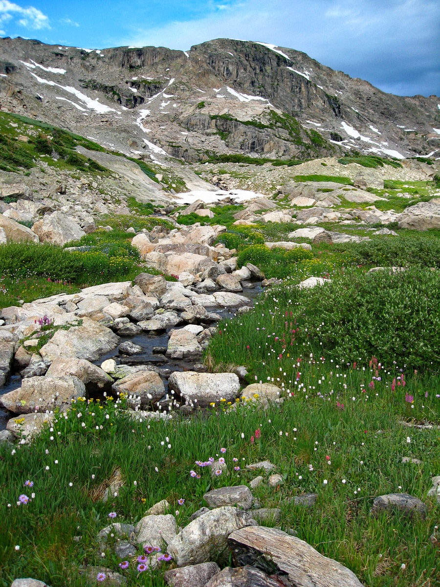
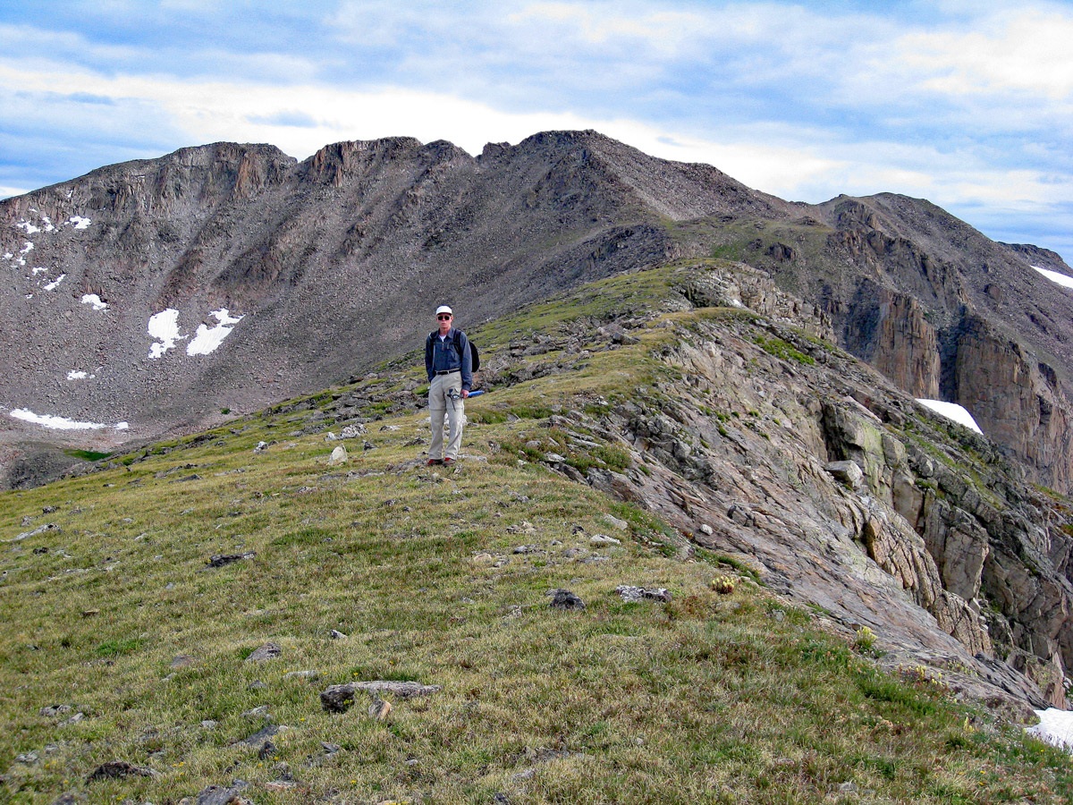
Cross the lake outlet and hike north and west along the shore before beginning a diagonal ascent on the north slopes toward Lark Pond. From the Lark Pond, we “pondered” (pun intended) over the best route to Isolation Peak. We ended up taking a slanting route, past Pipit Lake and up the east flank of the ridge that bounds this upper valley on the west and struggled through some steep and very loose talus as we approached the ridge. We emerged on the ridge perhaps near the 12,400 ft. contour south of the low point saddle below Isolation. This meant we would have to descend some to that saddle and then regain 900+ feet of elevation. Once past the saddle, it was a fairly easy stroll to the summit of Isolation with a mixture of rock and tundra, perhaps more rock than expected from the initial distant views.
Once atop the summit, we could survey the valley below and came to the conclusion that if you want the easiest route up Isolation, you should just stay in the valley hiking up past Pipit Lake, swing north to Isolation Lake and then walk up fairly easy slopes to the west to the summit of Isolation. The stroll up the valley would have been much easier than our route, especially if you stayed on the north side above the lakes. Class wise, we're talking Class 2+ versus Class 2. Neither route has any significant difficulties other than the talus.
Additional BETA
Links to other information, routes & trip reports for this peak that may be helpful. -