LoJ: #331 (Pre-LiDAR #336) / 13,385' Italian Mountain
Peak Summary
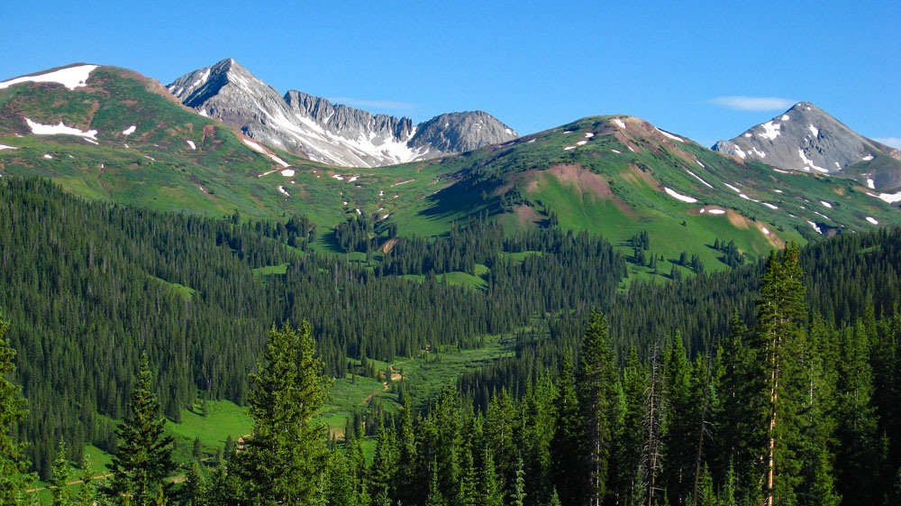
With 4WD to access the trailhead, Italian Mountain is an easy Class 2 hike that can be completed in a morning. Without 4WD, this peak is a long haul up Cement Creek, or via FR759 which is north of Taylor Park Reservoir, the access could be shorter. This is beautiful, lush country abounding in wildflowers in the higher elevations. There are also some easy 12ers, one directly south of Italian, that can be climbed as well. The head of Cement Creek offers a nice loop hike with a stellar view of Star Peak. Pre-Lidar elevation was 13,378 ft.
Italian Mountain South Ridge Route
-
-
Cement Creek - Italian Mtn TH
From the center of Gunnison, CO and the intersection of US50 and CO135, drive north on CO135 for just over 20 miles to the turnoff for CR740. This intersection comes between mile markers 20 and 21. The turnoff is to the right and this also serves as access to the local airport. The road starts out paved, but in one mile, turns to good, graded gravel. In 3.6 miles is the Cement Creek CG. After the campground there is a residential areas of several cabins followed by the Deadman Gulch TH. After this trailhead, there is another residentail area of more cabins, then road begins to degenerate into more of a 4WD track. At 8.0 miles, the road crosses Cement Creek to the east side, then climbs uphill on some switchbacks. On two of the switchback curves are some primitive campsites. At 8.6, 9.0 and 11.1, there are good primitive sites as well. The one at 11.1 is the trailhead for Hunter Creek. At 13.2 miles appx., the road crosses back over to the west side of Cement Creek. Right after crossing the stream, there's a place to park for one or two vehicles. This serves as the trailhead for Italian Peak. There may also be a spot or two before crossing the creek alongside the road. Overall, the drive back here is not technically difficult. 4WD capability is not as important as good clearance for all the potholes. Generally, rocks are not a big problem. Drive time from CO135 will be close to an hour.
An additional note: It is possible to continue up the road along Cement Creek with 4WD for some more distance if you're interested in exploring more of this area or hiking Crystal Peak. When you get to the Crystal peak Trail turnoff (#958), the road after that point becomes true 4WD. On the map we provide, we have shown a loop hike for Crystal Peak. This is a very nice half day hike that offers a tremendous and impressive view of Star Peak and Taylor as well, and it passes through an area of abundant wildflowers.
Camping
In the description above, there are several possible, primitive camping sites mentioned. Most if not all of these will be occupied on a weekend. There is one National Forest CG mentioned above. It is the Cement Creek CG. Here's the link to the Gunnison NF website page for this campground: https://www.fs.usda.gov/recarea/gmug/recarea/?recid=33152
Campsite Locations
Cement Creek › N 38° 49' 44", W 106° 50' 08"Elevation 8980 ft.
Click thumbnail to view full-size photo + captionRoute Description
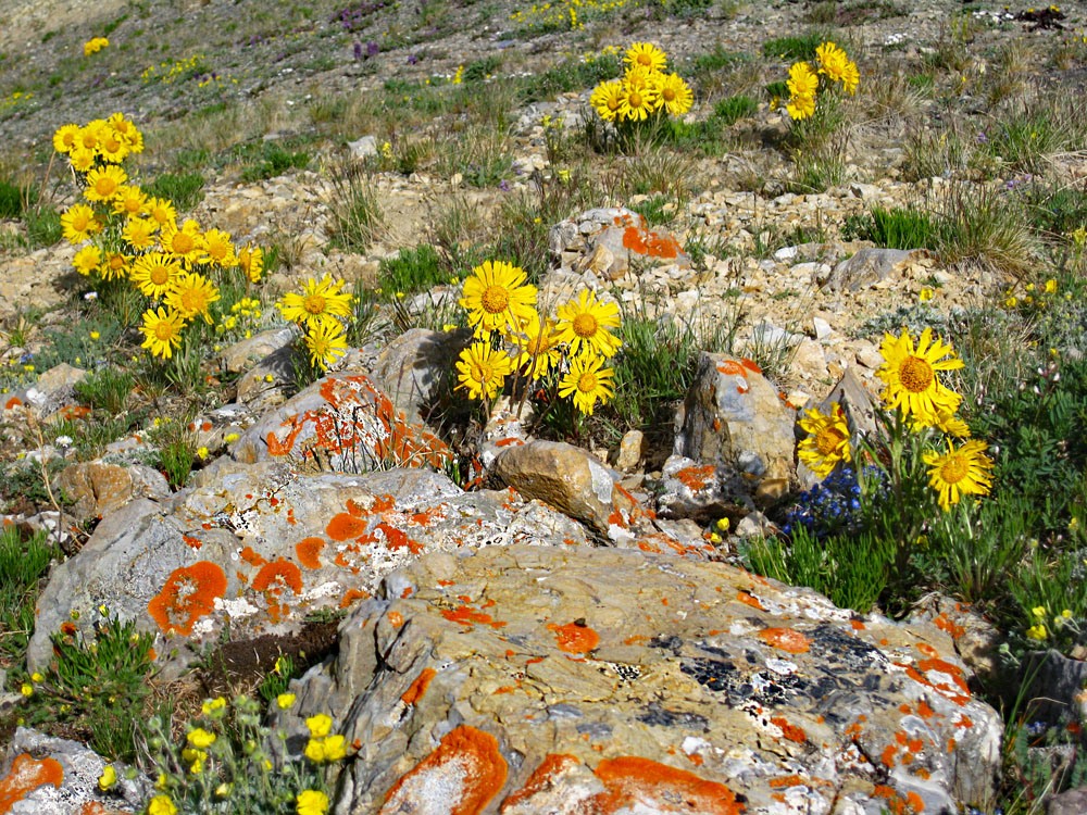
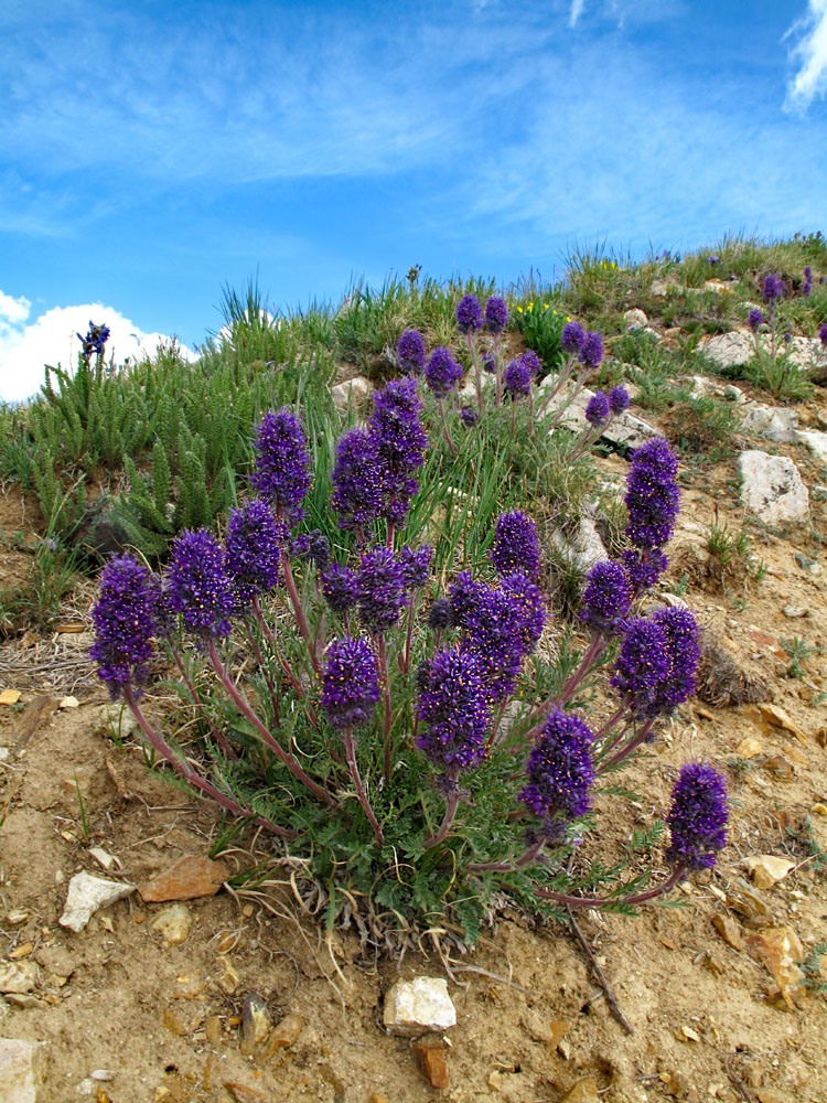
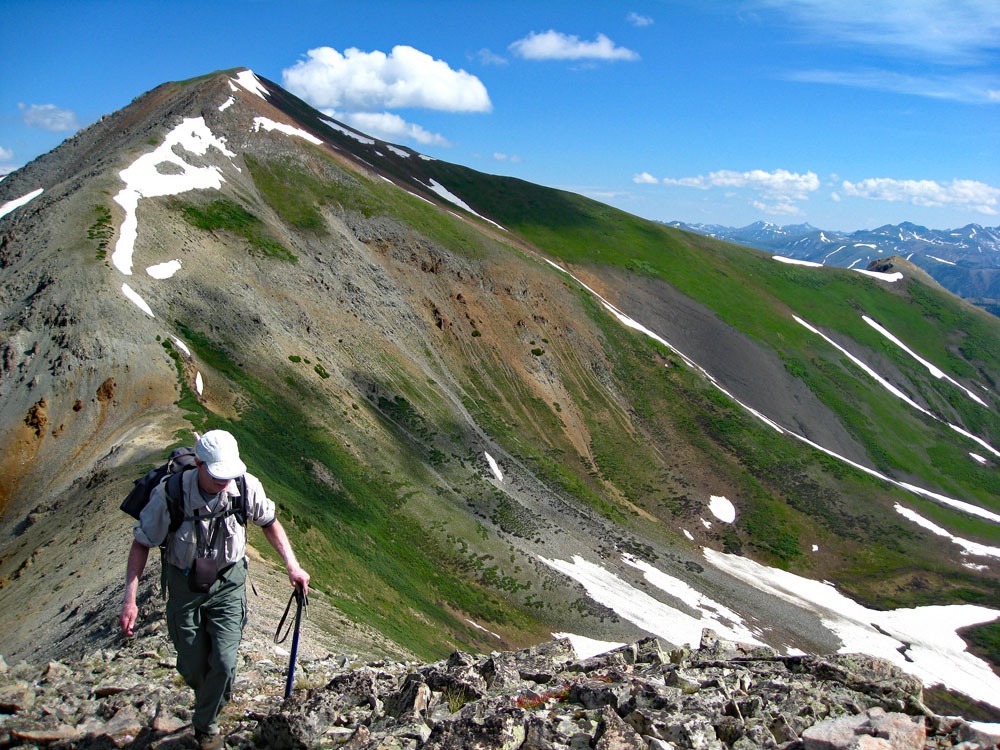
Year Climbed: 2011From the main creek, cross back over to the east side if you parked where suggested and begin hiking south, then east, crossing to the south side of the very minor little creek that drains down from about half way up to the saddle between Italian and UN 12, 830. Hike eat uphill staying mostly either out of or on the edge of the forest. Walk up moderately steep slopes of grass and numerous wildflowers – especially paintbrush. Above the open slope, skirt the end of a rock glacier to the right side and follow a very faint trail around and above it to a flatter meadow are, guarded by low willows. There was also a nice rivulet running through the open meadow that we enjoyed, but we were here fairly early season.
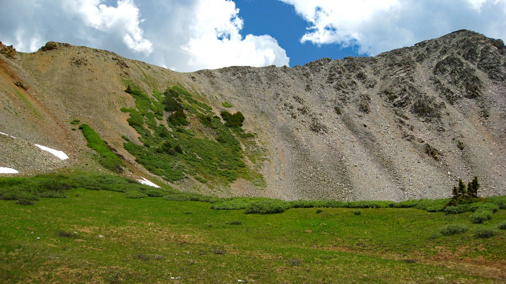
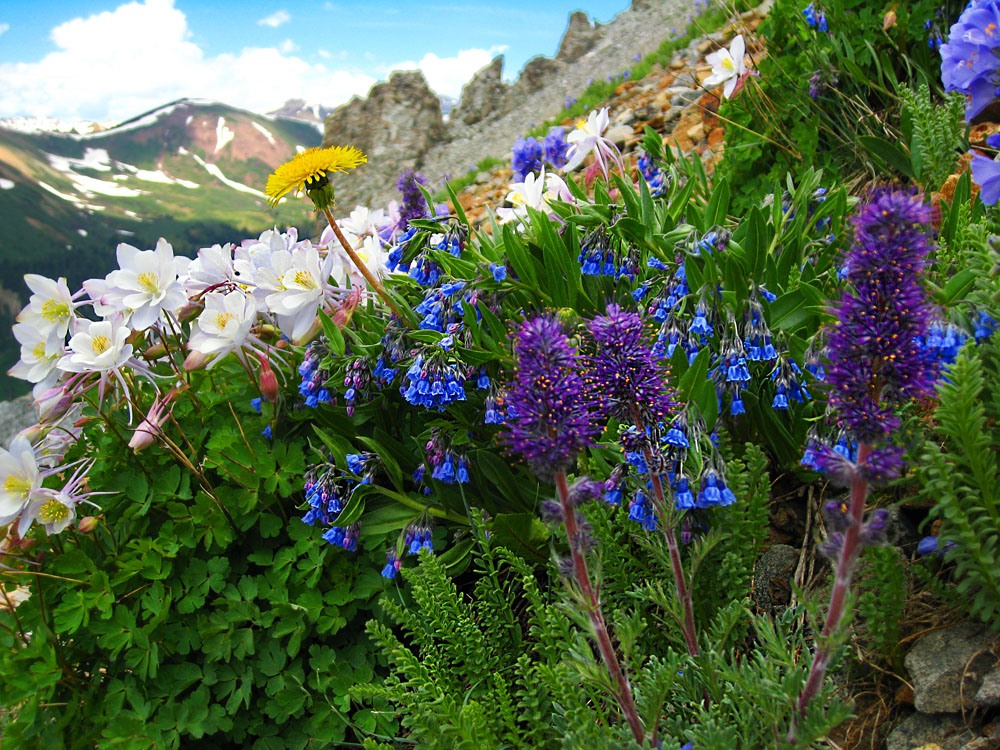
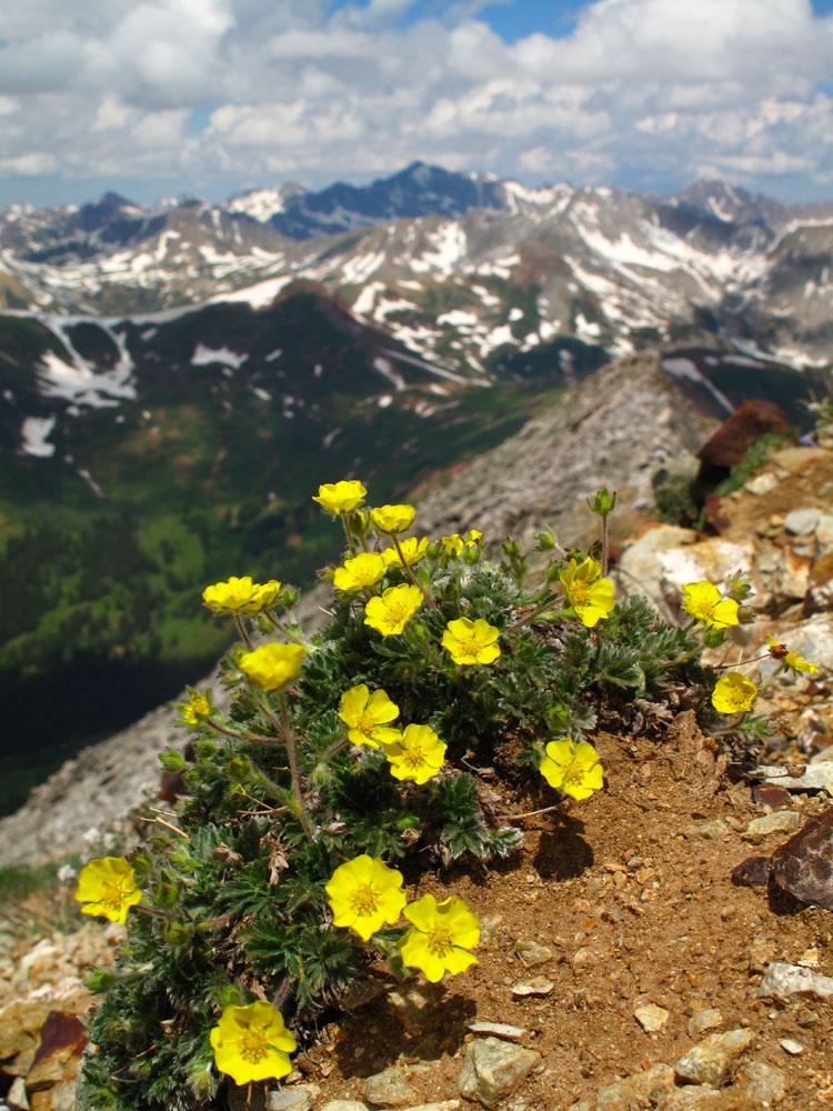
Above the flatter meadow area and the last willows, enter a not too steep gully that leadd to the saddle south of the Italian summit. There is about 500 feet of rubbly hiking over smaller rocks. There are some nice flowers going up this slope. As you hike higher, an amazing vista unfolds of brilliant, lush green mountains topped by gray rocky summits and patches of white snow against a blue summer sky. We could hardly believe how green everything was.
At the saddle, we found a large patch of Old-Man-On-the-Mountain. They all had their faces turned to the east sun and we took photos of them in a backlit position. The unnamed 12er summit is only a little over 300 feet of gain to the south, so you may want to climb it first. It is mostly a quick hike over chiprock, small talus, some rocky outcrops and some tundra and only takes about 15 minutes to reach the summit. From this summit or Italian and the connecting ridge, watch for elk below. From UN 12,830, walk back down to the saddle and begin the 900 foot ascent of Italian Mtn.
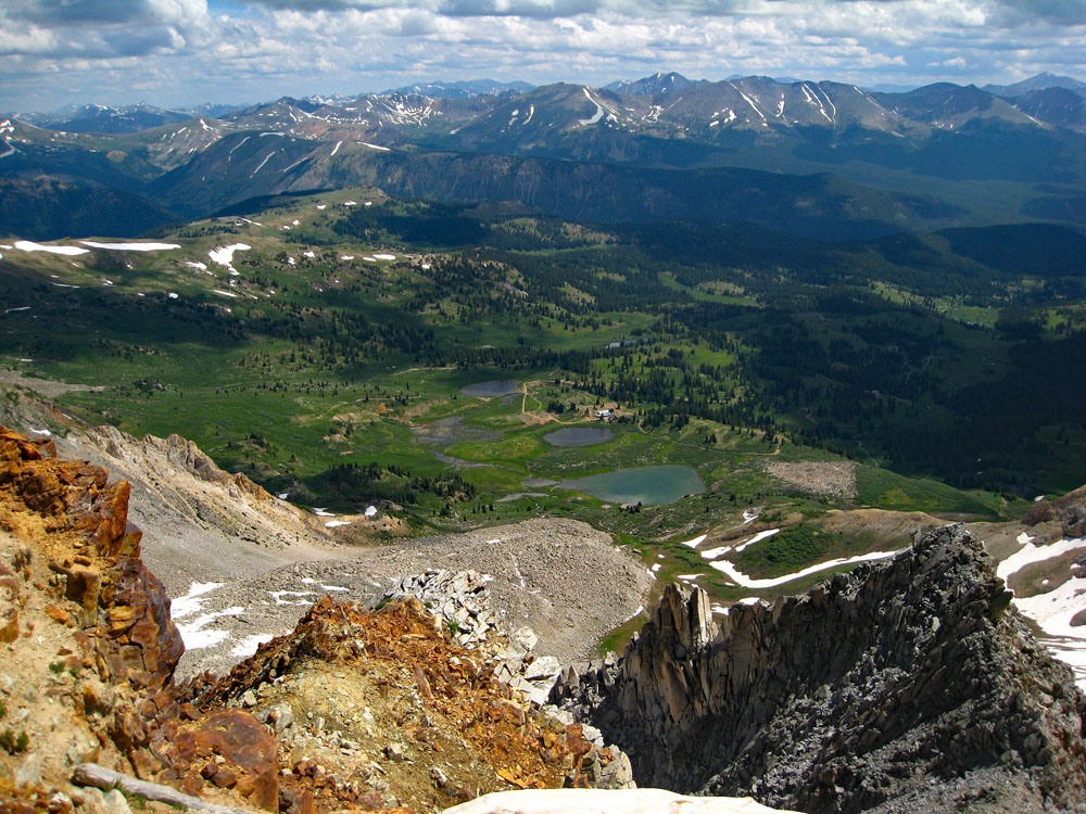
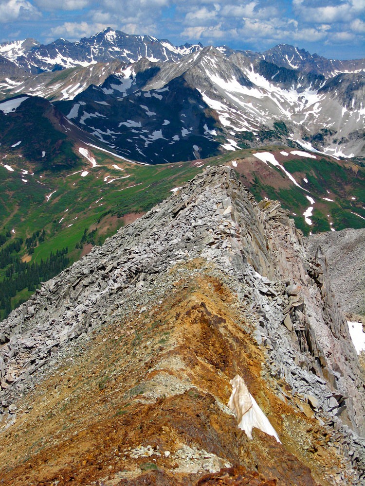
Most of that part of the hike goes along the ridge crest on more talus, chiprock and scree. Part of the hike also passes through vibrant tundra filled with abundant alpine avens & buttercups, small blue flowers and some clumps of Purple Fringe. The summit has just a little bit of tundra, a rock cairn and we found the lower jawbone of an elk perched on the cairn. Looking to the north, we could see the interesting ridge that connects over to Lambertson. We watched two people, who had apparently just left the Italian summit, head for Lambertson. To the east, we could see old mining activity and over on American Flag Mountain, we could watch a group of ORV’s drive all the way to that rounded summit. North and NE of us, we could see much of the southern Elk Range with a great deal of snow still showing.
For the descent, return as you came, but some may want to consider the traverse over to the unranked Lambertson. That involves navigating a section of "knife-edge" ridge. We have not attempted that traverse so you would need to research on other sites. Gary Neben has a useful report on Mountain Handbook if you desire to approach Italian from the east side and the Star Mine and also makes a brief comment about the Lambertson-Italian ridge.
Additional BETA
Links to other information, routes & trip reports for this peak that may be helpful. -