LoJ: #313 (Pre-LiDAR #309) / 13,417' Little Giant Peak
Peak Summary
A Class 2 hike that mostly follows old mining roads/trails and takes you by interesting mining ruins. Relentlessly steep, but still only a moderately strenuous hike. Pre-Lidar elevation was 13,416.
Little Giant by Dives Basin Route
-
-
Cunningham Creek - Silverton TH
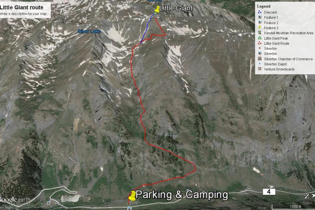
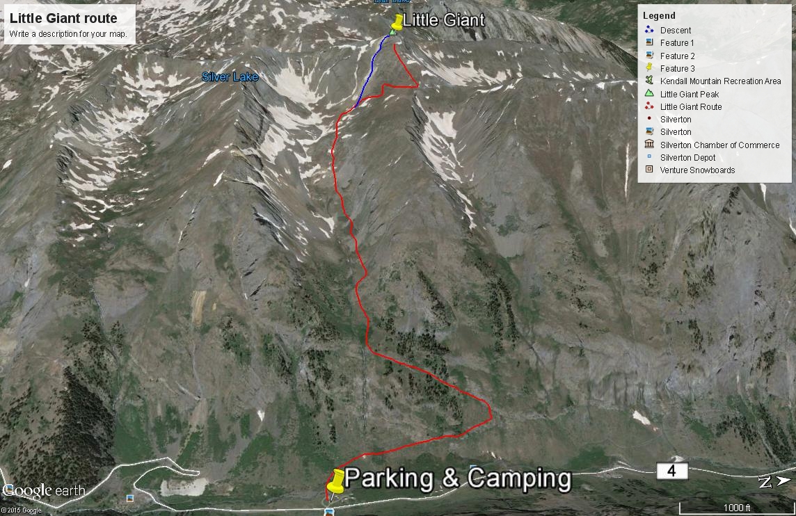
From the Town of Silverton, drive to the east end of town where the paved road splits one block past the courthouse. Set your odometer and veer right onto blue-signed County Road 2. (On Trails Illustrated map #141 this is road #110 aka: BLM 4500.) After 2 miles, the pavement ends and the road becomes well-maintained, graded dirt. At 4.2 miles, you'll come to an intersection and the old townsite of Howardsville. Turn right onto BLM 4513 or FS589. A sign here indicates Cunningham Gulch and Stony Pass. At 4.4 miles from town, stay right. At 5.9 miles, stay right again. Do not drive up the Stony Pass Road. Continue driving south along Cunningham Creek. At about 7.1 miles is the place to park to access Little Giant Peak. At 7.6 miles is an old toilet on the east side of the road and a camp area on the west. At 7.8 miles, the good road ends, but passenger cars with moderate clearance can still make it to the trailhead. Take the right fork, drop down and cross the creek, then begin climbing on a single switchback to the trailhead. At 8.6 miles, turn left and descend sharply to cross Cunningham Creek again, (This is a low-water crossing which can be difficult in runoff season,) then drive another .2 to the limited trailhead parking area. If there's no room to park here, you can park before crossing the creek on a flat area just beyond the intersection atop some old mine tailings. Trailhead coordinates provided above are for parking at the first crossing of Cunningham Creek. The coordinates for the actual trailhead are: N 37° 46' 51.43" W 107° 34' 47.30".
Camping
At either of the two trailheads, you could park and vehicle camp overnight. On the drive up Cunningham Creek, once you pass the turnoff for Stony Pass, you can find a few other pullout type spots for an overnighter. Be careful about private property issues though. Back along CO110, there are a number of at-large, primitive sites, usually occupied by RV's and the likes. The nearest National Forest campgrounds will be either up South Mineral Creek or Little Molas Lake.
If you desire to spend more than a day in the area of the Highland Mary Lakes, then there is a short little backpack you can do to a good camp location that's only about 1.5 miles in from the passenger car trailhead or about 1mile from the 4WD trailhead. It's located in the last trees north of the lakes just above 11,670 ft., on a sloping ridge between the two main forks of the creek. There's room for several tents and a good water supply. This is where the trail to the lakes takes a decided turn to the west to follow a secondary drainage. Coordinates are approximately: N 37° 46' 10.4" W 107° 34' 34.8".
Route Description
Year Climbed: 2002From the parking/camping coordinates provided at 10, 400 ft., look for an old mining road/trail directly across the creek that shows on the USGS quad. This trail switchbacks up the mountainside - first north, then SW. It may require some searching at first to find it, but once you're on it, it will be easy to follow. You will have to wade across Cunningham Creek. After the initial big switchback, the trail climbs steeply on the north side of the stream in Dives Basin, with multiple switchbacks. It took us about 2 hours to get to the old Shenandoah Mine ruins. We found a strange hole around here - about 30 feet deep that was perhaps the remains of an old exploratory dig. It looked more like a small, meteor impact crater. There was also a cable that stretched out way up onto the mountainside to some other mining activity.
Continue following the old trail higher into the basin. A large, yellow couloir sweeps down from the summit of Little Giant on the SE flank of the peak and pans out onto a large, rocky slope. This can serve as a quick descent route later on. Continue following the old trail where you wish toward the east ridge of the peak on mostly steeper tundra. Once on the east ridge, it's fairly easy walking over rubble to the summit. Overall time to the summit for us was just under three hours.
To descend, either return as you came or for variety, head west from the summit, dropping down a short distance to explore some more mining ruins very near the summit. From there, drop on down the yellow rock couloir to the SE, utilizing some nice scree slopes for quick descent. Then cross back over to join back in with the old trails in the upper basin and follow the track back down to Cunningham Creek. the relentless descent will take a toll on your feet, but you can cool them when you cross the creek.
An interesting side note: While exploring around the Shenandoah Mine, we found an old board that had a still legible stamp on it indicating it had been manufactured in Louviers, CO, which is between Littleton and Castlerock on Santa Fe. The date on the board went back into the late 1800's.
-