LoJ: #165 (Pre-LiDAR #164) / 13,669' Lookout Peak

Peak Summary
Lookout Peak is easily accessible from Ophir Pass, and much of that road does not require 4WD, but you will need it to traverse the upper section of the pass which will require 4WD. Climbing Lookout from Ophir Pass presents an opportunity to see a section of the San Juans that are often passed by. It's a scenic drive and the climb is one of those types that can be completed well before lunch. From a start on Ophir Pass, the route is a loose-rock, Class 3 climb. Lidar added 8 feet of elevation to this summit.
Lookout Pk South Ridge Route
-
-
Ophir Pass TH
If coming from Durango/Silverton, drive north from the main highway intersection on the west side of Silverton on US550 for 5.5 miles and watch for the turnoff on the left for FR679 to Ophir Pass. The road drops down to cross Mineral Creek before beginning its climb west up the valley. It will be about 4.6 miles to the pass summit. Most of the road is fairly easy driving, but as you approach the pass, this is where you'll likely be glad for 4WD.
If coming from Ouray, drive south on US550 over Red Mountain Pass. On the south side of the pass at the large hairpin turn, it will be another 2.9 miles down the road to the turnoff on the right for FR679. Follow the road across Mineral Creek and drive 4.6 miles from US550 to the summit of the pass.
If coming from Telluride, From "Society Junction" about 4 miles west of the town of Telluride on HWY 145, turn south and head up the hill and past the turnoff for the ski area. Continue south several more miles to the turnoff for Ophir. Drive east on FR630 to Ophir - which is mostly a collection of summer cabins. Continue driving east past Ophir to the pass. At the top of the pass, FR630 becomes FR679. It's all the same road. From the center of Ophir, it's about 3.9 miles to the pass summit.
Camping
There's not a lot of good choices for camping in the vicinity. The nearest Forest Service CG is the South Mineral out of Silverton. Another option is where FR679 turns off of US550, there's an open spot in some trees right off the highway. You'll have to put up with highway noise and no privacy.
On the west side of Ophir Pass, there' s a lot of private property around the village of Ophir, so the best option may be the Swamp Canyon TH for climbing V.3. Look up the other Ophir Pass TH that describes how to get to Swamp Canyon.
Click thumbnail to view full-size photo + captionRoute Description
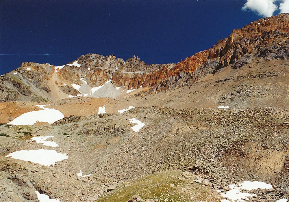
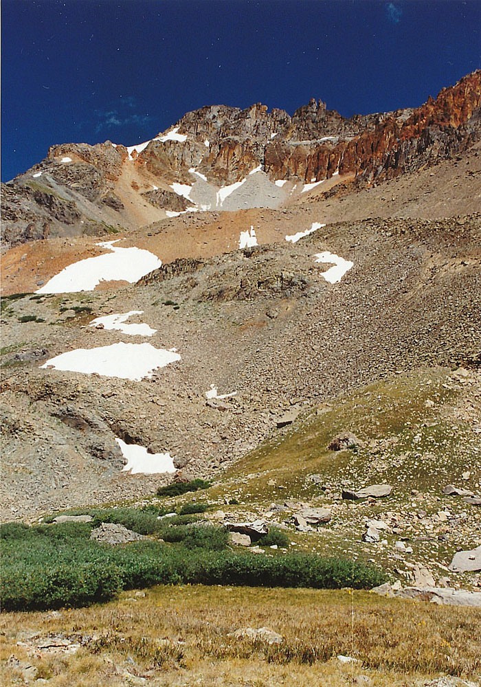
Year Climbed: 1993If you have parked at the top of the pass, walk back east to a bend in the road and then begin contouring uphill to the NE. This route will avoid having to go over the 12,187 ft. hill directly north of the pass. In 1993 we found a trail that worked its way up through willows and contoured into a small basin a little below 12,000 ft. with a small tarn. We were able to continue on this trail in a generally northern direction, but it became increasingly vague until it no longer mattered. The winter of 1992 - 1993 was a fairly high snow year in the mountains and we were doing this climb on July 31. At 12,200 ft., we encountered the first snow and followed patches of snow farther into the basin above. The view of the Lookout summit from this SE-facing basin is intimidating. It appears very steep and very rocky. Make note of a reddish-colored, great couloir that sweeps off to the left to join the south ridge higher up. This couloir makes a nice quick descent. We continued into the upper basin at 12,600 ft., on increasingly rocky terrain. At that elevation, you'll see a partially tundra-covered slope to the west that gains the south ridge of the peak. This is probably the easiest way to gain that ridge even though the footing is not always secure. It did not take too long to gain the south ridge at least.
Once on the south ridge, follow it up toward the summit. Most of the ascent will be Class 2 walk-up on all kinds of broken, crumbling rock., but not too difficult. Along the way there will be some rock outcrops to work around or over. Higher up, cross the head of the previously mentioned great couloir at about 13,275 ft. In this particular year, the head of the couloir was still partially blocked by a snow cornice. Continue past the head of the couloir, still on the main ridge and at about 13,375 ft., you'll begin to encounter cliff sections that will require 3rd class scrambling to work up through. Above the head of another large couloir, we could see a steep, but consistent slope that provided access to the main summit area. Keep climbing on more rocky outcrops with some increasingly exposed 3rd class moments, to reach the slope above. There was one point that intimidated the kids a bit and we gave them some assistance. This "slope" will still require some hands down technique for stability and there's also a lot of scree to keep you concentrating on your steps. Shortly, you should arrive at the final summit ridge and it will be a brief stroll to the summit.
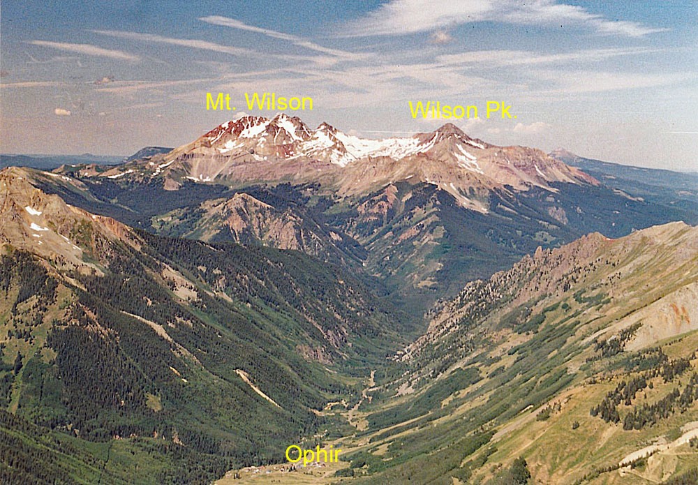
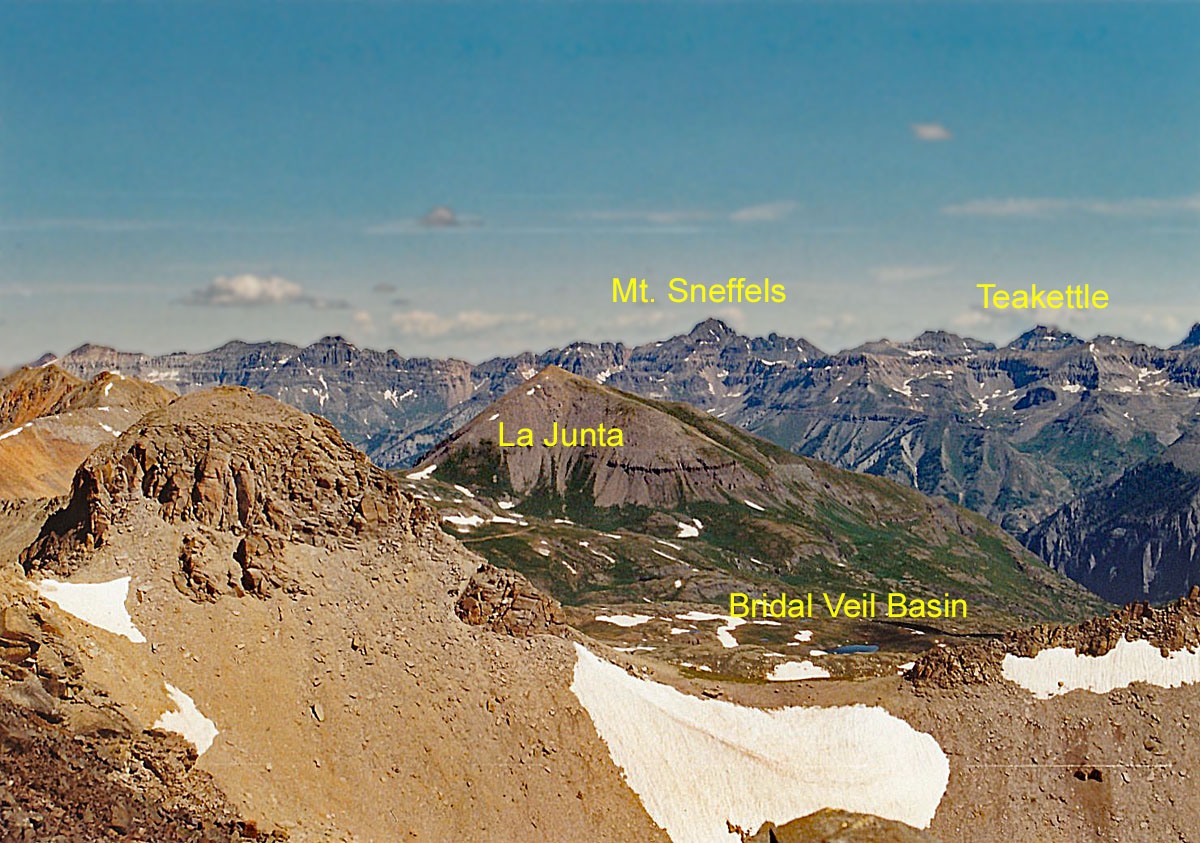
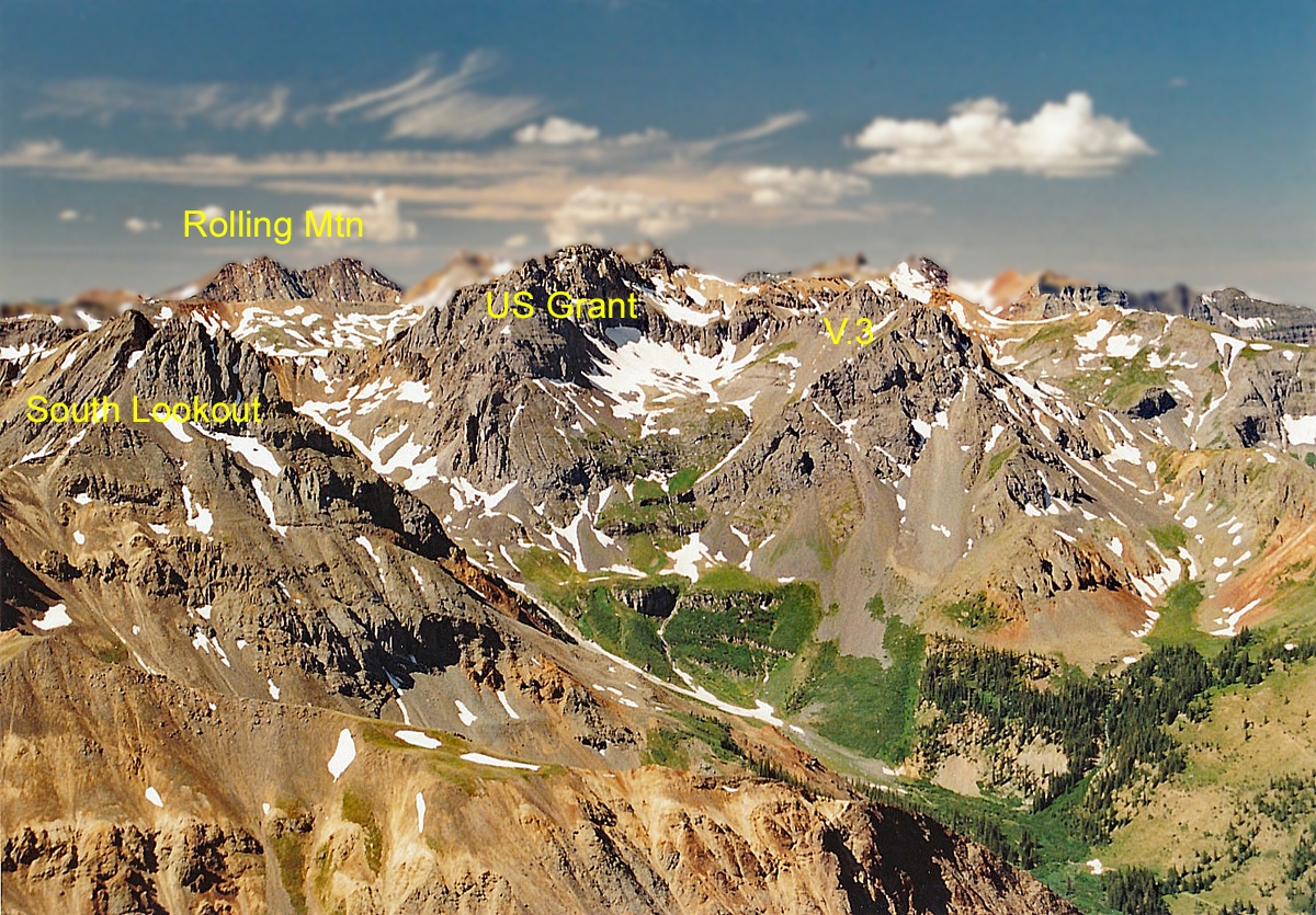
It required less than two hours to gain this summit from the pass. With an early start, you should be able to make it back to your vehicle before lunch. The view offers several unique perspectives. You'll be able to gaze west down the valley to the small community of Ophir and at the head of that view will be the Wilson impressive massif. To the north, you'll enjoy a great view of upper Bridal Veil Basin, typically accessed from Telluride. Also visible will be the peaks of the Ice Lake Basin area, Mt. Sneffels to the north of Telluride, some of the Needle & Grenadier Ranges and Closer by, South Lookout Peak and the imposing US Grant.
For the descent, basically follow your route back down to the head of the large, red couloir mentioned earlier. If you can access the couloir, it makes an excellent descent. At the head, you ma need to work around a snow cornice, and then clamber on some rocks with a little exposure to fully enter the gully. Once you're in it, the going becomes easier. Most of the descending will be on scree and loose rock. Plunge-stepping can be useful here. As the couloir plays out, rejoin your route from the morning and finish the walk back to your vehicle.
Additional BETA
Links to other information, routes & trip reports for this peak that may be helpful. -