LoJ: #65 (Pre-LiDAR #64) / 13,939' Mount Hope
Peak Summary
Mt. Hope is a Class 2 hike from the Clear Creek drainage near Winfield. This is one of the easiest summits to climb of the Top 100, other than for the overall elevation gain. The Sheep Gulch TH is accessible to passenger vehicles. Mt. Hope pairs nicely with Quail Mountain for a longer, but still manageable day with about a vertical mile of total gain. Much of the hiking is on a well-used trail.
Mt. Hope East Ridge via Sheep Gulch Route
-
-
Sheep Gulch Trailhead
Once again you'll access this summit by driving up from Clear Creek Reservoir toward Winfield. From US 24 between Leadville and Buena Vista, turn west on CR 390, a graded dirt road. This road is just short of 15 miles north of the main light in Buena Vista - town center; a little over 19 miles south of Leadville; or 4.3 miles south of the US 24/SH 82 junction. Drive west on CR 390 for 9.25 miles appx. to a road that turns off to the right, just after some large beaver ponds. This short road leads to a trailhead parking area. The trail you'll be using is #1776, and is one of the segments of the Colorado Trail. 4WD vehicles can make it another .2 mile before having to park. This segment is usually a part of the Leadville 100 foot race and is considered a "crux" section, in part because of the 2,670 foot gain to "Hope Pass." If you come to the turnoff for "Rockdale," you've gone too far. Turn back about .4 miles. The parking area has room for several vehicles and sits amid lodgepole forest.
Camping
There used to be some primitive sites at the trailhead, but if they've been closed, then you can probably "car camp" at the trailhead. There are numerous primitive sites all along CR 390 on the drive in. Weekends though can make it tough to find a spot to stay for the night unless you arrive early. The only designated camping is back at Clear Creek Res.
-
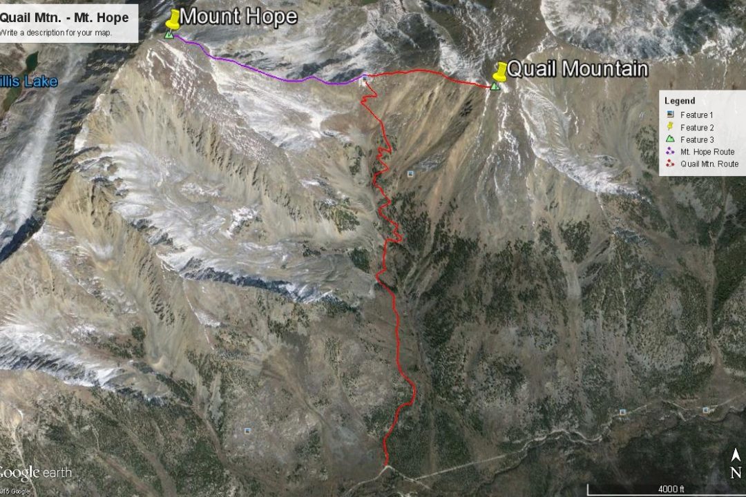
From Quail Mountain
Open This Route in a New Window(Quail Mtn. is sequenced with Mt. Hope). From the trailhead parking, hike north on the well-used trail that begins to gain elevation immediately. Like many of the other trails in this section of the Sawatch, there is steep hiking out of the lower valley (the first mile) followed by a little more mellow terrain in the upper valley sections. The trail heads up through lodgepole forest that eventually gives way to the more pleasant aspen and conifers higher up. At about 11,300 ft., the trail crosses to the east side of the gulch and the basin mellows out a bit before the final gain to "Hope Pass" on some switchbacks.
From the pass, trudge east directly up the west ridge of Quail Mountain. You will probably encounter multiple paths at times. They all offer a means of finding your way through the mostly rubble-covered ridge to the summit. At one time, there was an old cabin with a collapsed roof here. I doubt if much of any of it still stands. Quail Mountain was once the summit of a proposed ski area overlooking the Twin Lakes. When we climbed it in 1994, a number of entries in the summit register objected to this proposed development. Total time to summit: 3.5 hours with an 11 and 13 year old in tow.
From the summit, enjoy inspiring views of the Twin Lakes and Arkansas River Valley far below and of the expansive Sawatch Range. Return by the same route, but if you have not already climbed it, you should certainly add a trek up Mount Hope to the west of the "Hope Saddle" to your day. It too, is an easy Class 2 ascent and from the saddle can be completed in about 2 additional hours.
Click thumbnail to view full-size photo + captionRoute Description
Year Climbed: 1994Mt. Hope is sequenced with Quail Mountain. One way mileage and elevation gain are measured from the summit of Quail. Round-trip mileage and elevation gain assume completion of the sequence.
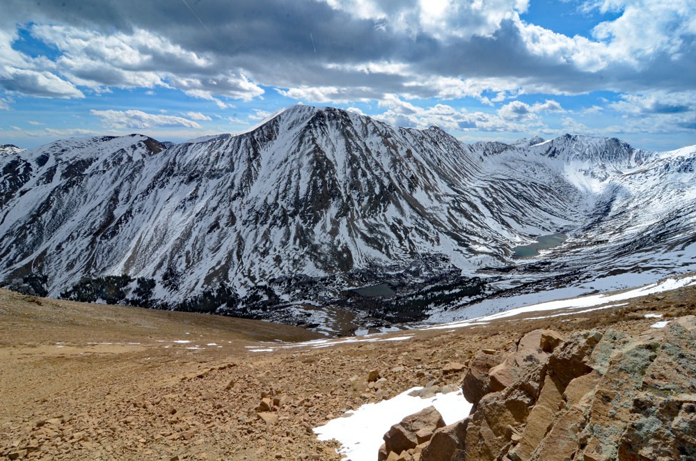
From the summit of Quail Mtn., descend back down the broad west ridge to the Hope-Quail saddle. The mostly rocky descent will take about a half hour. To ascend Mt. Hope, you will mostly follow the east ridge, always staying on the south (left) side of the ridge crest. (Since it's been over 25 years since we were on this route, expect to find multiple use trails along this east ridge.) Most of the lower portion of the ascent is on tundra making things fairly easy, with a few steeper sections to enhance the workout. The nearly 1,400 feet of gain to the summit will seem to take a very long time however. You'll be thinking you're getting close to the summit and expecting a view of it only to be disappointed by seeing more ridge. As you gain more elevation, the tundra will gradually turn to more rock - both embedded and rubble and talus. Between 13,400 and 13,800 is the roughest part of the ascent as you work south of several lesser couloirs and a great couloir that splits the NNE face of the peak. When we hiked this in mid-June of 1994 with our kids, we began to encounter snow at 13,400 ft. (That year was closer to a normal snow season.) Along this section, there may be a snow cornice right along the ridge that will follow the ridge much of the way to the summit. Even into the middle summer, there may still be an area of snow that must be crossed around 13,700 ft. Once past the snow difficulties, beyond 13,800 feet, the remainder of the hike is mostly on broken rock/tundra mix. The final summit plateau is a cake walk to the summit cairn.
The view from this very high summit is mostly unobstructed. Due north is the Mt. Elbert massif and due south will be the more crowded 14ers, Missouri, Huron, Belford & Oxford. For the descent, return as you came to the Hope-Quail saddle, then follow the trail back down to the trailhead for the long, step descent.
Additional BETA
Links to other information, routes & trip reports for this peak that may be helpful. -