LoJ: Not Ranked / 13,277' Mount Lady Washington

Peak Summary
Mt. Lady Washington, prior to the application of LIDAR technology, was considered a ranked summit (#416) with a prior elevation of 13,281 ft. It is now classified as unranked with a new elevation of 13,277 ft. and a prominence of 279 ft.
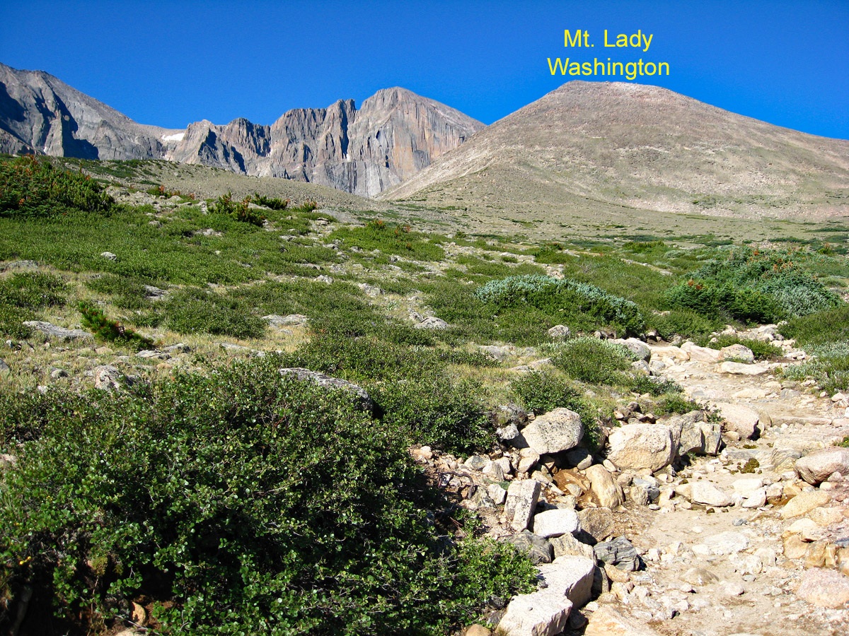
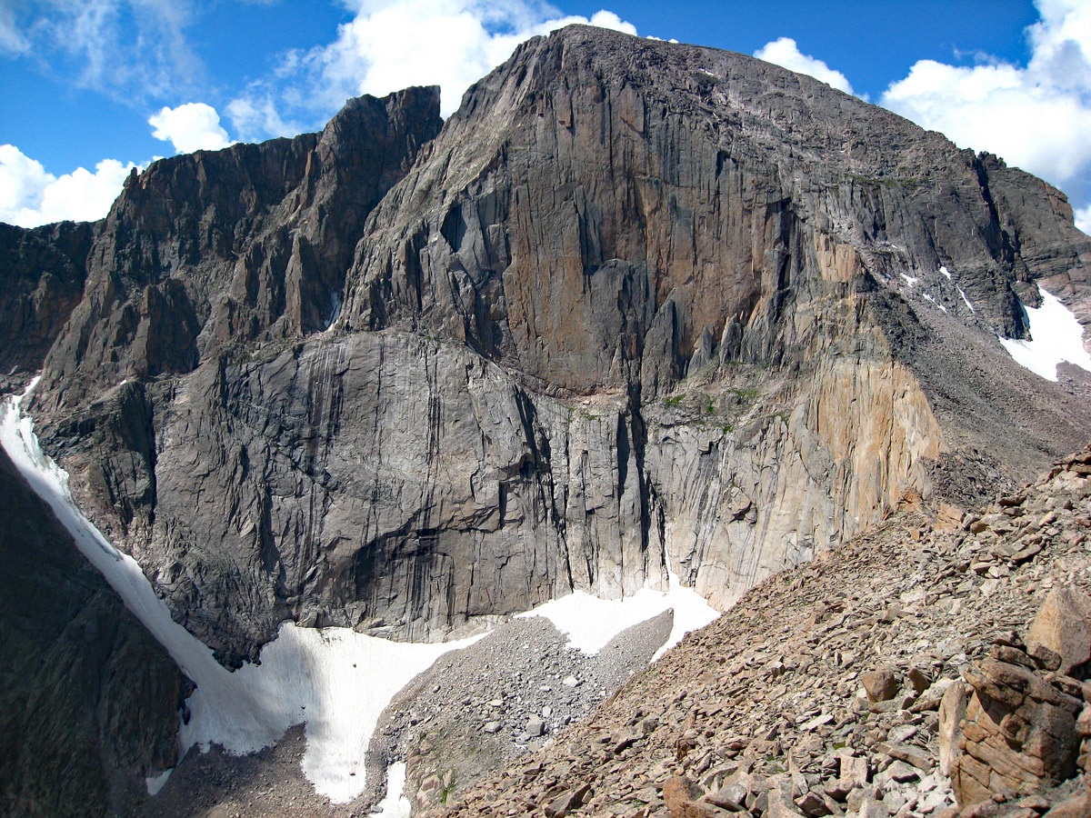
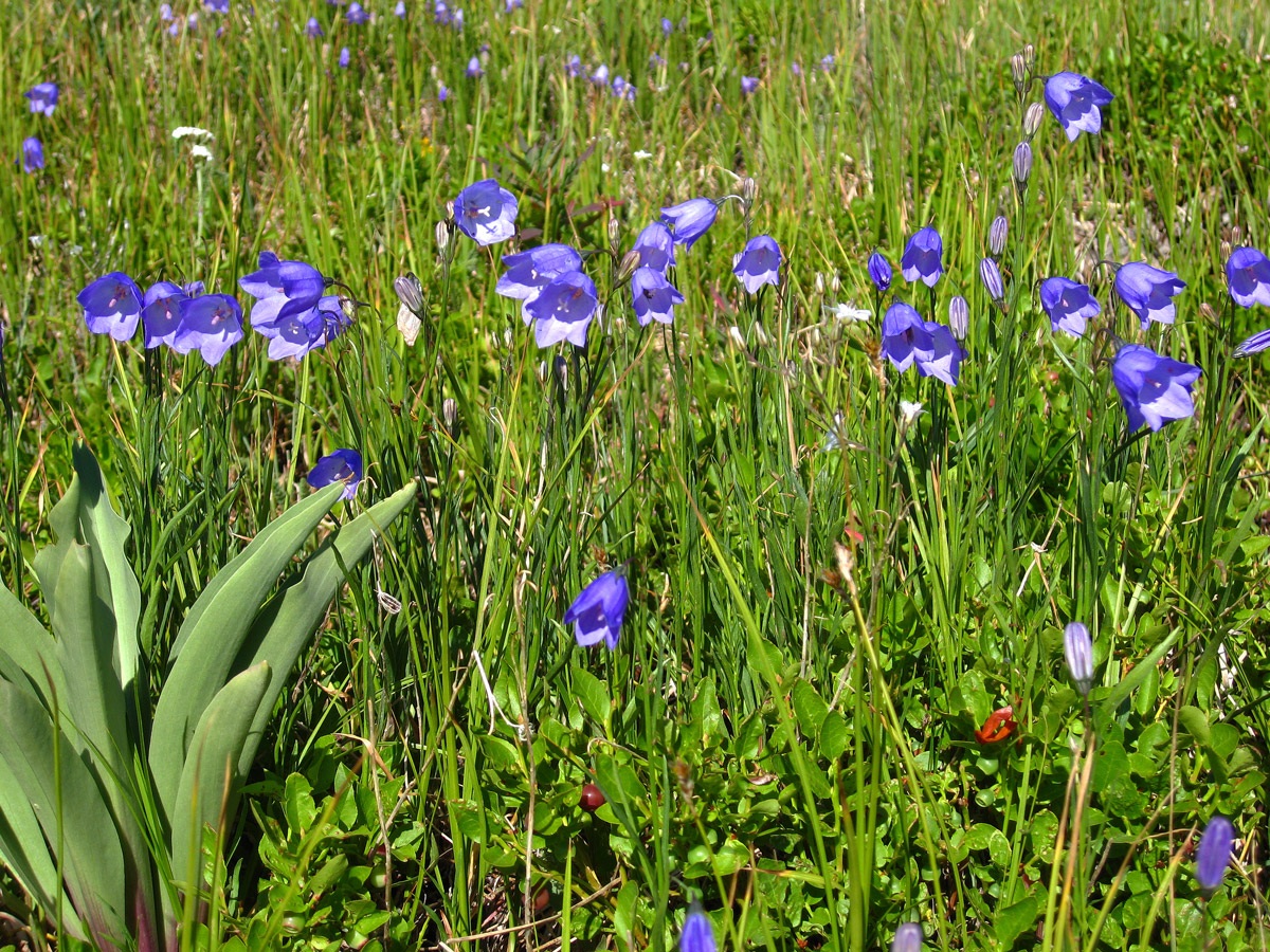
Mt. Lady Washington by itself has little to commend it. The best feature of this peak is the close-up view of the east face "diamond" of Longs Peak. The peak is most easily accessed by the Longs Peak Trailhead and trail so if you use that route, you'll be joining the hordes of tourists heading up Longs. A very early arrival is necessary to assure finding a parking spot on weekends and even summer weekdays can find the parking situation crowded. At least the parking is accessible to most any passenger vehicle. The route to the summit is rated a Class 2 and for Front Range peakbaggers, Denver metro area and north of there, this doesn't involve a long drive.
Mt. Lady Washington East Ridge Route
-
-
Longs Peak TH
For Front Range residents, there are any number of ways to reach the trailhead for Mt. Lady Washington. It is the same as the Longs Peak TH and access to Mt. Meeker begins here as well for our suggested route. Probably the most direct route on the Front Range is from Longmont to Lyons, and then west on SH/CO 7 to Allenspark and continuing north to the turnoff on the left for the Longs Peak TH. The turnoff is 10 miles north of the SH7/72 intersection. If coming from Estes Park, the turnoff is 9.2 miles south on SH7 from the SH7/US36 intersection. Drive about a mile to the trailhead parking.
Warning: The trailhead parking is frequently filled to capacity during peak summer season months. Often you will find vehicles parked along the side of the road for a significant distance down from the trailhead. This is especially true on weekends, when even with a 6:00 AM arrival, you may have trouble finding a place to park. So plan on an early arrival.
Camping
Overnight camping in vehicles at the trailhead is not permitted. There is a campground close to the trailhead called the Longs Peak CG. It is "first come - first served," tents-only and has about 25 sites. It easily fills daily. Some of the other campgrounds in RMNP have a reservation system. There are also National Forest campgrounds relatively close by such as: Olive Ridge, Camp Dick, and Peaceful Valley which can also be reserved. Try www.reserveamerica.com or check out this link:
https://www.nps.gov/romo/planyourvisit/camping.htm
Click thumbnail to view full-size photo + captionRoute Description
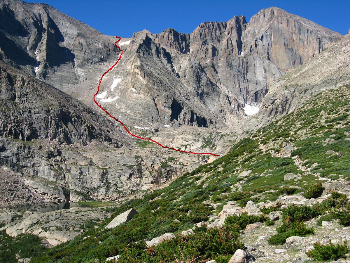
Year Climbed: 2007From the parking for the Longs Peak trailhead, begin hiking on the famous, well-worn and used Longs Peak Trail. The last time we were on this trail was 2007. At that time, there had been some major trail work on the first mile and a half of the trail with gravel having been brought in to raise the bed of the trail. Farther on however, the trail was still in bad need of repairs, especially as you get above timberline and the trail becomes entrenched in places. The trail initially heads WNW and there's a junction about a half mile up where you should stay left. In another mile, the trail comes to a series of a half dozen switchbacks, then crosses "Alpine Brook" which originates in the Jim's Grove area. Avoid taking the alternate trail to Jims' Grove (if it's still an open trail) and continue to tree line and the "Mills Moraine." The trail will come to an intersection. The right hand fork continues on to the "boulder field" and the Long's Peak route. The left fork takes hikers to Chasm Lake, at the foot of the east face "diamond" of Long's Peak. In 2007, there was a solar toilet nearby.
From this intersection you can head directly up the east ridge of Mt. Lady Washington. It's also possible to hike WNW along the Longs Peak trail a short distance and then turn west as well. Just choose whichever path looks most inviting to you. The first 200 feet of gain will be mostly on a tundra/embedded rock mix. Easy enough. As you continue hiking up, the angle of the slope steepens and the tundra gives way to more rock. The last 200 - 300 feet to the summit, the rocks gain boulder size and there's even stacked boulders that require scrambling around, through, over and under. This last part becomes a little slow and tedious.
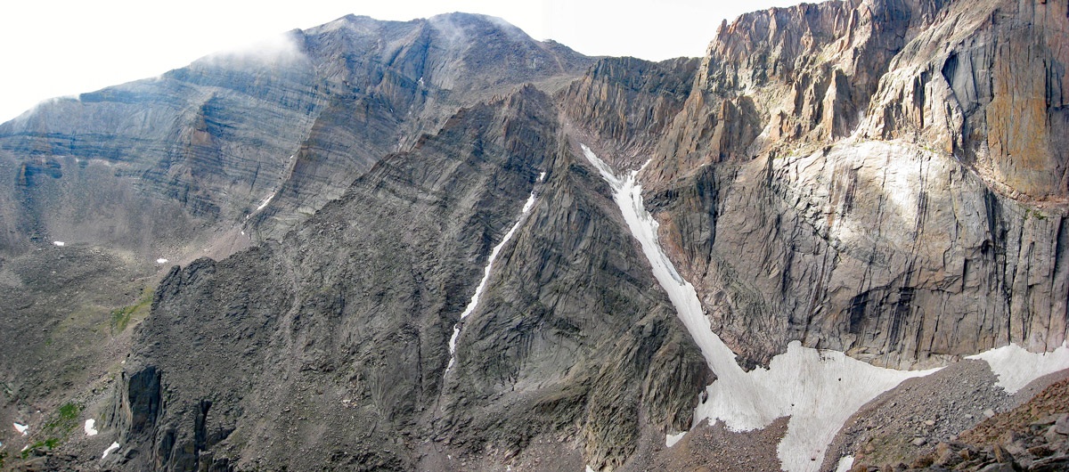
Once on the summit, as mentioned before, the best feature of this hike is the close-up view of the Longs Peak east face. You can obtain an even better view by heading on over to the lower, west summit of Lady Washington, no more than 10 minutes away. Not only do you get to see the east face, but also Mt. Meeker and the "Ship's Prow" form a spectacular and imposing rock face to the south. Take your time if weather allows. Enjoy the view, eat some lunch, then return by the same route.
Mt. Lady Washington can be easily combined with Mt. Meeker but the addition in time to that route will be at least two hours, probably closer to 2 and a half or three because of the additional 1,600 feet in gain. Done alone, the Mt. Lady Washington hike can be done in a comfortable 8 hours round trip. Stronger climbers should be able to complete in much less time.
Additional BETA
Links to other information, routes & trip reports for this peak that may be helpful. -