LoJ: #493 (Pre-LiDAR #478) / 13,195' Powell Peak

Peak Summary
Powell Peak is a Class 2 hike in Rocky Mountain National Park that utilizes trail approaches for about half the hike. The route we provide is the easiest, least technical approach, but is fairly lengthy coming in at 15.6 miles RT with over 4,800 feet of gain. This is similar to a Longs Peak kind of day. While younger, stronger hikers will be back in time for dinner, others may find themselves pushing it past dinner time. The trailhead is accessible to any passenger vehicle. During the main summer months, crowds in the park can be quite a deterrent and finding a place to camp impossible. Fortunately for Front Range residents, the trailhead parking can be reached easily and a parking spot located with a very early morning start. Lidar has demoted the elevation and ranking of this summit. Previous elevation was 13,208. Now, 13,195 ft.
Powell Peak via Andrews Pass Route
-
-
Glacier Gorge - RMNP TH
From Estes Park, the shortest way to the Glacier Gorge TH is to take CO36 SW out of town toward the park. Drive past the Beaver Meadows Visitor Center and continue to the entrance station and gain your admittance. A short distance past the entrance station is an intersection where you should turn left onto the Bear Lake Road. It's about 1.3 miles from the Beaver Meadows Visitor Center to this intersection. Head on up the Bear Lake Road, going past the large Glacier Basin Campground and continue to the Glacier Gorge Trailhead parking area, which is about 8.4 miles from the intersection just past the entrance station. If this parking area is already full, there are two other close-by options. One is to continue on up to the Bear Lake parking area, which holds even more vehicles. From there, a trail leads back down that will intersect the Glacier Gorge trail. Another option is to go back down from the Glacier Gorge parking area two switchbacks and after the second one, there is a small parking area for a half dozen vehicles. From there, you're probably best off to just walk back up to the Glacier Gorge TH. All of these parking areas tend to fill completely on summer days, especially weekends. But there's almost always someone pulling out. Best advice is to get here early - prior to 7:00 AM. Do not park along the road. Your vehicle may be towed.
If arriving from Granby and the Trail Ridge Road, turn right at Deer Ridge Junction and drive 3 miles to another right turn onto the Bear Lake Road.
There is also a shuttle bus system maintained by the park for visitor use. Shuttles even bring visitors in from Estes Park. To learn more, go to the park website and search for the shuttle schedule.
Camping
There is no at-large camping allowed within Rocky Mountain National Park. There is a system of designated backcountry campsites and there are also regular, fee campgrounds with the typical features of toilets, firepits, tent platforms for tent sites, water and pull-through options. The nearest of these is the Glacier Basin Campground. Sites may be reserved in advance at www.Recreation.gov. Most are reserved months in advance. Beetle kill has resulted in many of the trees in that campground being cut down so a number of the sites are now treeless.
In regards to backcountry campsites, these are available on an advance reservation system as well that also involves a drawing/lottery. Permits for a backcountry site must be applied for several months in advance. You'll be provided an opportunity to list alternate choices. It can be difficult to obtain your first choice for the date you desire. There is only one camp location in the Loch/Andrews Tarn area called "The Andrews Creek" at 10,560 ft. It is about 3.6 miles in from the TH and is on the trail to Andrews Tarn and Glacier at about where the trail takes a decided turn to the west after having been heading in a northerly direction. In Glacier Gorge, there is only one backcountry site there as well which is the "Glacier Gorge, #39." Permits for these sites can be obtain & submitted online now. Begin your search here:
Campsite Locations
Glacier Basin › N 40° 19' 47", W 105° 35' 44"8610 elevation
-
From Taylor Peak B
Click thumbnail to view full-size photo + caption
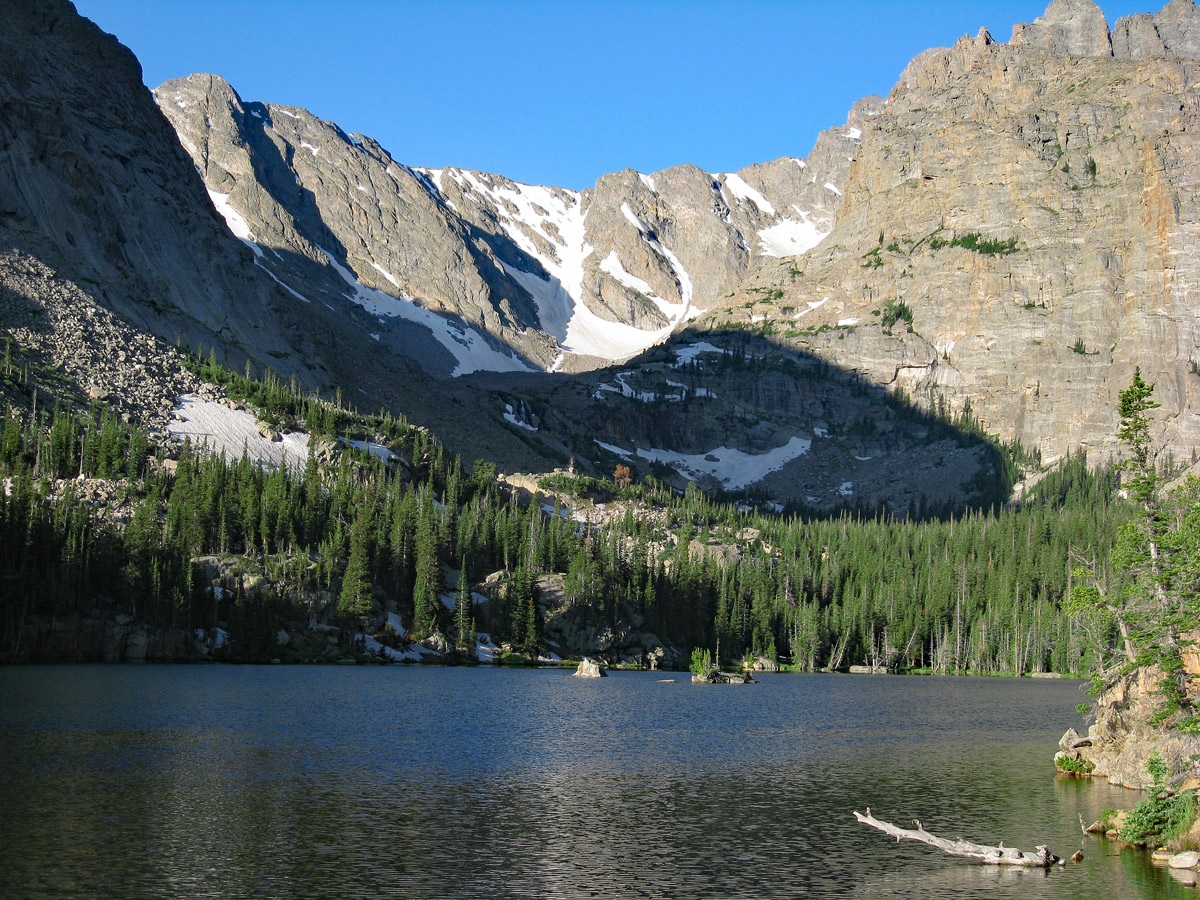
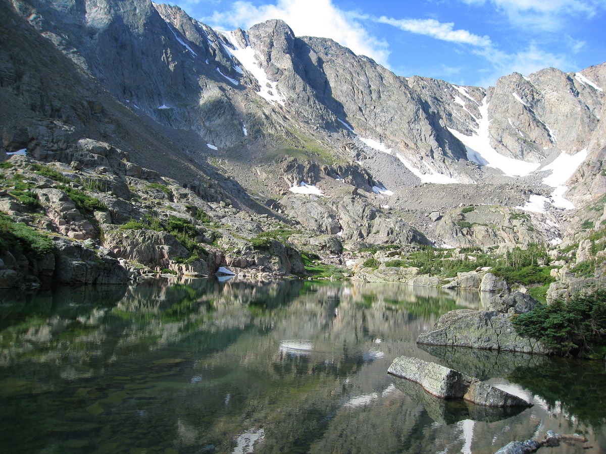
Open This Route in a New WindowTaylor Peak is sequenced with Powell Peak in our route descriptions for a long-mileage, full-day hike. Assuming you're able to begin at the Glacier Gorge Trailhead parking lot, head off from the SW end of the lot on a trail that drops down a little toward Glacier Creek, then crosses it to continue SW to a trail intersection. The trail passes briefly through a nice little fern forest. At the intersection, (.3 mile from the Glacier Gorge parking) a trail comes in from the right which comes down from the Bear Lake parking area. Make a left turn and head for Alberta Falls, a half mile away. The trail to that point is highly used. Pause to view the impressive, roaring falls if you have time. Continue past the falls gaining more elevation now to another trail intersection. The left fork heads up Glacier Gorge to Black Lake. Stay right at this junction to reach "The Loch," a beautiful lake at the head of "Loch Vale" valley. The Loch is about .8 mile from that last intersection. It took us 67 minutes, to cover the three miles or more to “The Loch” on this trail familiar to us. Continue past The Loch on the same trail another .8 mile to the turnoff for Andrews Tarn and Glacier. It took us 90 minutes from the TH to reach this intersection.
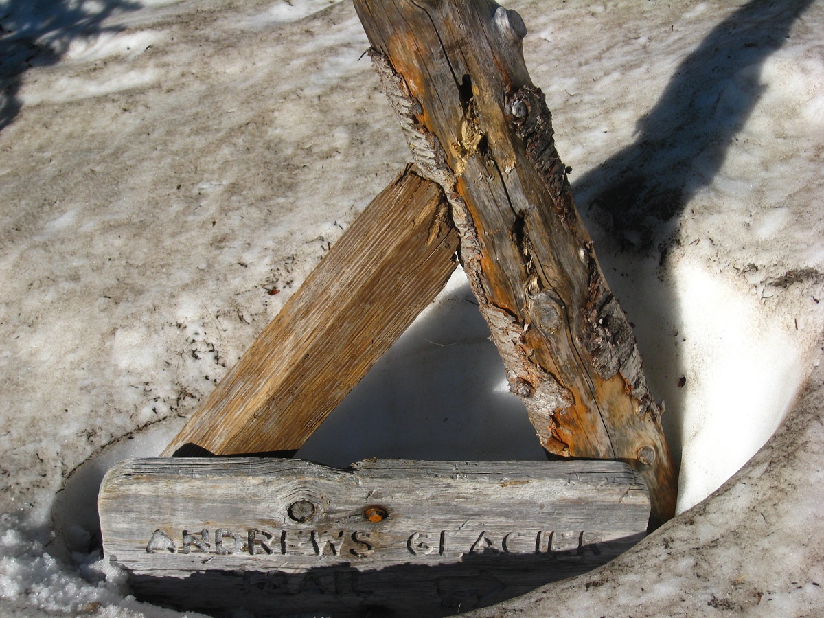
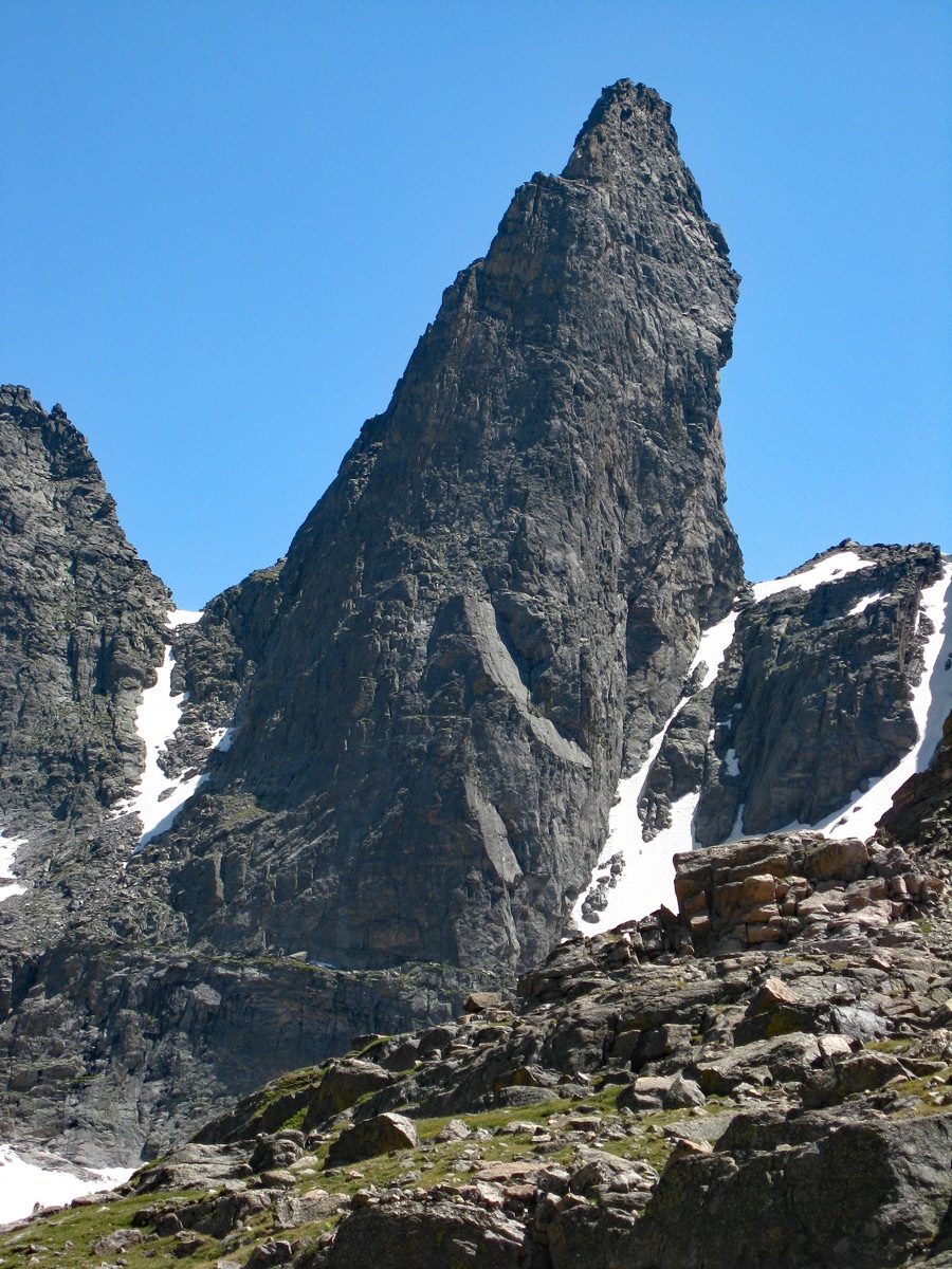
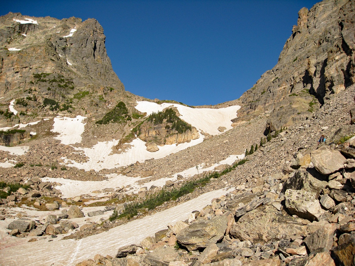
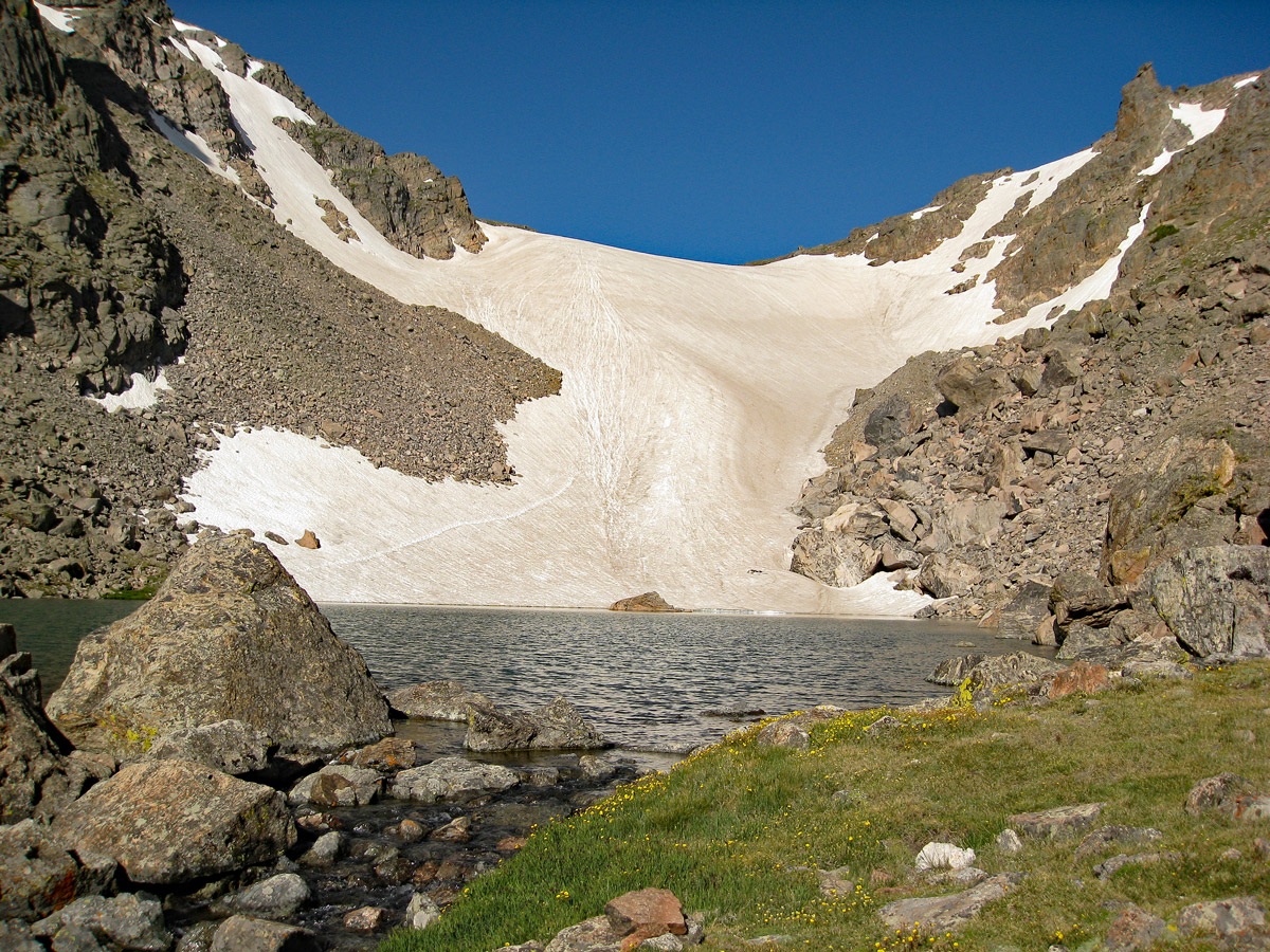
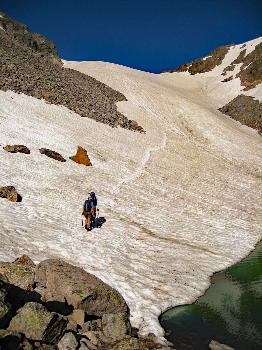
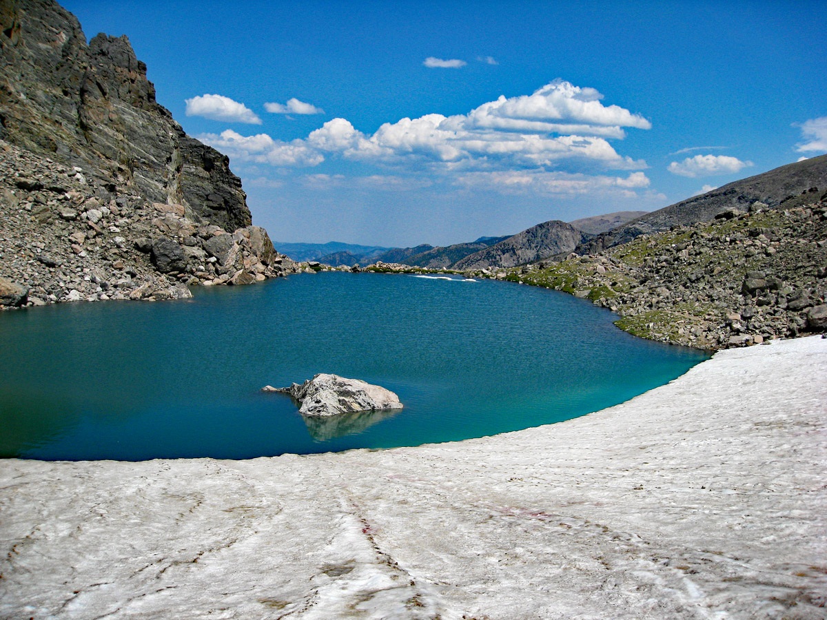
The .9 mile trail up to Andrews Glacier and Pass is another well-marked and maintained trail, but early in the season, you may begin to run into some snow once you get into the highest trees and the upper basin. A sign post pointing the way was nearly buried in the deep snow when we did this in mid-July. Footprints of other hikers assured us of the best route. Just above the last main group of trees, a valley comes in from the south identified as “The Gash” on the survey map. At the head of The Gash is “The Sharkstooth,” a highly pointed and technical looking spire visible from the Sky Pond side, but more impressive from the trail to Andrews Tarn. The trail then climbs steeply up 400 feet to the Andrews Tarn, a nice little lake really, and the Andrews Glacier that flows directly into the lake. This so-called glacier is mostly a large snowfield that rises almost another six hundred feet to Andrews Pass. A well-worn path will typically lead up the glacier, which we never found too steep, however an ice axe is nice to have, especially for the descent back down. By the time we arrived at Andrews Pass, three hours had elapsed since leaving the TH.
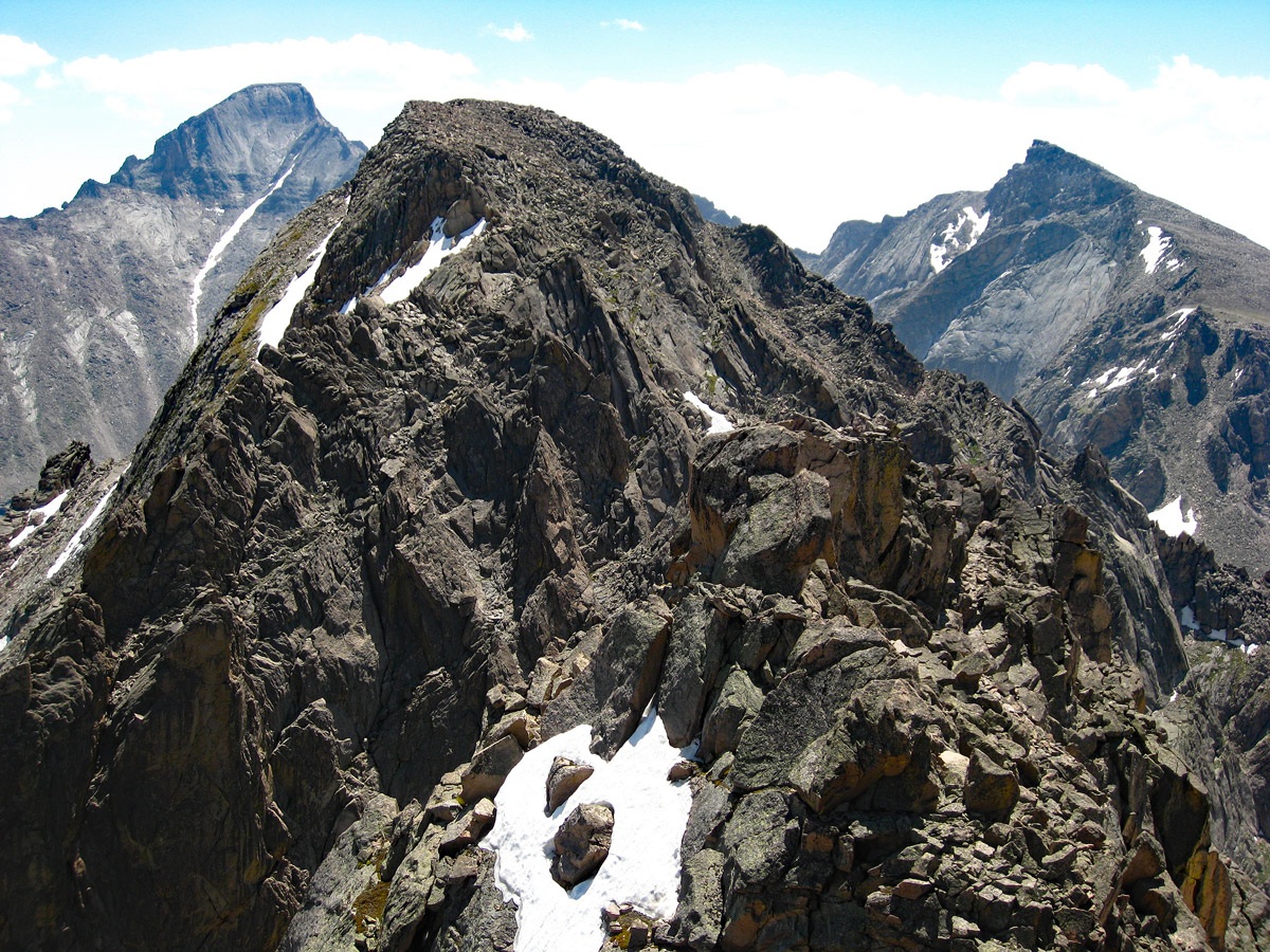
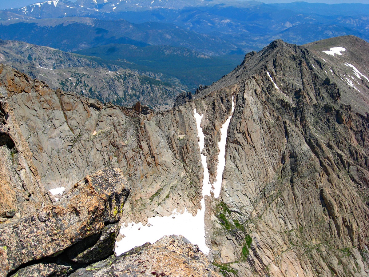
From the pass, it's about a mile to the summit of Taylor, but it seemed to take inordinately long to get there. From the east end of Andrews Tarn, it's 1.7 miles. We hiked up just moderate slopes covered in tundra with ribbons of exposed rocks where earlier snowmelt flows course their way down the mountain. It is another 1,200 feet of gain and eventually, you'll be standing on the summit. The summit view is spectacular. To the west is the vast valley of the “North Inlet” to Lake Granby. Immediately east of the summit, there is an abrupt drop of over 1,500 feet to the valley of Glass Lake and Sky Pond below. The sheer cliffs at the head of Loch Vale are simply amazing. Breaks in the summit plateau afford views down sheer couloirs of rock that plunge to deadly depths. If not going any farther, simply retrace your route back to the Glacier Gorge TH. Otherwise, continue on to Powell Peak.
Click thumbnail to view full-size photo + captionRoute Description
Year Climbed: 2008Powell Peak is sequenced with Taylor Peak. One way mileage and elevation gain is measured from the summit of Taylor to Powell. Round-trip mileage and elevation gain assume completion of the sequence as described.
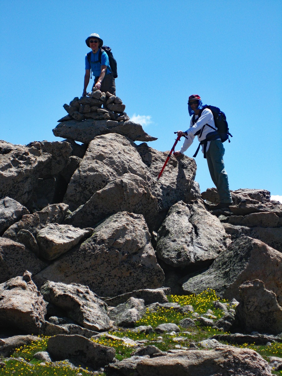
Continue from the summit of Taylor, stopping a few times to peer down into the depths of some of these great couloirs and over the edges of the cliffs, looking down into the Loch Vale cirque. Take pictures if you dare. The hike over to Powell is never difficult but a little tedious at times as you walk over tundra, then rocks, then tundra, then rocks, etc. You get the picture. We only had to drop a little under 400 feet in elevation from Taylor so regaining the Powell summit is not arduous, just long. It becomes much rockier as you approach the Powell summit, with great blocks of rock impeding your progress. With a climber’s patience, bear along with the difficulties and soon stand atop the second goal of the day.
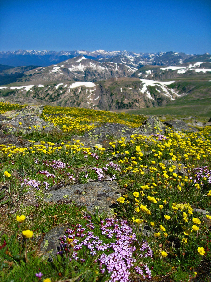
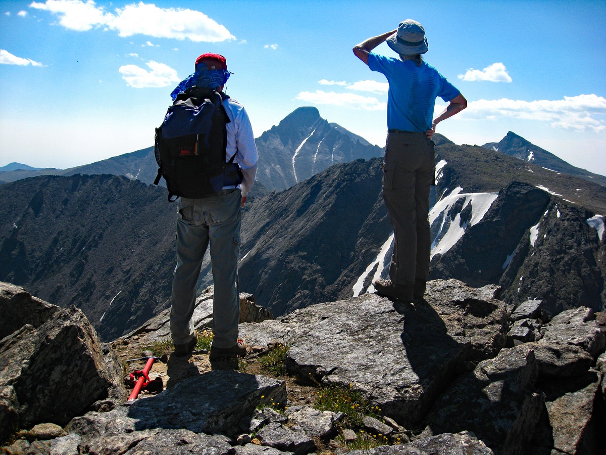
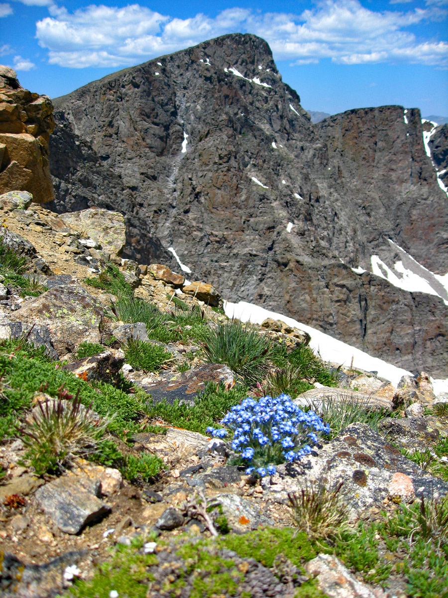
With good weather underway, it's tempting to spend a little extra time here, even though it's a long trip back, just so you can soak in the view. No wonder this area was made into a national park. The summit of Powell is a rocky perch that drops off and even seems to overhang a little bit over the Loch Vale valley far below. We took plenty of photos. So should you. Off to the west, the beetle ravaged forest around Granby were sadly visible. Other summits like McHenrys lay close by, but separated by a substantial notch, and Long’s Peak looms in the distance like a great monarch of the Rockies, its odd square top unmistakable.
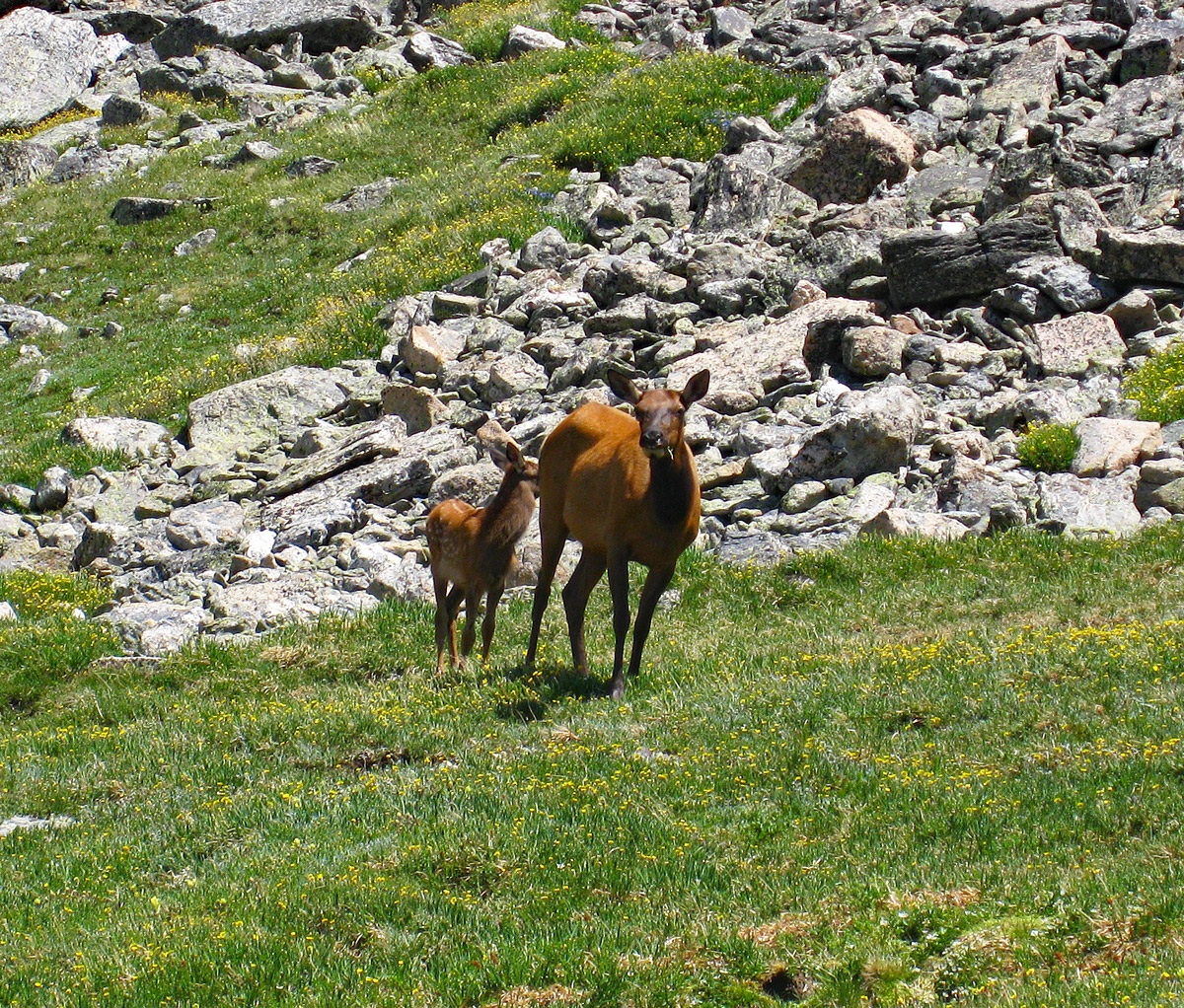
The trip back is a long contour. If you do not wish to hike over the summit of Taylor, swing to the west side of it a few hundred feet below and then head straight north for Andrews Pass. As we neared the pass, we spotted a cow elk and her newborn calf. Neither seemed too worried about us and we were able to get very close for some photos. The little calf would always stay behind its mother, keeping her between us and it. Glissading down the Andrews Glacier is a fun ride, a little intimidating at first because of the steepness, but more manageable further down. If weather permits, take some extra time heading back down the trail to enjoy some of the other features like "The Loch." Cool your weary feet in its waters. You will likely begin to pass a variety of tourists now, up for their shorter day hikes. If carrying an ice axe, they may give you strange glances, if not even slightly frightened looks. Total time for us to return to the Glacier Gorge trailhead was 11 hours. That included a one hour break on the summit of Powell.
Powell Peak can be also climbed from a route that begins by Sky Pond. From "The Loch," remain on the trail to Glass Lake and Sky Pond instead of taking the turnoff for Andrews Tarn and Glacier. Before reaching Glass Lake, the trail gains one section steeply with a nice waterfall nearby. If you arrive early at Glass Lake, you'll see how it gets its name. And Sky Pond also offers beautiful, reflective photos of the upper cirque. The following is our account of our attempt to climb Powell from Sky Pond:
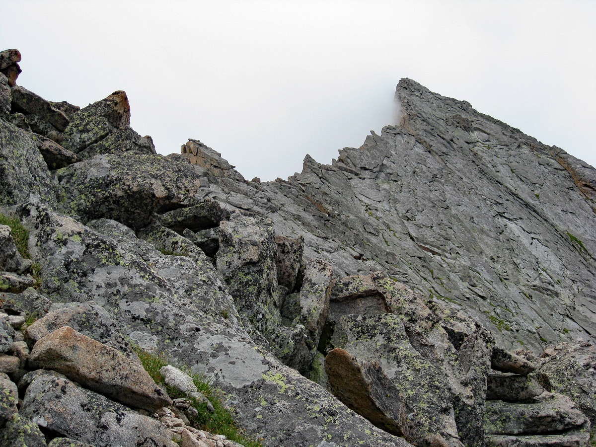
"After considering several options, we settled on hiking up a long talus slope to the saddle between Powell and Thatchtop and then an attempt on the NE ridge of Powell. While I had read a little about this ridge, I had not paid enough attention to what I read. More about that in a minute. The hike up the talus was steep, loose and difficult. 1,700 feet of gain were all work and no play and required a lot of time. When we were at Glass Lake, the sky had some puffy white clouds, but the day still seemed nice. We had hoped for better weather, but that was not to be so. By the time we reached the saddle at 12,600 ft., clouds were gathering into showers and it was misting on us. We proceeded cautiously south along the ridge which drops nearly vertically on the east side and on the west side, where we were, it sloped of dangerously. The exposure was complicated by the wet, brown moss/lichen that covered most of the rocks. It made then slick as snot, requiring great care just to progress a short distance. We had not come prepared with adequate climbing equipment."
"After making progress of only about 100 yards and spending 45 minutes to do it, we came to a section of ridge that was much more vertical and would require some real climbing. By now, rain was imminent, so after some options discussion, we all agreed the only life-preserving option was to retreat. So that meant a cautious retracing of our route along the ridge and then a descent of the interminable talus slope back to Sky Pond. Far below, as we descended, we could see hikers at the lake. I’m sure they wondered what we were up to as we sent rolling boulders down frequently. After a tedious descent, we arrived at the lake somewhat wetter from the drizzle that fell as we descended. There was at least one fortunate timing in all this. The real rain held off until we got off the ridge."
In retrospect and having looked more closely at a few sources, I've seen the north ridge of Powell rated anywhere from 4th class to a middle 5th class climb. It is indeed very exposed on the east side. If attempting this, get some reliable information. We would suggest Gerry Roach's pocket guide book of "Classic Hikes and Climbs" in RMNP. It's still available on Amazon or order it direct from Gerry.
Additional BETA
Links to other information, routes & trip reports for this peak that may be helpful. -