LoJ: #536 (Pre-LiDAR #529) / 13,141' Precipice Peak AKA: U 2
Peak Summary
A "classic" San Juan hike up a peak that from below appears to dish out formidable obstacles but in reality is at the most a Class 2+ steep ascent. 4WD with good clearance will get you to the closest start but still accessible by passenger car - just more hiking mileage. Lidar reduced elevation by 3 feet.
Precipice Southwest Gully Route
-
-
West Fork Cimarron River TH
There are two ways to access the upper West Fork of the Cimarron River. One comes in off US 550 from a little north of Ridgway and the other comes in from US 50 and goes by Silver Jack Reservoir.
From US 550 turn east onto County Road 10 which is marked for Owl Creek Pass. This turnoff is 1.8 miles north of the single light on US 550 at the intersection for Ridgway. From here, just stay on CR10, avoiding any other options. The road goes mainly through open meadows or alongside pinyon/juniper forests. Watch for it making a right turn where County Road 8 comes in from US 550. (If coming from Montrose, CR8 can be used as a shortcut.) At the turn, you will now be on CR8. Follow it past the Sleeping Indian Ranch and across Cow Creek. A little further up valley, the road makes a sharp switchback and begins gaining elevation more seriously through open scrub oak terrain. Soon, you'll pass the Forest Service sign and enter FS land. The road tends to degrade some here but passenger cars driven carefully can continue. The Forest Service designation for the road is 858. It's a long slog to the top of Owl Creek Pass - usually requiring around 45 minutes of drive time. When you get to "True Grit" meadow that offers the nice view of Courthouse & Chimney Rock, and is usually filled with corn lilies, you're almost there.
At the top of Owl Creek Pass, there's a small, unofficial camp area on the north side of the road. Continue down east to the first turnoff you see, less than a half mile from the pass. This road to the south is FR860. Drive up this usually good road that offers several possible campsites all the way to the Courthouse trailhead (about 1.7 miles from CR8). A short distance past the trailhead, passenger cars will need to stop. There's some limited parking there. It will be obvious where you need to stop. The main road veers to the right and becomes much worse.
If you have 4WD with good clearance, continue south up the road as it goes up a steep, rocky section, then levels some as it passes through a section with large potholes. In .75 mile, it drops down a little and makes a sharp left to a ford of the West Fork. There are some good campsites here. The ford is a low water crossing and can be difficult in earlier season. Use good judgment. If you can't drive across, walk upstream a good distance to find perhaps a fallen tree across the stream. From the stream crossing, it's another.7 mile to the trailhead. This is not a graded lot. It's basically just the end of the road. Park where you can find room & it's not too rocky.
If coming from Montrose, by way of US50, drive past Cimarron about 2.7 miles and turn south on County Road/Forest Road 858 that goes to the Silverjack Reservoir. From Gunnison, drive west on US50 past the Blue Mesa Reservoir, down through a narrow canyon section, up over a pass at 8,700 ft., then down a long and winding descent toward Cimarron. The turnoff is one mile past the turnoff for CR864 and just past a small resort on the south side of the highway. It's a long, 22 miles drive back on a graded, dirt road, suitable for passenger cars, but can be dusty and/or washboarded. Continue past the Silverjack Reservoir about a mile and then make a right turn to cross the creek and then continue driving on FR858 to Owl Creek Pass. The turnoff for FR860 will be just after a major switchback and about 6.5 miles from the right turn that takes you across the creek after driving past the Silver Jack reservoir. See information above for the drive up FR860.
Camping
If coming from US550 on CR10 & CR8, the best camping will be at "True Grit" meadow on the west side of Owl Creek Pass; at the top of the pass; or along FR860 as it goes south up along the West Fork. There are numerous spots along 860, many of which will be occupied on a weekend. See also our CalTopo map for some of the closest spots to the trailhead.
If coming from US50 & the Silver Jack reservoir, there are three Forest Service campgrounds just north of the reservoir and then after making the right turn beyond the reservoir, there's an area with numerous campsites along FR861.A1 Otherwise, if you want to camp more closely, continue to FR860 and find a spot along there as described above.
Click thumbnail to view full-size photo + captionRoute Description
Year Climbed: 2007Note: This route description is written with the assumption of having a 4WD high clearance vehicle available. If coming into this area with a standard passenger car, you'll need to park earlier so add about 1.4 miles one way to the total mileage and another 350 vertical feet of gain.
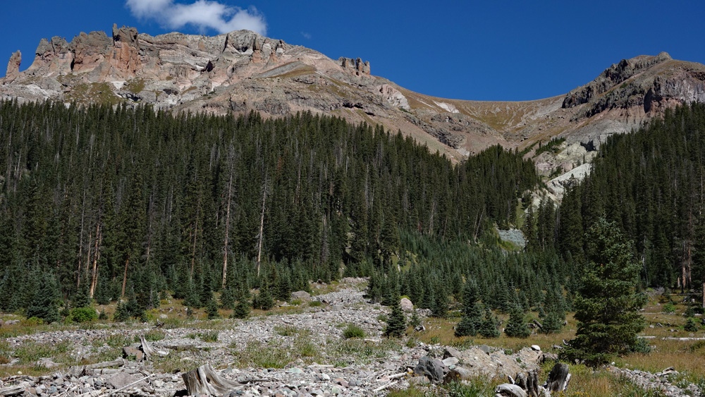
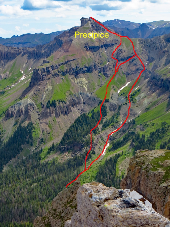
The route for Precipice begins directly from the 4WD parking area. If you look east, there's a prominent gully that sweeps down from a green section of saddle far above. That saddle is the intermediate goal. You can't see all the difficulties that lie in between, but that gully represents the basic route. Head towards the gully staying on the north side. (Seems like many people prefer this side as a faint trail is developing.) The lower end of this gully has significant avalanche debris which will likely force you into the forest some distance to avoid tripping and climbing over all kinds of logs, dead trees, etc. Just persevere through the debris as best you can. Further up, you'll be able to return to the gully. In early season, there may be sections of snow so an ice axe may be useful. Using our photo in the gallery, as you head further up the gully, two options will present themselves. If you persist in the gully, about half way up it will divide. Head up the nose of the dividing ridge to a few trees and some more steep tundra. Then you'll need to pick a way up and through a cliff band, most likely by swinging right some. This will take you to upper slopes of scree and then more tundra all the way to the saddle.
The other possibility is to climb up left (north) out of the gully proper to the forested ridge above. Lower down, this is very steep. Further up, the steepness lessens and the trees open up. Once above the last trees, you'll be on a long grassy/tundra slope that will lead up to the cliff band obstacle. As our photo suggests, you can either work left or right to avoid the main difficulties, or you can even make a more direct assault and look for a break in the cliff. Once above, scree slopes prevail for a while until you can reach more tundra to the saddle.
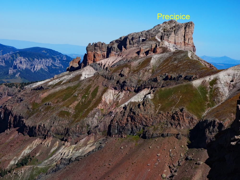
For any option that reaches the saddle on the ridge south of the summit, head north towards some prominent rock buttresses/spires. At first appearance, they may seem to present an obstacle to gaining the summit, but you can easily pass between them and continue on deteriorating scree & rock (choss) to the summit. There is one place where the ridge narrows to a foot or two with drop offs on either side. A few more decades of erosion may create a hazard here and obstacle to gaining the summit, but for now, you can still breeze on through and finish the climb. There is a developing trail through all this section because the terrain forces everyone onto the same route.
From the summit, enjoy the excellent view of the rugged terrain over above the Middle Fork or looking back toward Fortress Peak. You also have a bird's-eye view of Courthouse and Chimney Rock. Descend as you came. For another report on this route, see the links to Lists of John or Mountain Handbook.
Additional BETA
Links to other information, routes & trip reports for this peak that may be helpful.ListsofJohn › Precipice Peak -