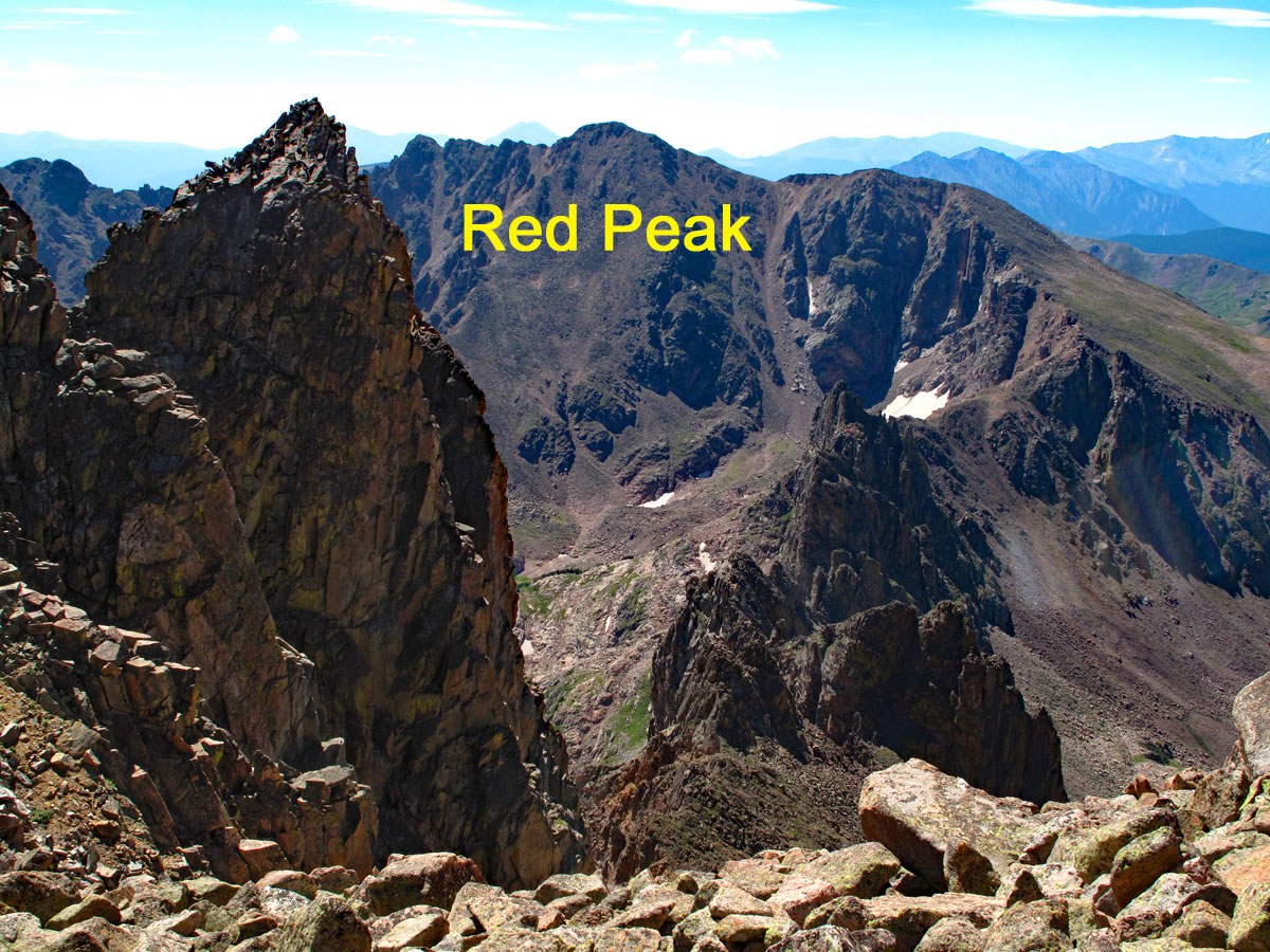
#494 / 13,186' Red Peak Red Peak B

Peak Summary
Coming in at about 11 miles round trip, Red Peak is not an easy mileage day but the peak itself is a Class 2 walk-up with a trail access for most of the distance. The trailhead is accessible to any passenger vehicle. This makes an excellent introduction to the Gore Range and is easily accessed by Front Range hikers. Lidar reduced elevation by 3 feet.
Red Peak South Flank Route
-
-
Buffalo Mtn. - Lily Pad Lake TH
Directions taken from the White River National Forest Website: From I-70 take Exit 205, Silverthorne/Dillon, and travel north on HWY 9 (a short distance) and turn left at the first traffic light, Rainbow Drive/Wildernest Road. Travel 3.6 miles on Wildernest Road (turns into Ryan Gulch Road). You will pass many condos and at the top of the road there will be a trailhead parking area on the left. There are two trailheads at this parking area, be sure to start at the Buffalo Cabin Trailhead, which is the more northern one. Our Note: in 2011 there were no restroom facilities here of any kind - not even a port-a-potty. We would also not recommend trying to stay overnight in your vehicle, in part because there are condo units very close by. This is also a very popular trailhead and parking spots can completely fill on weekends so arrive early.
Camping
There is no camping anywhere close by this trailhead. The closest campgrounds are north on SH9, the first being the Blue River CG, then further north, there are other national forest fee campgrounds located on both sides of Green Mountain Reservoir.
Click thumbnail to view full-size photo + captionRoute Description
Year Climbed: 2011Begin this hike by heading WNW on the Buffalo Mountain Trail. The initial trail is wide and well-used and leads through beetle-kill forest with lots of downed timber to the trail junction for Buffalo Mountain. The trail climbs gently for no more than 200 feet elevation to this turnoff and levels off. It is about .75 mile to this junction and the trail is well marked. Stay straight on the trail that will now lead down to South Willow Creek and the Gore Range Trail. For a short while, the trail continues at a fairly level pace, then begins to drop steeply to the NW. As it drops, it becomes difficult at times to follow as it comes down through rocky outcrops, ledges and trees. It then follows an old ditch for about a quarter mile. When you're within earshot of South Willow Creek, the trail makes a wide turn to the north and as you approach the creek, you may find several runoff streams that make crossing through here both muddy and wet. At times we could not stay on the trail, but had to find our way around these temporary streams as best we could or use log bridges built by others. Eventually, you will come to the main creek crossing and will find a sturdy bridge you can walk across.
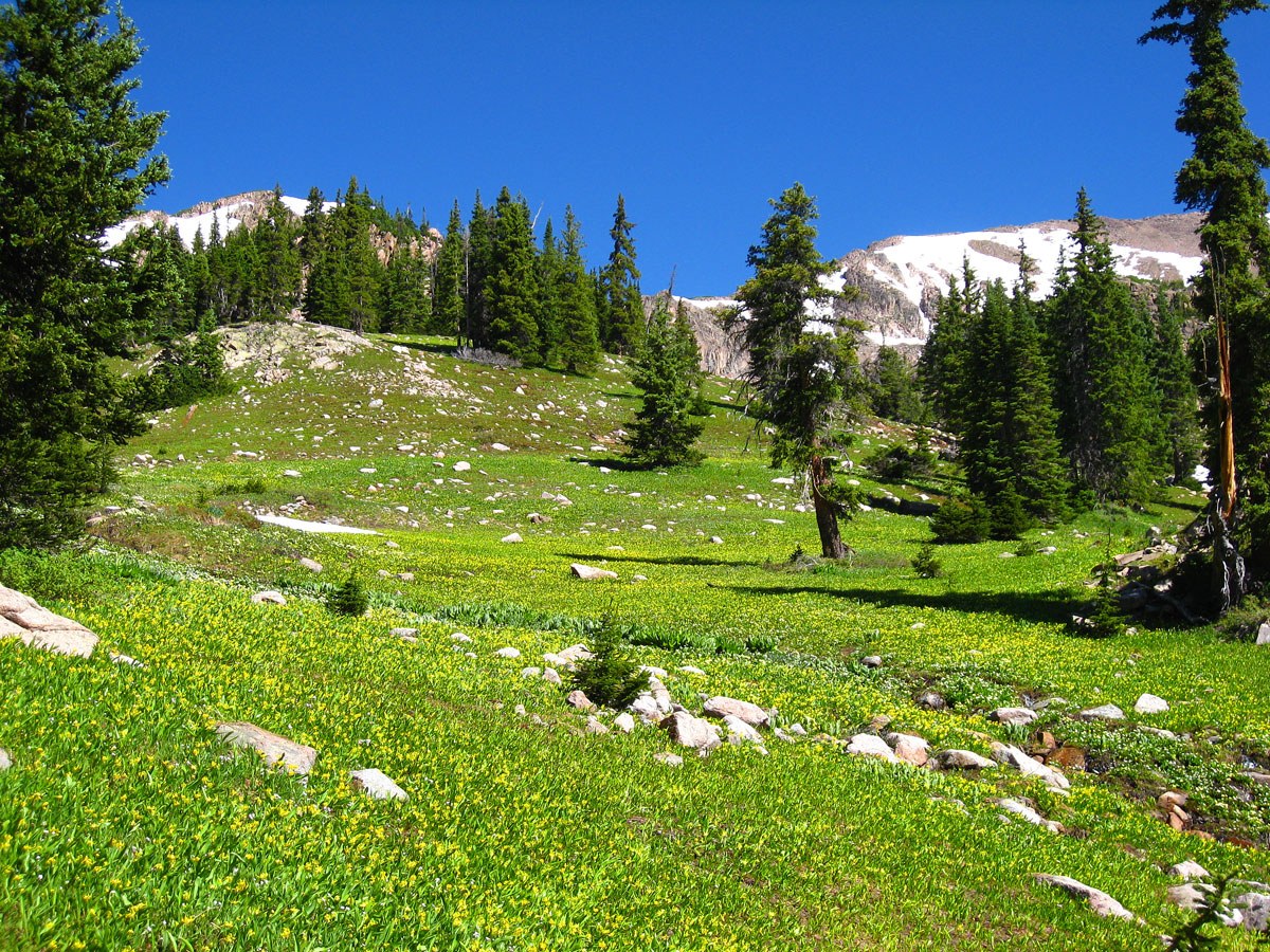
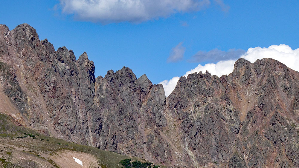
After crossing the main stream, the trail heads uphill to join the Gore Range trail. Continue hiking west on the Gore Range Trail amid the continued hordes of mosquitoes, earlier season. (The winter of 2010-2011 had seen abundant snows in this area and the runoff season had extended well into the summer leaving streams still running high and fueling the development of more mosquitoes.) The first mile or so of the trail is rocky and climbs steadily. It then switchbacks to gain some elevation above a waterfall. After the falls, the trail is not so rocky and levels off a little. Higher up, we began to encounter multiple runoff streams, some of which posed crossing difficulties. As we began to approach the upper basin and treeline, there were still numerous, large snow patches. We began to have to cross some of them and of course, at times you may post-hole. The north flank of Buffalo Mountain offers an imposing and rugged appearance from this basin.
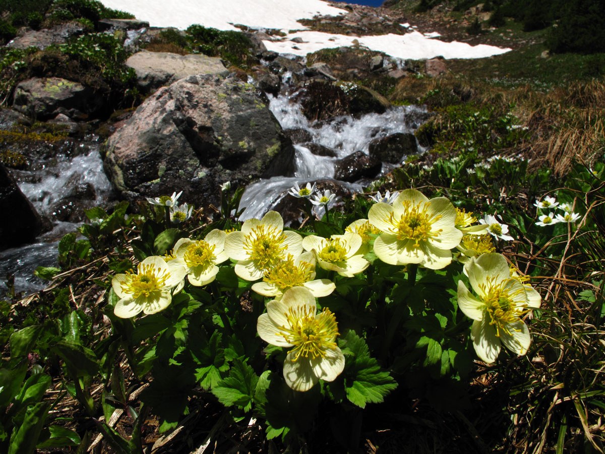
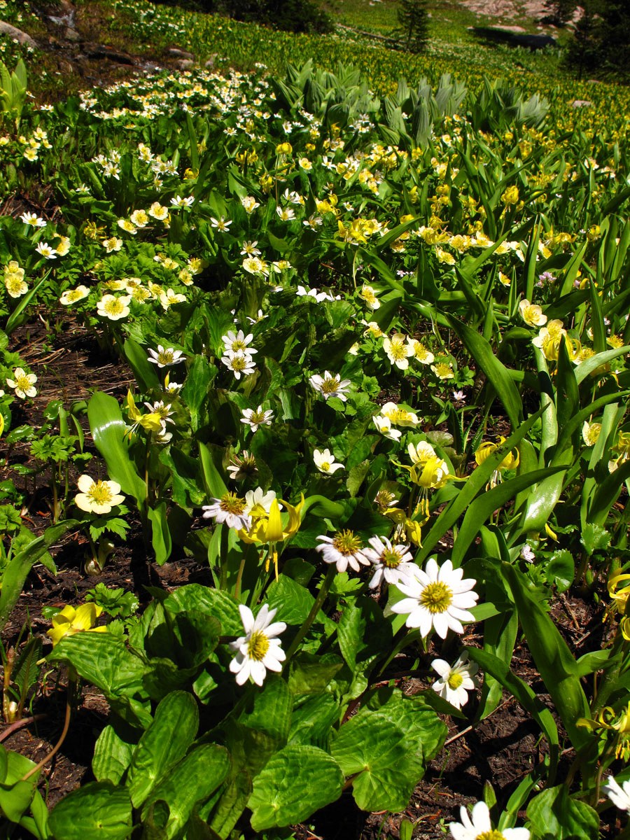
As the trail begins to swing to the SW, we decided to depart it and blaze our own path that took us through vibrant fields of yellow avalanche lilies – the most we have ever seen anywhere in Colorado. We had to stop numerous times for photos of the spectacular display. Our original plan had been to follow the trail all the way to Red Buffalo Pass, then hike north along the ridge that would eventually swing east to the summit of Red Peak. That ridge may from this view appear to have some difficulties, but the west side of the ridge is mostly free of such problems. However, we began hiking below the ridge on the east side, following a drainage that led us to a basin south of the summit. We passed an old mine along the way, a little before exiting the trees. As we headed into this upper basin, there was abundant stream runoff pouring out from the large snowfields. All that snow gave us the hope of some fun glissading on the way back down.
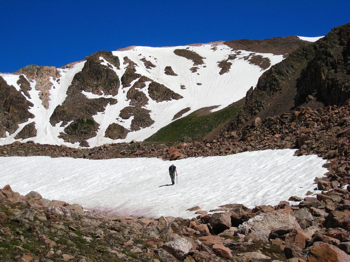
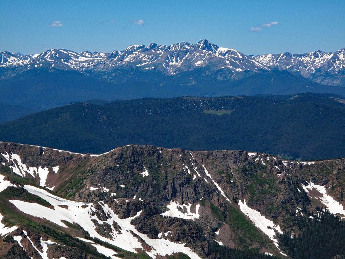
As you approach the headwall of this upper basin, hike to the right up a rocky slope or large snowfield (earlier season) to a somewhat broad, level area of tundra and possibly snow on the south flank of the peak at 12,200 ft. From this bench, it is a rocky ascent for the next 1,000 feet directly to the summit. We encountered boulder talus along the way. It took us overall, 4:30 to arrive at the summit, which offers a nice view of the southern Gore Range and the Dillon area. We found no register on this summit and surprisingly, not even much of a summit cairn, but there was one small rock shelter. If time and weather allow, this summit makes a great lunch spot with outstanding views all around and you will likely not share it with anyone.
For the return trip, descend as you ascended, or you may want to try the west, then south ridge back down to the pass where you can pick up the Gore Range Trail. Earlier in the season, you can pick up some fun glissades coming back down as we describe going up. Just remember that on the way back, you will have to regain about 400 feet in elevation as you hike out of the South Willow Creek drainage.
Additional BETA
Links to other information, routes & trip reports for this peak that may be helpful. -