LoJ: #188 (Pre-LiDAR #189) / 13,612' Tijeras Peak
Peak Summary
A formidable appearing peak that really only has one difficulty which involves a 3rd class ramp that breaks through a cliff to easier terrain. Access is by Music Pass and the upper Sand Creek drainage. A backpack trip is likely. 4WD required to reach the upper trailhead. Lidar added 8 feet to the previous elevation of 13,604.
Tijeras Peak North Side Approach Route

-
-
Music Pass TH
From Westcliffe, head south out of town on SH69 as though going to the South Colony Lakes area by the Crestones. Drive 4.4 miles south from the intersection of highways 69 and 96 in town, then turn right onto CR119 (Colfax Lane) and drive 5.5 miles to the junction where if you turn right, you'd be heading for the Crestones and South Colony Lakes. But instead of turning right, turn left, to the east, then in a few hundred yards, (quarter mile) the road again turns abruptly south and in about 5 miles comes to a trailhead parking area where passenger cars should give it up. This is the Rainbow trailhead here. Coordinates for this lower parking area at 9300 ft. are: N37° 55' 49.07" W 105° 27' 26.52".
If you have 4WD with good clearance, then proceed up the steepening 4WD road to the south and west for another 2.5 miles (appx.) to the upper trailhead at the coordinates and elevation given above. Our first drive up this road in 1995 was made in a Jeep Cherokee Sport. We found the road in surprisingly good shape, even though it was a steep single-track type road. In 2005 we returned to the same area in a Toyota T-100 pickup. In those 10 intervening years, the road condition had deteriorated considerably. It proved more of a challenge in our longer-bed vehicle, but we still made it okay. In any event, be prepared for a rough ride on a steep, narrow road with difficult rocky stretches. Reaching this upper parking area will greatly shorten the suggested backpack.
Camping
Primitive camping is available at both the upper and lower trailheads. There are no close by National Forest Service campgrounds.
-
From Music Pass TH via Sand Creek Base Camp
A short and sweet backpack over Music Pass and into upper Sand Creek can set you up for access to the numerous 13ers that surround this basin. In fact, there are 10 accessible summits that could all be climbed in as little as 3 - 4 days depending on your pace and endurance.
From the upper trailhead parking, hike 1.35 miles on Trail #1337 to the summit of Music Pass at just below 11,400 ft. The trail starts out through forest where in early summer you may still find, patches of snow, snowbanks and resulting muddy spots. As the trail approaches the pass, it climbs more steeply and ascends out of the forest. At the top of the pass, you'll enjoy an expansive and very impressive view of the upper Sand Creek Basin and all the surrounding 13ers. Once you cross the pass, you'll be entering the "Great Sand Dunes National Preserve."
Once you've soaked in the view, follow the good trail as it drops NW into the Sand Creek drainage. There's a large meadow that extends for over a mile mostly on the east side of the creek. At the upper end of that meadow, just before the trail enters the forest, there are good campsites at approximately these coordinates: N 37° 56' 06.97" W 105° 31' 20.53" Elev. 11,060 ft. This location can serve as an excellent base camp if you don't want to move your campsite. It's 2.6 miles to here with no more than 750 feet of gain, some of which you lose. As trail #1337 drops into this meadow, it will intersect trail #743 coming in from the San Luis Valley side. So in a little over an hour, you can be in a great wilderness location and setting up your tent. Don't be surprised however, if you're sharing this location with some other groups. This seems to be a popular destination, especially weekends and long weekends.
If you desire a campsite closer to your peaks of choice, then there is also good camping at both Lower and Upper Sand Creek Lakes. We have camped at the lower lake and found several good campsites on the east side of the lake and on the north side of the outlet. To get there, you'll need to cross Sand Creek near where the trail enters the forest. There may be more than one trail in this area and crossing the creek can be difficult in runoff conditions. Once across, the trail heads NW along the creek for a ways before branching and turning SW and winding its way to the lower lake over a distance of about one mile and 430 feet of gain.
The main Sand Creek trail also continues up valley to Upper Sand Creek Lake which can serve as a good camp location for accessing Milwaukee and Pico Aislado. This trail may or may not go as indicated on the USGS topo map. When we climbed here in 1995, that summer followed on the heels of a heavy snow winter and most everything above 11,000 feet in this valley was still covered in snow. To gain Upper Sand Creek Lake will add 1.55 miles of hiking and another 700 feet of gain.
Camping
There is camping as described above at 11,060 ft. at the upper NW end of the long meadow and at both Lower and Upper Sand Creek Lakes.
Campsite Locations
Upper Meadows of Sand Creek N 37° 56' 06.97", W 105° 31' 20.53"Water conveniently available & trees for shelter
Open This Approach in a New Window
Click thumbnail to view full-size photo + captionRoute Description
Year Climbed: 1995Starting from our suggested campsite at the end of the "approach," cross Sand Creek and follow the trail to Lower Sand Creek Lake. The route for Tijeras peak can also begin from a campsite location on the east side of Lower Sand Creek Lake. We used the basic route description provided by G&M in their first edition and repeated in the 3rd edition. This climb was completed June 27, 1995 which was a summer that followed one of the snowiest winters in recent records. We had to break through snowbanks to arrive at Music Pass and beyond our suggested campsite at 11,060 feet at the end of the meadow, it was all snow in the trees, all the way up to Lower Sand Creek lake and the NW basin above the lake was almost all snow-filled. This made identifying the trail impossible.
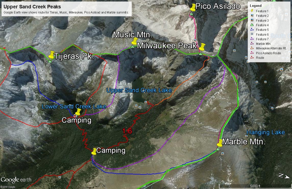
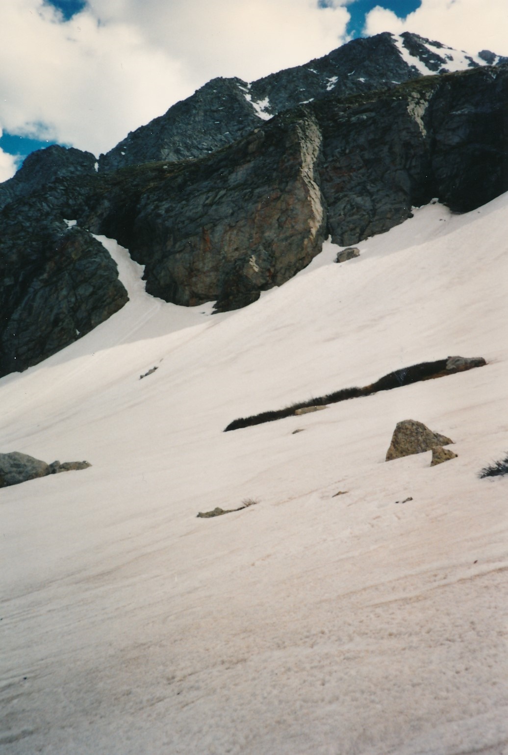
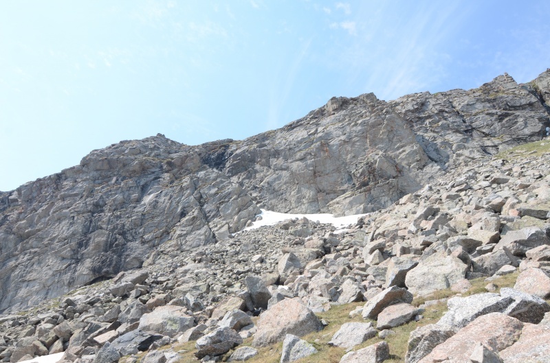
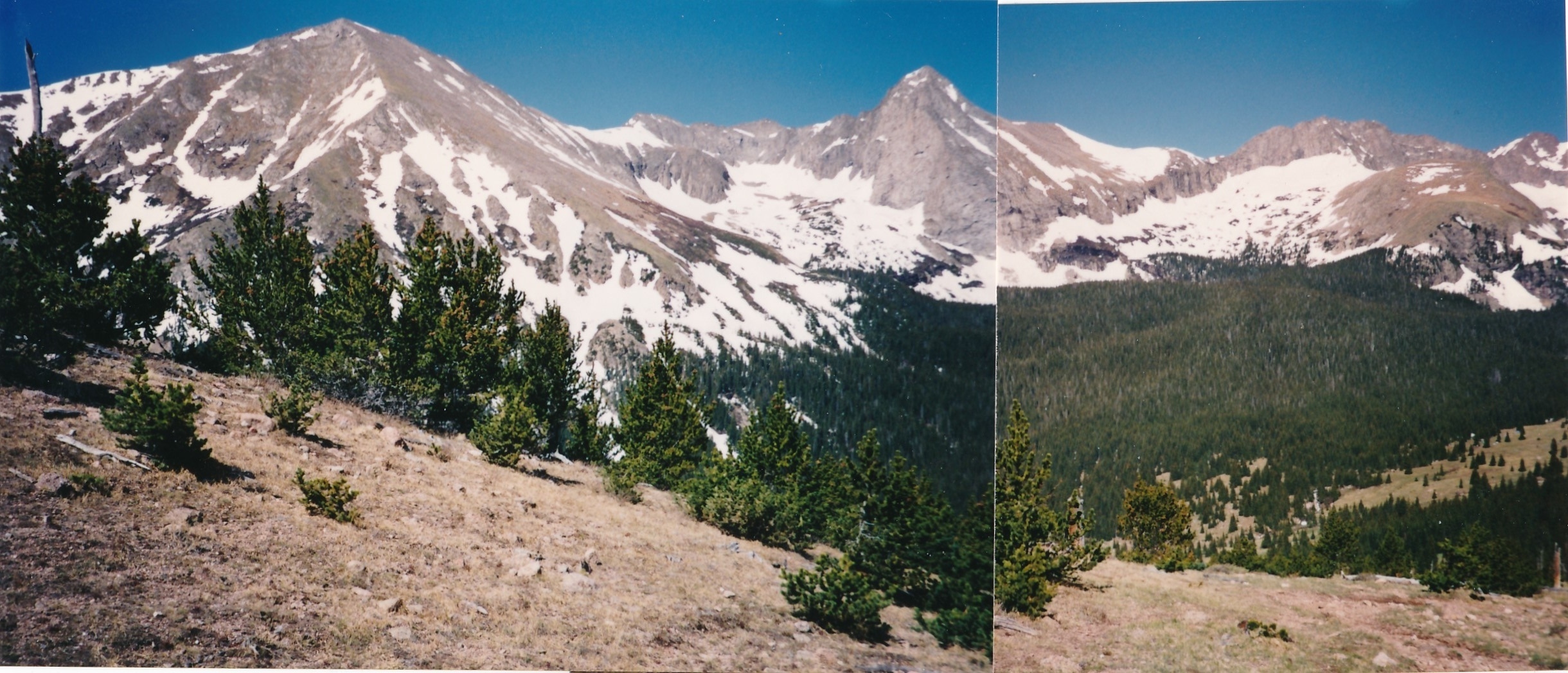
So from the NW end of the long meadow west of Music Pass, locate and then turn off on the trail to Lower Sand Creek Lake. From the 11,060 campsite, the main trail quickly crosses to the west side of the creek, at least when we were there. Make your way to the lake where on the east shore area, there are good campsites if not covered in snow as we found in 1995. Follow trails near the shore around to the north side of the lake and then begin working your way up through the forest to the northwest basin above the lake. Music Mountain is at the head of this basin. On the south side of the basin, there's a long cliff at about the 12,200 to 12,400 foot level that blocks access to the higher terrain below the summit of Tijeras. It will become clearly visible once you hike out of the trees. Continue up basin through willows and watch for breaks in the cliff. G&M reported that there would be "several breaks in the cliff band, but the best one for climbing is approximately centered between sheer cliffs on the right and on the left." We found what we believed G&M meant, but in 1995, there was a waterfall a little right of the ramp that was spraying it profusely. There was also a large gap (bescherung) between the end of the snow and the rock of the ramp that would have required leaping from the snow to the spray-slickened rocks. This uninviting option led us to keep looking for alternatives.
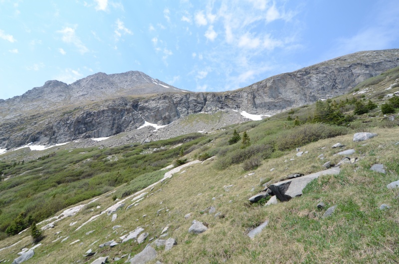
Two more options presented themselves. More toward the up-valley, right end of the cliff band was another ramp/couloir that sloped upward from right to left, and to the far left end of the cliff band was yet another ramp/couloir that sloped similarly that led to a steep tundra and rock slope above. Both of these other ramp/couloirs were filled with snow. We elected to try the one furthest to the right. The bottom of that ramp ended in a large talus cone (if there had been no snow). We ascended the steep ramp/couloir using ice axes and crampons. We figured the angle to be perhaps 50 degrees. It penetrated all the way through the cliff and deposited us on much more gentle slopes below Tijeras. The climb up through here seemed quite "airy" and reminded us of the couloir often used to ascend Cathedral Peak in the Elks.
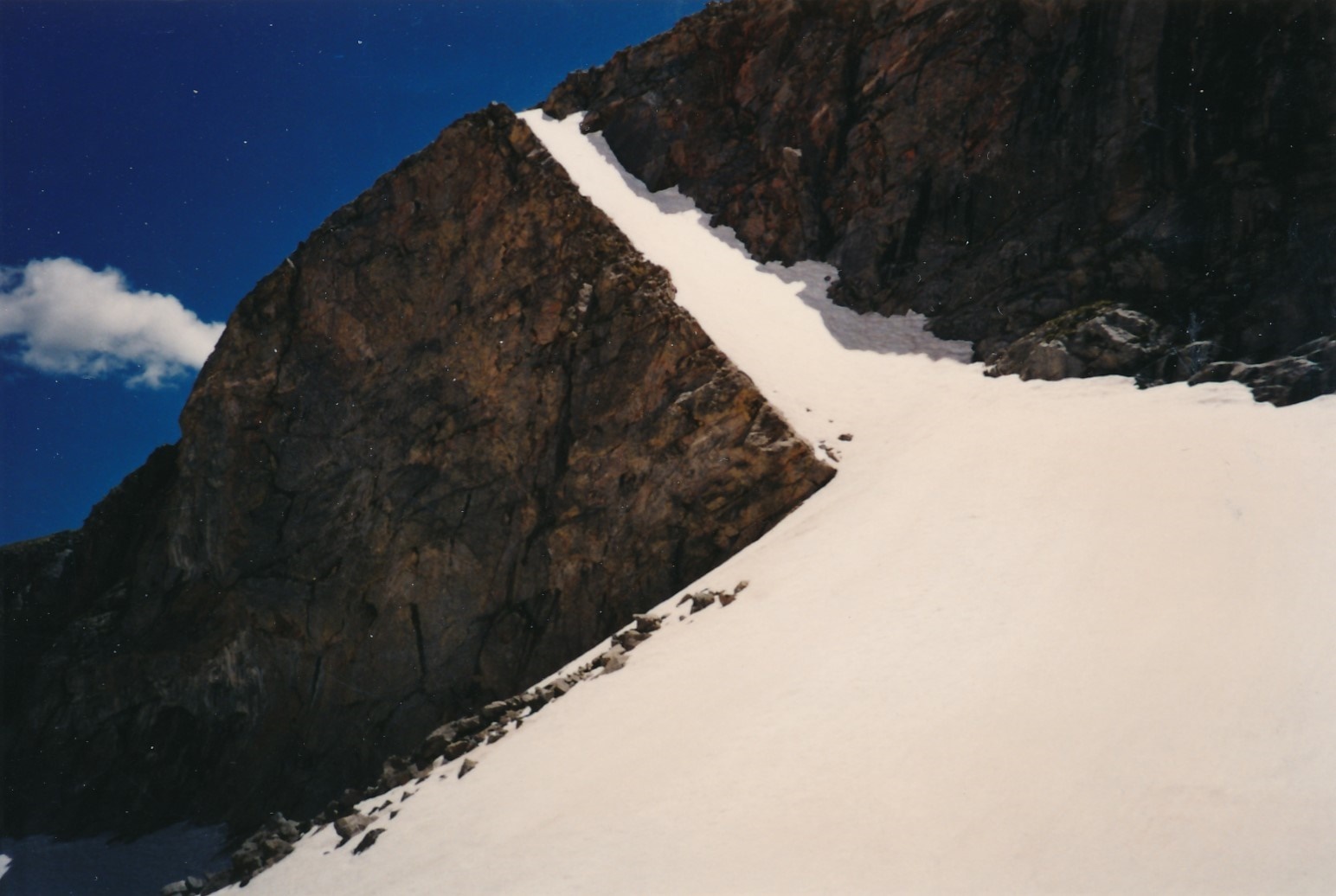
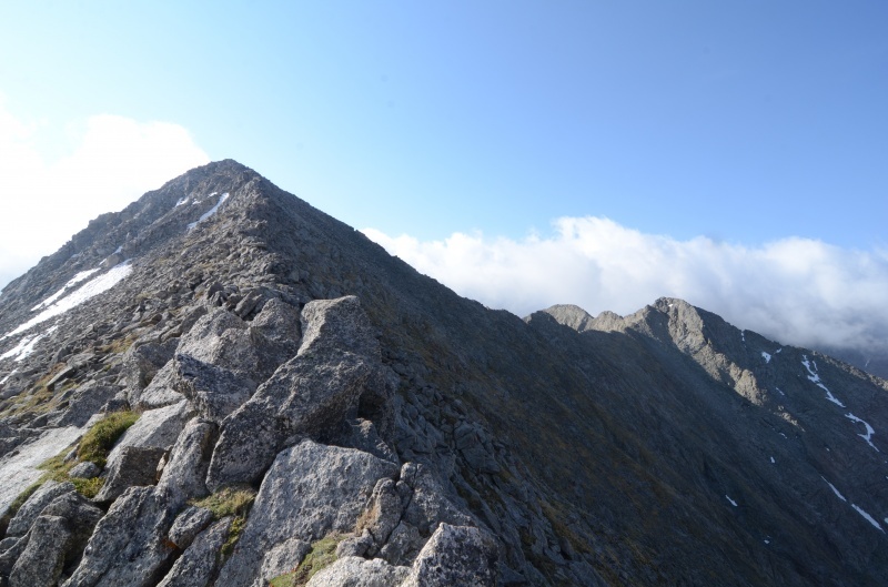
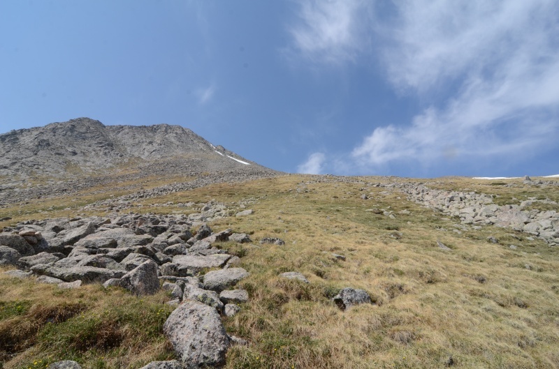
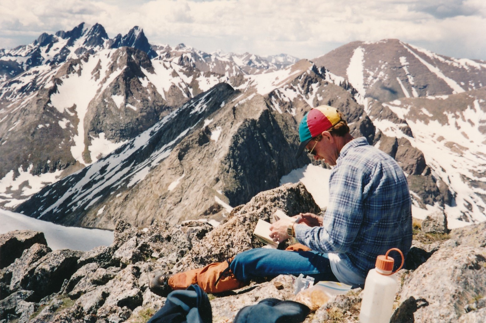
Once through the cliff band, enjoy strolling across some tundra for a while, aiming for a saddle just SE of PT. 13,290. The tundra will give way to fields of rock. Gain the NW ridge of Tijeras and continue to the summit staying on the ridge crest as much as possible and scrambling over large blocks of rock at times. This can reach 3rd class scrambling. Getting off to either side of the ridge does not make the going any easier. Arrive at the small summit to enjoy the spectacular view that includes the Crestones, Music Mountain and Pico Aislado.
Return as you came. Hopefully you marked the ramp/couloir you came up so you can find it on the way back down. However, for variety, the ramp/couloir mentioned above at the far SE end of the cliff band can also be used. We found this ramp to have less snow than the other and hence, a little easier to descend, but just as steep and a little intimidating. At the base, we had to leap across a gap between the rock and the snow (bescherung). This led to an unplanned glissade and self-arrest. If this basin is snow-filled, you can obtain a very nice glissade back down to the lake.
Additional BETA
Links to other information, routes & trip reports for this peak that may be helpful. -