LoJ: #138 (Pre-LiDAR #141) / 13,721' Twining Peak
Peak Summary
Twining Peak is an easy Class 2 walk-up summit that can be easily reached from Independence Pass. It sequences nicely with UN13,500. Together, these two summits can be done before lunch and the trailhead (Independence Pass Summit) can be reached by any passenger vehicle. Makes a good short-day outting and family hike. Lidar measurements added 10 ft. changing this summit from 13,711 ft. to 13,721 ft.
Twining Peak South Ridge Route
-
-
Independence Pass TH
Two possible access routes but both involve Highway 82:
From US HWY 24 between Leadville and Buena Vista, take the State HWY 82 west, around Twin Lakes and to the summit of Independence Pass. Park at the pass summit.
From Glenwood Springs/Aspen, drive on State HWY 82 through Aspen and continue driving one of Colorado's most thrilling passes to the summit of Independence Pass.
Camping
On the east side of Independence Pass, designated Forest Service campgrounds include Parry Peak and Twin peaks. There are also numerous primitive sites all along Lake Creek. One of the best is here: N 39° 04' 54.99" W 106° 32' 21.86". This is where a diversion tunnel empties out into the Lake Fork and is just under 2 miles past the turnoff for the south fork of Lake Creek.
On the west side of Independence Pass, there are designated Forest Service campgrounds at Difficult Creek, Weller, Lincoln Gulch and Lost Man. There are no good primitive sites, but you may be able to use the trailhead parking area across from the Lost Man CG.
-
From UN 13541
Click thumbnail to view full-size photo + caption
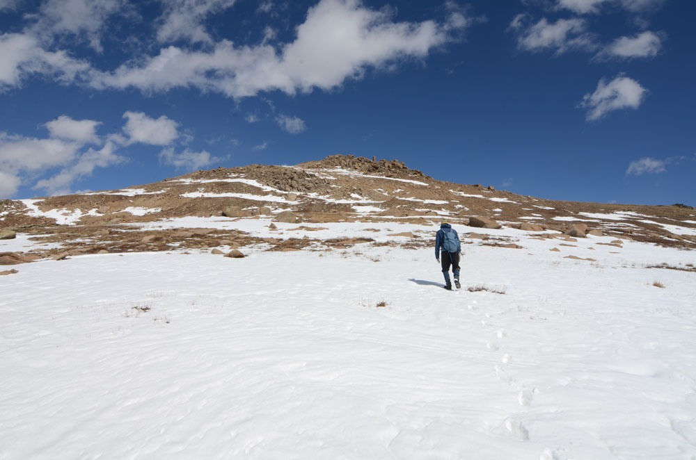
Open This Route in a New WindowFrom the summit of Independence Pass, head north, skirting the small lake on the west side and avoiding willows as best you can. Then begin ascending the SSW ridge of the peak on mostly tundra with more willows at times. As you approach the summit, things will become a little rockier, but there's nothing difficult. Park to summit is about 1.5 hours and round trip time about 2.5 hours. A great time to do this route is just after the pass opens for the summer. Take an ice axe and some micro spikes or crampons and get an early start before the snow softens up. Enjoy a nice glissade back down. Better yet, if you're a skier, take your skis up for a nice ride down.
Also note: This peak combines well with Twining Peak, a Top 200 summit less than one mile north along the ridge.
Click thumbnail to view full-size photo + captionRoute Description
Year Climbed: 1989Twining Peak is sequenced with UN13,500. One-way mileage and elevation gain are measured from the summit of UN13,500. Round-trip mileage and elevation gain assume completing of the two-summit circuit.
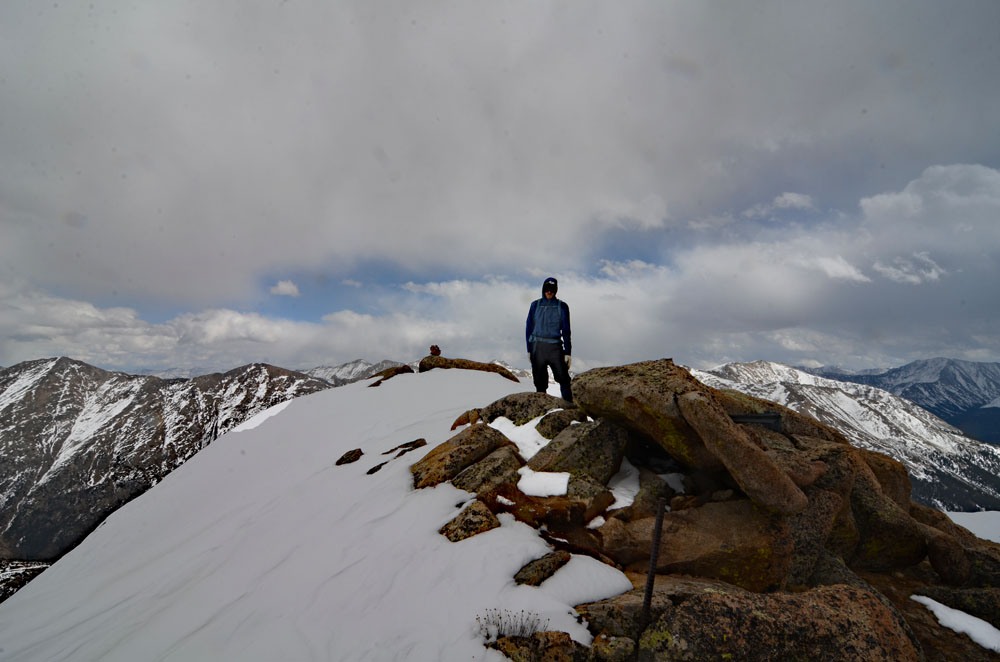
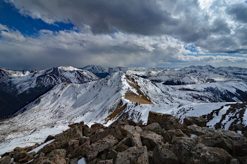
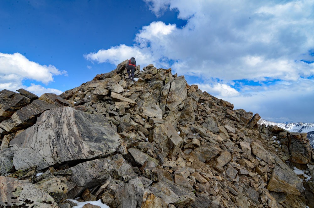
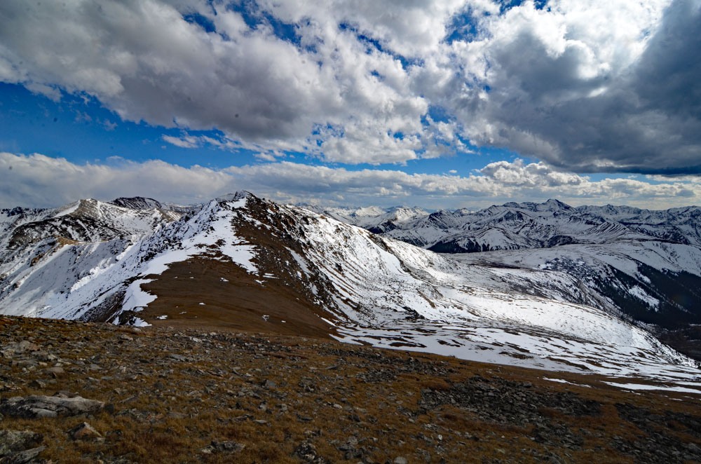
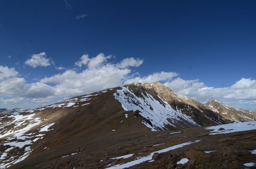
From the summit of UN13,500, walk down the ridge to the NNW over what is the rockiest section of this overall hike. Continue to the saddle at 13,140 ft. Begin the easy hike to regain 570 vertical feet to the Twining summit by walking first NW, then NNE along the ridge crest to the rocky & blocky summit of Twining Peak. Most of this hiking will be on low tundra, embedded rocks and rubble of various sorts. The Twining summit offers an expansive panorama of the central Sawatch Range and some of the prominent Elk Mountain summits are also visible to the SW.
To return to Independence Pass, hike back down the ridge you just came up to the saddle at 13,140 ft. Descend to the SW from the saddle for a few hundred vertical feet into a basin that drops SW. Begin contouring more to the south and don't drop below about 12,500 ft. Hike over a broader west ridge of UN13,500 and keep contouring south, then SSE to cross the SE ridge of UN13,500. This is the ridge used to ascend that summit. Once across that ridge, head down to the pass parking lot working around low willows and bogs and enjoy the tourist hordes stopped at the pass. This return route can be used as a means of climbing Twining and bypassing UN13,500 if you're only working on the Top 200 summits. However, in our books, it hardly makes sense to bypass UN13,500.
Additional BETA
Links to other information, routes & trip reports for this peak that may be helpful. -