LoJ: #229 (Pre-LiDAR #223) / 13,543' UN 13543
Peak Summary
A possible day climb from the TH or turn this into a 3 - 4 very scenic backpack trip and climb several other summits in the immediate area. Though this particular summit is not so "family friendly," others in the area are and you also have easy access to two 14ers. Lidar added a couple of feet to this summit.
Southwest Slope/South Ridge Route

-
-
Willow Lake Trail #865 TH
The trailhead is located east of the small town of Crestone. Take US 285 south from Poncha Springs, over Poncha Pass for 21 miles and turn left onto CO17, another four miles south of Villa Grove. Drive another 13 miles to Moffat and turn left onto "T" Road, aka: Russel St. Drive about 13 miles east to Crestone. T Road will make a 90 degree jog right, then back left and a couple miles further will make a shorter jog left, then right. As the road enters the town, it will make a couple jogs again before you reach the center of town. From the town of Crestone, from the second stop sign, turn right on Galena. Follow the gravel road 1.5 miles to a location where 2WD vehicles can park. 4WD vehicles can proceed another .75 mile to the trailhead parking. South Crestone Lake trail #860 heads out straight ahead. Willow Lake trail # 865 veers to the right and crosses the creek.
If coming from Alamosa, head north out of town on CO 17 and continue north past both Mosca and Hooper to Moffat., appx. 29 miles. Turn right (east) onto "T" Road and follow directions as above.
Camping
Primitive sites are available along FR949 once you get on Forest land. Be careful about private property through here, especially on the south side of the road. Some limited car camping at the trailhead.
-
From Willow Lake Trail #865 TH via Willow Lake
Last visited this trail in 2002. At that time, there was no official bridge crossing Crestone Creek at the TH. We were able to get across on fallen logs, but in higher runoff, you may have to wade. After crossing the creek from the TH, the trail climbs east up an open hill, then begins a series of switchbacks through forest, crosses a ridge and then contours up valley, well above Willow Creek. As the trail approaches a large waterfall it climbs on switchbacks more steeply, heading in a more southerly direction, crosses Willow Creek below the waterfall on a log bridge, and climbs steeply up an area of rubble as it turns back to the east and begins to level out as it approaches the beautiful Willow Lake. A scenic waterfall plunges into the far eastern end of the lake. Overall, this is a moderately strenuous backpack. Trail is maintained and easy to follow except where it crosses back over Willow Creek above the waterfall and a little before the lake.
Note: Expect high weekend traffic at the trailhead because this is an access for climbing Challenger and Kit Carson and has become very popular.
Camping
Main camping on the approach is at Willow Lake. In keeping with FS camping policies, campsites are located away from the lake and along the northern side, somewhat elevated above the lake. Also, there are sites well before reaching the lake on the hike in. Watch for FS signs designating where to camp. Camping locations may have changed due to FS regulations since our last visit in 2002. There are also some limited primitive camping spots at and just before arriving at the trailhead.
Note: This area has become very popular with the 14er bagging crowd. Competition for campsites at Willow Lake on weekends may result.
Open This Approach in a New Window
Route Description
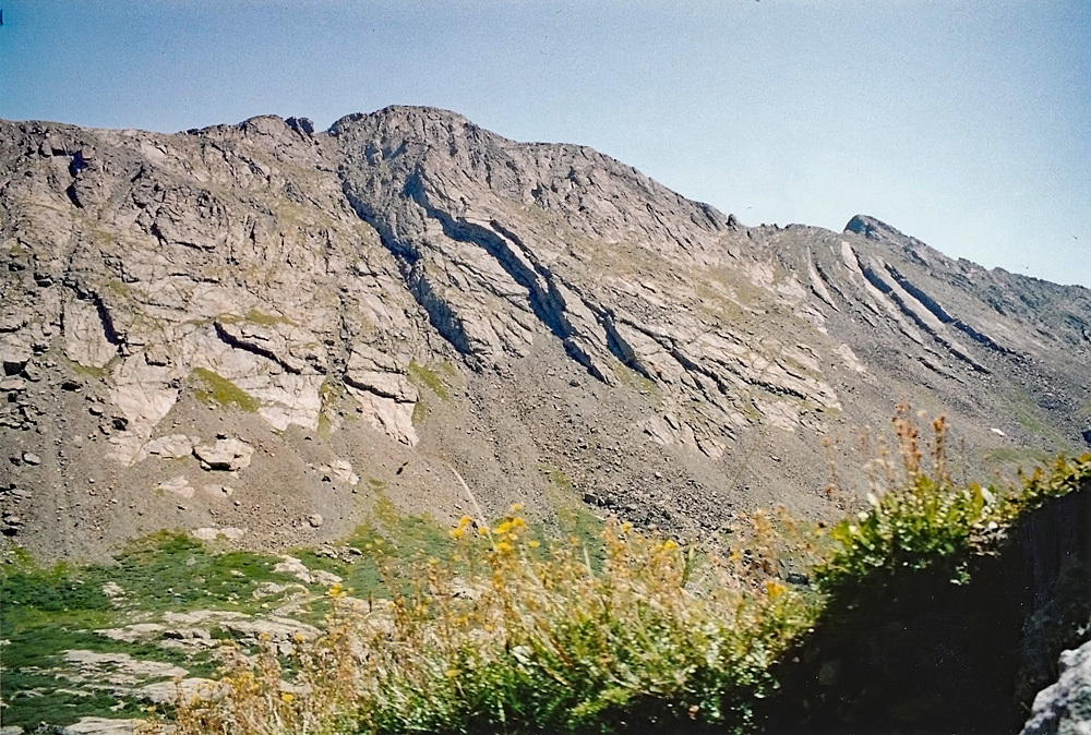
Year Climbed: 2001From Willow Lake, follow the well-used climbers trail around the north side of the lake, crosses the stream above the waterfall and then turns SE as it heads into the upper basin. Ignore the trail that turns off for Challenger Peak and continue walking SE toward the upper, unnamed lake at 12,325 ft. and re-cross the stream to the east side where a break in willows offers a chance to do so about 1/3 mile below the lake. About a quarter mile before that upper lake, turn abruptly to the NE and head towards a saddle between UN 13,543 and unranked 13,398. Tundra slopes will give way to tundra with embedded rock and then more talus as you gain the 1,000 ft. vertical to the saddle. Turn north and begin following the ridge crest until you encounter some exposed 4th class rock in about 100 yards. While some have successfully negotiated the ridge crest on to the summit, we did the following:
Retreat from the 4th class difficulty back along the ridge and drop to the west 100 feet or more aiming for a sparsely covered tundra ramp below that slopes upward to the north and in the direction of the summit. Getting to the ramp may involve a few delicate moves on some steep slabs of firm rock. The ramp will be easy and will lead to a steep and narrow gully. Climb/scramble up the gully on good rock until it eases and you find yourself about 100 feet below the summit. From here, the best route continues to a little north of the summit where you'll need to scramble a little more to gain the summit ridge. Turn south and walk on to the actual summit. The summit register that day indicated that Jennifer Roach had followed a similar route but another climber had followed the ridge all the way to the summit.
For an exit, locate a steep couloir that descends from near the summit to the south for several hundred feet. Lower down, exit the couloir and continue down on steep tundra slopes until you reach the valley floor. It's also possible to continue on north along the ridge crest to unranked 13,517 and then the ranked, 13,543, formerly UN13580.
Additional BETA
Links to other information, routes & trip reports for this peak that may be helpful. -