LoJ: #568 (Pre-LiDAR #576) / 13,102' UN 13102 Formerly UN 13090
Peak Summary
Probably the easiest summit to climb from the vicinity of Grizzly Reservoir and Lincoln Creek. Class 1 and 2 hiking on mostly trail and tundra terrain. A pleasant short day hike with plenty of July flowers to brighten the excursion. Lidar added 12 feet of elevation.
UN13,102 SE Slopes Route
-
-
Lincoln Gulch - Grizzly Reservoir TH #2
Use this trailhead to access the following summits from the west side of Independence Pass: Grizzly, Garfield, UN 13,460, UN 13,090, both Truro summits, UN 13,631, and Petroleum Peak, all of which are located south of Grizzly Reservoir. The trailhead for Tabor Peak can be accessed from the same 4WD road up Lincoln Creek before reaching the reservoir. Same for the New York Creek/Peak TH. The coordinates provided above are for the Portal Campground located by Grizzly Reservoir. This location will serve as the trailhead.
From the Town of Aspen, drive east up state highway 82 toward Independence Pass. Two miles past the turnoff for the Weller CG, or one mile past the Grottos TH, turn south (right) and drive down toward the Lincoln Gulch Campground. There is an information kiosk right off the highway and a mileage sign for locations along the Grizzly Reservoir/Lincoln Gulch road. Coordinates for this turnoff are: N 39° 07' 10.50" W 106° 41' 18.27". The road immediately crosses the Roaring Fork River. If in a passenger car, you'll need to park either at the kiosk or down at the campground. If you have a 4WD or a better clearance type vehicle, then the road to Grizzly Res. turns off to the left shortly before reaching the campground. The road is rated "4WD." There is a sign indicating the campground is straight ahead with a Forest Service gate. The road to Grizzly "appears" to be in better condition than the one to the campground, but the short road down to the campground is still passenger vehicle passable.
If coming from the Front Range, drive to either Leadville or Buena Vista and turn onto SH 82 from US 24 at Twin Lakes. Drive up and over Independence Pass. On the west side of the pass, drive on past the Lostman CG, and in just under 4 miles past that campground will be the turnoff for the Lincoln Gulch CG. on the left. 4WD or vehicles with better ground clearance may then continue ESE for Grizzly Reservoir as described above. This road is identified as CR23 or FS107.
Along the first 3 miles up to the New York TH, there are 22, designated, primitive campsites with bear-proof lockers for food storage. The road tends to be slow going with potholes, etc., but no real major obstacles. At times, you'll be driving over slabs of rock, but clearance is usually not an issue. We drove the first 3 miles of this road in 2019. While there was one area of extensive avalanche damage and another smaller area, both at about 2 miles in, both had been cleared. It may take over a half hour to drive the 6 plus miles back to the reservoir. There is a small campground there with toilet facilities called the "Portal" campground; first-come, first served.
The trailhead for New York Creek/Peak on the mileage sign mentioned above is 3.3. We measured 3.1. If using that trailhead, the turnoff will be on the right and if you drive a short distance down through some overhanging willows, there is a large parking area with lots of cobbled rock. There is no bridge to assist crossing the creek here. Coordinates are: N 39° 05' 39.23" W 106° 39' 35.51". Elevation 10,100 ft.
The trailhead for Tabor Creek is another 1.8 mile past the signed trailhead for New York Creek/Peak. Coordinates are: N 39° 05' 33.11 W 106° 38' 39.81". Elevation 10,290 ft. There is no bridge to assist crossing the creek.
Just past the Portal campground, in prior years, we have found a locked gate across the road as it continues south up the valley. Because there are some private holdings farther up valley, we've seen some persons with a key to that gate. We've seen the Forest Service keep that gate closed past the 4th of July weekend, depending on snow melt conditions. The gate may also be closed again in early fall. If the gate is open and you have good 4WD clearance, you may continue to drive up valley as far as "Ruby," and the Ruby Mine, right around, 11,400 ft. If the gate is closed, be prepared to walk up to an extra 4 miles, or do as we did one time , and bring mountain bikes and ride up the road as far as you need to go. The bikes won't seem much faster than walking when going uphill, but will speed your return to the campground considerably.
Alternate Trailhead for Petroleum Pk: See the trailhead description for Tellurium Creek north of Taylor Park Res.
Camping
There are two designated Forest Service campgrounds: The Lincoln Gulch CG and the Portal CG at Grizzly Reservoir. In addition, for the first 3 miles as you drive SE to Grizzly Res., there are numerous (22?) "designated" primitive spots for camping. These have been marked by the Forest Service. On summer weekends, both campgrounds and all the designated primitive spots can be fully occupied. Seems to be a very popular area. If the road is open south of the Portal CG, there may be some other, usable primitive sites. Both the Portal and Lincoln Gulch CG have vault toilets, but neither has water. Both have only about 6 sites. The Lincoln CG, you could get an RV or trailer down into, but not the Portal.
Campsite Locations
Lincoln Gulch CG › N 39° 07' 01.72", W 106° 41' 44.39"Elevation 9,600 ft.Portal CG › N 39° 04' 32.82", W 106° 36' 45.35"Elevation 10,560 ft.
Click thumbnail to view full-size photo + captionRoute Description
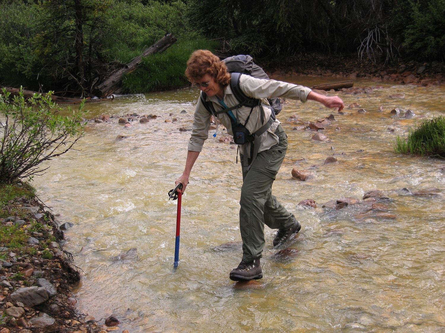
Year Climbed: 2009From the Portal Campground, drive south up the road if the gate is open about a mile and a half to where you can see Truro Creek coming down to meet Lincoln Creek on the west side of the road. Park and then deal with the main challenge of the day, finding a way across Lincoln Creek. You'll probably have to wade, but when we did this crossing, we found a place where the stream widened just enough that we could step-hop on some rocks just under the water surface and get across relatively dry. It was kind of like walking on water, but cheating.
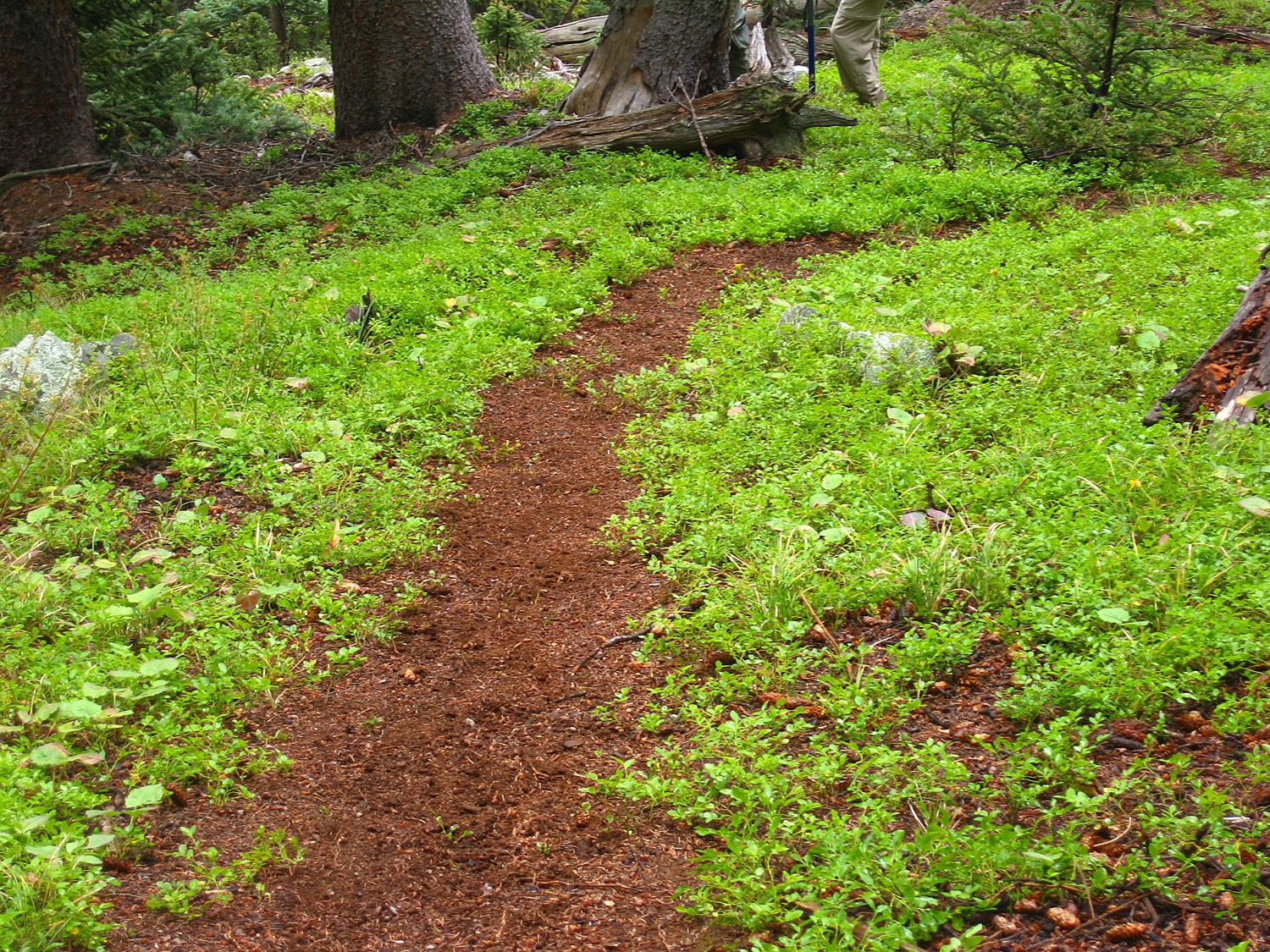
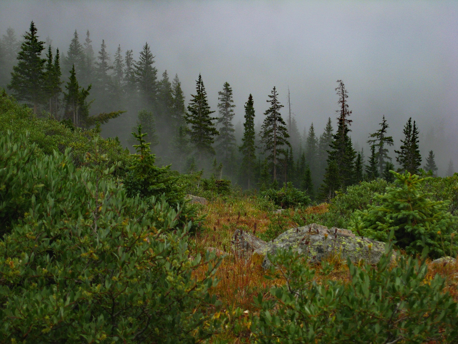
Once across Lincoln Creek, locate the old trail that heads up along the north side of Truro Creek. You may have to work through some willows initially. Once in the conifer forest, the trail should be fairly easy to find, but gets a little sketchy at times. This trail shows on the USGS quads but does not show on the Forest Service map. Follow it as it gains about 1,200 feet in elevation until you arrive at the forest edge where things level out a bit and open tundra begins. Turn NW and begin an ascent toward the summit of UN13,102. At first, there will be low willows and conifers, but higher up, the slopes open up to a mix of tundra and scree. We followed a shallow gully laden with flowers, especially paintbrush. This gully led almost all the way to the summit and was never any more difficult than Class 2.
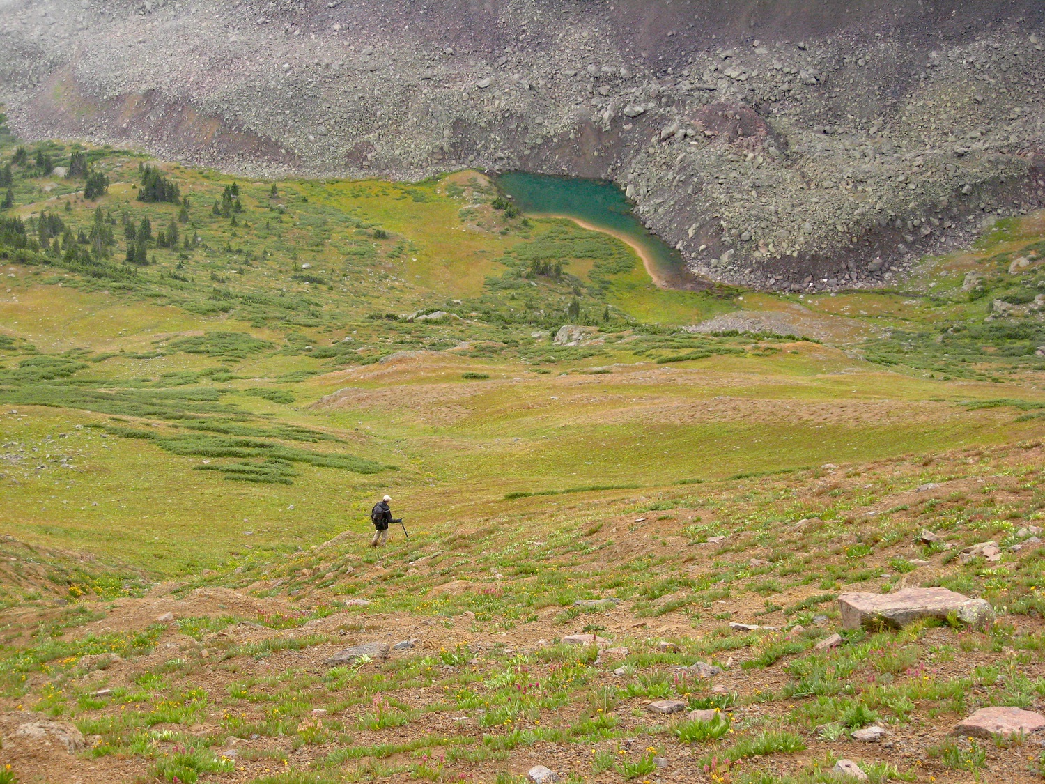
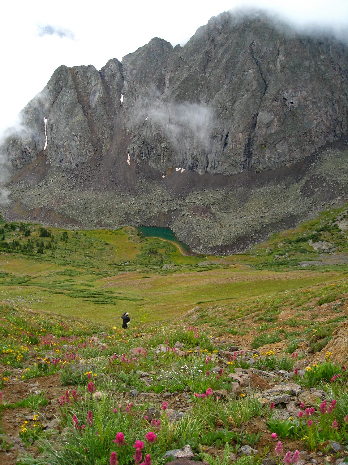
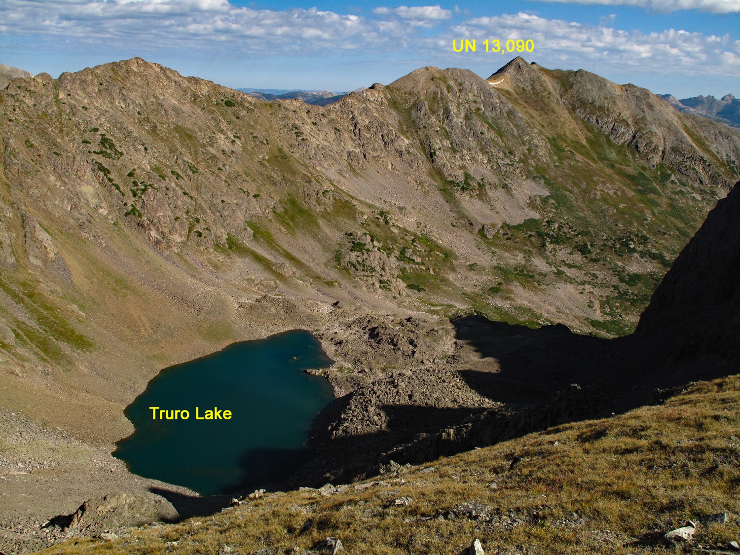
From the summit, enjoy the view of the pristine Truro Lake and the dramatic north face of Truro Peak with its 1,000 foot sheer face. Return by the same route and enjoy a very quick trip down. When we hiked this peak, we found bear scat on the lower trail. Just a reminder that bears may be closer than you think.
-