LoJ: #578 (Pre-LiDAR #577) / 13,085' "Mount Solitude" Formerly UN 13090 B

Peak Summary
UN13,085 (Previously UN 13090 and still Mount Solitude) is a Class 2 ascent by way of its west slope and the Pitkin Lake trail a few miles east of Vail and off I-70. The trailhead is accessible to any passenger vehicle. The peak can be climbed in a moderate day hike from the trailhead, or could be combined as part of a backpack trip and accessed from either a lower campsite about 3.75 miles up the Pitkin Lake trail or a higher campsite located near Pitkin Lake.
Mt. Solitude West Slopes Route
-
-
Pitkin Lake TH - Gore Range
Whether coming from the west or east on I-70, take Exit #180 off of I-70, about 4 miles east of the main Vail town exit. Proceed to the north side of the interstate and turn east (right) onto Fall Line Drive. Drive just a short distance past some condo units on your left, cross Pitkin Creek and find a very small trailhead parking area immediately after crossing the creek. Just a few yards further is a cul-de-sac and another condo unit. Do not park there. The trailhead parking offers a total of 10 slots. Obviously, these will fill on weekends. If you can't find a parking spot, try going back to the Exit 180 interchange and drive south on Big Horn Road then SE and there's a parking lot just past the interchange you may be able to use. From there, you'll have to walk back to the trailhead.
Camping
The nearest campground is the Gore Creek Campground, a National Forest Service fee area with vault toilets and water. To get there from the Exit #180, you'll need to drive SE on Big Horn Road past the trailhead parking for the Deluge Lake and Gore Creek TH. Reservations may be made for campsites at reserveamerica.com. Other than that, there is virtually no other place close by with at-large/primitive camping. Your best bet may be to go up to the summit of Vail Pass and drive down the Black Lakes Road where there is a pullout parking area right where the road is barred from vehicular traffic and becomes the Vail Pass bike trail, east end. This is not a primitive camp location but you may be able to sleep in your vehicle.
Campsite Locations
Gore Creek Campground › N 39° 37' 37.14", W 106° 16' 26.33"Fee required. 8750 elevation. Lots of interstate traffic noise.
-
From Pitkin Lake - Gore Range TH via Pitkin Creek Lower Campsite
The small parking area for the Pitkin Lake Trail has a sign warning about a 2-day parking limit. If planning on being there longer, call the Vail Police Department - Enforcement Division and ask for permission to park there longer. Be prepared to provide license plate and vehicle description.
The trail begins by ascending gently along the east side of the stream, then crossing on a sturdy bridge. A short distance farther on, it abruptly begins an incredibly steep ascent with well-positioned logs to reduce runoff and provide steps for the arduous climb with full packs. For the next half mile, you might as well be climbing a mountain, but after that, the trail begins to level off, still maintaining some distance from and above the creek. Overall, this trail is in fairly good condition and after the initial section was not too arduous.
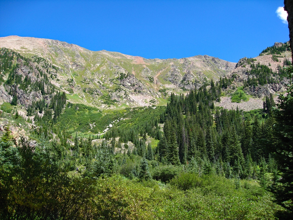
After about two miles up the trail comes right beside the creek. After the section near the creek, the trail remains very moderate until it crosses an open meadow and then begins climbing up to another bench level. At about 3.25 miles in the trail crosses the west fork of Pitkin Creek and there is a large campsite past that crossing. In 2010, the campsite was not well-used. It's a short distance before the trail makes a left turn to begin a steep ascent out of the valley to Pitkin Lake. We are calling this the "lower campsite." It can be used as a base camp for Mt. Solitude, Peaks X and Z. The waterfall shown on the map is somewhat obscured from here.
Campsite Locations
Pitkin Creek Lower Campsite N 39° 40' 48.95", W 106° 16' 38.73"Elevation 10.460 ft.
Open This Approach in a New Window
Click thumbnail to view full-size photo + captionRoute Description
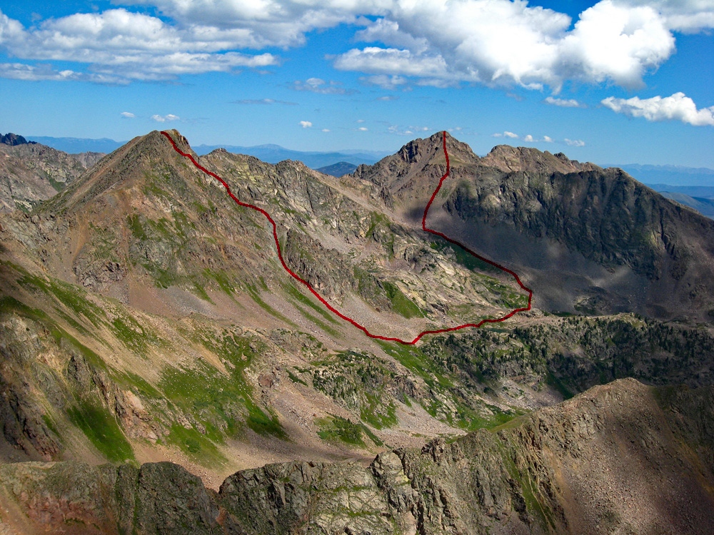
Year Climbed: 2010From the Pitkin Lake trailhead, it's 3.75 miles to our suggested "lower campsite." From there, the route we took up to the summit was 2.1 miles and the shorter return mileage back to the campsite was 1.25 making a 3.35 mile loop. From the lower campsite location, we followed the trail a short distance on up and then left it and crossed to the east side of the main fork of Pitkin Creek. From here, we walked through an open meadow toward a steep valley that leads southeastward all the way to a saddle just south of “Climber’s Point” (13,022). Getting into the upper section of the drainage will be the most difficult part of your day on this hike. First you must wade through lush, tall vegetation & flowers with hidden rocks toward a steeper embankment of a couple hundred feet, the upper portion of which is covered with willows. From below, it appears that with a little short bushwhacking, you can push through the willows and reach more gentle ground above. There are two small creeks that come down from above. We headed for the one to our left (north) and pushed our way up through the vegetation. When we reached the willows, it was too steep to climb up through them forcing us into the only open spot, the drainage itself, which had a small amount of water running in it. We literally climbed up it, at times doing what seemed like 3rd class maneuvers and eventually broke out of the willows, further up than we expected or wanted.
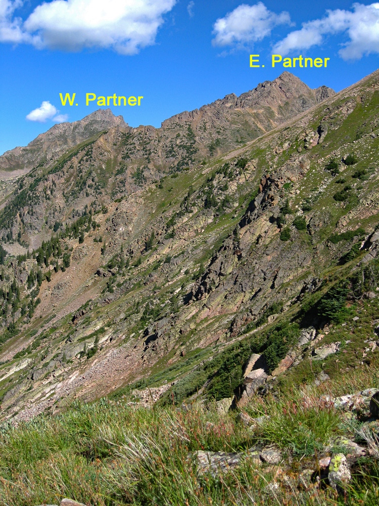
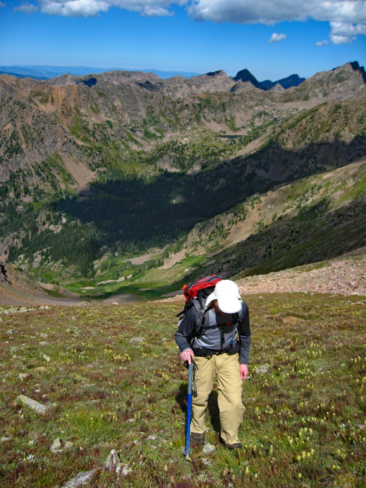
Above the willows now, the remainder of this great valley/gully, is mostly tundra for a long ways, but lush vegetation often obscures the dangerous rocks and boulders hidden under the flowers. It is 1,800 feet of continuous up, taking a good hour and nearly another half. As you gain elevation, the impressive views of the Partner Peaks will attract your attention. As you near the saddle, it becomes more rocky, but there is still plenty of tundra to walk on. At the saddle just south of Climber’s Point, you may wish to pause for the outstanding view. The east ridge of Climber’s Point forms a formidable wall overlooking the head of the valley below. You can look down into the Bighorn Creek drainage and across the way, North Traverse Peak loomed over the valley below. You could also view the Grand Traverse ridge.
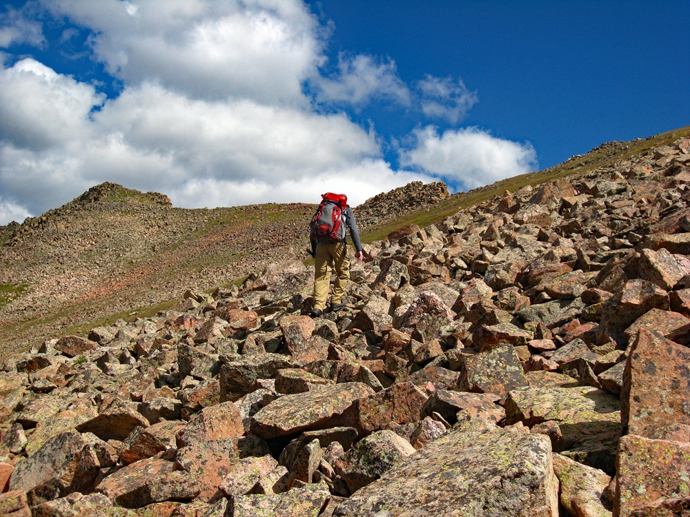
From the saddle hike up over Climber’s Point and then follow the ridge crest toward Mt. Solitude. This is a little more difficult than it appears at first and involves a few ups and downs and some scrambling around some rocky sections, however, this makes the summit approach a little more enjoyable. The day we arrived on this summit, we thought it somewhat ironic to find two other peakbaggers arriving not long after us on a peak named, "Mt. Solitude." So many of the 13ers, you never see a soul. The tundra-covered summit beckons you to take a comfortable seat and enjoy a fine climbers lunch while basking in the amazing wilderness view and the sea of Gore summits all around.
When we finished our lunch, we decided to take a more direct route from the summit of Solitude that led back into the same valley we had ascended in. It was mostly very steep tundra and grass, and toward the upper section, there was some scree that enabled us to plunge-step our way down very rapidly for a short while. As we came to about the last 400 feet of elevation loss to the creek, we decided to avoid the willow section we had encountered in the morning and so headed over to the south side of the drainage, hoping that the conifer trees we saw would keep us out of willows if we followed along the edge. But this led us into some very steep slopes with hidden bluffs. For a while, the idea worked, but eventually, we were forced back into willows, where we had to do some major bashing. The best route turned out to be the other little creek. This got us through the quagmire of plants and dropped us back onto the lower slope, filled with the flowers that stood about hip high, which also conceal larger boulders that you can easily trip on or sprain an ankle on. Once back across the creek, locate the Pitkin Lake trail and return to either your campsite or the trailhead.
Additional BETA
Links to other information, routes & trip reports for this peak that may be helpful. -