LoJ: #565 (Pre-LiDAR #569) / 13,107' "Corbett Ridge" Formerly UN 13100 C
Peak Summary
UN 13,107 (Corbett Ridge) is a Class 2+ climb of a seemingly insignificant summit on the far east end of Dallas Divide, dwarfed by its higher neighbor, Whitehouse Mountain. The route we suggest is on the north side of the peak and is accessed out of Ridgway. A higher clearance vehicle will get you close enough to the peak to make this a moderate day hike.
UN13,107 (Corbett) NNW Ridge Route
-
-
Upper Miller Mesa Trailhead
From the town of Ridgway, drive west on SH62 to the last street on the left you can turn onto (S. Amelia St.). Drive about 3 blocks south and turn right onto CR5. Drive on a graded dirt road about 5.3 more miles up onto Miller Mesa, Elk Meadows and an intersection. There's a large parking area. These are the coordinates provided above. Passenger cars should park here. Higher clearance vehicles may continue to what we'll call the "upper trailhead."
Continue walking or driving SSE on FR852. The road will round a low hill, cut back to the SW to an overlook of the Beaver Creek drainage, then cut back to the east and then SE. It will follow an old ditch and then drop south to a crossing of a fork of Coal Creek, where it switchbacks and rounds a low ridge. This is where it crosses onto Forest Service land at a gate. From the lower trailhead to the Forest Service boundary, it's 3.7 miles. Continue following the road as it turns south again another.4 mile to a place where it turns sharply east. Right here, there's some good camping. If you continue east at a fork here, the road leads up to the Burn Hut and our route for Corbett Ridge. Right where the road makes the turn to the east, there's a trail that heads off to the west up an embankment. This is the trail you want if climbing Whitehouse and Ridgway. If marked, it's called the "Dallas Trail" and on the Trails Illustrated map #141, its number is 200. Elevation here is 9,430 ft. Approximate coordinates are: N 38° 03' 26.03" W 107° 45' 08.46". These have not been field tested, so don't take them too literally. It's hard to find this spot on Google Earth, so prefer the driving/hiking directions over the coordinates if confused or in doubt. Last time we were here, the trail sign was knocked over and difficult to spot.
Camping
There are a few primitive spots along the 3.7 mile drive in on FR852 ( but you may be on private land) and at the upper trailhead location. Be careful regarding private property. You should be on National Forest land at the upper trailhead.
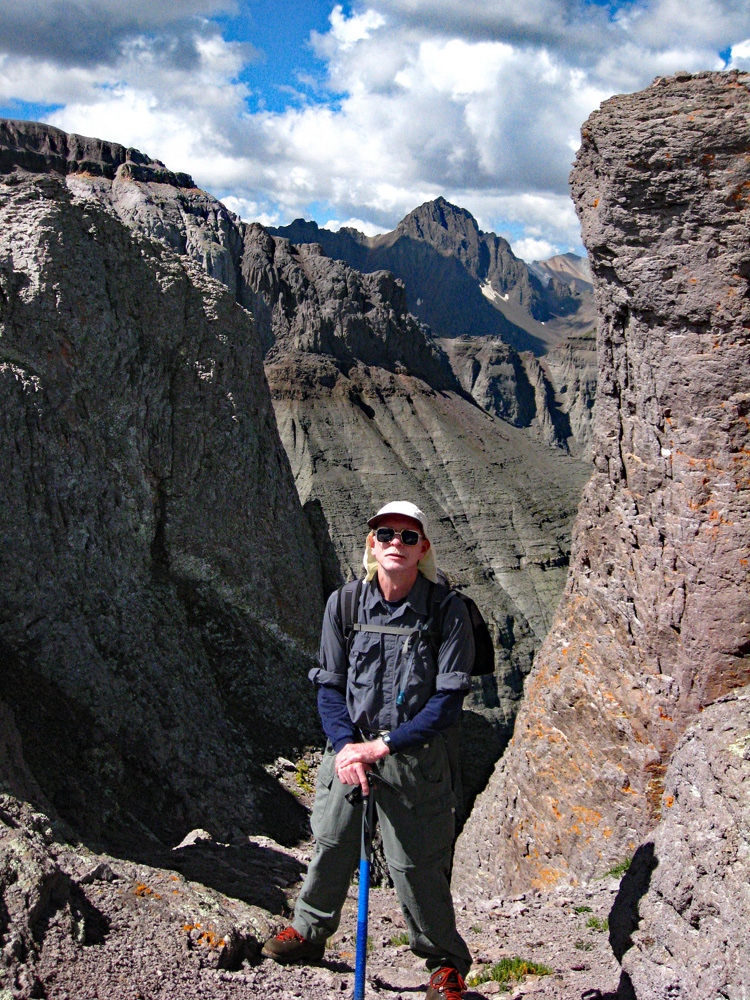
Click thumbnail to view full-size photo + captionRoute Description
Year Climbed: 2007Here's an alternative route to climbing Corbett from Ouray, from either up the Dallas Trail or Oak Creek. This will save both miles & elevation if you have a higher clearance vehicle. We are measuring mileage and distance from the "upper trailhead." If you must park at the lower TH on Miller Mesa, add four miles one way to our estimates and an additional 700 feet of elevation gain. If you can drive from the "upper TH" in a higher clearance vehicle to near the Burn Hut, you can deduct about 1.1 mile one way from our estimate and save about 330 feet in elevation gain.
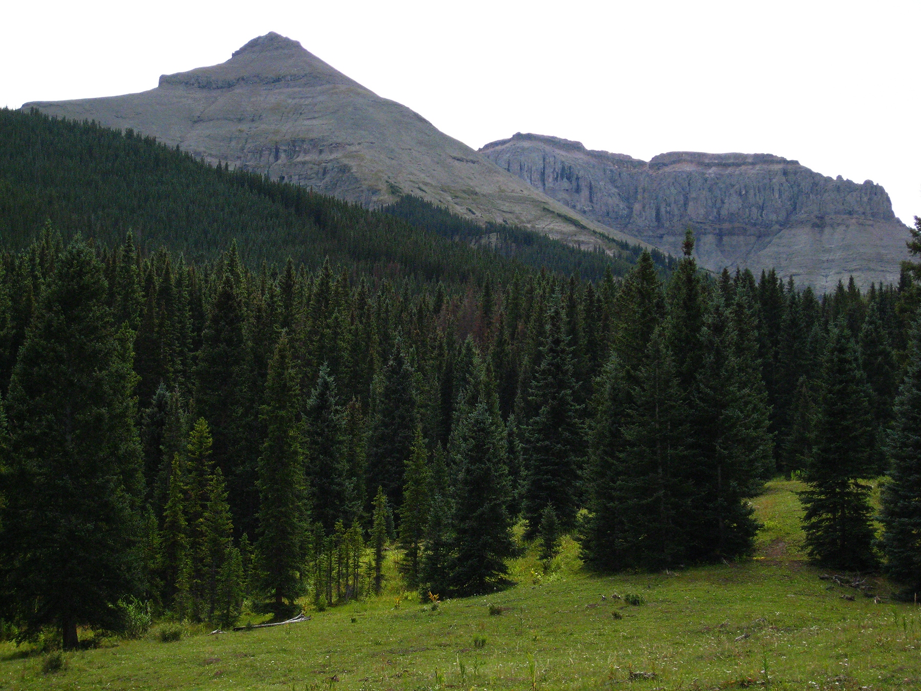
From what we call the "upper" trailhead where you can access the Ridgway Hut and Whitehouse Mtn. and Mt. Ridgway, head straight east on the continuing vehicle track. A trail sign indicates you will actually be driving on a portion of the Dallas Trail. Continue driving (if you have 4WD or good clearance) or walking another 1.3 miles to the end of the road. There is limited parking and plenty of other places to camp along the way. At the end of the road, you are just a short distance from the "Burn Hut" of the San Juan Hut System. (The road all the way into here from Elk Meadows is never very rocky. The only real clearance problems are presented by the mud holes that develop after rains.) You will need to park part way into a large meadow that shows on the survey map as about 2 miles directly north of the Corbett summit at around 10,000 ft. elevation. The Burn Hut is located toward the east edge of this large clearing at these coordinates in case you want to visit it: N 38° 03' 12.10" W 107° 44' 03.17".
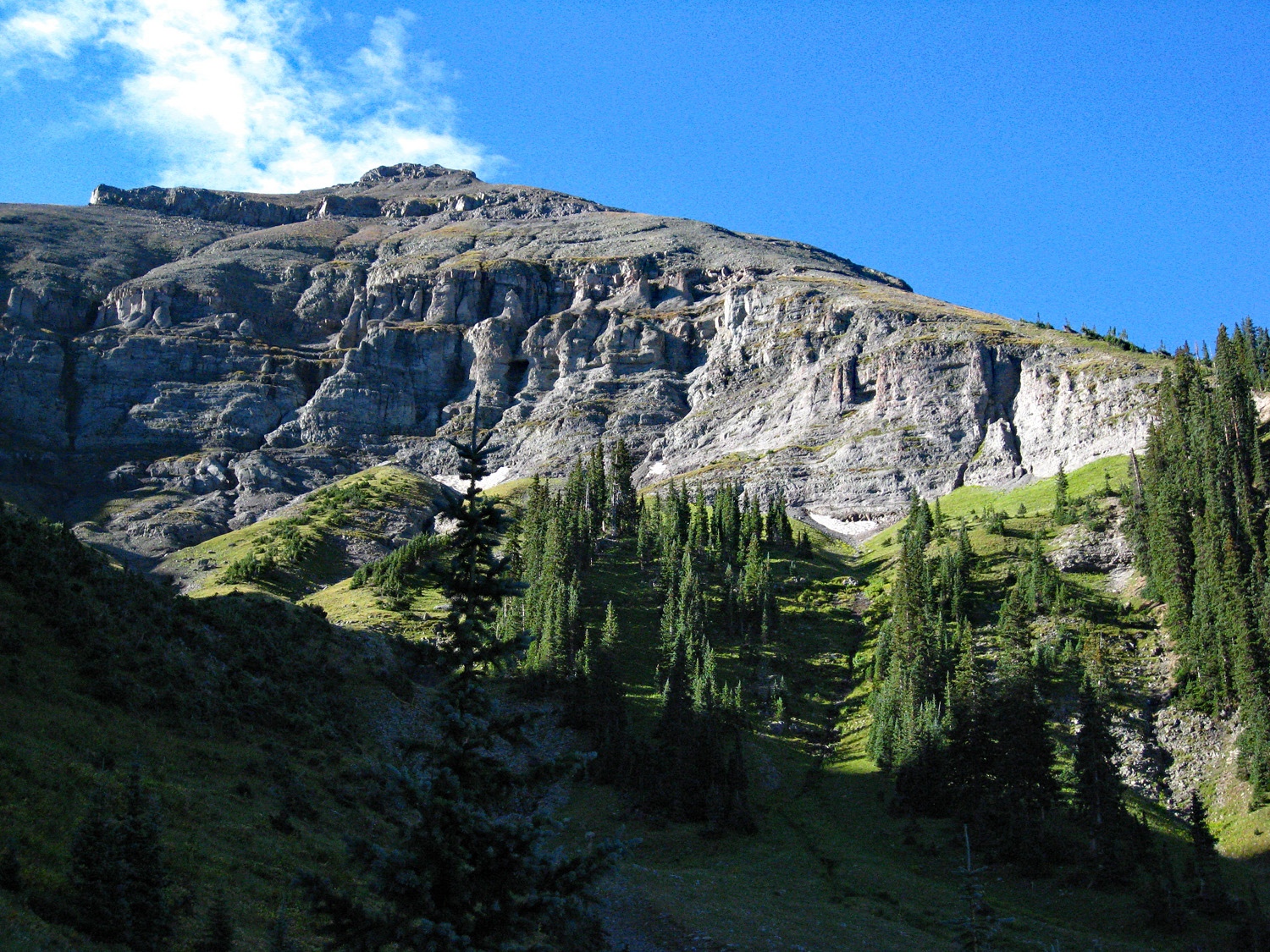
Hike SSE through the beautiful, grassy meadows all the way to the southeast end of the meadow. The survey map makes it appear that the meadow continues all the way to a NE ridge of Corbett. Actually, trees close in just before 10,400 ft., but game trails lead upward to the ridge just northeast of the 11,172 elevation mark on Corbett's north ridge. Once on the ridge at about 10,800 ft., proceed southwest, following a very well used game trail just below the ridge crest on the east side. This trail will bypass the 11,172 point and contour to the saddle just south of it.
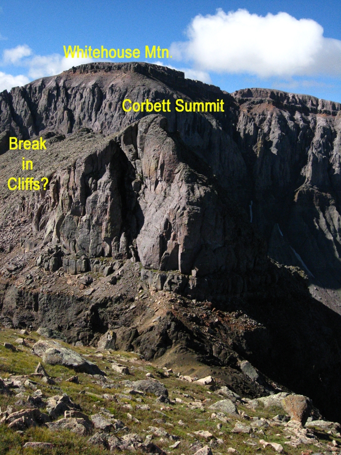
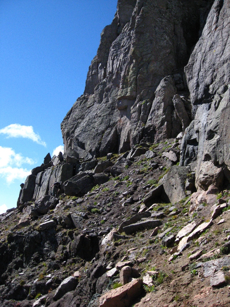
From the saddle, continue hiking southwest on one of several game trails, staying at about the same level until you intersect the open, main drainage on the north side of the peak. You will cross over one minor and briefly open drainage before the main one. Once in the drainage, hike steeply up for 400 - 500 feet of gain and intersect the main north, NNW ridge of the peak at treeline. From here, it is a steep grunt up slopes of loose rock all the way to the false summit. Much of this is "two-steps-forward, one-step-back" kind of scree-like stuff. This will lead you to a tundra-covered false summit. From the false summit, descend south to the saddle about 75 feet at the foot of the rock outcrop that comprises the true summit. Walk carefully along a sloping ledge on the east side of the true summit block until you get past some cliffs and can walk on broken rock up to the real summit. This real summit is extrapolated to be 13,100 ft., but in reality is probably only about 10 feet higher than the false summit. The traverse along the sloping ledge and final push to the summit is about the only interesting part of this climb other than the opportunity to run into some elk or bighorn sheep. In the cover photo, the most prominent ridge seen on the right skyline is the one you can take in this description all the way to the false summit.
On the summit, soak in the impressive view of the north face of the Dallas Divide summits. Return as you came, but on the descent of the NNW ridge, be careful. Footing is treacherous.
Additional BETA
Links to other information, routes & trip reports for this peak that may be helpful. -