#567 / 13,102' UN 13102 Formerly UN 13100 A

Peak Summary
UN 13102 (Formerly UN 13,100 A) is an easy Class 2 ascent that we have sequenced with Sheep Mountain C. These two summits are located along the Little Cimarron River. There is a fairly long trail approach to reach these two summits. The trailhead is accessible to most any passenger vehicle. Even with the longer trail mileage, the route finding is easy and both may be completed in a day-hike. Lidar added all of 2 feet.
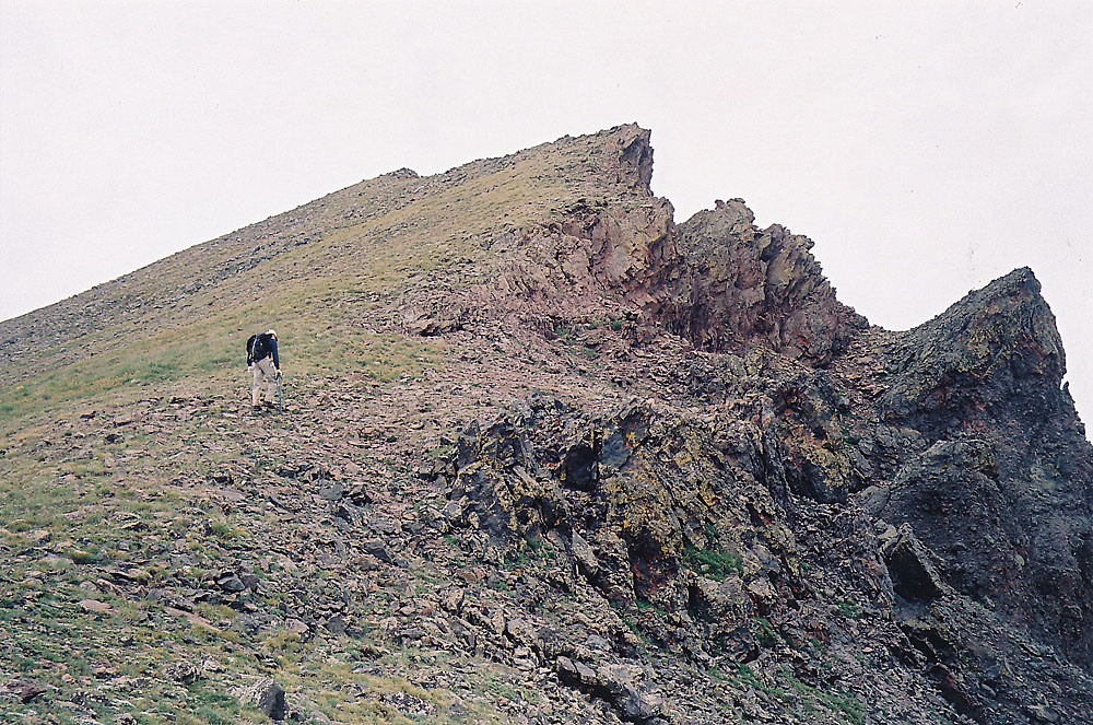
UN 13,102 North Ridge Route
-
-
East/Little Cimarron Trail TH
The only direct road access to the trailhead is from a turnoff along US50 a few miles east of Cimarron. From the center of Montrose, the turnoff for CR864 is appx. 21 miles east on US50, or appx. 64 miles west of Gunnison on US50. The road turnoff is marked. Drive generally south for 17 miles on a good graded, gravel road to reach the trailhead, which is a very small parking area on a sharp switchback. When the road crosses into Uncompahgre National Forest land, it becomes FR864. The trailhead is called the " East Cimarron Trail on a sign post."
Camping
About a half mile back from the switchback and trailhead parking, there is a primitive camp area that also serves as a location to pick up the Alpine Trail #225. This is primitive camping with no facilities but there is a bridge across the Cimarron here and a trail leads south which eventually ties in with the Little Cimarron Trail #246 which provides the access for Sheep Mountain and UN 13,100.
When CR864 crosses into the National Forest, there is a primitive camp area almost immediately on the right and there are at least two other such camp areas as you continue driving south.
Campsite Locations
Alpine Trail Access › N 38° 13' 14.74", W 107° 27' 58.50"Elevation 9,550 ft.
-
From Sheep Mountain
Click thumbnail to view full-size photo + caption
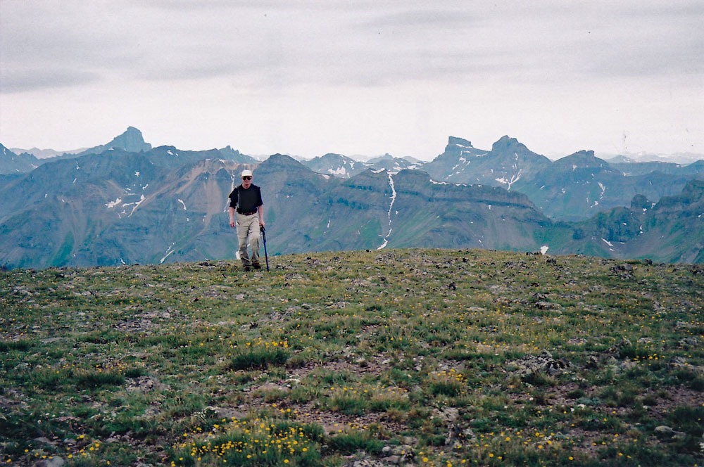
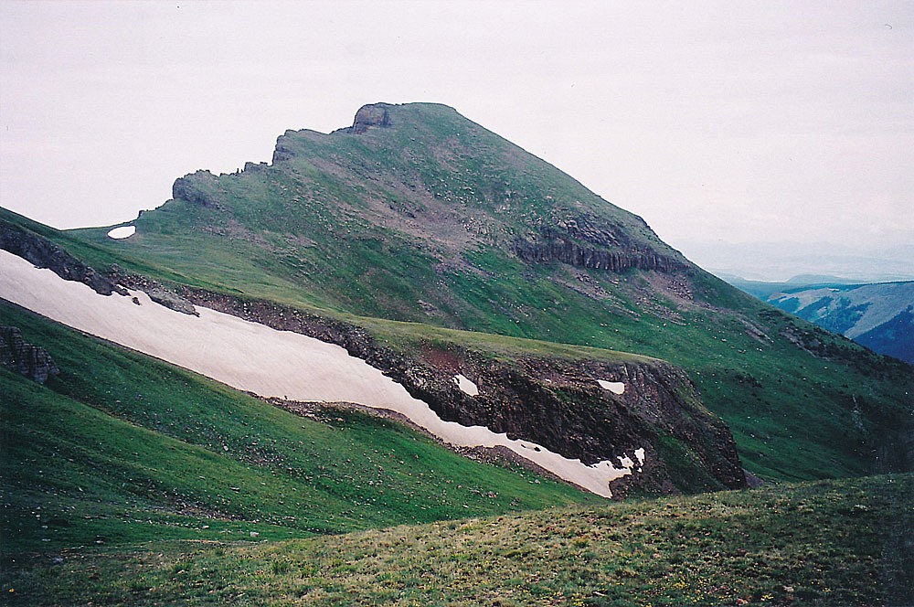
Open This Route in a New WindowFor years, we had driven US50 between Montrose and Gunnison, seeing this mountain and its very noticeable flat, north-sloping summit ridge. It can be spotted from many miles away by this distinct shape. For a long time, we were unaware that this was a ranked 13er.
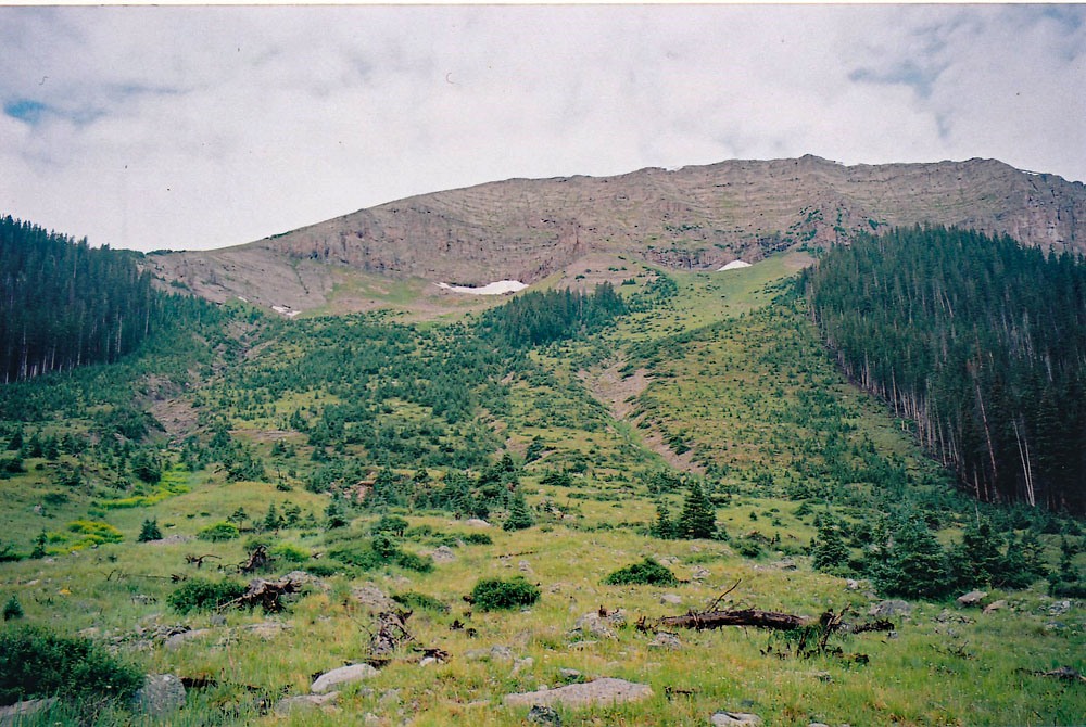
Begin this hike from the trailhead located at the sharp switchback on FR864, a half mile south of the camp area and trail crossing of the Alpine Trail. The hiking here is easy and gentle, following an old roadbed for 1.5 mile to a crossing of the Little Cimarron over to the west side. There will likely be no assist here to cross. Continue hiking south another 1.5 mile still following the old roadbed that will dwindle to a trail. At about 3.0 miles in on this hike, you will be east of the northern flat summit ridge of Sheep Mountain. To this point, most of the hiking has been well forested. There is a now series of five distinct avalanche chutes that sweep down off the east face of the mountain. Count these chutes and when you come to the fifth, that's where you can head up to the west. By then, you will be almost directly east of and below the summit. This particular chute is distinguished from the others by having an "island" of trees in the middle of the chute that have survived. There are also two drainages within this chute. Google Earth shows the trail well up on the hillside here, above the creek. Coordinates for this chute are: N 38° 09' 43.68 W 107° 26' 59.48".
Head west, hiking up this chute which will steepen as you gain elevation. You will be hiking through low conifers, avalanche debris and farther up, lush grass and tundra. When we did this hike, there was abundant evidence of elk grazing in this area. Most of your elevation gain for the day will be in this stretch - around 2,400 feet. As you near the summit, it's probably easiest to swing a little more south to avoid some cliffs below the summit, following on the south side of a ridge of sorts to emerge on the summit plateau just south of the true summit. The lush tundra will have given way to low tundra and smaller embedded scree and rocks. Once you arrive here, take a look at the view into the East Fork of the Cimarron far below.
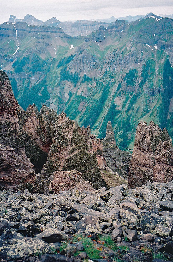
The view into the East Fork of the Cimarron is astounding from here. As one can see on the map, the entire western flank of Sheep Mtn. is an intricate convolution of eroded rock worn into fantastic cliffs, spires, gullies and indescribable forms. It's really indescribable. From this summit, either return as you came or continue on to UN 13,100.
Additional Note: It is also possible to begin this hike from the primitive camp area a half mile north of the switchback/trailhead, where the Alpine trail can be accessed. There is a bridge across the creek here to take hikers to the west bank. Hike south on a good trail until you come to an intersection. Take the lower trail (left) and continue hiking south up along the creek. At times, this trail may fade in grassy, open sections, but press on. After 2 miles, it will intersect the main trail where it crosses over from the east side of the Little Cimarron. From there, on, the route is as described above.
Click thumbnail to view full-size photo + captionRoute Description
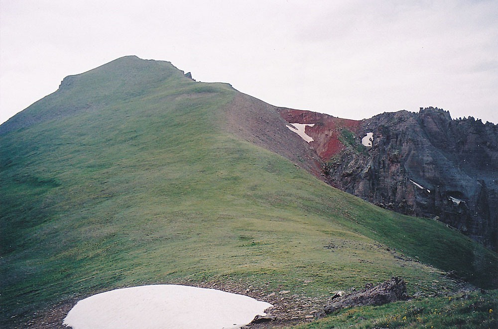
Year Climbed: 2007UN 13,102 is sequenced with Sheep Mountain. One-way mileage and elevation gain are measured from the summit of Sheep Mountain. Round-trip mileage and elevation gain assume completion of the sequence.
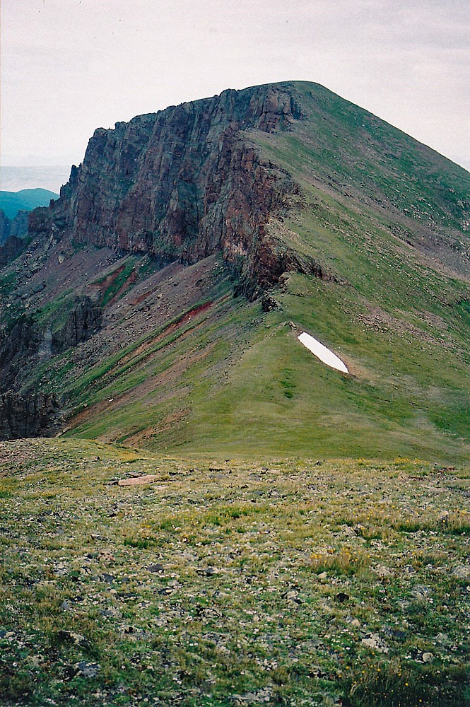
Walk south from the summit of Sheep Mountain on the grassy slopes and easily descend to the saddle at 12,576 ft. Along the way, you may want to stop to view the western cliffs, stare down the steep gullies and take a few more pictures of the incredible forms. From the saddle, it is an easy stroll up to the the summit of UN 13,102 on more tundra. Overall, it took us about an hour to cross over, taking time for photos. As we sat on this summit and surveyed the slopes below us, we were finally rewarded with the view we most hoped for. In the tundra basin to our southeast and just below a little knoll marked as 12,615, we saw a large group of elk scattered around the basin, feeding on the abundant grasses. They had not spotted us yet, so we could enjoy watching them as we finished eating our lunch. When it was time to head on down, we descended east toward the 12,615 knoll, but tried to stay out of site of the elk. They knew of our presence by now though and began moving down the basin and around the same knoll on the opposite side of us. As we descended northeast into another basin, we spotted the main group again, heading down and into some trees. This would be the last we would see of them.
To finish our descent, we continued down and then began a descending contour across the slopes east of the 12,576 saddle. We crossed a ridge directly east of the Sheep Mtn. summit at about the tree line and descended into the original avalanche chute we had ascended in. The descent went rapidly. From here, it's just a long plod on already tired feet, back to the trailhead. The wade back across the creek was actually welcome for some tired feet. From the creek crossing it's another mile and a half to the finish that should go quickly.
Additional BETA
Links to other information, routes & trip reports for this peak that may be helpful. -