LoJ: #462 (Pre-LiDAR #442) / 13,227' Peak Z / 'Gorgeous Peak' (Formerly UN 13245)
Range ›
Gore Range
Quadrangle ›
Willow Lakes
Summit Location ›
 N 39° 42' 50.54", W 106° 14' 59.57"
(Not Field Checked)
N 39° 42' 50.54", W 106° 14' 59.57"
(Not Field Checked)
Neighboring Peaks ›
"Mount Solitude" [Formerly UN 13090 B]
Peak X [UN 13085 B]
"East Partner Peak" [Previously UN 13,057]
"West Partner Peak" [Formerly UN 13041 A]
Peak Summary
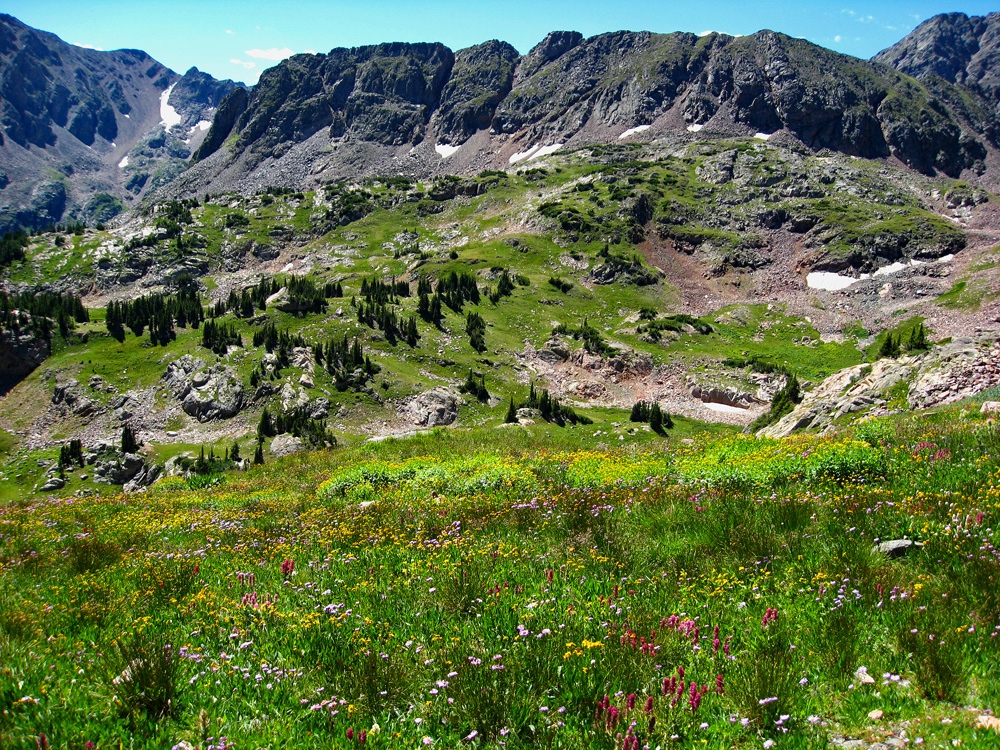
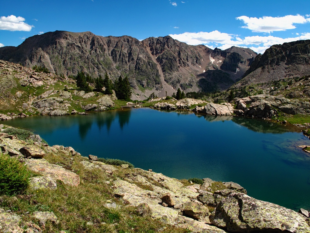
Peak Z (aka: "Gorgeous Peak") and previously known as UN13245) is located in a remote area of the Gore Range. Reaching this summit from the east side of the range will entail long mileages and a likely backpack trip. From the west side of the range, our route takes you up Pitkin Creek, over "Usable Pass" to the summit of Peak X and then on to Peak Z, crossing superb alpine country. Both peaks can be accomplished in a long day from the Pitkin Lake Trailhead, however, a shorter backpack up the same trail to either a lower campsite where the two main branches of Pitkin Creek divide, or all the way up to Pitkin Lake can position you to climb as many as six 13ers in just a few days and enjoy some outstanding Gore Range scenery and wilderness. Lidar subtracted 18 feet of elevation off this summit.
Peak Z South Ridge Route
Class 2+

Backpack + Medium Day
Climbed with
Peak X
RT From Pitkin Lake TH - Gore Range:
15.2 mi / 6,285'
RT From
Pitkin Creek Lower Campsite
with
"UN 13085 B":
7.7 mi / 4,275'
From "UN 13085 B":
1.40 mi / 1,250' (One-Way)
-
-
Pitkin Lake TH - Gore Range
Whether coming from the west or east on I-70, take Exit #180 off of I-70, about 4 miles east of the main Vail town exit. Proceed to the north side of the interstate and turn east (right) onto Fall Line Drive. Drive just a short distance past some condo units on your left, cross Pitkin Creek and find a very small trailhead parking area immediately after crossing the creek. Just a few yards further is a cul-de-sac and another condo unit. Do not park there. The trailhead parking offers a total of 10 slots. Obviously, these will fill on weekends. If you can't find a parking spot, try going back to the Exit 180 interchange and drive south on Big Horn Road then SE and there's a parking lot just past the interchange you may be able to use. From there, you'll have to walk back to the trailhead.
Camping
The nearest campground is the Gore Creek Campground, a National Forest Service fee area with vault toilets and water. To get there from the Exit #180, you'll need to drive SE on Big Horn Road past the trailhead parking for the Deluge Lake and Gore Creek TH. Reservations may be made for campsites at reserveamerica.com. Other than that, there is virtually no other place close by with at-large/primitive camping. Your best bet may be to go up to the summit of Vail Pass and drive down the Black Lakes Road where there is a pullout parking area right where the road is barred from vehicular traffic and becomes the Vail Pass bike trail, east end. This is not a primitive camp location but you may be able to sleep in your vehicle.
Campsite Locations
Gore Creek Campground › N 39° 37' 37.14", W 106° 16' 26.33"Fee required. 8750 elevation. Lots of interstate traffic noise.
-
From Pitkin Lake - Gore Range TH via Pitkin Creek Lower Campsite & "UN 13085 B":
-
Peak X SSW Ridge Class 2+ / 2.6 mi / 2,625’ One-Way
Click thumbnail to view full-size photo + caption
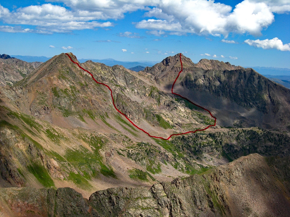
Open This Route in a New WindowOur route for Peak X begins from the "lower campsite" along Pitkin Creek that's 3.75 miles upstream from the trailhead. If starting from Pitkin Lake, adjust accordingly. We have sequenced Peak X with Peak Z for a fairly full day of hiking. Mt. Solitude could also be added in to the sequence but we decided to keep it separate because we completed that summit on a separate day. If pressed for time (such as a regular weekend), you could pack in Saturday and climb Solitude after establishing a camp, then climb Peaks X & Z Sunday and pack back out.
From the lower campsite head back up the main/east fork of Pitkin Creek, utilizing the faint trail that follows on the east side of the creek. (You will need to cross the creek at the easiest place you can find near the campsite.) One section of the trail will take you up on a flat shelf where there's a little flat area with nice grass, trees and surrounding protection from some rock outcrops. This could also serve as a nice campsite. After here, the trail works down to the creek again where you will pass some small ponds and will wade through lush flowers and grass that can be damp from previous days rain.
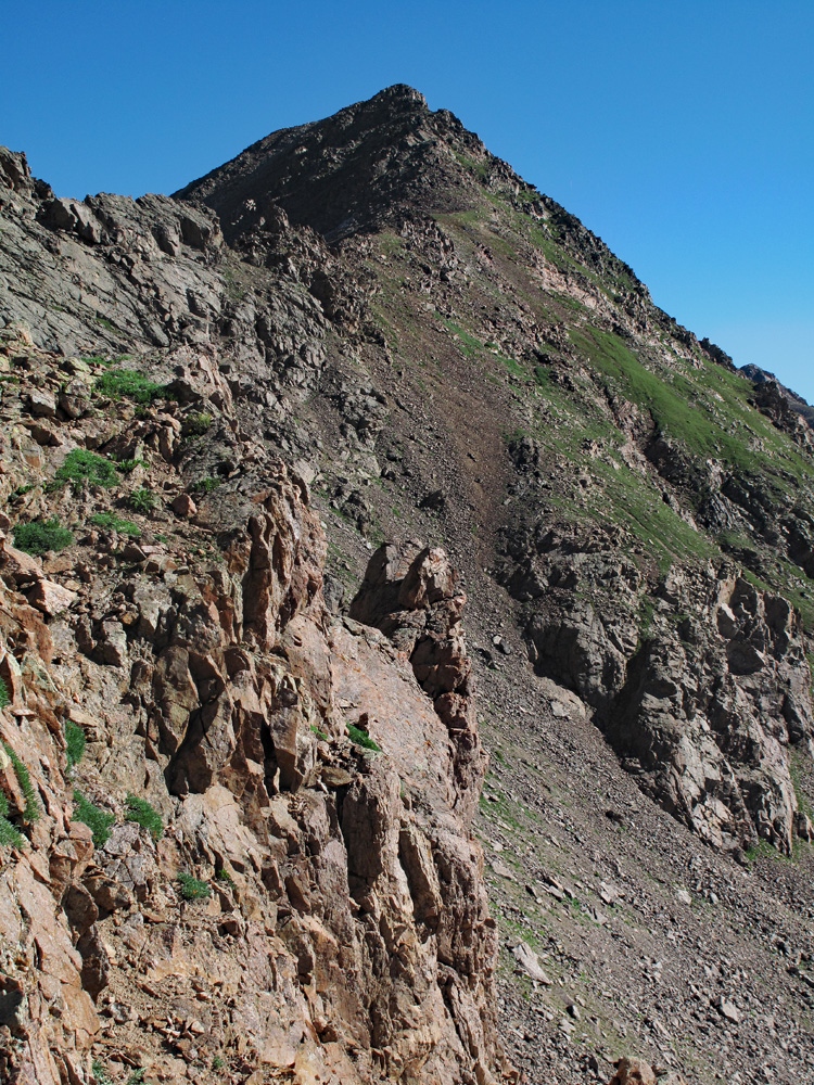
In about an hour you can make it up to the head of the valley where you will need to start climbing up to “Useable Pass.” See our map for the location of this pass. It may require another 45 minutes to hike up to the pass. The hike up to the pass is fairly easy over mostly tundra and smaller broken rock & rubble. Useable Pass is just a means of crossing the ridge south of Pt.12,710 and accessing the slopes of Peak X or dropping into the headwaters of the north fork of Boulder Creek. The east side of this pass is extremely steep for the first 100 feet down or so. Carefully work your way down, descending on mostly unstable gravel and dirt. Lower down, you will see an opportunity to head over to the base of a cliff wall to the left. At the base of the wall, there is just enough flat space to walk along on more stable ground. In fact, there appeared to be a faint trail here. Lose perhaps another 100 feet in elevation before deciding to contour over toward the saddle between Peak X and 12,710. Hike on mostly rubble, small boulders and small shelves of tundra. In short order, gain the SSW ridge of Peak X. From here on, it is just another ridge hike. Most of it is class 2 or 2+ with a few scrambles around boulders, small cliffs or other obstacles, but in all, you should be able to follow the ridgeline. We found the ridge to be stable, a welcome relief from previous days on the Partners and Peak Q.
Time from the lower campsite to the summit is under three hours. We felt some relief that this peak was a little easier than anticipated. The descent from Useable Pass was probably the most difficult part. Either return as you came or continue on to Peak Z.
-
Click thumbnail to view full-size photo + captionRoute Description
Year Climbed: 2010Peak Z is sequenced with Peak X. One way mileage and elevation gain from Peak X will add an additional 1.4 miles and 1,250 feet of gain. On the return trip, you'll also have to gain between 400 and 500 feet elevation to get back over "Usable Pass." RT mileage and elevation gain from the lower campsite will be 7.7 miles and 4,475 feet of elevation gain. In this terrain, that's a serious enough day as it is.
The connecting ridge over to Peak Z looks pretty rugged, by way of Peak Y, so we ruled that option out, partly in the interest of time and partly because we didn’t want to find ourselves cliffed-out. Head back along the SSW ridge of Peak X to where you can start down the East ridge The ridge from the summit appears to be fairly difficult, but a better view of the east ridge prompted us to stop and reconsider. After some more study, we decided to attempt this east ridge, even though we had no information regarding it. For several hundred feet you can descend with relative ease, even though it is fairly steep. There was a drop further down where we could not see for sure what would happen, but thought we could manage it. So down we went.
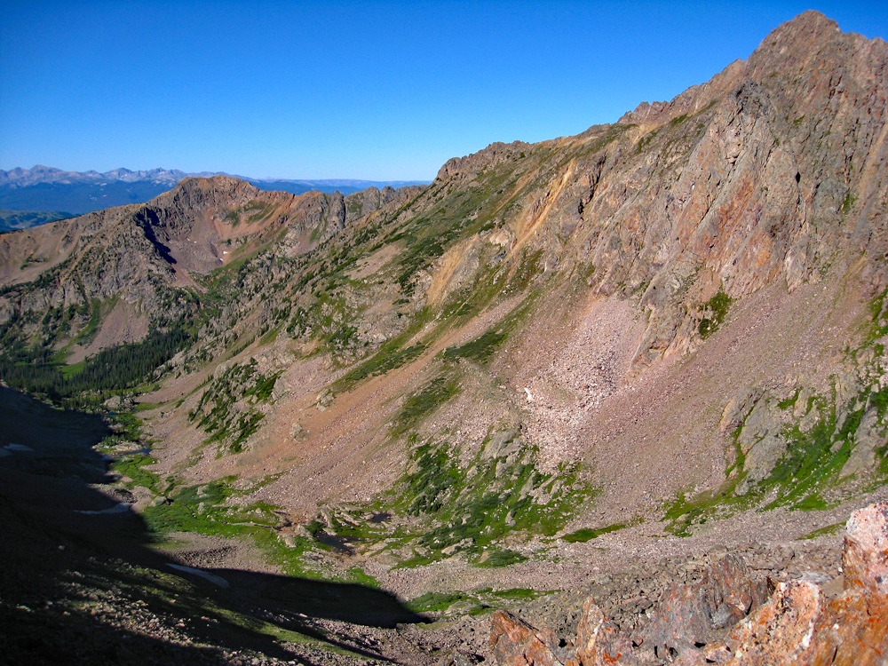
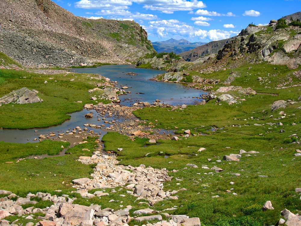
As we descended this unknown ridge, the more we went down, the steeper it became. When we came to the section that appeared from above to drop off some, we left the ridge and began descending off to the right on steep tundra slopes with some rock. At times, it was so steep that we found ourselves gingerly crab-walking down short sections. Below us we could see that the ridge intersected a large couloir/trough that led directly south down to the more level, valley terrain. We headed over to the head of this couloir and then began descending it. There was some nice scree that allowed us to plunge-step our way down rapidly for a while, but it gave way to more rocks until things began to level out at about 12,000 feet. We were relieved to have successfully negotiated this descent without any overly difficult problems. Once out of the couloir, we turned eastward, walking over more gentle, tundra terrain now, interspersed with rock outcrops and flowers. We hiked past a beautifully colored shelf lake just above 11,880 feet with a few small trees around it. Once past the lake, we began ascending toward Peak Z.
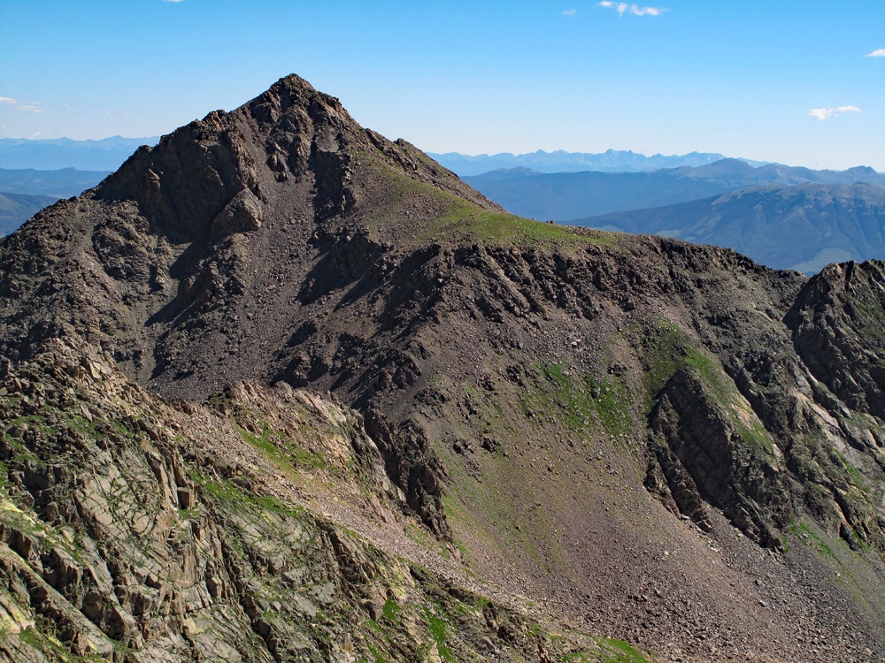
Most of the lower ascent section is over tundra, with some boulder fields thrown in. Instead of going for the saddle/low point between Peaks X and Z, we decided to head right of the connecting ridge toward a steep slope that appeared to have some tundra, at least lower down, and that climbed up through a steep, rocky outcrop that guarded the flat south ridge of the peak. This flat area is very distinguishable on Peak Z from afar. The ascent through here is steeper than you might anticipate and we found ourselves using a cliff wall section for handholds as we ascended. Further up, we had to work our way through boulders and steep scree and then finally broke through to the flat southeast ridge. At this point, you are little more than 200 feet below the summit to the north. The remainder of the hike is easier, but still involves a little scrambling around boulders, etc. Looking back at the ridge between Peaks X and Z, we were glad we had not attempted a traverse. It was a very rocky ridge and had at least one section that dropped vertically. It most likely would have become a minimum of 4th class scrambling or even some 5th class work. Perhaps there's a report on it somewhere.
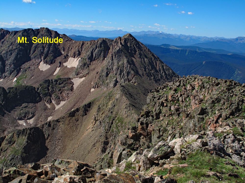
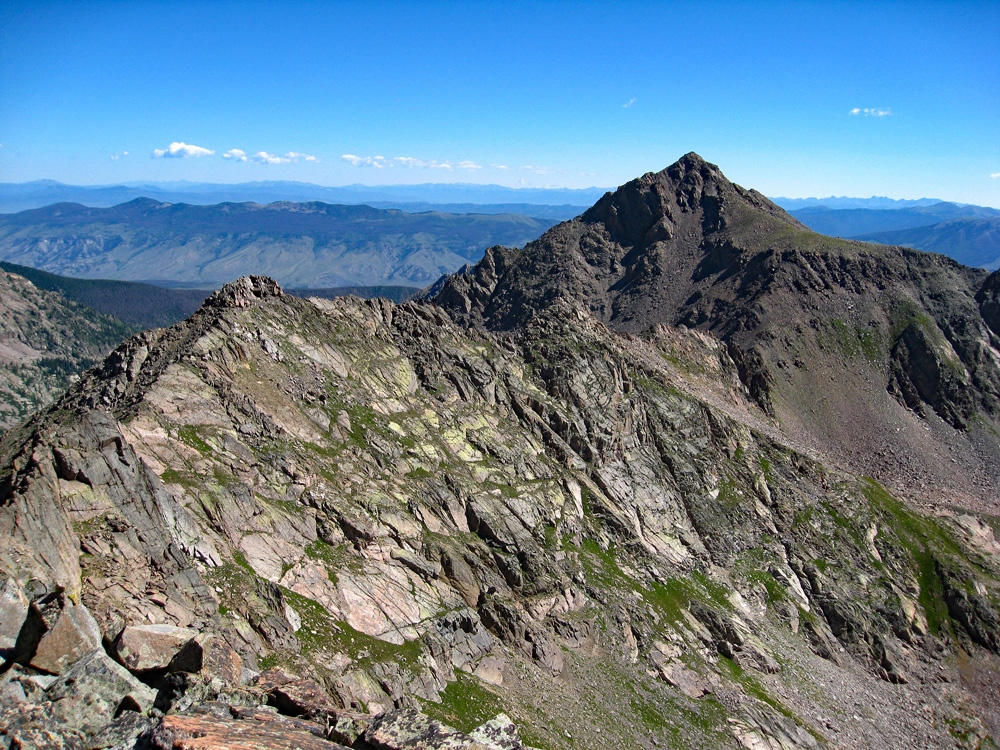
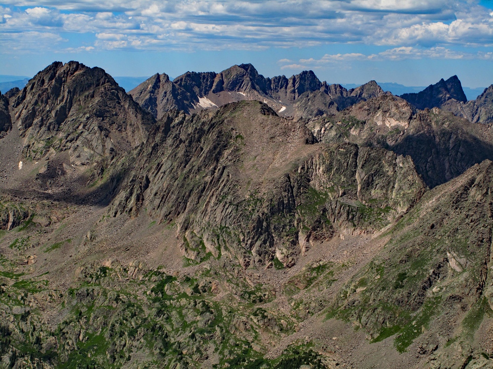
It took us about five hours to arrive at the Peak Z summit from the lower Pitkin Creek campsite and Peak X. Across the Boulder Creek drainage to the south, you are able to view Keller Mountain. To the north, there's a great view of Peak L, one the most difficult summits above 13,000 feet in this range. To return, descend back to the flat ridge area and if looking for some variety, take the southwest ridge back to the saddle and then turn south toward the bench area above 11,800 ft. You can follow that bench back to Useable Pass. We should have taken that SW ridge to begin with. Hiking down it was easy compared to how we went up and it was no problem hiking down to the bench level. A short distance beyond the shelf lake at 11,880 ft., the real fun begins. Following the bench southwest past the lake, we came to what we had avoided earlier in the day – a field of boulders that stretched a good 2/3 mile, all the way back to the base of Useable Pass. By descending the east ridge of Peak X, we had avoided almost all of this (and that was another motive for taking that descent), but now it's time to pay the piper.
Make your way west slowly and tediously, across the boulders of all shapes and sizes. Now a quick jaunt across a boulder field can be somewhat entertaining, but 2/3 mile is just plain pain in the rear, especially towards the end of the day. It seemed to take forever to get across and to the base of Useable Pass, (12,380 ft.) but we finally arrived there and then made the 300 foot ascent back up. The last 100 feet are difficult as anticipated, but we made it without injury and then began the hike back down the Pitkin drainage to our campsite. Return either to your campsite or the trailhead. If you manage to do this entire hike in a day, you are to be congratulated.
Additional BETA
Links to other information, routes & trip reports for this peak that may be helpful. -

"The world is not in your books and maps, it's out there." J. R. R. Tolkien
Warning!
Climbing peaks can be dangerous! By using this site and the information contained herein, you're agreeing to use common sense, good judgement, and to not hold us liable nor sue us for any reason. Legal Notice & Terms of Use.