#196 / 13,587' UN 13587 Formerly UN 13,581
Peak Summary
A fairly easy Class 2 summit with the best access up Wager Gulch to Carson Pass (out of Lake City) which will require 4WD with good clearance. Most difficult part of climbing this peak may be avoiding willows. Excellent views of a central area of the San Juans with lots of gentle, tundra terrain.
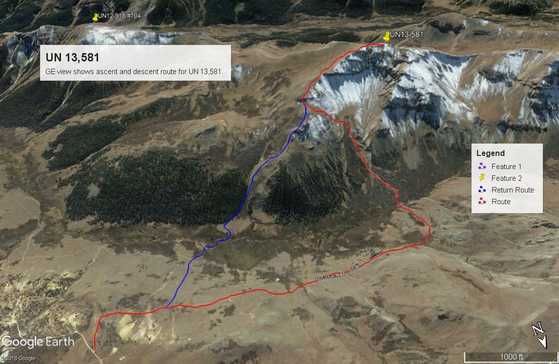
UN13,587 NE Ridge Route
-
-
Carson Pass TH
Most of the 13er summits on the Pole Creek Mountain quad and the Finger Mesa quad can be most easily accessed from one of two trailheads, both off of County Road 3, south of Lake City and Lake San Cristobal. The first TH is Carson Pass at the head of Wager Gulch. This access requires 4WD with good clearance. The drive in is followed by walking the Colorado/Continental Divide Trail west. There is minor elevation gain and loss and no more than 4 miles of hiking/backpacking. The other trailhead is accessible to passenger cars, but requires more elevation gain (2,500 ft.) on foot. That access utilizes the Cataract Gulch Trail from near "Sherman." It's about a 4.5 mile hike/backpack up to Cataract Lake for a base camp. We used the Wager Gulch/Carson Pass access, hence our trip reports will be based on that as the start point. Peaks accessed in this manner include: Coney BM; UN13,260 D; Bent Peak; Carson Peak; "Tundra Top;" Cataract Peak; Half Peak; UN13,674(Quarter Peak); UN13,581; UN13,580 A; UN13,660; and Pole Creek Mtn. For information regarding the Cataract Gulch TH, you can find that by searching for that trailhead. We have never actually hiked that trail except in the vicinity of Cataract Lake. Our route descriptions for many of these peaks should be usable regardless of which TH you choose with the exception perhaps of Bent, Coney BM and UN 13,260 D.
Wager Gulch/Carson Pass
From the Town of Lake City, drive south on SH149 and then turn right onto CR3 (BLM 3306) to Lake San Cristobal. Trails Illustrated labels this road as CR30. The road is paved past the lake then turns to graded dirt, passable for all passenger cars. About 2 miles past the Williams Creek campground, watch for a road turning off to the left (south) for the old townsite of Carson. This road is identified on maps as either BLM3308 or FS568. it's also called the "Wager Gulch" road. From this point on, 4WD is advisable.
Head up the road through aspen and conifer forest. At times, the road climbs steeply, but generally is not too rocky or in very poor condition. Along the drive up, there are a few primitive campsites. See coordinates below for what we consider to be the best primitive camp area. The road is fairly easy driving to the old townsite of Carson. Beyond there, it works its way up to Carson Pass through areas of willows and becomes quite rocky in stretches. We drove this summer of 2018 and found that a lot of the willows had been cleared away and though rocky in stretches, the road was easily passable in our Toyota Tundra. If you're not comfortable with driving this last part, park down near Carson and walk this last mile. From the summit of the pass and the coordinates provided above, you can begin your hike or backpack. In previous years, it was possible to continue driving south on a 4WD track for another half mile to where you would actually connect with the Colorado trail. Those coordinates are: N 37° 50' 52.67 W 107° 22' 06.06". Elevation here is 12,150 ft. so you've dropped down from the pass a little.
Camping
There are designated, Forest Service campgrounds at Lake San Cristobal, Williams Creek and Mill Creek (which is past the Wager Gulch turnoff). On the drive up Wager Gulch, we observed a few nice, primitive sites at some level locations. The best location was just a little before reaching the road that turns off for Carson. There is some open meadow on either side of the road and a good cam area on the west side. Be advised though that the beetle kill all through here is heavy and there are numerous dead trees around this camping location. See coordinates below.
Campsite Locations
Carson Primitive Site › N 37° 52' 46.78", W 107° 21' 49.41"Elevation 11,240 ft.
Click thumbnail to view full-size photo + captionRoute Description
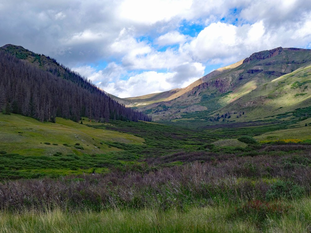
Year Climbed: 1992The most significant difficulty of climbing this peak is finding a way to avoid willows as you cross Lost Trail Creek. So the following route was based primarily on that goal. Since it's been 23 years or longer since we were there, the willows may have grown in significantly more so we offer no guarantees. So - from Carson Pass, or if you're able to drive south from the pass another half mile, connect with the Colorado Trail and head west for about one mile, dropping a couple hundred feet in elevation toward the creek. Turn off the trail at its low point where a small group of trees come close to the trail. This is about where the word "Driveway" appears on the USGS map. Head south and cross the creek.
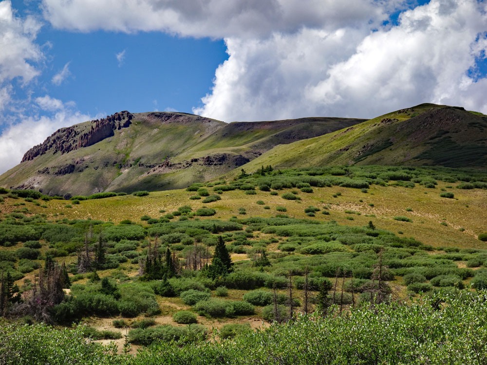
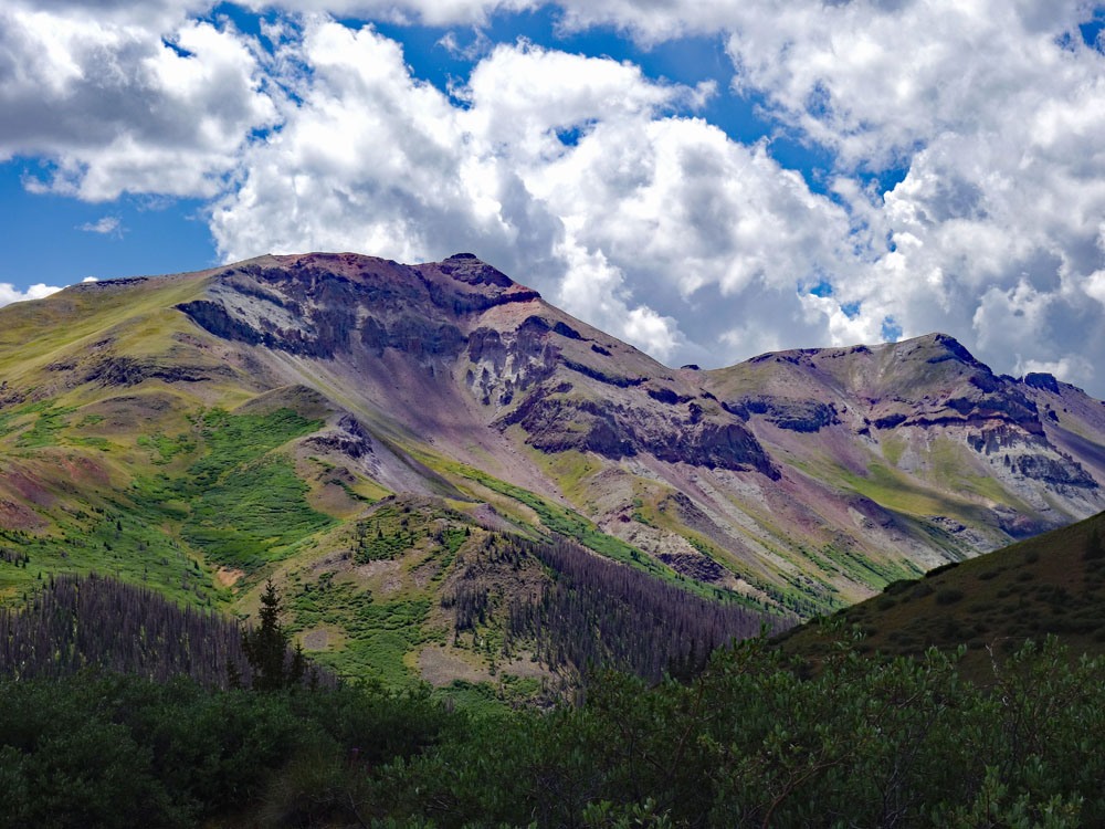
Find a good route through a few willows to the bank of a drainage coming down off the NNE slope of UN13,587. The edge of this bank was free of willows and allowed access to higher terrain without willow-bashing. Gain at least 400 feet along the edge of the drainage and then begin to veer left and gain the main NE ridge of the peak at about 12,700 feet where there's a small promontory on the ridge, on the USGS map. To this point, most of your hiking will be on tundra and grass with little rock. Once on the ridge, bear south, then SW, then west and finally NW for the summit. You will pass a very large rock cairn along the way probably built by shepherds. The trek to the summit will remain on mostly tundra until the summit block proper.
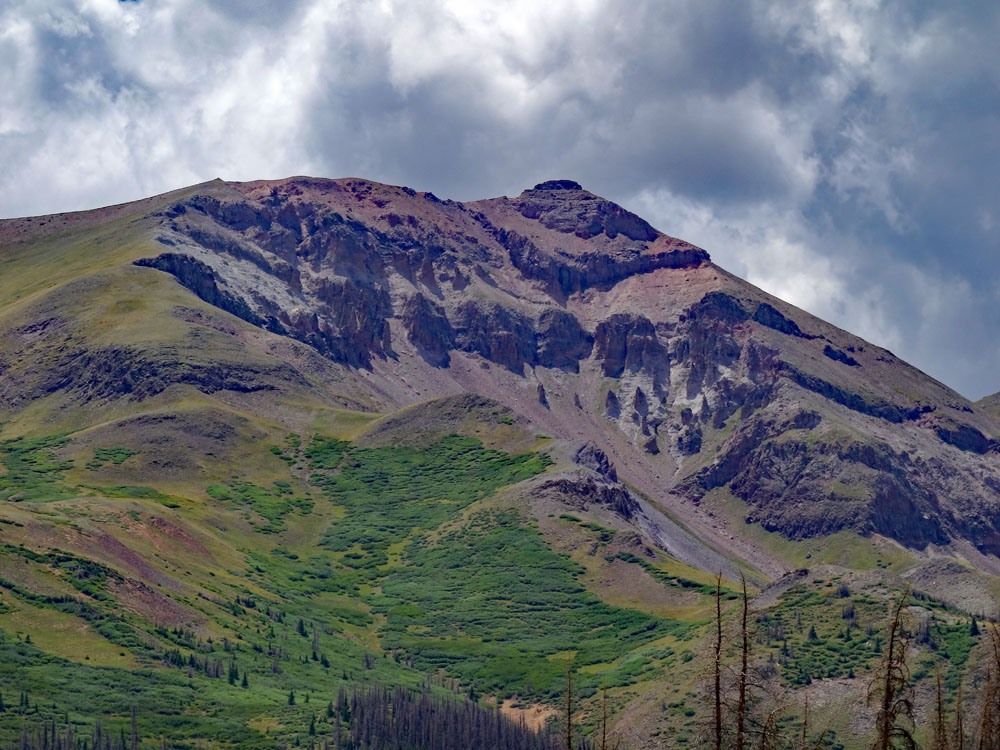
The summit is a rock dome that at first seems to present a difficult obstacle and might even require a rope to break through. A little searching should yield a break in the cliff band where you can scamper through to the summit with a short, near vertical little wall to deal with. At the hardest, this might be rated Class 3. From the summit, you can see the Grenadier Range in the distance. Arrow & Vestal stand out in sharp relief. We also observed a pair of golden eagles here.
To descend, either return as you came or you can short-cut the return by heading back down the NE ridge to where you originally intersected it, then continue on down the ridge staying left of a developing drainage until the valley bottom where you'll have to find a way through some man-eating willows, briefly. We had no great difficulty in finding a reasonable path through the willows, crossed the creek and then ascended NE to intersect the Colorado Trail and walk back to our vehicle. Even with our children, we were able to do this entire trip in only about 5 hours.
Additional BETA
Links to other information, routes & trip reports for this peak that may be helpful. -