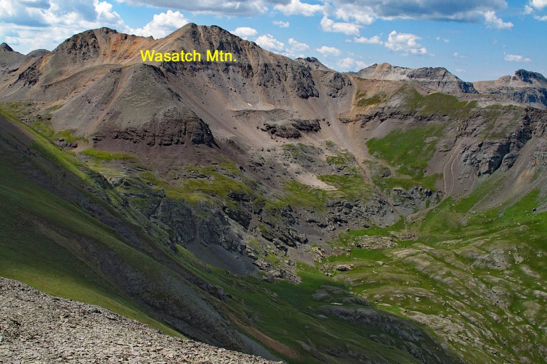
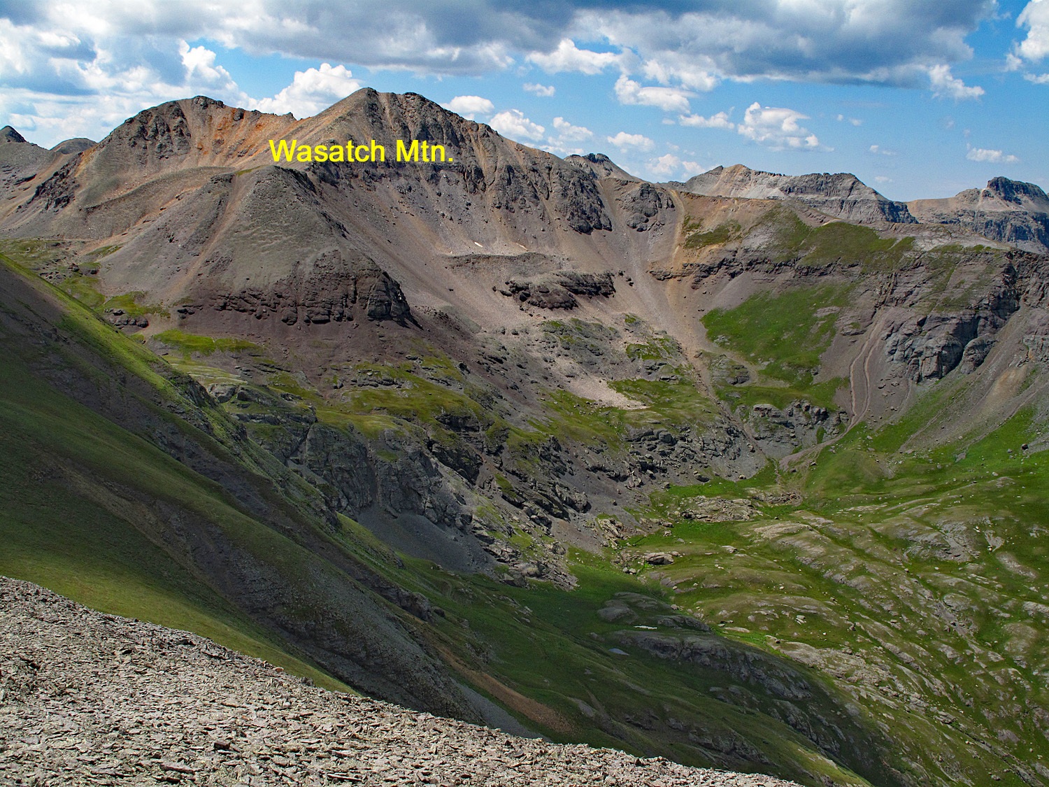
LoJ: #213 (Pre-LiDAR #214) / 13,560' Wasatch Mountain
Peak Summary
A pleasant hike up Bridal Veil Basin above Telluride on some old mining roads followed by a steeper hike on tundra, scree and rock to the Wasatch summit. Combines well with La Junta and Jackass Pt. to the north for a sequence of three summits. Trailhead accessible by higher clearance vehicles. Highly scenic area. Lots of old mining history. Pre-Lidar elevation was 13,555.
Wasatch Mtn NNW Ridge Route
-
-
Bridal Veil Basin TH
From the Town of Telluride, on the main street (Colorado Ave.) drive east out of town and continue on the same road which becomes the Black Bear Pass road, labeled as CR648. This road will climb above some mine ponds on 5-6 switchbacks and then straighten back out to continue SE and closer to Bridal Veil Falls. The road will cross Ingram Creek and shortly after begin the series of switchbacks that take you up the mountainside to Black Bear Pass. There is some room to park at the 4th switchback for the Via Feratta route, but for the trailhead to Bridal Veil Basin, continue for two more switchbacks and finish heading south to the trailhead parking, a little above Bridal Veil Falls and the historic power plant. Be careful not to venture any farther up the Black Bear Pass Road. Beyond the Bridal Veil TH, the road is one-way to the west.
Camping
There is no camping available in this immediate area unless you pack in for a ways. At-large camping anywhere near Telluride is difficult to come by and generally not allowed. The nearest campground is located along HWY145 about 5 miles south from "Society Junction." That's the "Sunshine" Campground. You may be able to find some at-large spots on 63J south of Illium or back along HWY145 before climbing the big hill into the Telluride Valley. There are several at-large spots along the highway, but be careful of private property. There is also a campground located on the east end of the town at the town park. Campsites are available on a first-come-first-served basis. These links offer more information:
http://www.telluride-co.gov/DocumentCenter/View/623
http://www.telluride-co.gov/181/Campground
Route Description
Year Climbed: 1996From the TH above Bridal Veil Falls, follow this popular day hiking route south into Bridal Veil Basin. The old mining road provides easy access to the upper basin area. It remains on the east side of Bridal Veil Creek and a couple of times, switchbacks up the mountainside to gain elevation. At about 1.5 miles in, the road forks, the left of which heads up to Blue Lake. Continue hiking on the less used right fork instead and continue along Bridal Veil Creek for appx. another 1.5 miles. About 1/2 mile from the previous junction, the road/jeep track will cross the creek and begin climbing on the hillside to reach a bench area below Wasatch, passing by a pair of small tarns at about 12,190 ft. Soon after, the road begins to play out.
From the two small tarns, walk uphill west, staying on the south side of the creek and head in the general direction of the Wasatch/La Junta saddle. This route will take you up a series of tundra benches with intervening rocky outcrops. You should intersect an old road/trail that goes on to cross the saddle and shortly after that, a small tarn at 12,815 ft. that shows specifically on the USGS map below the NNE ridge of Wasatch. A steeper tundra slope to the south of the tarn leads west to a saddle on the NNE ridge of Wasatch. Once at the saddle, it's an easy walk on mostly dinner-plate talus to the summit, another 400 feet up.
For your return trip, either descend by the same ascent route, or hike back down to the Wasatch/La Junta saddle and include La Junta in your days agenda as well as Jackass Point for a 3-peak day.
Additional BETA
Links to other information, routes & trip reports for this peak that may be helpful. -