LoJ: #423 (Pre-LiDAR #405) / 13,272' James Peak
Peak Summary
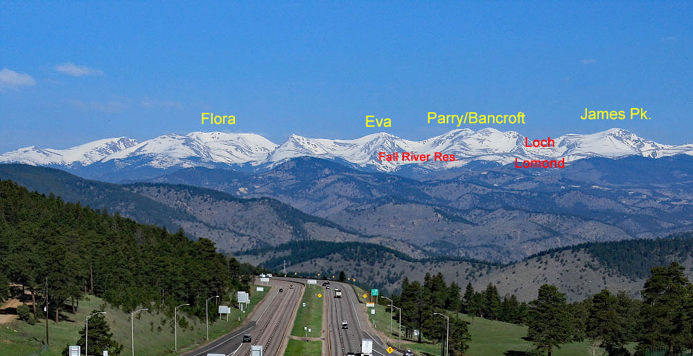
James Peak is a popular summer hike with several route possibilities. The three we suggest here are all Class 2, with our primary route offering some Class 2+ work on the descent. That descent takes you by the upper lakes in the Loch Lomond chain of lakes. Accessing this route requires high clearance 4WD. The other two suggestions can be accessed by passenger car. Most any route to James Peak on a summer weekend will find numerous other hikers. Lidar revisions have lowered the elevation of James Peak to 13,272 ft., a loss of 22 ft.
James Peak via St. Mary's Glacier Route
-
-
St. Mary's Lake/Glacier TH
From I-70, west of Idaho Springs, take exit 238 for the Fall River Road/CR 275. This paved county road 275 ends in the vicinity of a mountain village called "Alice," mostly a collection of summer cabins, etc. This is the same road that leads up to the well-known St. Mary's Lake and Glacier. The road follows the Fall River in a generally NW direction. After 6.6 miles, the road makes a second, abrupt switchback to leave the Fall River drainage and climb up to St. Mary's Lake and Alice. Continue north into Alice. Watch for a couple of parking lots on the left side of the road, one larger lot before the trail up to the glacier, and the other just after the trail/old roadbed heads up to St. Mary's Lake and Glacier. Coordinates above are for the larger parking lot. The smaller lot is directly west from Quivira Lake. If you come to the end of the pavement and Silver Lake, you've gone past the trailhead and parking lots. These two lots now require a $5.00 fee to use. There is a self-serve ticket station at each lot.
Camping
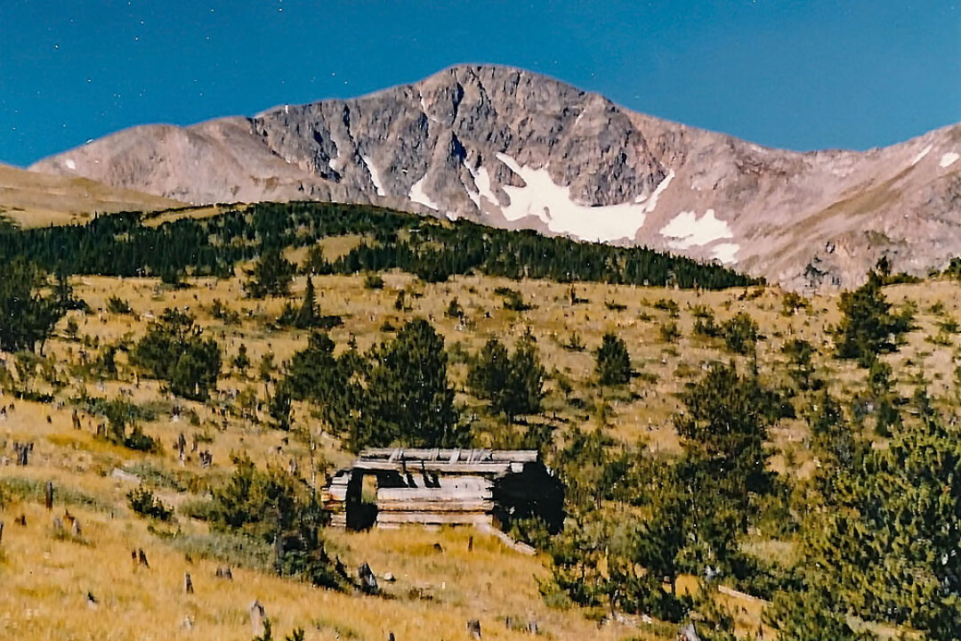
This entire area of Alice is private property. For at-large, primitive camping, you're better off driving back on one of the Forest Service roads such as FS 701.1 up to Fall River Reservoir. If you don't mind packing in some gear, you could head up to St. Mary's Lake and set up a tent if camping is allowed there any longer. Check with the Forest Service.
Route Description
From the trailhead parking for St. Mary's Lake and Glacier, head up the well-worn trail/old roadbed to the lake. From the lake, a trail leads through willows to what's left of the former "glacier." You can choose from a few options here. One would be to head up the gully that still holds a remnant of the glacier, kick-stepping your way up on the snow. Here's a chance to practice with your ice axe. Farther up the gully, the snow ends and there will be trails on the side of the gully, the most pronounced on the south side, which you can follow up onto the broad eastern flank of James Peak. Stay on trail and cross a 4WD track, walk a little more west and pick up the Continental Divide Trail that leads all the way to the summit of James Peak. After picking up that trail, you'll be joining in on the primary route we describe that begins at Loch Lomond.
Additional BETA
Links to other information, routes & trip reports for this peak that may be helpful. -