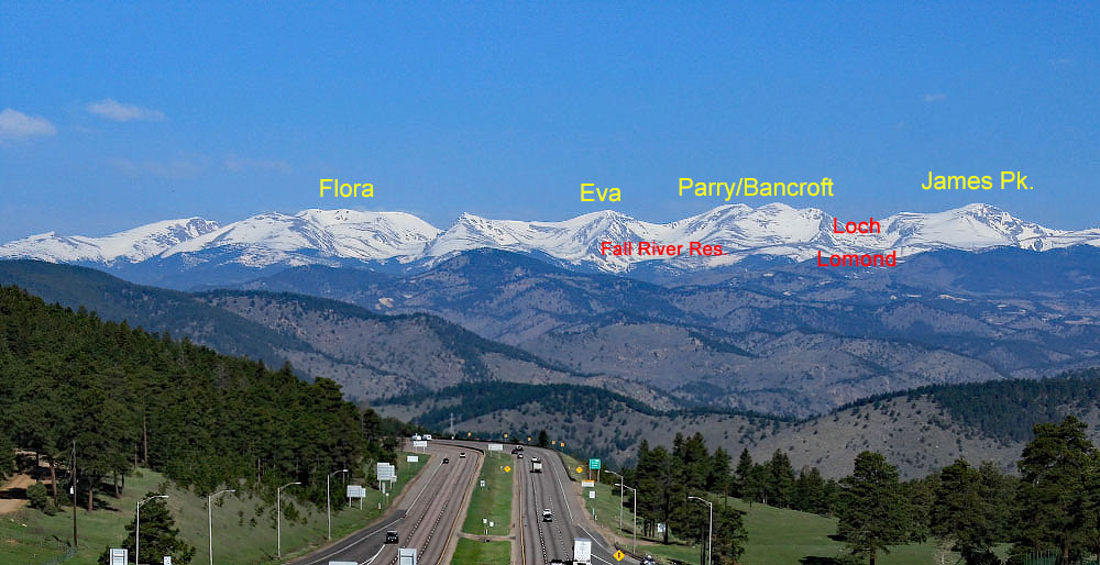
LoJ: #423 (Pre-LiDAR #405) / 13,272' James Peak
Peak Summary
James Peak is a popular summer hike with several route possibilities. The three we suggest here are all Class 2, with our primary route offering some Class 2+ work on the descent. That descent takes you by the upper lakes in the Loch Lomond chain of lakes. Accessing this route requires high clearance 4WD. The other two suggestions can be accessed by passenger car. Most any route to James Peak on a summer weekend will find numerous other hikers. Lidar revisions have lowered the elevation of James Peak to 13,272 ft., a loss of 22 ft.
James Pk. - CD Trail Fall River Route
-
-
Fall River Reservoir TH
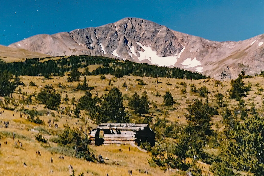
From I-70, west of Idaho Springs, take exit 238 for the Fall River Road/CR 275. This paved road ends in the vicinity of a mountain village called "Alice," mostly a collection of summer cabins, etc. This is the same road that leads up to the well-known St. Mary's Lake and Glacier. The road follows the Fall River in a generally NW direction. Measuring from the exit off I-70 and the intersection with CR275, after 6.6 miles, the road makes a second, abrupt switchback to leave the Fall River drainage and climb up to St. Mary's Lake and Alice. Turn left at this switchback onto "Rainbow Road," aka: FR 174.1. This is a graded, gravel road that becomes rougher the farther up valley you travel. The road starts out on the north side of Fall River, then at 8.2 miles, drops down to cross over to the south side of it. Just before making that crossing is a smaller pullout where you can park if you want to join a segment of the Continental Divide trail that heads up to James Peak from here. Coordinates are: N 39° 48' 40.45" W 105° 40' 01.32". This is the trailhead for our third route suggestion for James Peak. There is an open camping area here (elevation 10,140 ft.) and another across the creek. Before reaching this crossing, the road passes through almost all private property. We did not observe any campsites before this creek crossing. At 8.4 miles, the road crosses the official trailhead for the CD trail. There is minimal parking allocated here. Immediately after this point, the road becomes quite a bit rougher. While many SUV type vehicles can make it to this trailhead parking, we recommend that only higher clearance, 4WD proceed further.
If continuing on to the reservoir, as you near the Fall River Reservoir, there will be a road heading off to the left for Chinns Lake at 8.9 miles. That will be FR 174.1D. Stay right to finish the drive on up to Fall River Res. The road gets even rougher here and passes by more private property. At 9.4 miles, there are some campsites and there are a few more sites at the reservoir at 9.7 miles total from the start of CR275. A sturdy gate prevents driving up to the north end of the dam, but you can walk there easily. If heading to Parry Peak from here, walk past that gate, and about half way to the north end of the dam, watch for an old roadbed that veers off to the right, heading uphill. This can serve as the start for Parry.
Camping
A car camp is possible in the reservoir vicinity but these are 4WD only accessible. There are also primitive sites along the gravel road to the reservoir as noted in the trailhead description but there are homes/cabins and private property, so be sure you don't camp in someone's driveway. The best primitive camping opportunity appears to be when FR 174.1 crosses from the north to the south side of Fall River but there are cabins in the vicinity. See coordinates below. For Front Range hikers, overnight camping will likely not be a concern unless you're looking for an early morning start and want to come up the evening before.
Campsite Locations
Fall River Crossing › N 39° 48' 40.7", W 105° 40' 01.3"Elevation 10,160 ft. Be aware of Private Property
Route Description
Head NW on the Continental Divide trail which takes an ascending path that will lead to the Stewart Road (FS701.1) which is the 4WD access road to Loch Lomond. The road initially passes through forest as it makes this ascent. It follows the Stewart Road for a while, then crosses to continue on in a NW direction., now through more open forest, some willows and finally onto the tundra/grass of the broad eastern flank of James Peak. Once in the open, continue following the CD trail all the way to the summit of James Peak on mostly tundra terrain with some rocky areas of rubble to cross. This is all Class 2 hiking with no difficulties. Return as you came.
Additional BETA
Links to other information, routes & trip reports for this peak that may be helpful. -