LoJ: #480 (Pre-LiDAR #477) / 13,213' Teocalli Mountain

Peak Summary
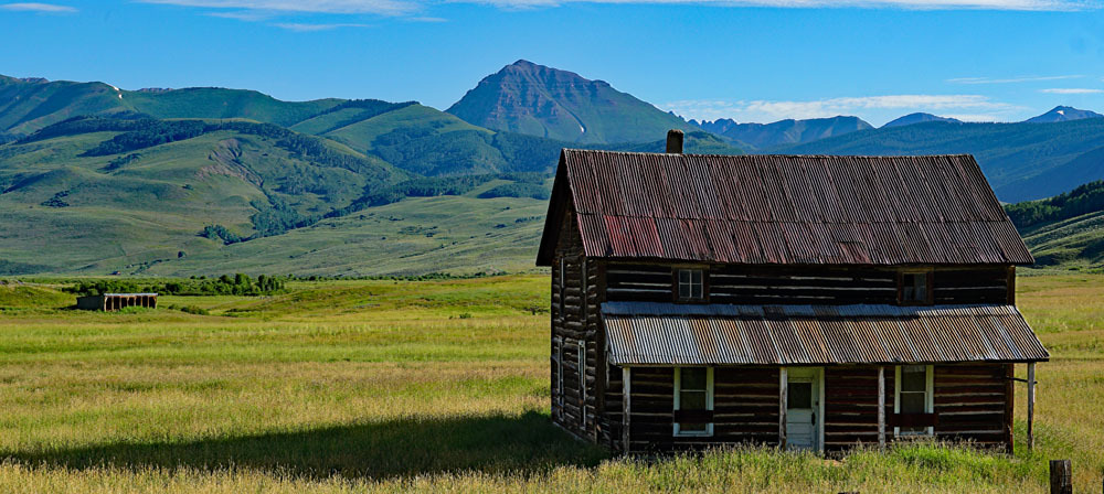
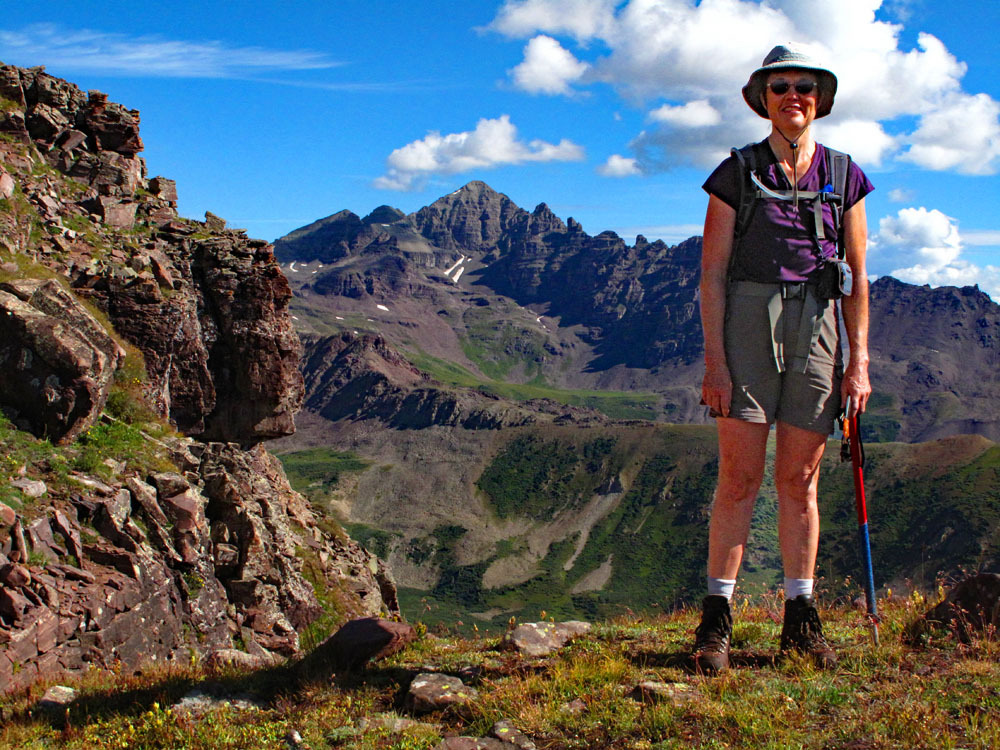
Teocalli Mountain is an easy Class 2 ascent in the eastern portion of the Elk Mountains. Access is most easily gained from near Crested Butte, but 4WD/good clearance is needed to keep this in the "day hike" range. The drive in on 4WD road is fairly long requiring close to an hour. The surrounding scenery is verdant and wildflowers proliferate around here. Lidar added 5 feet of elevation.
Teocalli South Face Route
-
-
Pearl Pass/Twin Lakes Access TH
From the Town of Gunnison: Turn north at the center of town on HWY 135. Pass through Almont and continue toward Crested Butte. About 2 miles before reaching the town, turn right onto CR738 which also becomes FR738. This is locally known as the "Pearl Pass Road." The road starts out paved, then changes to graded gravel. It initially passes through a subdivision. Before turning off the highway, you'll have outstanding views of Teocalli Mtn. Passenger cars can make it in the first 4 - 5 miles to a little past the junction where the East River comes in. Just about the time FR 738 begins to gain elevation, there is a primitive camp area on the right. Passenger cars should be parked here. Higher clearance vehicles and 4WD can continue north. Stay right at the next road intersection in about a mile, continuing on FR738. The road will drop down briefly to a low water crossing of West Brush Creek. Continue driving another 4.5 miles appx. to the Twin Lakes trailhead parking which turns off the main road to the left. If only driving in to climb Teocali, it is not necessary to drive all the way to the Twin Lakes TH. There is a primitive campsite on the west side of the creek at these coordinates: N 38° 56' 26.55 W 106° 51' 36.78". Elevation 10,100 ft. This is about 1.1 mile south of the Twin Lakes TH. An indistinct road turns off to the left and leads down to cross the creek with the campsite being on a bench just above the creek at the coordinates above. If unable to ford the creek, then it's possible to car-camp where this road turns off,
Camping
There are some good, primitive campsites right at the trailhead with some protective trees. You may find other weekend adventurers camped here. Also, see the coordinates provided above for a possible campsite before reaching the Twin Lakes TH that can serve as the TH for hiking Teocali.
Click thumbnail to view full-size photo + captionRoute Description
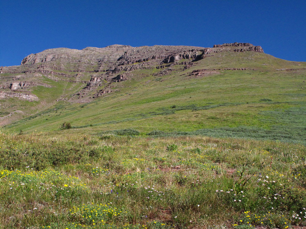
Year Climbed: 2011If you're not able to drive across the creek to the suggested campsite, then the first thing you'll need to do is to wade the creek. Once across, head directly west up open, grassy slopes with a few rock outcrops. We found the trail marked on the map that heads south up to Teocalli Ridge and the trail on the ridge crest. What we did not find was the section of trail that was supposed to head north and then switchback up to the broad south ridge of Teocalli on what the map showed as a “pack trail.” So we ended up blazing our own path up to Teocalli Ridge by hiking up very steep, open slopes of wet, tall clumps of grass. We came out on the ridge a little north of the 11,151 marker and intersected the main ridge trail. This is called the Teocalli Ridge Trail, #557 or #9557 on FS2016 map. Follow this clear trail north, and easily come to the intersection where the west branch of this trail descends/contours down and over to West Brush Creek. This will be on the edge of an area of lush, flowering growth with tall Delphinium.
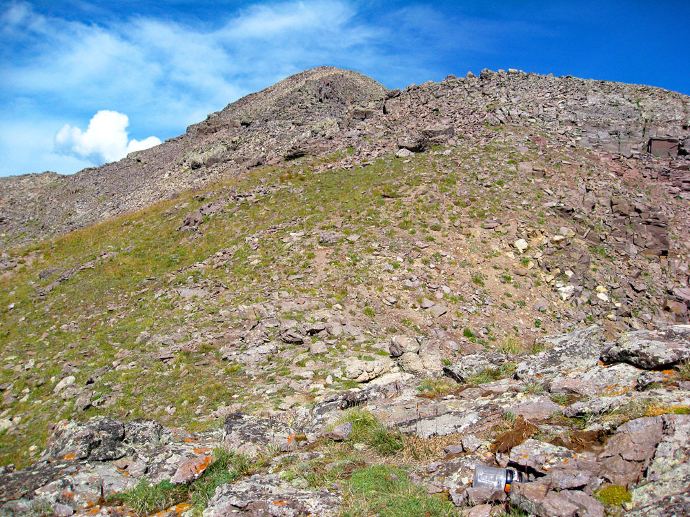
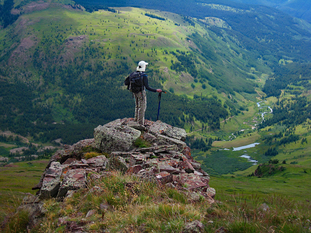
As the trail leaves the forest, it crosses into lush, tall vegetation, mostly delphinium and the like, which had already done most of its summer blooming when we hiked here in late August. The trail is difficult to follow through this vegetation at times, but we found it had been used just enough to have left some openings. Soon you will come to where the trail begins to head up the south side of Teocalli. It is quite visible here and this section does not show on maps. As it gains elevation, the vegetation begins to fade out and as the trail gets out of the taller vegetation and moves into the tundra zone, it begins to fade. It is fairly easy hiking though and you should be able to follow the semblance of a trail all the way to the base of some broken cliff bands of rock. We found an infrequently, cairn-marked passage up through the cliffs and above, and continued hiking on a mix of tundra and scree. Further hiking will bring you to the broad, SE ridge of the peak. Once on the ridge, the walking now turns to hiking over maroon broken rock and rubble to the summit, which is still almost a half mile away. But with no serious obstacles, and just typical rubble to deal with, you should arrive at the summit shortly.
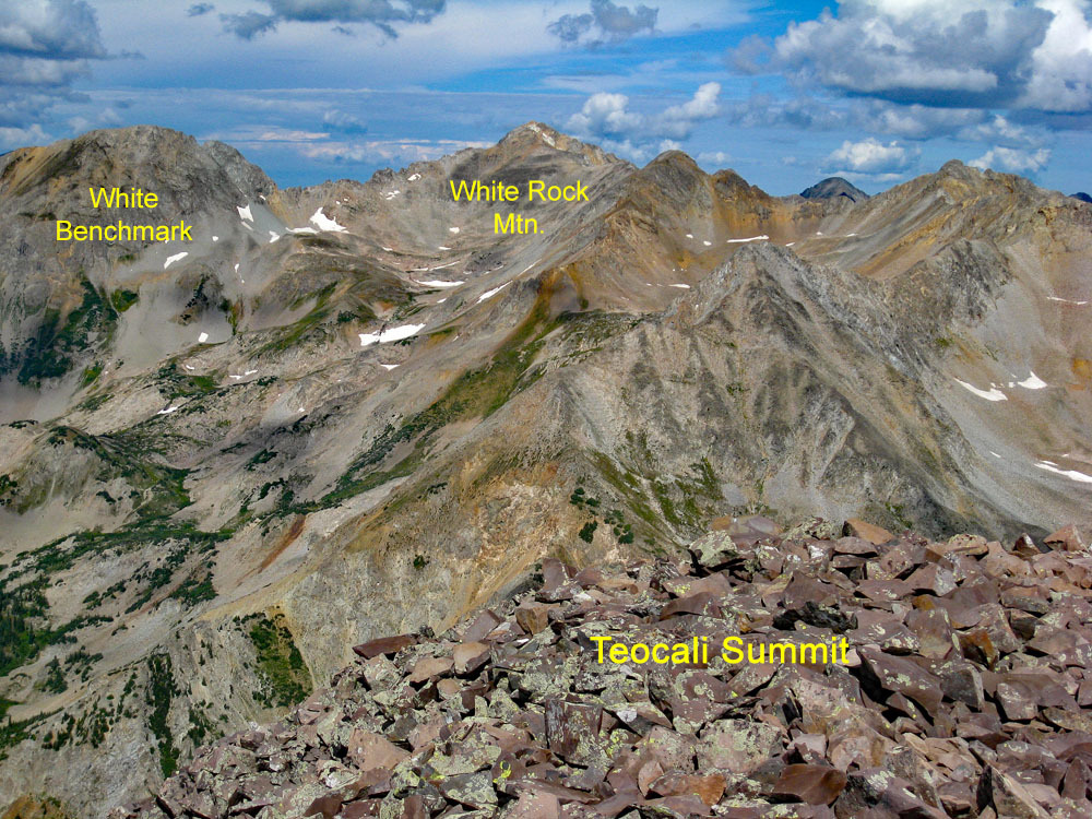
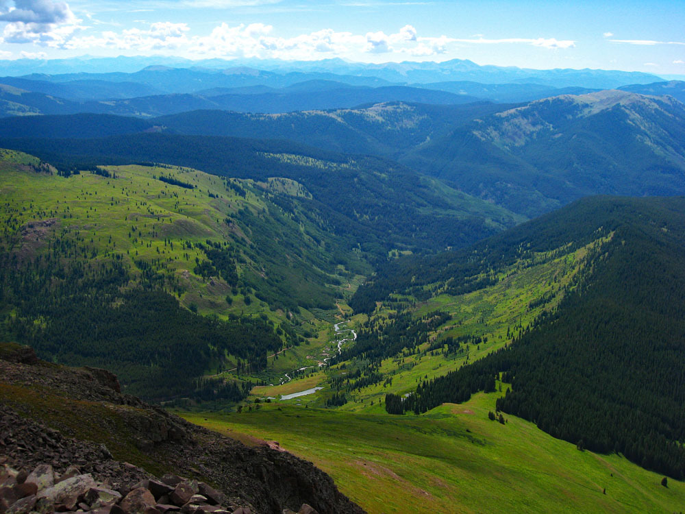
Absorb the magnificent view, especially of White Rock Mtn. and White Benchmark to the NW. To descend, we followed mostly the same route back down the south ridge of the peak and back to the saddle and the trail intersection. Mostly motivated by curiosity, but also by a desire to avoid the intensely steep grassy slopes we had ascended on, we decided to follow the Teocalli Ridge trail further south before dropping off the ridge to the east and descending back to our truck. So we hiked to a little beyond the 11,286 marker and then turned left into forest and followed what game paths we could find down onto the lower slopes. Staying close to a few trees on the east facing slope where footing seemed better, we eventually came across the trail that leads up from Middle Brush Creek to the ridge. From then on, we just followed this trail back down, passing a couple of day hikers as we approached the creek. Enjoy the wade back across the creek if necessary. By now, you're probably ready to cool your feet. This ascent took us 5 hours round-trip.
Additional BETA
Links to other information, routes & trip reports for this peak that may be helpful. -