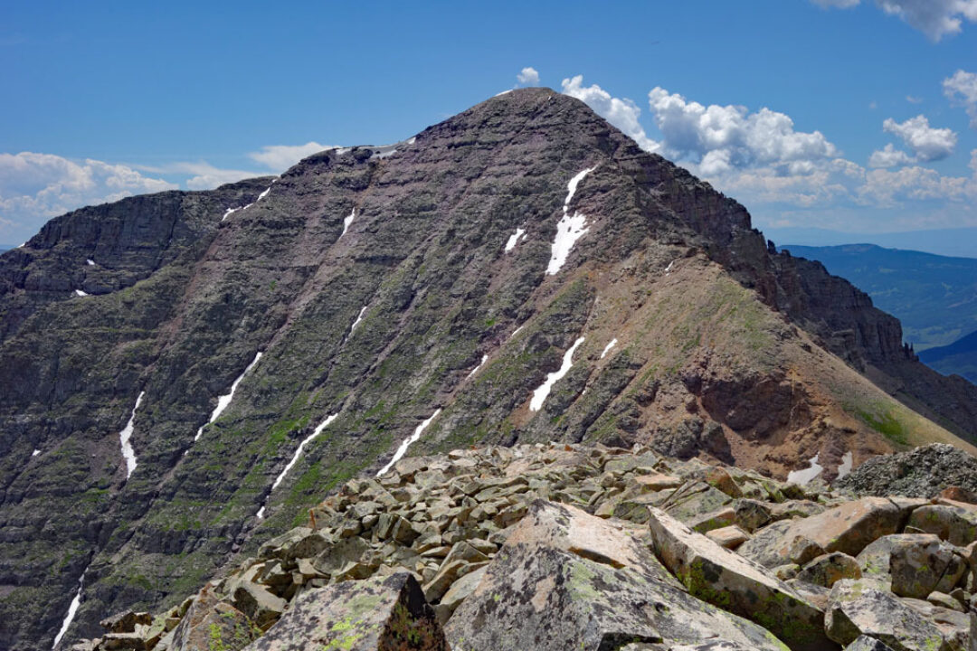
LoJ: #480 (Pre-LiDAR #477) / 13,213' Teocalli Mountain
Peak Summary
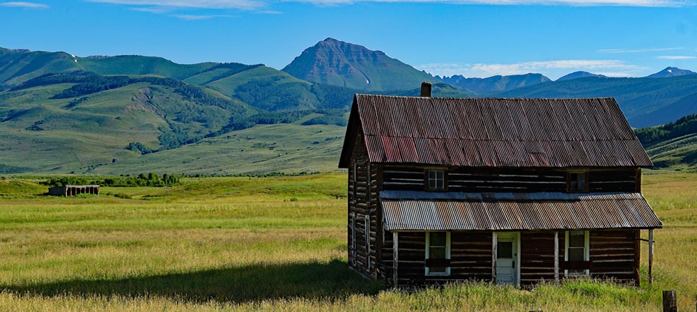
Teocalli Mountain is an easy Class 2 ascent in the eastern portion of the Elk Mountains. Access is most easily gained from near Crested Butte, but 4WD/good clearance is needed to keep this in the "day hike" range. The drive in on 4WD road is fairly long requiring close to an hour. The surrounding scenery is verdant and wildflowers proliferate around here. Lidar added 5 feet of elevation.
Teocalli via West Brush Creek Route
-
-
West Brush Creek TH - Elk Mtns.
From the Town of Gunnison: Turn north at the center of town on HWY 135. Pass through Almont and continue toward Crested Butte. About 2 miles before reaching the town, (between mile markers 24 and 25) turn right (north) onto CR738 which also becomes FR738. This is locally known as the "Pearl Pass Road" and also accesses the local airport. The road starts out paved, then changes to graded gravel after one mile. It initially passes through a subdivision. Before turning off the highway, you'll have outstanding views of Teocalli Mtn. Passenger cars can make it in the first 4 - 5 miles to a little past the junction where the East River comes in. At 2.3 miles in from the highway, there's a newer trailhead called the "Brush Creek TH." Most will want to continue driving past here. At 4.5 miles stay left where a private road turns off. The intersection of the Pearl Pass Road and the West Brush Creek Road comes at 5.3 miles from the highway as we measured. Just before FR 738 begins to gain elevation, and shortly after (.2 mile) FR738.2A turns off for West Brush Creek, there is a primitive camp area on the right. Passenger cars should be parked here. If not parking a passenger car, turn left onto FR738.2A which heads NE on higher slopes above West Brush Creek. This initial half mile has numerous potholes. The road turns a more northerly direction after about half a mile, stay right at 6.2 miles, there's a gate at 6.4 miles and the road stays well above West Brush Creek for the next mile before dropping down to and crossing the creek at 7.3 miles. At 6.7 and 6.9 miles there are some possible campsites. There is an excellent campsite here. The creek crossing requires driving through West Brush Creek so in early season this may be a problem.
Continue on the east side of the creek now for another1.7 miles appx. to the end of the road. There is no formal parking area - just a grassy, open knoll after climbing steeply up a section of road that passes through willows. This last two miles will be the slowest mainly because of potholes. We did not find too many rocky obstacles on a drive up here in 2011 and again in 2019, but some minor drainage crossings proved to offer some clearance problems for some vehicles. There's another nice campsite at 8.4 miles and a less used one at 8.8 miles. The road ends about .2 mile after that. Much of the 4 mile drive in passes through open, grassy terrain.
It should be noted that this trailhead can also serve as a TH for Teocalli. From the end of the road, if you hike along the trail that heads up West Brush Creek, in a few tenths of a mile a trail heads off to the right at the wilderness boundary. (N 38° 56' 51.68" W 106° 53' 34.46") The trail which does not show on either the USGS quad, or the Gunnison NF map, heads east from a trail junction to the south ridge of Teocalli ("Teocalli Ridge" on the USGS map) and crosses the ridge at 11,100 ft. Head north from that saddle for an easy Class 2 hike to the summit on a trail that eventually fades away below some minor cliff bands. Mountain bikes use this trail as an access to Teocali Ridge.
Camping
There are no formal, forest service campgrounds either along the West Brush Creek Road or the Pearl Pass Road. There are however, a good number of primitive sites to be enjoyed. We have provided mileages above to help campers & hikers locate a place to stay.
Campsite Locations
Campsite #1, › N 38° 53' 48.90",,, W 106° 53' 05.64",,Shortly past where FR738.2A turns off from FR738 (The Pearl Pass Road), there is a frequently used primitive camp area on the right. Elevation 9,180 ft.Campsite #2, › N 38° 55' 17.11", W 106° 52' 44.71"Is a little over 2 miles in on FR738.2A (the West Brush Creek Road) and comes just before the road crosses from the west side to the east side of West Brush Creek. Elevation 96.15 ft.Campsite #3 › N 38° 56' 23.60", W 106° 53' 03.63"At about 9,900 feet elevation, before the West Brush Creek road makes its final climb to the TH. Select your own primitive site somewhere in this vicinity with some good trees for shelter. Elevation 9,920 ft.
Route Description
Year Climbed: 2011From the Trailhead, car-park, continue NW on the old roadbed as it diminishes to trail to a trail junction close to 10,400 ft. There's a wood trail sign here. Follow Trail 554 to the east as it makes a contouring ascent up to Teocalli Ridge. Locate the trail on Teocalli Ridge and follow it north through lush vegetation. From there on, the route is the same as the South Face route. There is very little difference in using either of these two routes when it comes to elevation gain and total mileage. Your choice will probably depend on your peak-bagging agenda.
Additional BETA
Links to other information, routes & trip reports for this peak that may be helpful. -