LoJ: #132 (Pre-LiDAR #131) / 13,743' Argentine Peak
Peak Summary
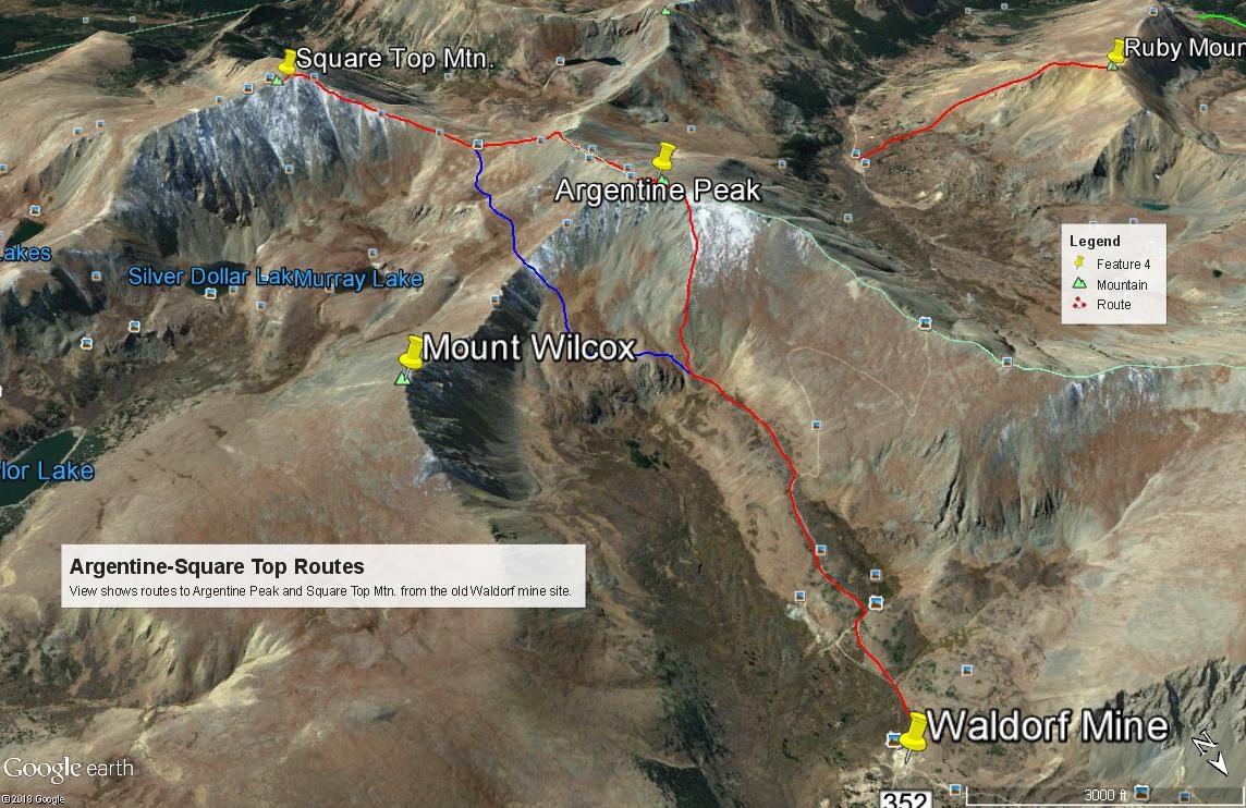
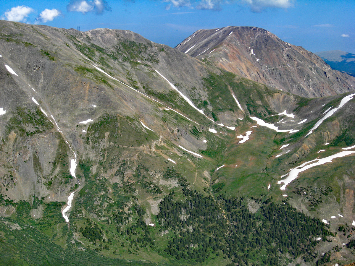
Argentine Peak, located in the Leavenworth Creek area, is an easy, Top 200, Class 2 ascent on mostly gentle terrain and can be accessed by vehicles with higher ground clearance. The area is very popular with weekend ATV-ers, and other 4WD explorers as well as hikers. If you don't have the ride to get you back to Waldorf, you could probably hitchhike. Close proximity to the Front Range cities makes this a good family outing for those living on the Front Range. The banner image shown here primarily shows Square Top Mtn., but the summit of Argentine is just off to the left, so the west and southwest slopes of Argentine are visible here as they drop off into Peru Creek.
Argentine Peak NE Ridge Route
-
-
Leavenworth Ck - Waldorf TH
From I-70, take the Georgetown Exit 228 and drive east on 15th St. to a traffic circle. Proceed 1/4 of the way through the circle and exit south onto Argentine St. Drive south on Argentine then turn left onto 11th St. Turn right onto Rose St. and head south into the main part of town. Continue all the way to 2nd St. where you'll turn left and will be on SH 381. This is the Guanella Pass Road. Follow it south for 2.7 miles to the turnoff for the Leavenworth Creek Road #352 (aka: FS 248.1). The turnoff is at the sharp curve of a second sharp switchback south of the Georgetown Reservoir by about .7 mile. If you come to Green lake, you have gone too far. The elevation at this turnoff is 9,520 and coordinates are: N 39° 40' 59.55" W 105° 42' 09.83". The road will initially parallel above the highway, then make a sharp switchback to head up to a crossing of Leavenworth Creek. After that crossing, there will be three more sharp switchbacks before the road joins the old railroad bed and stays on it all the way back to Waldorf. The most difficult & rockiest part of this road occurs before joining the railroad grade. If you make it to that point in whatever vehicle you're driving, you can likely make it to Waldorf. 4WD is not necessary for a railroad grade road, but good clearance is helpful.
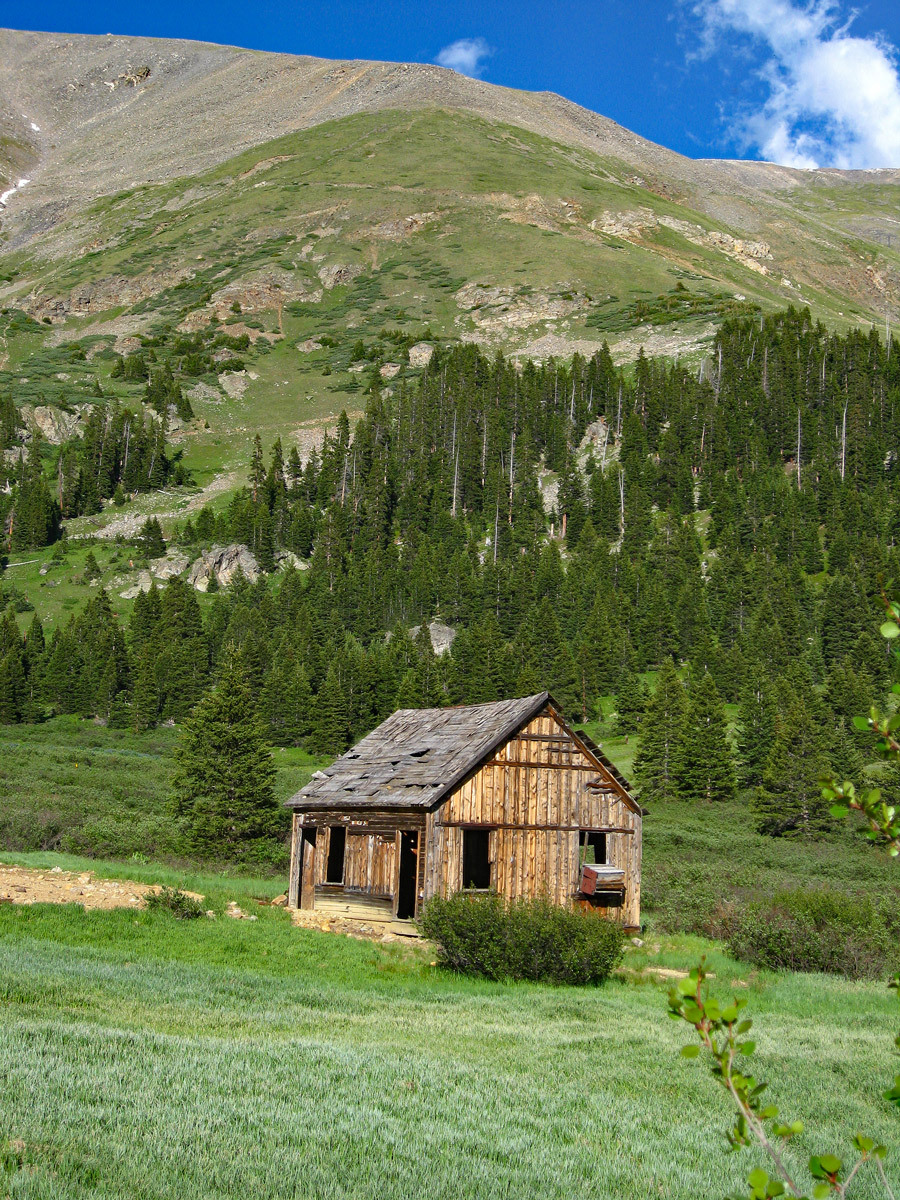
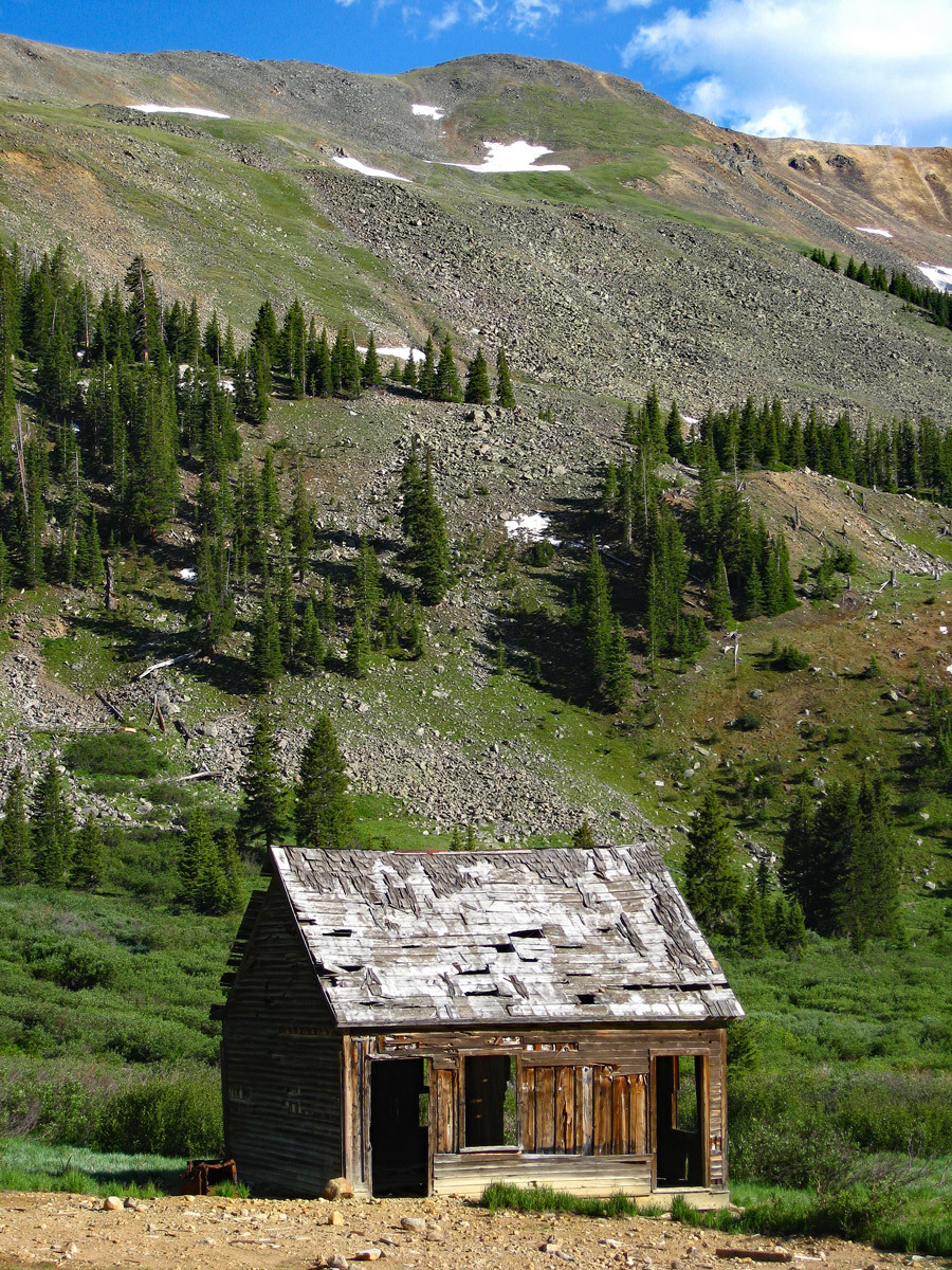
It's about 5.6 miles up the Leavenworth Creek Road to the old site of Waldorf. The road is dirt/gravel and is best driven in at least a higher clearance vehicle. This area is very popular for weekend visitors in ATV's and various 4WD vehicles. When we lived on the Front Range prior to 1990, visiting up Leavenworth Creek was one of our favorite places to go for a quick mountain getaway. As you head up this road toward Waldorf, there will be several at-large primitive campsites if needed, most of them located well up canyon, but expect most all to be occupied on summer weekends. Park at the old mill site at Waldorf at the coordinates provided above the map. Many vehicles will stop here during the course of the day, so if you would like to park your vehicle a little more out of the way, continue south up the road another half mile to a small pond where you can park at: N 39° 37' 59.26" W 105° 46' 11.15". (A report provided to us in 2020 indicated confusion with the roads beyond this point and difficulty in locating the "pond.") Beyond the Waldorf mine area, the road begins to deteriorate & become rockier. Parking at either of the two locations makes a good start location for Mt. Edwards, Wilcox, Square Top or Argentine.
The townsite of Waldorf was established in 1867, three years after a large silver vein/deposit was found in this area. John Edwards Wilcox, a Methodist minister, had much to do with the development of Waldorf. You can read more about the history of this area at: https://www.summitpost.org then search for Mount Wilcox under "Climbing, Hiking and Mountaineering."
Camping
The closest National Forest CG is further south on the Guanella Pass road. There are two: the Clear Lake and the Guanella Pass CG's. Otherwise, you can hope to get lucky and find a primitive site as you head up Leavenworth Creek. One of the best possibilities appears to be here: N 39° 38' 41.64" W 105° 45' 17.62".
Click thumbnail to view full-size photo + captionRoute Description
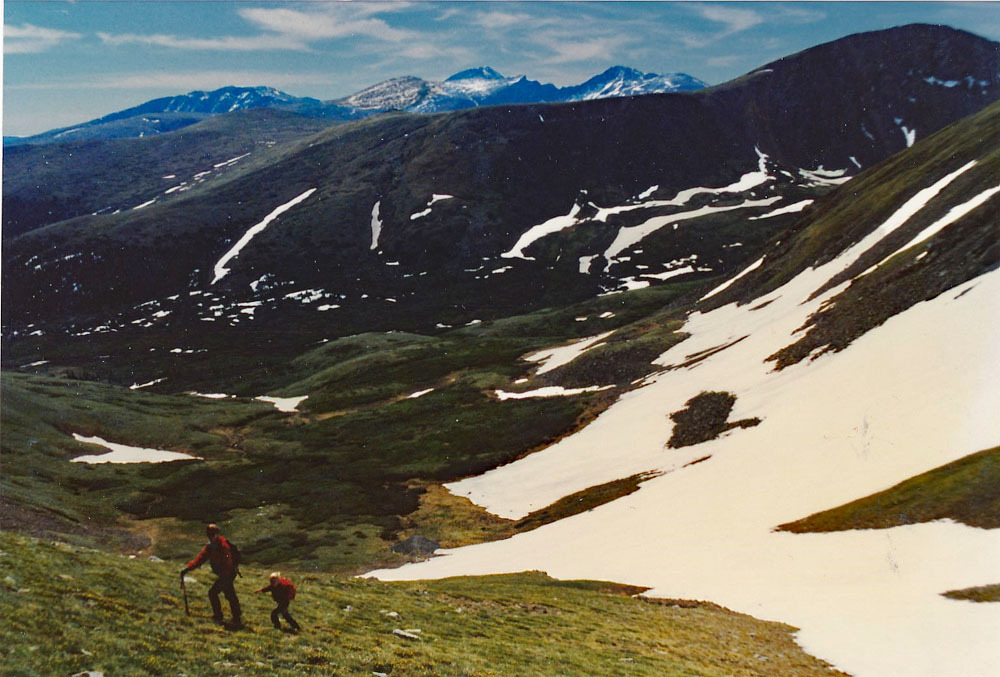
Year Climbed: 1989From parking at the Waldorf Mine site head .3 mile to the crossing of the stream that drains the east side of Mt. Edwards. Cross on over and then take the right fork of the road which will climb up to the pond mentioned in the trailhead that offers another parking spot. (Most likely only 4WD with good clearance will access this spot.) The road makes a 90° left here and continues south up valley. Shortly, there will be a second fork. The right fork goes all the way up to the ridge that connects Mt. Edwards and Argentine Peak. This would be Argentine Pass. You could just walk this road all the way up to the ridge and then follow the ridge south to Argentine Pk. But on weekends, following the road will likely result in being continually passed by ATVers, etc., and eating their choking dust. So at this second fork, we suggest staying left and following the older, abandoned roadbed that continues toward the head of Leavenworth Creek. Where the road meets the NE ridge of Argentine Peak, depart the road and head up the ridge. A little ways up is a rocky section on the ridge crest that can be avoided by staying right of the crest. Most of the hike up is on tundra with embedded rock, some minor loose scree and occasional rubble. There's nothing difficult other than the angle of ascent is moderately steep.
From the summit, enjoy a nice panorama of the Front Range and of the view down into Peru Creek to the west. You will also be able to see the old road, now more trail, that was the west side of Argentine Pass. That stretch is now part of the Continental Divide trail. From the summit, return as you came; go back north along the ridge and hike down on the Argentine Pass road; or continue on the Square Top and/or Wilcox.
Additional BETA
Links to other information, routes & trip reports for this peak that may be helpful. -