LoJ: #154 (Pre-LiDAR #152) / 13,692' Cirque Mountain

Peak Summary
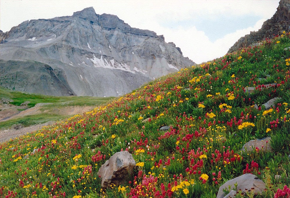
Cirque Mountain is the easiest 13er route in Yankee Boy Basin coming in at a Class 2 hike. Pre-Lidar elevation was 13,686. The uncomplicated route to the summit takes you through abundant wildflowers in mid-July to early August, renowned throughout the state. The lower basin is accessible to passenger cars. The upper basin can be accessed by higher clearance vehicles. The hike also makes a good family excursion. If you're looking for a view of the Yankee Boy summits from altitude, this is the place to go.
Cirque Mtn. West Ridge Route
-
-
Yankee Boy Basin - Mt. Sneffles Trailhead
Road up Yankee Boy has recently been improved as of 2018. The shelf sections are now smooth & graded. There should be no issues for passenger vehicles to continue up to the start of the 4x4 section at the Governor Basin road turnoff (just past the Atlas Mill) other than the washboarded switchbacks and unrelenting steepness.
To access this trailhead, head south out of Ouray on Highway 550 up Red Mountain Pass for 0.4 miles. At the first switchback, take a right onto Ouray County Road 361 (aka 'Camp Bird Road")—a graded dirt road. Immediately after this turn, the road branches with the right fork taking off toward Box Canyon Falls. Take the left fork, (just continue straight ahead actually) which will lead you on a bridge over the creek before beginning the relentless climb up into Yankee Boy Basin. Continue past the turnoffs for Camp Bird Mine & Imogene Pass and across the famous, spectacular shelf section of the Yankee Boy Basin Road (CR 26). Keep going until the road branches to Governor Basin around mile 7.75. Passenger cars shouldn't have any issues making it to this point (usually).
NOTE: The best parking may be just before the Governor Basin Road turnoff back near the Atlas Mill.
If you're driving a 4x4 vehicle, continue right farther up the Yankee Boy Basin Road for approximately another 0.9 miles to a large pullout with a solar vault toilet at around 11,380'. The 4x4 road up to the bathroom is in great condition as of 2018 as well—no obstacles of any real significance. A little clearance and low gears are helpful, but there should be no difficult maneuvers up to the trailhead that a stock 4x4 can't handle. Even some crossover vehicles should be able to make it if driven carefully.
Camping
The only camping allowed in Yankee Boy basin is now restricted to Thistledown and Angel Creek Campgrounds. As of June 2018 the Angel Creek Campground was temporarily closed "due to hazard trees." At Thistledown, there is an overflow area on the north side of the road just past the main campground thta has three or four other sites which are "walk-in" sites.
About 100 yards past the solar vault toilet, a road turns off to the left that drops down a little, crosses a larger puddle and then swings up into an area of trees. There are about five primitive campsites in among these trees. IN 2018, we observed on two separate weekends, various groups openly camping here with tents & RV's. We are not sure if using these spots is truly permissible or not. One Forest Service ranger told us that camping on FS land is not permissible anywhere in the basin, however, she also pointed out that there are all kinds of old claims in this area that are not considered FS land and that some of these areas could be used for camping. That may be the case with the spot described here, however if not on FS land, then you are on a private holding of some kind. On another trip, our son saw several people up at the various turnouts on the 4x4 section camping in their vehicles, but no tents. When he returned to the car after his climb, there was a woman associated with a Yankee Boy Basin conservation group who was checking the area round the restroom and also the trail and level area above it for signs of camping usage. She was photographing and documenting everything. Camp at your own risk on this one!
Campsite Locations
Thistledown › N 37° 59' 37.84", W 107° 42' 01.64"8,760 ft. elevation
Click thumbnail to view full-size photo + captionRoute Description
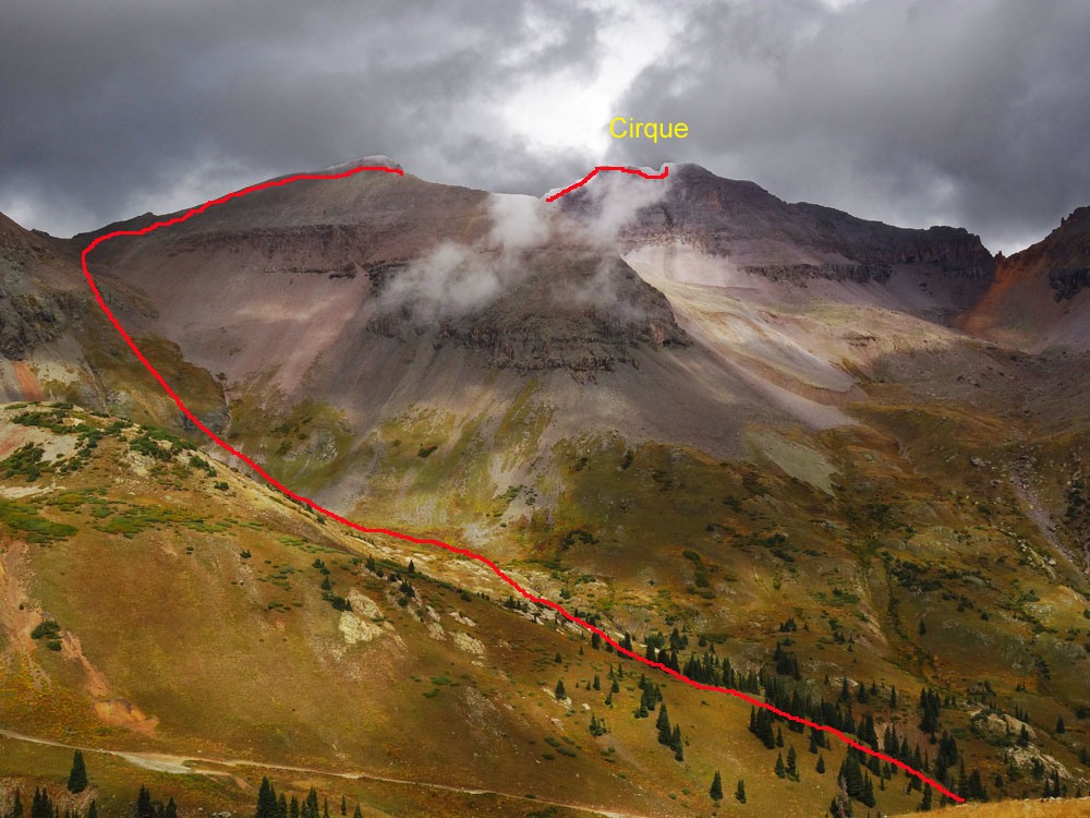
The route for Cirque begins from the parking area at the solar vault toilet at 11,300 feet in Yankee Boy Basin. The route we describe here is largely the same as that described by G&M and their information is what we used for this 1990 hike. After the toilet, the road degrades quite a bit but can still be driven by shorter bed 4WD with good clearance. If you're walking, you may be passed by several vehicles. Walk up the main road that leads to Mt. Sneffels for .4 mile and depart the road near these coordinates: N 37° 59' 23.24" W 107° 46' 18.49". This will be just after crossing a drainage coming down from a valley south & west of Cirque. Head uphill on steeper terrain passing open trees and walking on lush tundra laden with colorful wildflowers in mid-July and later. Utilize the tundra for as long as you can. It will play out at about 12,550 ft. Above there, you'll be on loose talus for the remainder of the distance to the west ridge of Cirque. either continue straight up the drainage to the saddle above, or some choose to begin swinging right and leave the saddle out to intersect the west ridge of Cirque higher up. Either way you'll be hiking on mostly all talus. The saddle at 13,060 ft. is called "Dyke Col." The unofficially named "Kismet" is to the left of the saddle.
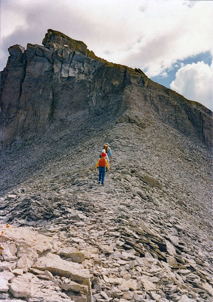
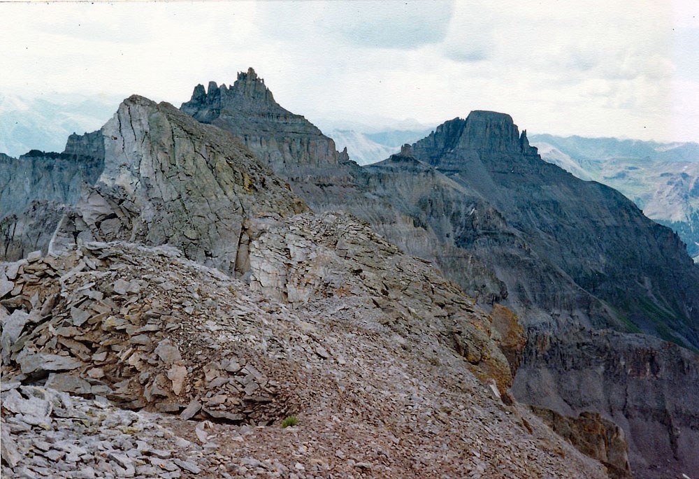
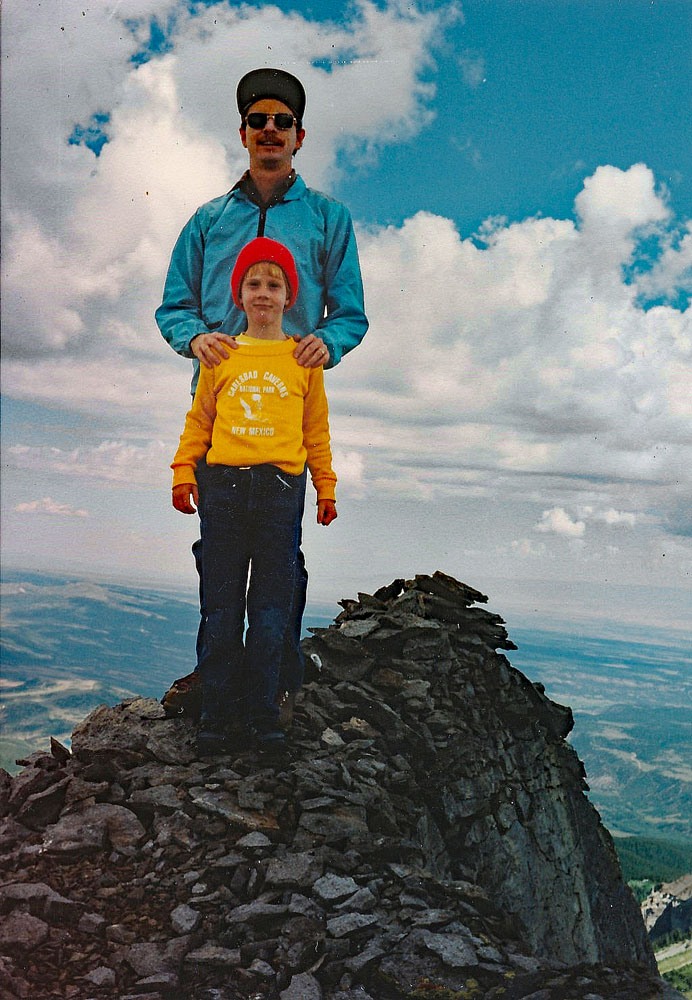
When you reach the ridge, turn right (east) and follow it to the dual summit. There are "use" trails and cairns pointing the way. Along the way there will be one stretch of ridge that narrows quite a bit and drops off on either side. We recall our 9 year old daughter being a little intimidated by that stretch but there was no real exposure. That section shows in the vertical photo. The ridge is also covered in spots with what we call "dinner-plate talus," which are flatter, thinner rocks that break under foot and sound like you're walking on china. This kind of rock occurs frequently in the Dallas Divide group of peaks. There is one steeper cliff band to overcome at about 13,500 ft. on the way to the summit. It proved to be no problem for our kids. Then there is one more close to the summit. Some rate these as Class 2+ or 3. When you arrive at the summit proper, you will see that the summit is "split." Though the north side of each high point drops off severely, each high point can be easily attained. Climb both to make sure you've covered your bases, but the western one is supposed to be the highest.
After admiring one of Colorado's most amazing views, descend as you came, especially if with younger family. Some people take a decent route that goes almost directly off the summit south into a large bowl. Higher up are steep, scree gullies with some rock outcrops to avoid. Lower down, you can return to flower-laden tundra. The bowl empties back out onto the 4WD road where you can stroll back to your vehicle.
It is also possible to climb Cirque from Blaine Basin on the north side. A "faint" trail leads up through the basin and to Dyke Col. From there, you can follow the main route to the summit.
Additional BETA
Links to other information, routes & trip reports for this peak that may be helpful. -