LoJ: #81 (Pre-LiDAR #80) / 13,866' Clinton Peak
Peak Summary
Clinton Peak is a relatively easy Class 2 hike , but with a longer approach for most who do not have a very capable 4WD. Without that type of vehicle, the hike to Clinton includes several miles of walking from Montgomery Reservoir to Wheeler Lake before the real ascent begins. See the trailhead description for information regarding the 4WD road conditions and if you want to tackle that challenge as well. Our route for Clinton begins by first including two unranked summits - Traver Peak and McNamee. Clinton is then sequenced with Wheeler Mtn. for a circuitous and scenic route around the headwaters of the Middle Fork of the South Platte River. The trailhead at Montgomery Reservoir can be reached by most passenger vehicles.
Clinton PK SSW Ridge Route
-
-
Wheeler Lake-Montgomery Reservoir TH
If coming from Breckenridge on State Highway 9, drive to the summit of Hoosier Pass, then continue south just over 1.0 mile and turn right (west) onto CR 4.
If coming north from Fairplay on SH 9, drive north to Alma and just over 5 miles from the center of town, turn left (west) onto CR 4.
Follow CR 4 as it heads downhill toward the scenic Montgomery Reservoir. Avoid making any turnoffs either left or right and continue down to the north side of the reservoir. Just before the dam, veer right when the road forks. The left fork goes down to the lake. There is parking available there if you're in a passenger vehicle that you do not want to take further. The right fork will take you around to the west end of the lake. Stock 4WD and many crossovers should be able to continue. Continue to a trailhead parking area at roads' end. If in a passenger vehicle, do not attempt to take the 4WD drive road that turns off to the right and heads up to the Magnolia Mill. Continuing up the 4WD road brings one immediately to a difficult, rock-slab climb with a difficult 2 -3 foot step. If you're driving a stock 4WD of some type and don't feel comfortable making it up this first section, you should probably not try to go any further, though stock vehicles with better than average clearance may be able to continue over another 2 miles, west along the Middle Fork of the South Platte River. Overgrown willows will likely scratch up your beautiful paint job. On one of the regional four-wheeling sites, the road is rated a 5 to 7 with warnings about rocks and holes larger than 12 inches, 8" deep mud, stream crossings to 18", slopes to 25 degrees, and side hills to 30 degrees. Roach suggests stock vehicles not drive beyond 11,680 ft. where the road begins to gain serious elevation up to Wheeler Lake.
Camping
There is little to consider as viable camping at the trailhead though you might be able to "car-camp" overnight. The reservoir itself is surrounded by private property and cabins. The closest National Forest campgrounds are back up Four Mile Creek south of Fairplay. For most Front Range hikers, camping is not an issue since this TH is a relatively short drive of less than 2 hours for many. If you need to camp, try the few primitive sites at the top of Hoosier Pass (see North Star Mtn.) or head up Beaver Creek out of Fairplay (see Mt. Silverheels). If you have a capable 4WD that can navigate FR 408 toward Wheeler Lake, there are a couple of possible campsites right off the road, but generally, camping options are poor because of all the willows.
Click thumbnail to view full-size photo + captionRoute Description
Year Climbed: 1988Our route description will assume a start from the trailhead parking at the western end of Montgomery Reservoir. We do this in part because many hikers with stock 4WD vehicles, may not want to test their trusty steed on the rigors of the 4WD, single track road up to Wheeler Lake. Roach proposes driving in stock vehicles as far as 11,680 feet. This is approximately where the road turns NW and begins a steeper climb up to Wheeler Lake. That's where conditions become much worse. Many drivers will find themselves questioning whether or not to proceed on this road back at the Magnolia Mine area, so we offer the route description as beginning from there. This route description will also include information about Traver and McNamee.
Walk west up the road along the middle fork of the South Platte. The road stays on the north side of the drainage. During summer months you can expect to encounter some large potholes of water and mud that may force you over into the willows, which are quite numerous. Just before the road begins the climb up to Wheeler Lake, there is a fork that heads off to the left and goes down to cross the creek. That old fork will not gain you any advantage. Where the main road does make a sharp right turn toward Wheeler Lake, if you wish to avoid the lake, you can head west up a couloir to the flatter, basin area above the rock outcrops and cliffs which sits at the foot of Traver, McNamee and Clinton. Otherwise, continue to the lake. It is possible to find some tent sites here if you want to backpack into this lovely location.
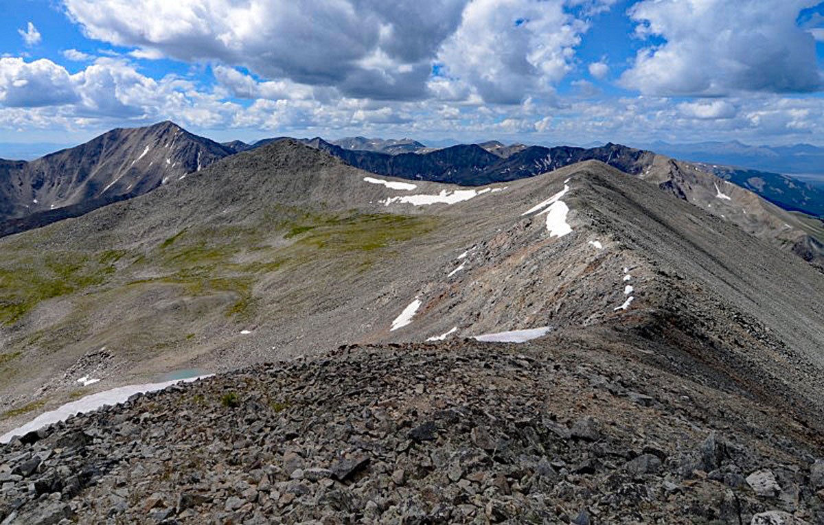
From the lake, follow the old road along the west shore, then turn west up a fairly large gully that will grant access to the same flatter basin area below Traver, McNamee and Clinton. From here if you wish to avoid the tour de basin by hiking over Traver and McNamee, you could head WSW up the basin to its head, then head NW up to the summit of Clinton over mostly Class 2 talus. The lower section of this basin has tundra, rock outcrops and talus.
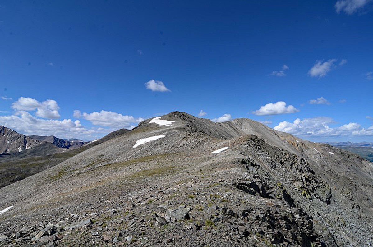
For the full tour, head SW up the basin to about 12,900 feet. Make a turn to the south and gain a minor, broad ridge that comes off the ENE ridge of Traver. Walk up that minor ridge, gain the ENE ridge and follow it to the summit of Traver over mostly Class 2 rubble. It's 1.8 miles from the lake or 5.4 miles from the TH to the Traver summit. From the summit of Traver, head NW along another ridge that connects over to McNamee. The easy ridge is Class 2 with some rubble, tundra and embedded rock. You'll only need to regain about 160 feet from the connecting saddle. It's about .45 mile.
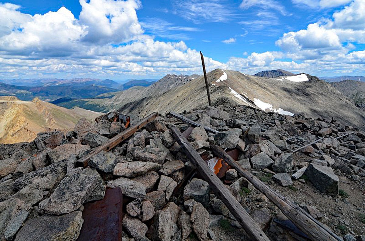
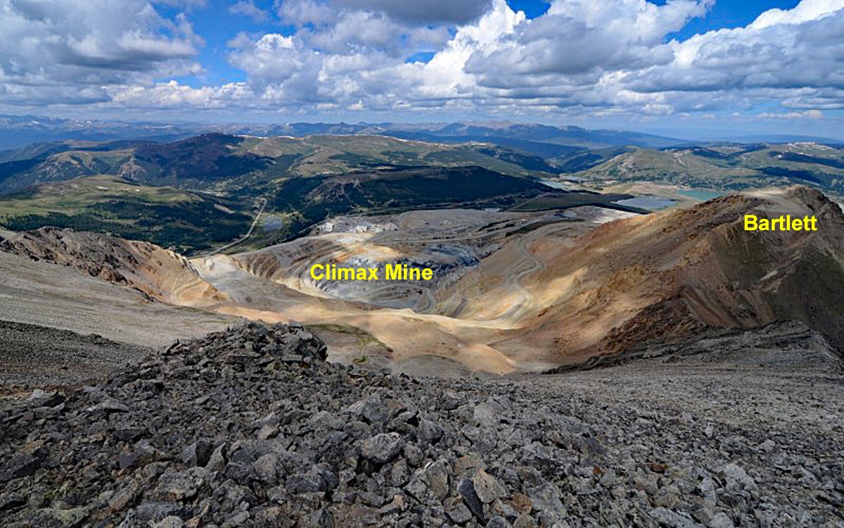
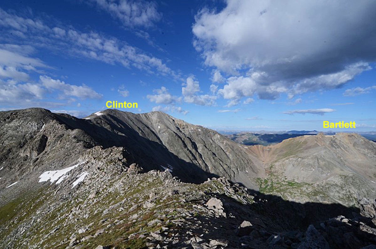
From McNamee, follow a similar ridge NNE to the Clinton summit. Still Class 2 with limited tundra, embedded rocks and rubble. You'll only need to regain about 160 feet in elevation. The distance is a little over a half mile. From Clinton, you'll be able to look down upon the Climax Mine operation. There is also a ridge from the summit of Clinton that heads in a NW direction and connects over to the remnants of Bartlett. If only climbing Clinton, you can drop from the summit SE back into the basin below and rejoin your route that came up from Wheeler Lake for a descent. Otherwise, continue on east, then NE on a high ridge to reach Wheeler.
Additional BETA
Links to other information, routes & trip reports for this peak that may be helpful. -