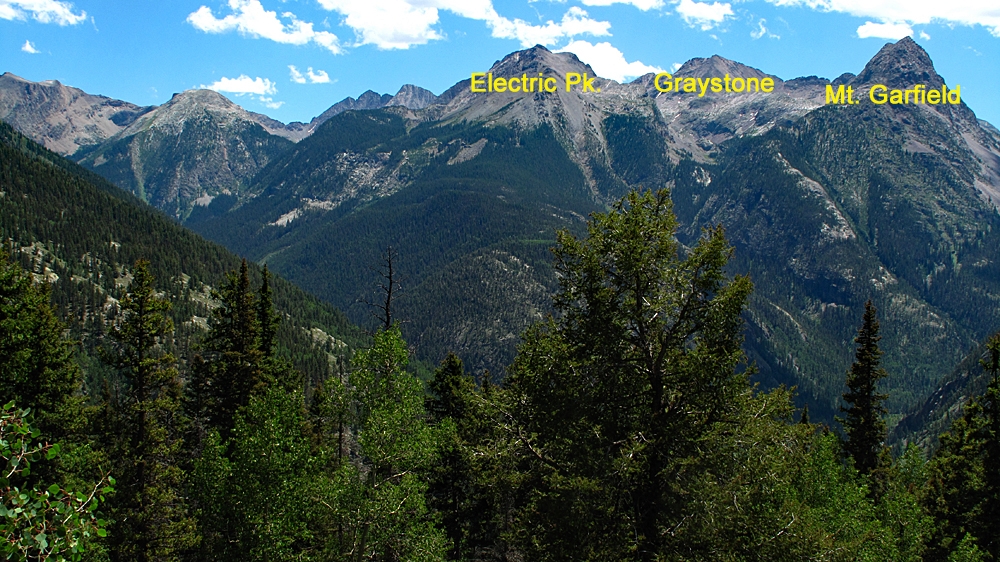
LoJ: #405 (Pre-LiDAR #407) / 13,297' Electric Peak Electric Peak B

Peak Summary
A Class 3 scrambling ascent from the saddle between Electric and Graystone. Access will most likely involve a backpack trip. Combines easily with Mount Garfield and Graystone Peak with a Vestal Creek access. Pre-Lidar elevation was 13,292 ft.
Electric Peak B South Ridge Route

-
-
Molas Pass - Elk Park Trailhead
From the highway intersection just west of Silverton, CO, drive south on US550 in the direction of Molas Pass for 5.3 miles. About .6 mile, or at 5.3 miles total, after the turnoff for the Molas Lake there is a turnoff to the left into the trailhead parking area, accessible to 2WD vehicles. The dirt parking lot may be muddy at times and have a few potholes to avoid. There is usually plenty of room to park here, but can get a little full on weekends.
If coming from Durango, drive north on US550 over Coal Bank Pass and Molas Pass. After cresting Molas Pass, the turnoff for the trailhead will be 1.1 mile further north and on the right. The drive from Durango will take about an hour.
Camping
You can probably vehicle camp at the trailhead but there is no immediate toilet facility. You could also hike south along the trail a short distance from the TH and pitch a tent. There is a vault toilet back at the top of Molas Pass or at the turnoff for Molas Lake, you can drive down to the park and pay a fee to camp where there are not only vault toilets, but also hot showers for $5.00. There is also a fee campground at "Little Molas Lake," which is on a graded dirt road that turns off to the west, from the highway back towards Molas Pass. So overall, there are plenty of camping opportunities in the immediate vicinity.
Click thumbnail to view full-size photo + captionRoute Description
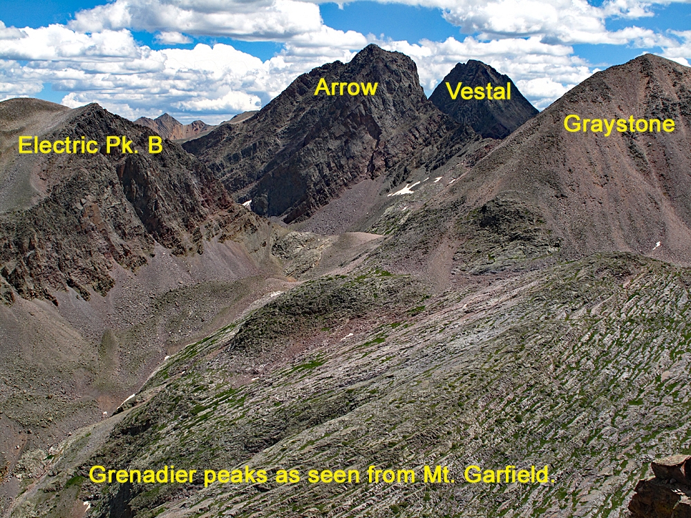
Year Climbed: 2011The following summary will apply to all the peaks accessible from Vestal Creek. These include: Peaks Two and Three, The Trinities, Vestal, Arrow, Electric, Graystone, Point Pun (unranked) and Garfield. In describing the routes for all these peaks, we have used the beaver ponds on the Elk Creek trail as the "base camp" starting point. Mileages and elevation gain are measured from there for each. However, for those with the strength and fortitude, you can continue the backpack portion of the trip by heading up the unmaintained and sometimes confusing Vestal Creek Trail. That hike will be included with each summit in this area as part of the "approach." Not only is the Vestal trail confusing at times with multiple tracks to follow, it is very steep and also harbors a large number of fallen logs to cross. The campsites in upper Vestal Creek are also known for their aggressive and camp-destroying marmots. Protect your food supply accordingly and even your gear as well. In 1992, we had marmots chew their way into our tent, then they both slept and defecated on our sleeping bags. In addition, they completely destroyed a pair of shorts we had left outside to air out, chewed on our packs and socks left out and they chewed through one of the tubes for our water filter. In short, they were attracted to anything that had salt on it.
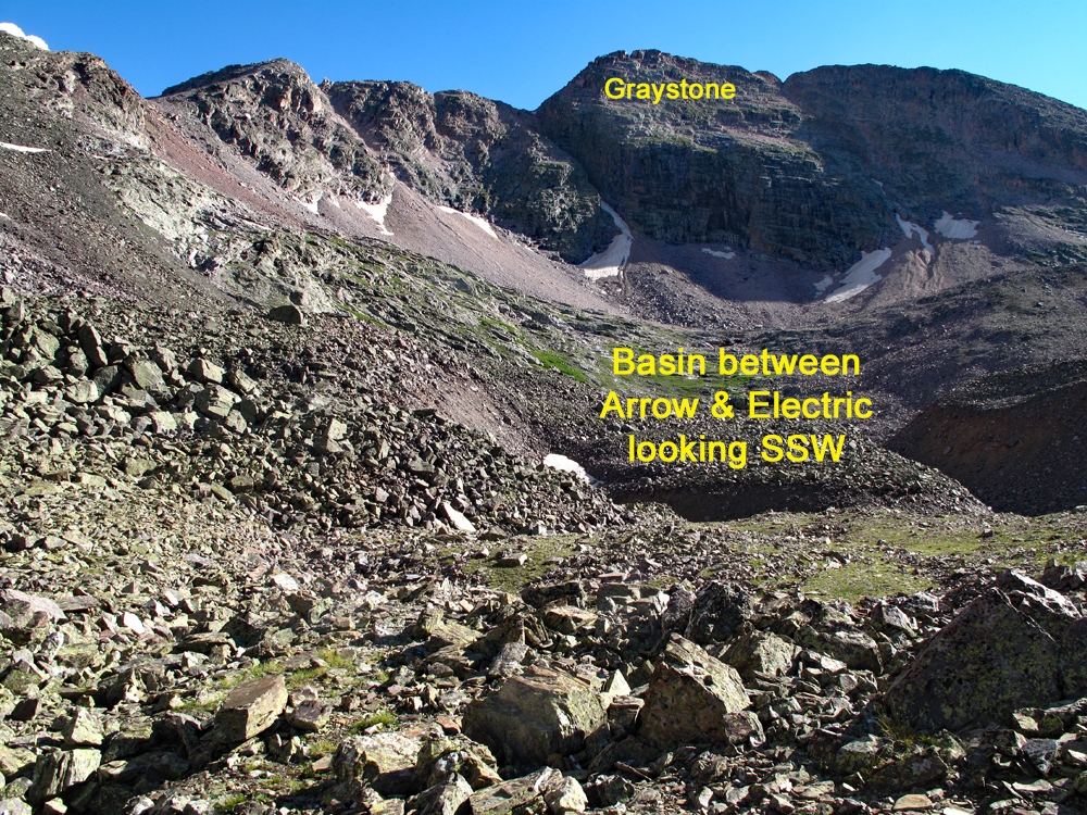
From where the Vestal Creek trail comes close to Vestal Creek at about 11,100 ft., and you can see the drainage between Electric and Arrow, cross the creek which will likely be easiest at the closest location of the trail to the creek. There's an old, rotting log right by the trail here, nice for taking a break on. Proceed toward the talus cone at the base of the Arrow-Electric valley, wading through hip-tall vegetation and hidden rocks. One approach is to aim for the center of the drainage which will involve hiking up the boulder-covered talus slope. There may be snow in the narrow drainage center up higher to deal with. Another way into this upper valley is to walk left of the talus slope and head up an open slope just out of trees that has many wildflowers. Continue up this slope to the base of a cliff band and turn left even more so and follow a green ramp up until you can breach the cliff band with a short, 3rd class move. Once through it, you'll be above the center drainage and on the east side.
However you gain the drainage, continue walking SSW amid tedious rocks, talus and boulders and perhaps some snow. Earlier season snow coverage can make this go much more quickly. Continue to the head of the valley, eventually veering to the west side of the drainage and follow some open slopes with fewer rocks, smaller scree and a little tundra to the saddle between Electric and Graystone.
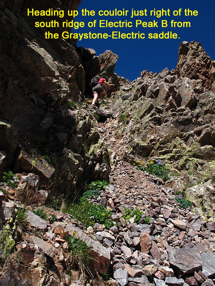
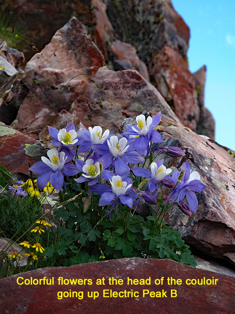
Once at the saddle, examine the south ridge of Electric. Just to the right (east) of the ridge is a small gully filled with scree, loose rocks and some vegetation that breaks into two sections. Head up that gully for about 75 feet to where it crests out on a very small ridge. As you ascend, it becomes progressively steeper and the footing more insecure. Turn a little left and continue up another portion of the same gully for another 75 - 100 feet to where it crests out on a rock rib with colorful wildflowers in July and a prominent cairn. From here, you'll need to make a choice. Straight ahead, you can cross and ascend a broader steep-sided bowl, filled with plenty of talus, of a much larger couloir. Hiking over Class 2+ terrain with some steep slopes to contour across, you can reach the summit coming out a little SW of it. Much of this is quite loose with mostly smaller scree. It actually makes a good descent route.
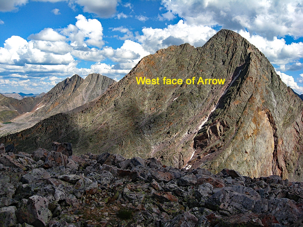
The other choice is to head left from where you crested out and clamber in the general direction of the south ridge. There's a lot of fairly secure boulder scrambling here as you gain elevation steeply. You can either attempt to gain the south ridge higher up or a little below the ridge, continue angling north below the ridge crest with more 3rd class scrambling. This route is actually kind of fun and not too exposed, though some may find it a little intimidating in spots. At one point, we found ourselves on a narrow and somewhat exposed arête. Eventually, you'll come out near the south, false summit and stroll over a scree patch to the summit which is covered in medium-sized boulders. The view east of the west wall of Arrow is quite impressive and you'll have a bird's eye view of Graystone to the south.
Descend as you came or try going back down the wider couloir described above, making it a point to rejoin your ascent route to take you back down the narrow gully and back to the saddle. It may also be possible to exit the summit north by following a NNE ridge down to PT. 12,174 and then descend an avalanche chute back to Vestal Creek, coming out near where you left the creek earlier, but we have no factual information regarding that route and there may be a difficult section not readily visible from the summit.
Additional BETA
Links to other information, routes & trip reports for this peak that may be helpful. -