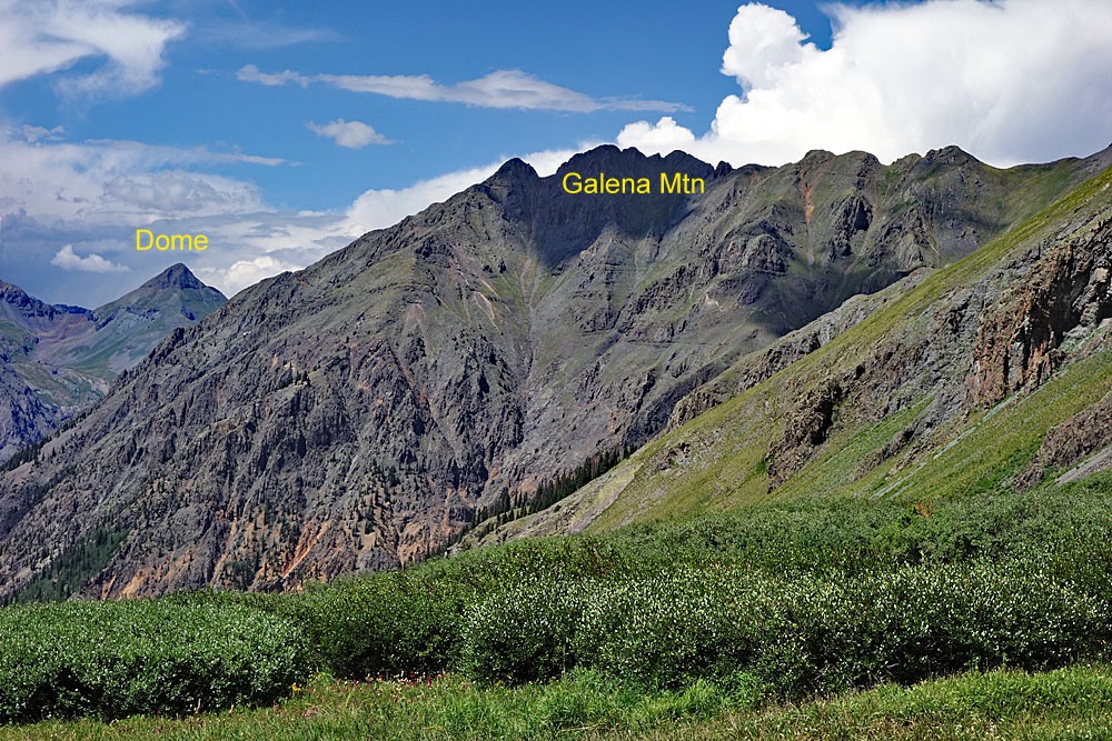
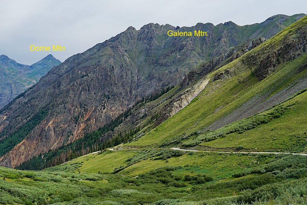
LoJ: #396 (Pre-LiDAR #401) / 13,307' Galena Mountain

Peak Summary
Galena Mountain is most easily accessed from the summit of Stony Pass which requires a 4WD vehicle with good clearance to reach. From Stony Pass, reaching this summit is a long Class 2 ridge walk that offers expansive views of the upper Animas River basin and surrounding peaks. Lidar added 7 feet of elevation moving this summit into the Top 400.
Galena Mtn. South Ridge Route
-
-
Stony Pass TH
From the Town of Silverton, drive east to where the paved road splits one block past the courthouse and veer right onto blue-signed County Road 2 (set odometer here) for 4.2 miles of nicely graded dirt road to Howardsville. (On Trails Illustrated map #141, this road is labeled #110. Pavement ends after 2 miles.) Turn right onto BLM/FS Road 589 for Cunningham Gulch and Stony Pass. At 4.4 miles, stay right and avoid going up to the "Old Mine Tour." At 5.9 miles driving south, take the left fork for Stony Pass and begin the climb out of Cunningham Gulch. The Stony Pass road is BLM/FS 737. Once you leave Cunningham Gulch, the road will begin to degrade to a 4WD/high clearance status. In 1998, when we made this trip, vehicles like Subaru wagons could have made it to the summit of Stony Pass. In subsequent years, the road has experienced enough traffic and weathering to have some rough spots where a higher clearance vehicle is the safer bet. This road is also quite steep for its short duration of about 3 miles to the summit. Once at the top of the pass, park at a small turnout on the south side of the road.
Camping
Best place for overnight camping would be back down in Cunningham Gulch, south of the turnoff for Stony Pass. There are a few at-large campsites before the road in Cunningham ends. Otherwise, it's possible to park and car or tent camp at the pass. We do not recall any camp spots on along the 3 mile drive up to Stony Pass.
Click thumbnail to view full-size photo + captionRoute Description
Year Climbed: 2002From the top of Stony Pass, look for a trail on the north side of the road that heads directly up the southwest slopes of Canby. The trail heads directly up a tundra slope, then turns north as it follows a tundra bench above some lower cliffs. (Do not be confused by the CD/Colorado Trail which also crosses the road near the summit of Stony Pass.) The trail that heads north crosses an area of rocks & talus and then returns to tundra as it leads upward to intersect the NW ridge of Canby at 13,080 ft. Once you gain the ridge, hike north along the ridge crest to Pt. 13,214. Descend NNE, still following the ridge to a saddle and then ascend to PT. 13,090. From here, just keep following the continuing ridge north to Galena, hitting every minor summit along the way just for good measure. There will be two other high points before the summit: Pt. 13,174 and Pt. 13,172. After Pt. 13,172, the ridge turns a little NW for the final climb to the Galena summit. The hiking along the entire ridge is easy being almost entirely on tundra that was crisp sounding under our feet on a September day. Far down in Maggie Gulch, we spotted a nice group of elk who were able to see us on the ridge and headed across the valley to distance themselves from us.
It only took a little over an hour to arrive at the summit of Galena from Stony Pass. The bench marker on the western summit is a little lower than the eastern summit, but not by more than a very few feet. G&M estimate this summit as being 13,300 ft, by interpolating between the 40 foot contours, but it is highly doubtful that the eastern summit is 22 feet higher than the western. In any case, we were simply glad that the 13,257 ft. point on the ridge another half mile away to the west was lower than us, because it would be a pain to get out there. Spend a leisurely amount of time on the summit enjoying the warmth of the sun (hopefully) and the outstanding view.
After your nice break, stroll back along the same ridge and descend to Stony Pass, if you have already climbed Canby. Otherwise, it would make a lot of sense to include Canby in your hike as well as Stony Pass Peak (UN 13,165) on the west side of the road. Including Canby would add about .75 mile additional hiking with another 420 feet of elevation gain.
Additional BETA
Links to other information, routes & trip reports for this peak that may be helpful. -