LoJ: #115 (Pre-LiDAR #116) / 13,789' Golden Horn
Peak Summary
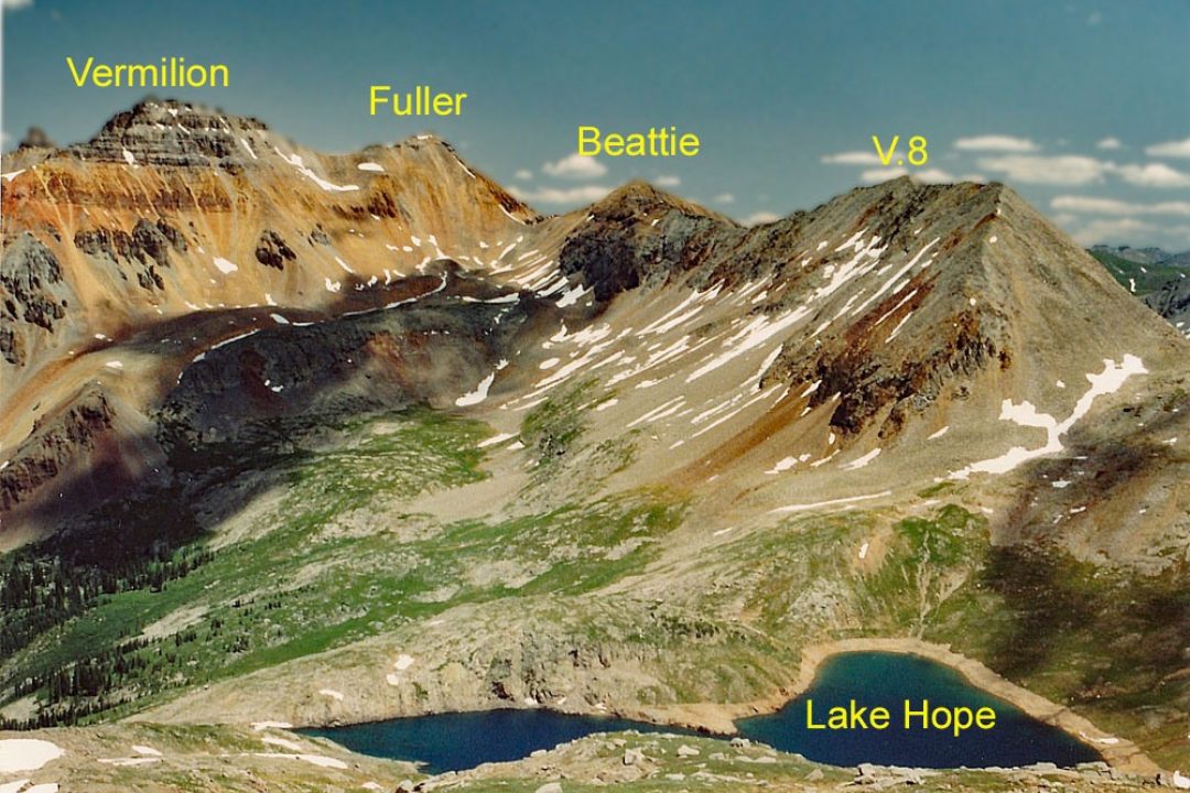
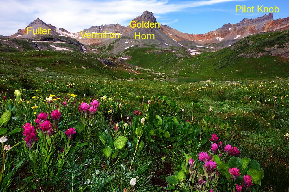
Golden Horn is the final summit in a sequence of four ranked and one unranked summits located at the head of Ice Lake Basin. The Class 2+ peak offers a little bit of fun scrambling as you approach the top with scree and gravel lower down. Golden Horn may be combined easily with Vermilion or Pilot Knob. Our approach to Golden Horn begins at the Lake Hope TH above Trout Lake, located south of Telluride and Lizard Head Pass. The trailhead is accessible to most cross over style vehicles with some extra clearance or 4WD. Passenger vehicles may be able to access if the road has been maintained and graded recently.
Golden Horn SW Ridge Route
-
-
Lake Hope TH
The following directions are provided from the National Forest Service: "From Telluride: Travel west on State Highway 145 for approximately 3 miles. Turn left at the first highway intersection, continuing south on State Hwy 145 for approximately10.1 miles. Turn left onto County Road 63A (signed as "Trout Lake"). Proceed on CR 63A for approximately 1.7 miles to Forest Service Road #627. Stay to the left on FSR #627 and continue for approximately 2.5 miles to the Hope Lake Trailhead. A high clearance vehicle is recommended for the last two miles of rough forest road that leads to the trailhead."
Our note: Measuring the distance to the trailhead on FSR #627 using the map program, we came up with 2.9 miles. The trailhead is located on a sharp switchback that will be turning back to the left.
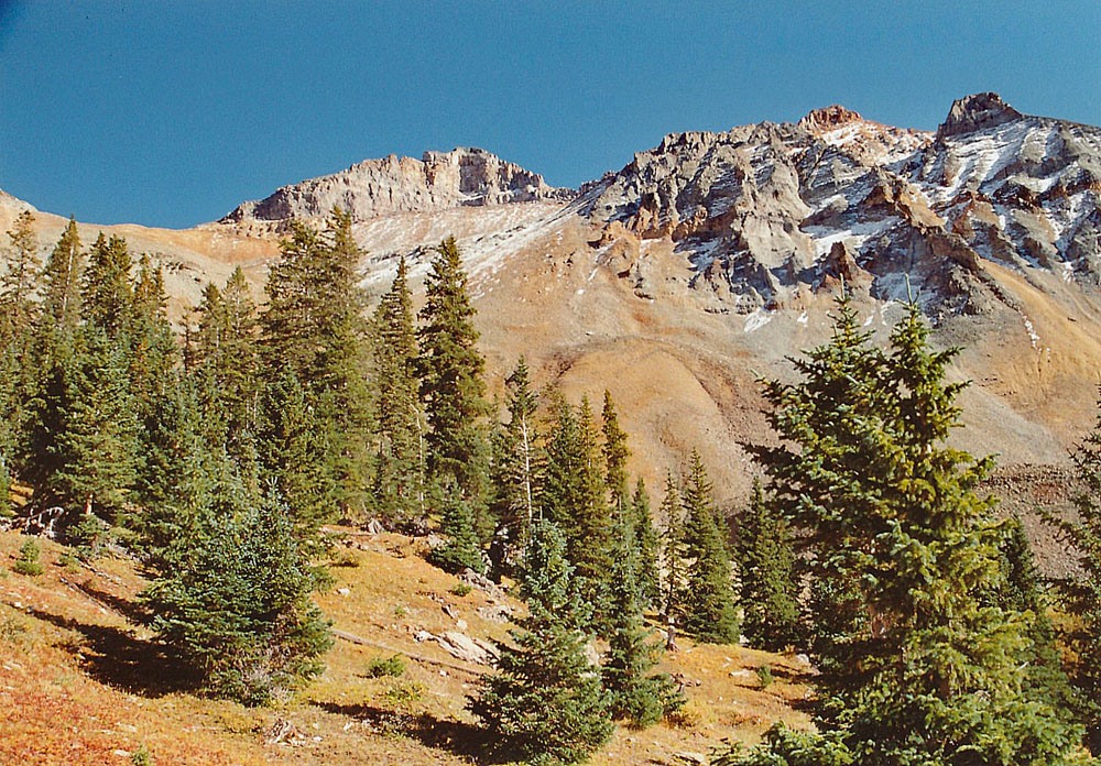
The Forest Service site also offers this description of the trail to Lake Hope: "The Hope Lake Trail #410 begins at the Hope Lake Trailhead and ends at the forest boundary with the San Juan National Forest. This is a favorite hike for viewing wildflowers and is one of the most popular trails in the Telluride area. The trail begins to gently ascend through spruce-fir forests until it crosses rock slides and meadows filled with wildflowers. As it climbs, openings in the trees provide nice views of Trout Lake and the nearby mountain peaks. There is an elevation gain of about 800 feet in just 0.6 miles which gives way to alpine meadows where wildflowers often abound. To the east, spectacular Vermilion Peak rises 13,894 feet. As the trail tops a grassy slope between two rocky hills, Hope Lake will come into view. About 0.8 miles beyond the lake, the trail crosses into the San Juan National Forest where it continues for about a mile before intersecting with Forest Service Road #585 (South Mineral Creek Road)."
Camping
Trout Lake, where you turn off from the main highway to access the Lake Hope TH, is largely surrounded by private property so few at-large camping places exists. It has been a number of years since we have visited this area and back then, FSR #627 did not extend as far as it does now and the trailhead was found at a lower elevation. (See the old USGS map). It appears that there may be a couple spots along FSR #627 as you drive to the TH, but there is also clearly private property along this route as well, so be careful and respectful. There is a pullout just back down the road from the TH where one could perhaps car-camp overnight.
The nearest National Forest Campgrounds are: Matterhorn and Sunshine, north of Lizard Head Pass on the way in from Telluride; and Cayton on the south side of the pass toward Rico. In addition, there are two other trailhead turnouts/parking areas: one at the summit of Lizard Head Pass and the other south of the pass at the Cross Mountain TH. In general, the closer you get to Telluride, the more difficult it is to find a legal place to camp.
Campsite Locations
Matterhorn › N 37° 50' 49.19", W 107° 52' 57.49"Campground elevation 9470 ft. Well-developed campground with 28 campsites, hookups and even showers.Can be reserved.
-
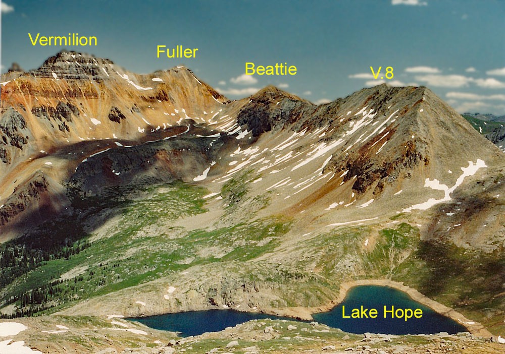
From UN 13302 Beattie Peak Fuller Peak Vermilion Peak
-
V.8 SW Ridge Class 2 / 4.1 mi / 2,555’ One-Way
Click thumbnail to view full-size photo + caption
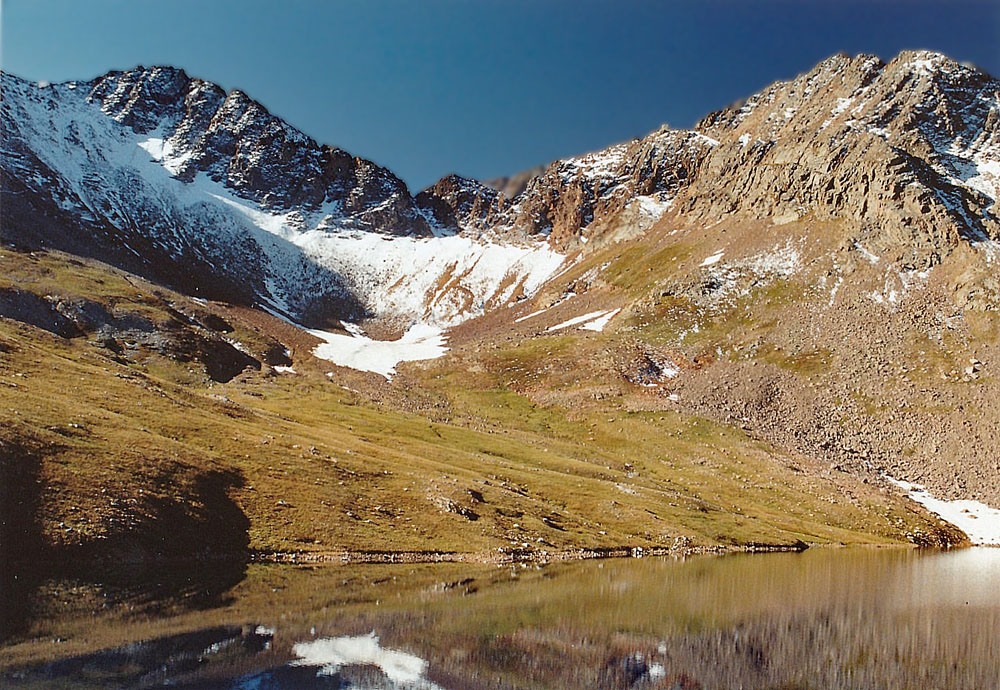
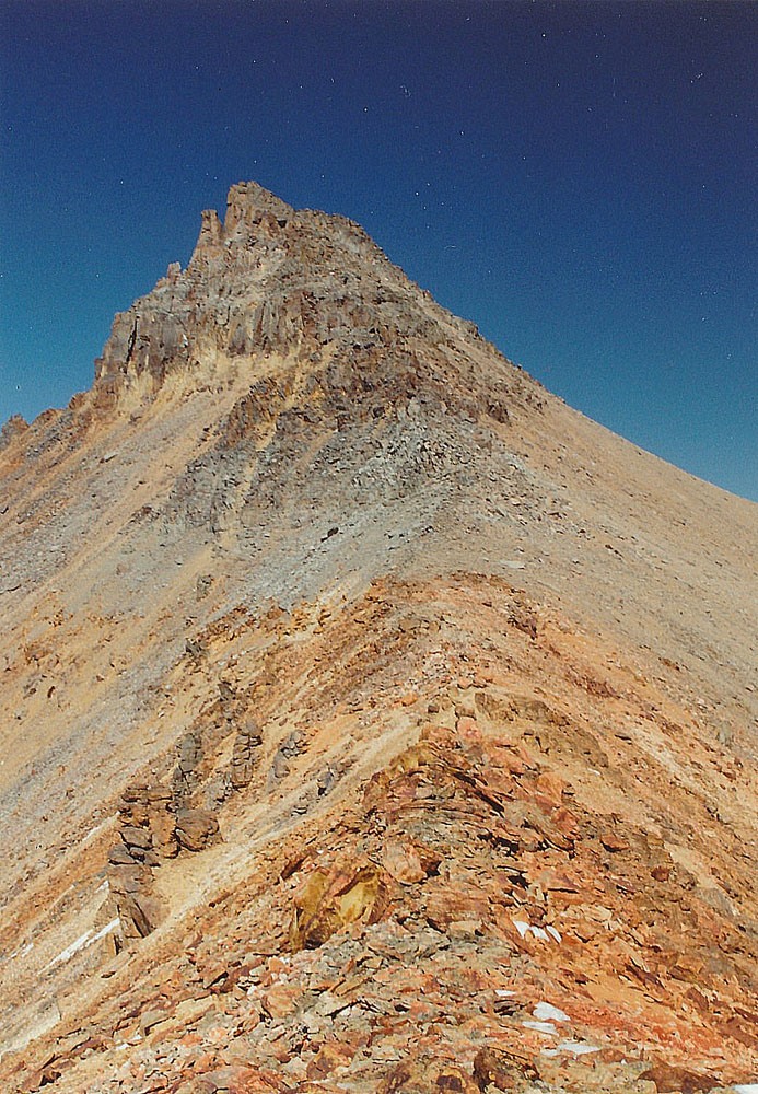
Open This Route in a New WindowThe official Forest Service TH now lies close to Poverty Gulch, so the trail now leads east initially, gaining a little elevation to cross Poverty Gulch. Once across, the trail loses a little elevation before gaining more steeply. As the trail steepens, it gains elevation on several switchbacks. As the trail nears the lake, you can continue on the trail until you have a beautiful lake view, but it's best to find a place to cross the creek below the lake outlet on its north side if doing San Miguel. From the lake, San Miguel appears as a rather nondescript summit that lies to the west and appears to be so small, you may not believe that it is a ranked summit you would want to climb. It will take about an hour to reach the lake.
From the lake, the trail remains on the east shore and continues to a pass at 12,445 ft. That's the easiest part. From the pass, head NNE up the ridge. The first 150 vertical feet are okay. Then the ridge turns to the large broken rock. The rocks are loose and easy to send tumbling down off the ridge. Perhaps this ridge is now more cleaned off and a little more stable than it was in 1993. The ridge then steepens when you encounter the rock. It will finally relent some at 13,220 ft. Continue following the summit ridge to the high point at the far NE end staying mostly on the ridge crest, still with no tundra & plenty of broken rock. There is one notch that requires some care because of brief exposure and more loose rock. Kids may have some difficulty with it. When you finally arrive at the summit, the continuing climb to Beattie, Vermilion & Fuller may appear to be a little discouraging. Enjoy the view of Lake Hope, now far below, and its crystalline waters. Then continue on to the Beattie-Fuller-Vermilion saddle.
-
Beattie Peak SW Ridge Class 2 / 0.75 mi / 360’ One-Way
Open This Route in a New WindowBeattie Peak is part of a sequence that begins with UN13,302 (V.8) and is followed by Fuller, Vermilion and Golden Horn. One-way mileage and elevation gain is measured from the summit of V.8. Round-trip mileage and elevation gain assumes completion of the sequence.
From V.8, follow the ridge to the NE down to the V.8/Beattie saddle. From there, continue NE on the same pronounced ridge to the summit of Beattie for a total distance of three-quarter mile. Pretty simple - except for the same large, blocky rocks, rubble, etc. There will also be more minor rock outcrops to work over or around. This is more difficult Class 2 terrain that our kids, ages 10 & 12 still managed to navigate, but under protest. Time to travel this section should be no more than about a half hour. From the summit of Beattie, chart out your best route to Fuller/Vermilion. Some trails will lead to either. Many will exclude Fuller because it is unranked, but it does have a summit somewhat worthy of the effort.
-
Fuller Peak SW & NW Ridges Class 2 / 0.6 mi / 740’ One-Way
Click thumbnail to view full-size photo + caption
Open This Route in a New WindowFuller Peak is part of a sequence of summits that begins with V.8, proceeds to Beattie, then to Fuller, and heads on over to Vermilion and finishes on Golden Horn. This circuit hike will net four ranked, 13er summits. Fuller is unranked. One-way mileage and elevation gain to Fuller are measured from the summit of Beattie. Round-trip mileage and elevation gain assume completion of the entire sequence.
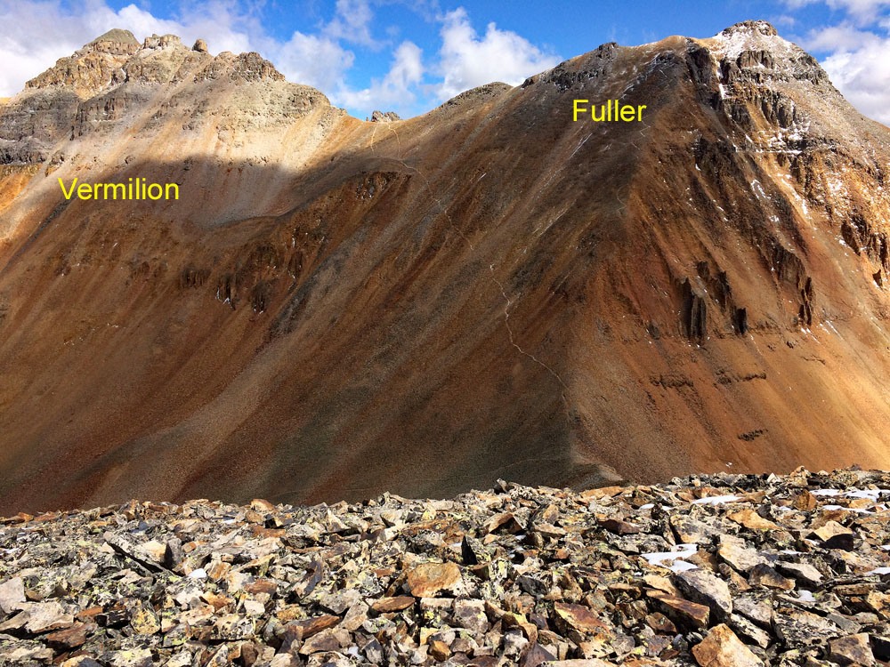
From the summit of Beattie Peak, continue north toward Fuller along the same relentlessly rocky ridge that has led to V.8 and Beattie. Before departing the summit of Beattie, you may want to make a decision as to whether or not to include Fuller and if you do, then which way you want to approach its summit. From the main cover provided, you can see two clear trails. One heads off the Beattie-Fuller ridge from just north of the saddle and angles left to intersect the Vermilion-Fuller saddle. Another trail continues directly up the SSW ridge of Fuller with numerous switchbacks showing. It would make some sense to head directly up the SSW ridge except for the steepness of the grade and the rock conditions which make this a rather less-than-pleasant ascent. There's plenty of loose, broken rock to go around, but the rock sizes diminish some from those on the lower ridge as you pass over V.8 and Beattie. The use trail will greatly assist in getting through all the rock. It took us about 40 minutes to make the traverse from Beattie. From the Fuller summit, if not too distracted by the amazing view, study the route to Vermilion. A trail should be evident that avoids most all of the ridge difficulties.
-
Vermilion Peak SE Ridge Class 2+ / 0.6 mi / 395’ One-Way
Click thumbnail to view full-size photo + caption
Open This Route in a New WindowVermilion Peak is part of a sequence that includes V.8, Beattie, Fuller, then Vermilion followed by Golden Horn. One-way mileage and elevation gain is measured from the summit of Fuller. Round-trip mileage and elevation gain assumes completion of the sequence. That sequence can be shortened a little by excluding the unranked Fuller.
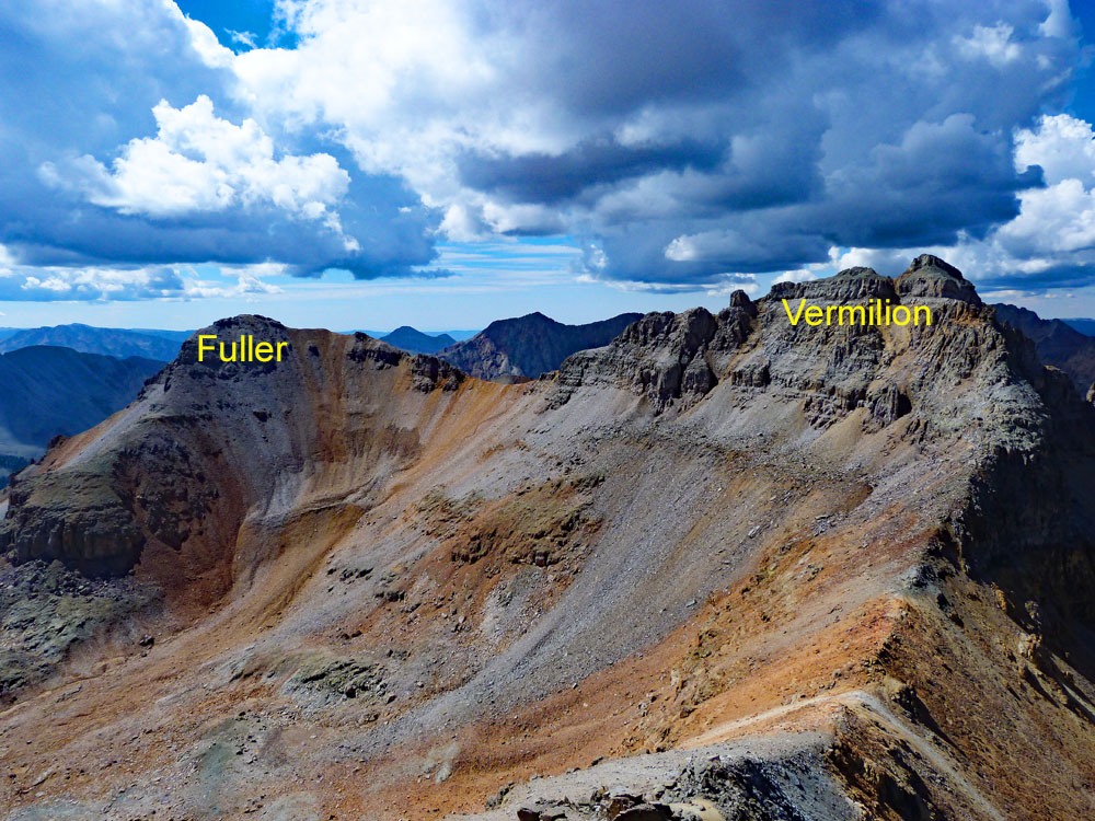
From the summit of Fuller, walk down the ridge to the NW to the Fuller-Vermilion saddle. If you have bypassed Fuller, the trail from the Bettie-Fuller saddle will intersect at the Fuller-Vermilion saddle. From that saddle, continue NW along the ridge following a trail that stays mostly on the south side of the crest. Even in 1993, this trail was well-established and easy to follow. For the most part, this ridge is a Class 2 walkup. There may be a little trouble with the trail about mid way up around a tower on the ridge. Just look around, and then at the summit finish, a short, loose scramble will complete your efforts. The entire ridge route is on rock of varying sort - no tundra. The rock was all reasonably stable. The traverse from Fuller to Vermilion will take about a half hour. If you're the more daring type, you may want to survey the ridge on down to the Vermilion-Golden Horn saddle. It's a daunting prospect. Most trip reports we could find do not mention attempting navigating this ridge. As per G&M, most persons return from the Vermilion summit back to the Vermilion-Fuller saddle, then traverse over to the Golden Horn-Vermilion saddle below the cliffs on the Vermilion NE face via a sloping bench of rubble.
-
Click thumbnail to view full-size photo + captionRoute Description
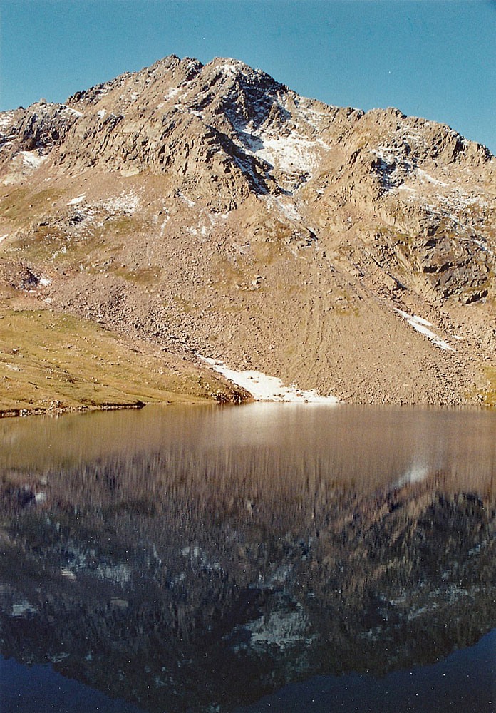
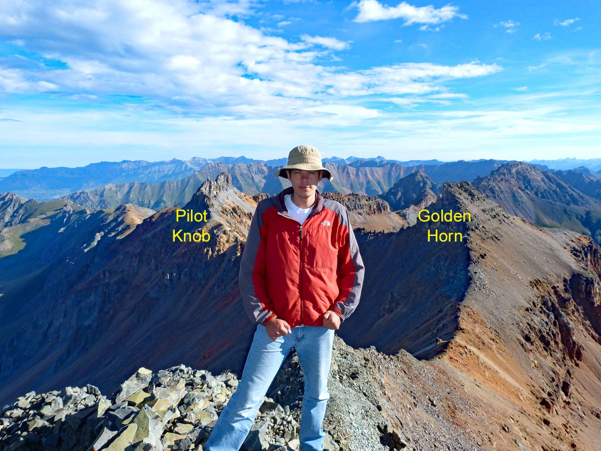
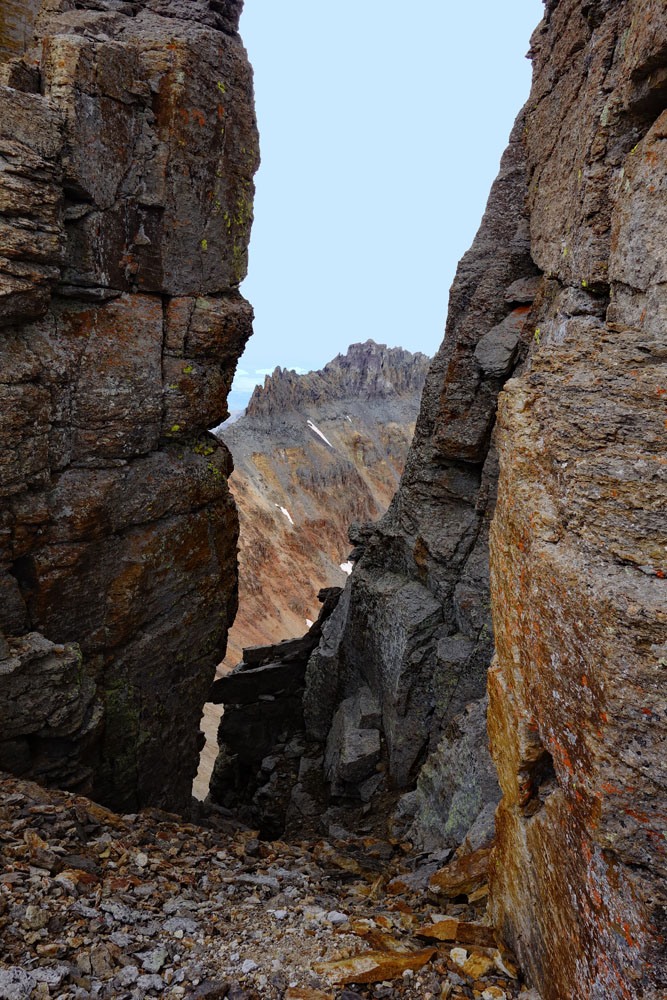
Year Climbed: 1993Golden Horn is the final summit in a sequence of peaks that includes four ranked and one unranked summit. One-way mileage and elevation gain is measured from the summit of Vermilion Peak. Round-trip mileage and elevation gain assumes completion of the entire sequence. When viewed from Ice Lake, Pt. 13,230 may be mistaken for the Golden Horn summit. That point actually obscures the true summit until you either proceed further up toward Pilot Knob or toward Fuller Lake.
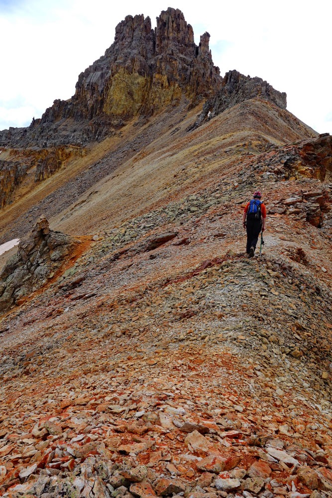
As previously mentioned on the Vermilion route description, an effort to descend the NE ridge of Vermilion and head directly to Golden Horn will be somewhat thwarted by cliffs you will not be able to detect from the Vermilion summit. We chose to follow the route suggested by G&M which took us back from the summit of Vermilion back down to the Vermilion-Fuller saddle. At the saddle, drop down to the north less than 100 feet in elevation to a shelf/bench that contours almost all the way over to the Vermilion-Golden Horn saddle. This shelf is located a little below the precipitous NE cliffs of Vermilion and the talus that accumulates directly below the cliffs. The shelf averages about 13,450 ft. in elevation. Footing tends to be on smaller loose rock to begin with that becomes typical talus. If you're lucky or timed things right, a snowfield can be found along this shelf that often persists all the way through July and even into August. The snow will greatly expedite the traverse and remove the tedium. Here's where an ice axe is useful for some security.
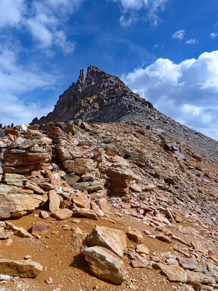
Once across the shelf, intersect the Vermilion-Golden Horn saddle at 13,380 ft. Absorb the spectacular view of Golden Horn ahead. Continue NE along the ridge heading toward the Golden Horn summit, but at some point, veer off onto the SE face to pick up the standard ascent route coming in from Ice Lake. Finishing the 400 foot ascent will go rapidly. It's mostly walk-up terrain with the Class 2+ work arriving as you near the main summit. Climbers will be on either good rock or shelves with gravel gullies in between. Scramble on to the summit, passing a large cleft that frames out a nice view of Pilot Knob. This overall gradual ascent is quite a contrast to the near vertical north face of the peak. The view from the summit of Pilot Knob is both spectacular and informative, if you have not climbed it yet.
Golden Horn may also be climbed from the ridge that connects it to Pilot Knob. That connecting ridge is mostly a Class 2 walk. The challenge in making that connection is the traverse under the Pilot Knob summit ridge. The traverse is slow and difficult on Class 2+ unstable rock. Tim & Shaun Cooney did this traverse in 2014 by contouring below the summit ridge of Pilot Knob on the east side. It was slow and tedious but doable. The west side of Pilot Knob under the summit ridge is probably similar.
For another perspective of climbing some of the peaks in this sequence, check out Kevin Bakers report on 14ers.com. See link below.
For the descent and return to the Lake Hope TH, descend back down Golden Horn as you came and then drop into the basin WSW of the summit. Descend on good scree to about 13,300 ft. and a shelf, clearly visible on the USGS map. From there, we descended mostly on more scree toward the Poverty Gulch area. Our route took us through another somewhat level area filled with lush grass that offered a brief break for feet tired of all the rock. We then continued on down on scree and rock into Poverty Gulch. We were able to descend about 2,000 vertical feet in about 25 minutes. The loose scree can be great for descending but a nemesis for ascending. We followed the gulch back until we intersected the Lake Hope trail, then concluded the hike back to the TH. The full 3,500 ft. descent took about an hour. The entire circuit took us 8 hours.
Additional BETA
Links to other information, routes & trip reports for this peak that may be helpful.14ers.com › Golden Horn -