LoJ: #542 (Pre-LiDAR #536) / 13,131' Hayden Mountain, North

Peak Summary
Hayden Mountain North is part of the larger designation for Hayden Mountain which on the USGS map extends more than two miles. Hayden North is usually combined with Hayden South, so in our report here, they are sequenced. A difficult and extended ridge connects these two ranked summits. To keep the route at a Class 2 level, our description calls for descending into the headwaters of Fall Creek, then re-ascending to gain Hayden North. The trailhead access is located along US550 near Ironton, so it is accessible to all passenger vehicles. Superb scenery and some wildlife viewing accompany this hike. Lidar subtracted 8 feet from this summit making it 13,131 ft. from a previous elevation of 13,139 ft.
Hayden Mtn North South Ridge Route
-
-
Ironton Park TH
From Ouray, drive south on US550, up the switchbacks out of town, through the Uncompahgre Gorge, and up the four switchbacks into Ironton Park - a surprisingly large, flat valley area that extends for over two miles. Driving south, the Hayden Mountains will be on your right (west). Though it's not very visible from the highway, there's a road that extends all along the west side of Ironton Park that goes in and out of trees and stays right at the base of the mountains and on the edge of the open meadow. This route will utilize that road.
Drive to the south end of Ironton Park and the very large tailings pond where a secondary, gravel road turns off to the right to access Gray Copper Gulch and Corkscrew Gulch. About 1,200 feet beyond that road, there's a pullout on the right (west) side of the highway with an old cabin. See coordinates below. Park here for the trailhead.
Camping
There are no national forest campgrounds along US550 between Ouray and the turnoff near Silverton for South Mineral Creek. There are however, a number of primitive sites, many of which are fully occupied on weekends. The previously mentioned road that turns off for access to Gray Copper and Corkscrew Gulches leads to a nice camping area in the trees with a number of sites. These tend to be occupied by trailer rigs.
If you drive south from the trailhead about 2,000 feet, there's a dirt road that turns off on the left and drops down into the river floodplain. There are numerous sites all through here as well. There are also a few other primitive sites along US550 as it departs Ironton Park heading south. YOu can also find some primitve sites off the highway near the summit of Red Mountain Pass.
-
From Hayden Mountain, South
Click thumbnail to view full-size photo + caption
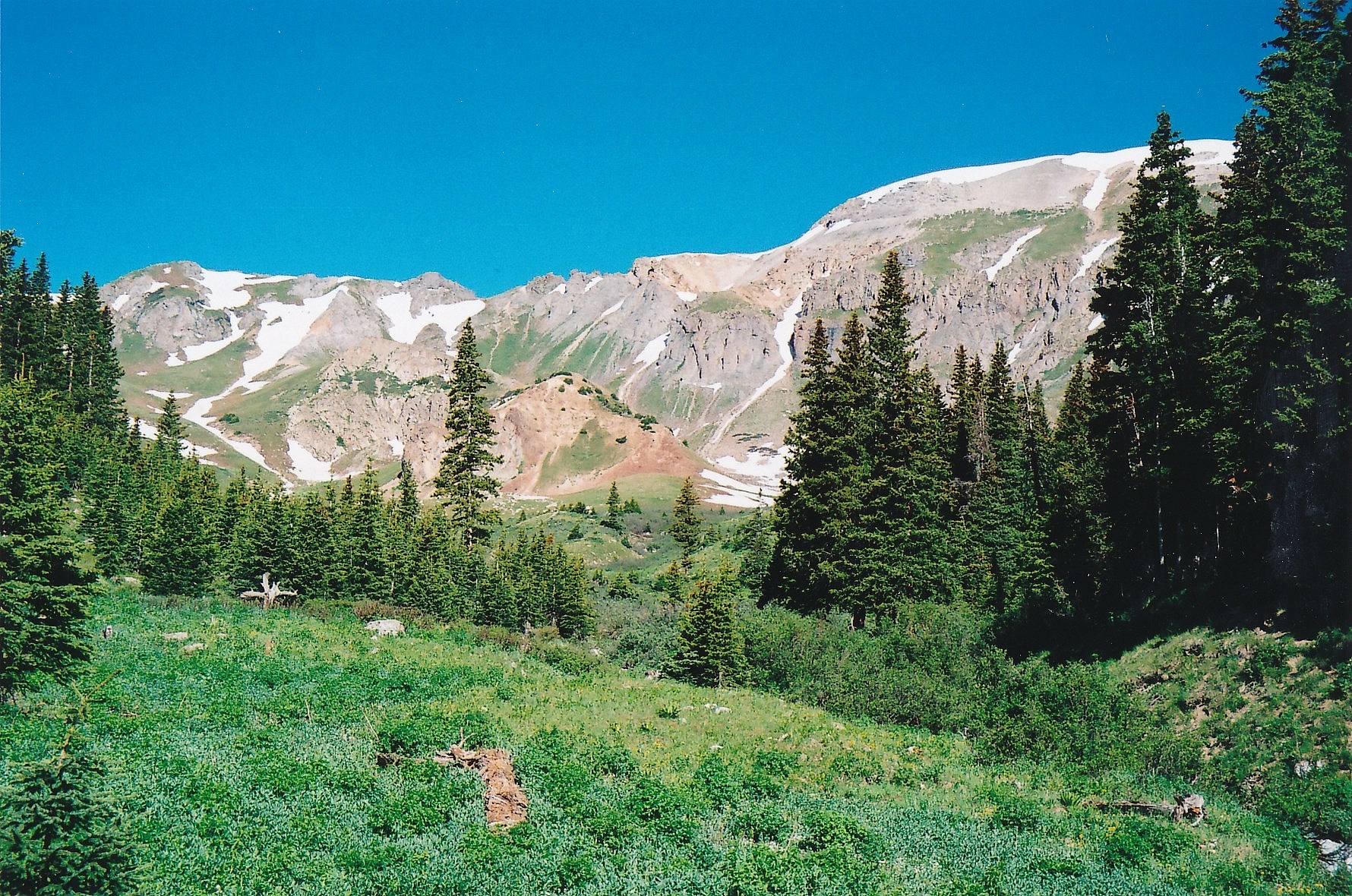
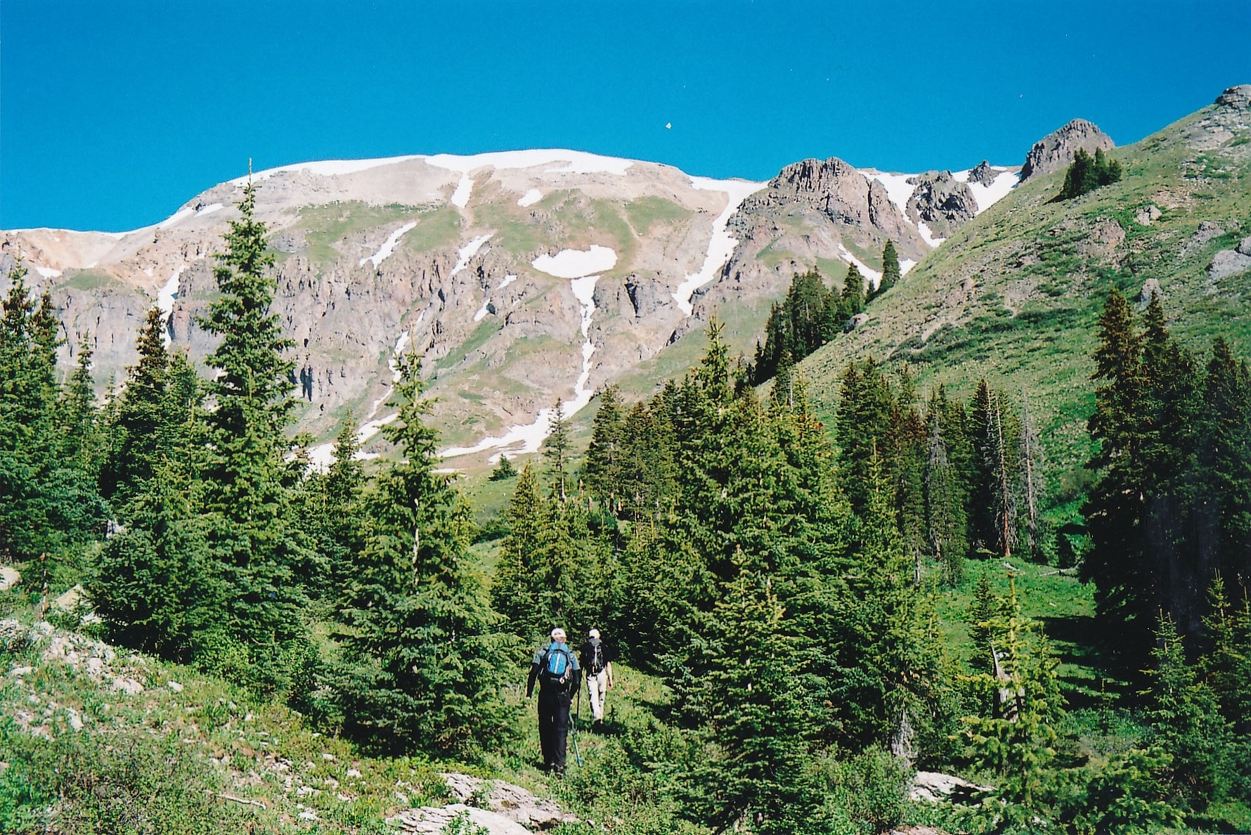
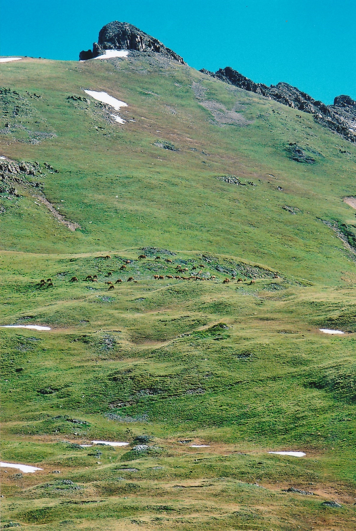
Open This Route in a New WindowFrom the trailhead parking, locate the road that heads off NE, then north to parallel the west side of Ironton Park. Generally, the road stays in the trees, just above the meadow. After walking north for less than 15 minutes, veer off onto an old mining road climbing west up the steep hillside. For a short time, this road is an assist, but it plays out near Full Moon Gulch. When it does, struggle west up the gulch, above the creek, on a very steep hillside with loose scree before reaching firmer footing several hundred feet up. Eventually break out of the trees and into the open basin of Full Moon Gulch where you will be southeast of Hayden Mountain South. We spotted some elk grazing in this basin and a deer or two. Proceed northwest toward a steep gully coming off the northeast flank of Hayden South. Hike toward the base of the gully and begin the steep ascent. Along the way up, we paused for a while to observe a deer in a parallel gully that was watching us closely. Continue the steep hike up mostly tundra toward the summit of Hayden. The basin we ascended out of was mostly free of snow, as was most of our route. The 2007 winter had not been a heavy snow year in these parts. In heavier snow years, you may find some larger snowfields left in here and an ice axe may be useful.
The gully we used brought us out near and to the left (south) of Pt. 13,009. Hike on SW to the actual summit. From here, we could see that if we had come in from the Richmond Pass trail and then up the south ridge of Hayden, it would not have been that difficult. In fact, two men we met later this day confirmed that to us. In retrospect, we should have used this Richmond Pass trail. It would have saved a lot of struggling up Full Moon Gulch. The start of that trail is a little difficult to locate. There are apparently two possible starting points for it, with both coming out on US550 not too far past the trailhead we have posted for this route. If you wish to try the Richmond Pass trail, here are two possible coordinate sets for a start: 1. N 37° 55' 57' W 107° 41' 04" 2. N 37° 56' 06" W 107° 40' 51".
Click thumbnail to view full-size photo + captionRoute Description
Year Climbed: 2007Hayden Mountain North is sequenced with hayden Mountain South. One-way mileage and elevation gain is measured from the south summit. Round-trip mileage and elevation gain assume completion of the sequence.
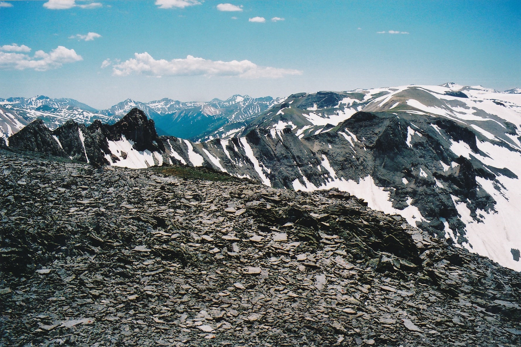
From the summit of Hayden Mountain South we attempted to descend northeast along the ridge toward the north summit but quickly came to a steep and intimidating section with no easy route to discern. We explored down the ridge some on the south side, but came to a severe drop just east of the 13,009 marker on the USGS map. So, we returned to the summit and decided on plan B. We will also mention that had we negotiated this section of ridge successfully, we would still have had a serious problem clearing the unranked 13,023, pyramid shaped summit blocking the ridge over to Hayden North. The west face of this obstacle is steep gullies filled with rubble and the north ridge of it is a cliffy array of rocks.
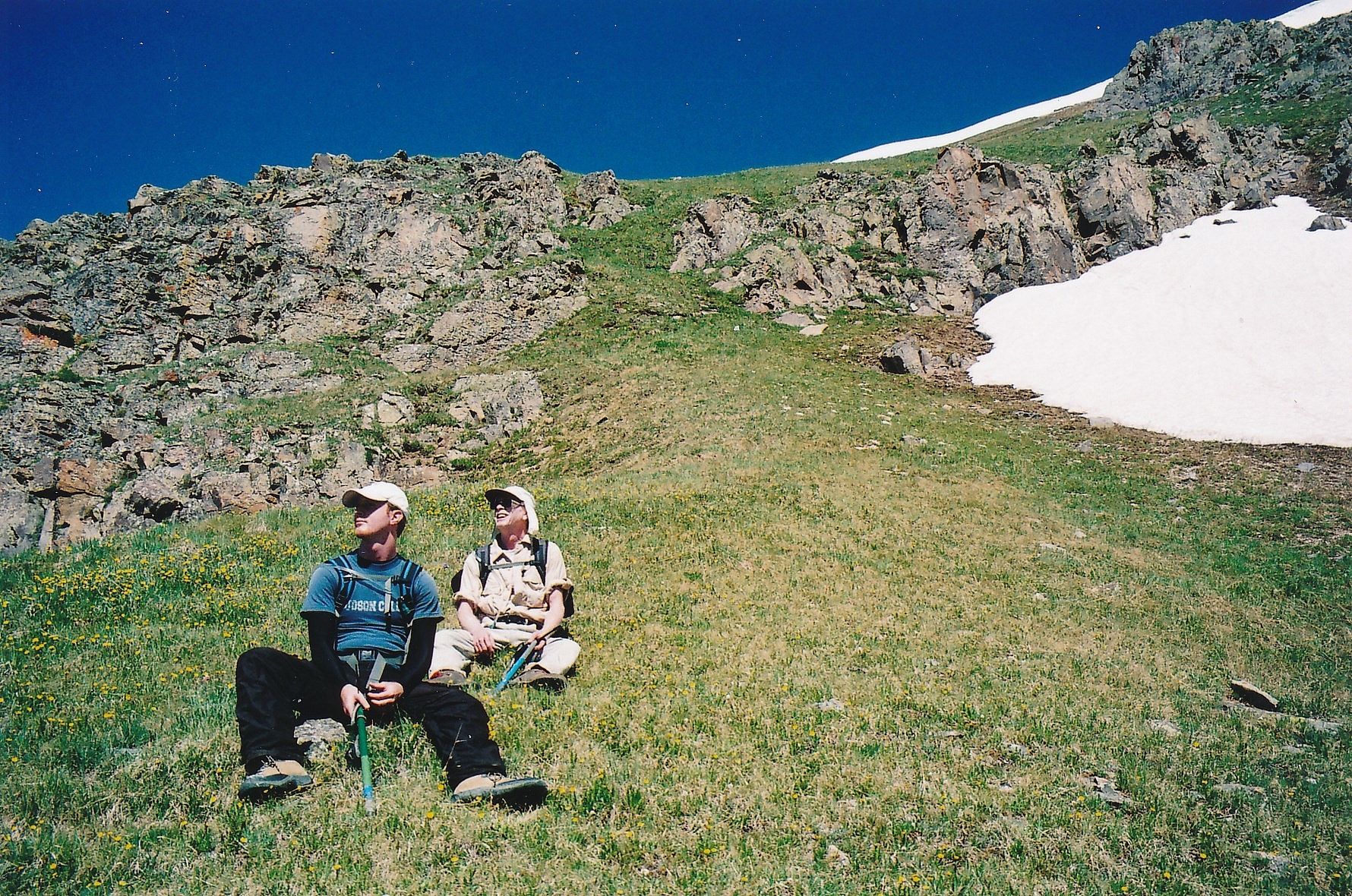
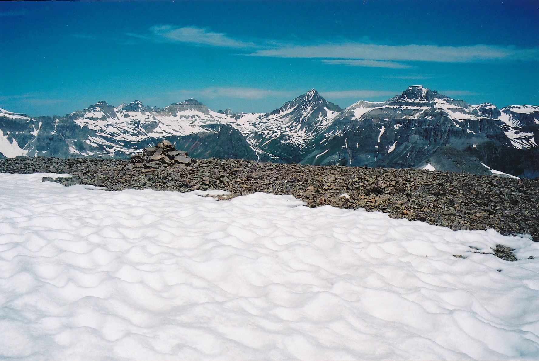
From the summit of Hayden South, descend by going a little west and then north, enjoying a rapid glissade on vast snowfields in June. Later season, probably talus. The snow was already quite soft and we broke through the crust in many spots. As we approached the basin head of Fall Creek, we began a contour northeast toward Hayden North and crossed as much as possible on snow, but also had to negotiate some rock fields/ rock glaciers. We were heading toward a game trail we could see that climbed out of the basin and ascended toward the saddle south of the Hayden North summit. We easily gained this trail and followed it up for some distance to the saddle. From there, it was relatively easy walking to the summit. This lengthy descent, traverse and ascent cost us nearly two hours. Enjoy the vast views, especially to the north. This is a great place for a lunch break.
After your lunch break, depart the summit and begin the descent into Half Moon Basin, southeast of the summit. The plan is to follow a large, wide avalanche path that descends all the way from the basin to the flat, Ironton Park meadow, pick up the same road you started out on in the morning that runs parallel to the meadow and walk back to the trailhead. The 3,000 ft. descent is a relentless affair on legs. Lupine dotted the steep, grassy slopes. The one redeeming aspect of this descent came near the bottom, just before we reached the old road. At this point, I was just ahead with Shaun and Carrie following. About 20 yards ahead, I spotted a cow elk, standing in the aspen trees and not running away, which they usually would have done. As I followed a faint path that led in her direction, she slowly moved off. When I came to where she had originally stood, there was a small clearing in the trees and lying on the ground, was a newly born calf. It was just beginning to try and struggle to its feet. Just to the side, the mother’s placenta lay on the ground with flies buzzing around it. The little calf was still covered with the canal fluids from its mother. We paused to see this most rare site, but quickly realized, we needed to get out of there and away so as to not run the mother off and have her abandon her calf. So we abruptly altered our direction away from the spot and continued our descent through aspen to the old road. Once you reach the road, it will be about a mile and a half walk back to the trailhead.
Additional BETA
Links to other information, routes & trip reports for this peak that may be helpful. -