LoJ: #473 (Pre-LiDAR #475) / 13,217' Homestake Peak

Peak Summary
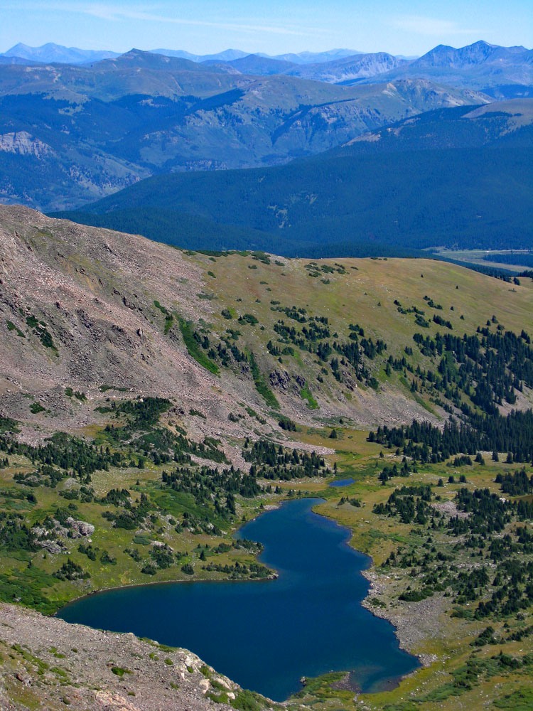
Homestake Peak is an easy Class 2 ascent that takes hikers by the scenic Slide Lake in an area NNW of Leadville and near the continental divide. The trailhead is accessible to 4WD with good clearance. 2WD vehicles will need to park about 3 miles back from the trailhead in the vicinity of the Wurtz Ditch road. This is a great hike for Front Range residents with outstanding views and good for family as well with overall easy terrain. Lidar added 8 feet elevation.
Homestake Peak via Slide Lake Route
-
-
Slide Lake - Homestake Peak TH
The turnoff for Slide Lake and access to Homestake Peak is 1.78 miles south of Tennessee Pass on US24 at these coordinates: N 39° 20' 50.26" W 106° 19' 56.46". Elevation 10,155 ft. Turn west onto CR 19. Drive through a sparse, residential neighborhood and from the highway, go 1.0 mile to an intersection. Turn right, continuing on CR19 which is signed with an indication for the Wurtz Ditch Road which is FR705. CR19 will take you in .8 mile to a pass which is actually the continental divide and the county line for Eagle & Lake Counties. At this pass, FR145 heads off to the left while the Wurtz Ditch Rod continues straight ahead. Take FR145, which will climb uphill to follow the ridge crest somewhat. Up to this intersection, 2WD vehicles should be able to make it, but FR145 definitely becomes a 4WD road. As it makes the climbing section, the road is very rough and narrow. Drivers in city-style SUV's may be inclined to give up for fear of what they may be getting into. But farther on, as the road levels out some, conditions become a little better. From the Wurtz Ditch intersection, it's just over 3.0 more miles to the Slide Lake TH. In 2007, we found a picnic table, fire ring and some parking space. It would be possible to camp here overnight. Shortly before arriving at the trailhead and back a little over .3 mile is the 10th Mountain Division Ski/bike hut. This is a very nice hut that can sleep 16 people with a couple more private rooms. The gentle surrounding terrain with very low avalanche hazard makes this a great winter cross-country skiing area. If you cannot drive all the way to the trailhead, walking this road goes quickly. It's not steep at all.
Camping
As mentioned above, there is camping at the trailhead, though no facilities and there are at-large, primitive sites along the way in on FR145. Most will come once the road levels out some. The nearest National Forest campgrounds are located back at Turquoise Lake, west of Leadville.
Click thumbnail to view full-size photo + captionRoute Description
Year Climbed: 2007When we drove up FR145 in 2007 in out T-100, we did not drive all the way to the trailhead. The rough, narrow first mile and a half of road left us concerned that things would only get worse, so we parked and hiked the remaining distance to the TH. We should have kept going in the truck because the road got better. However, if you do end up hiking the road, once it gets the elevation gain over with, hiking the road goes quickly.
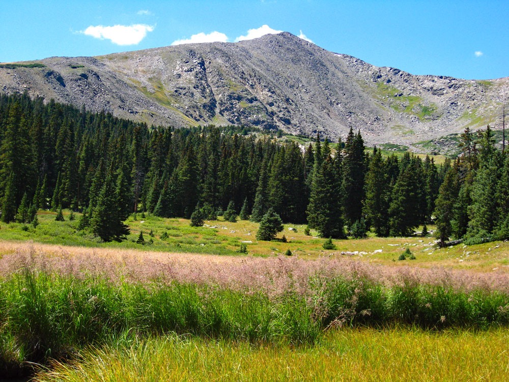
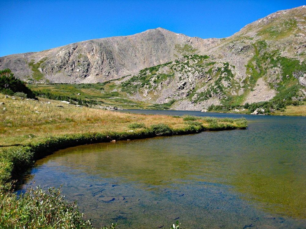
From the trailhead location, a good trail continues on up to Slide Lake which is an attractive, timberline lake with gentle, Colorado peaks behind it. In the winter, we could see several good possibilities for skiing from the 10th Mountain Division Cabin, but these mountains on the west side of the lake may be conducive to high winter winds.
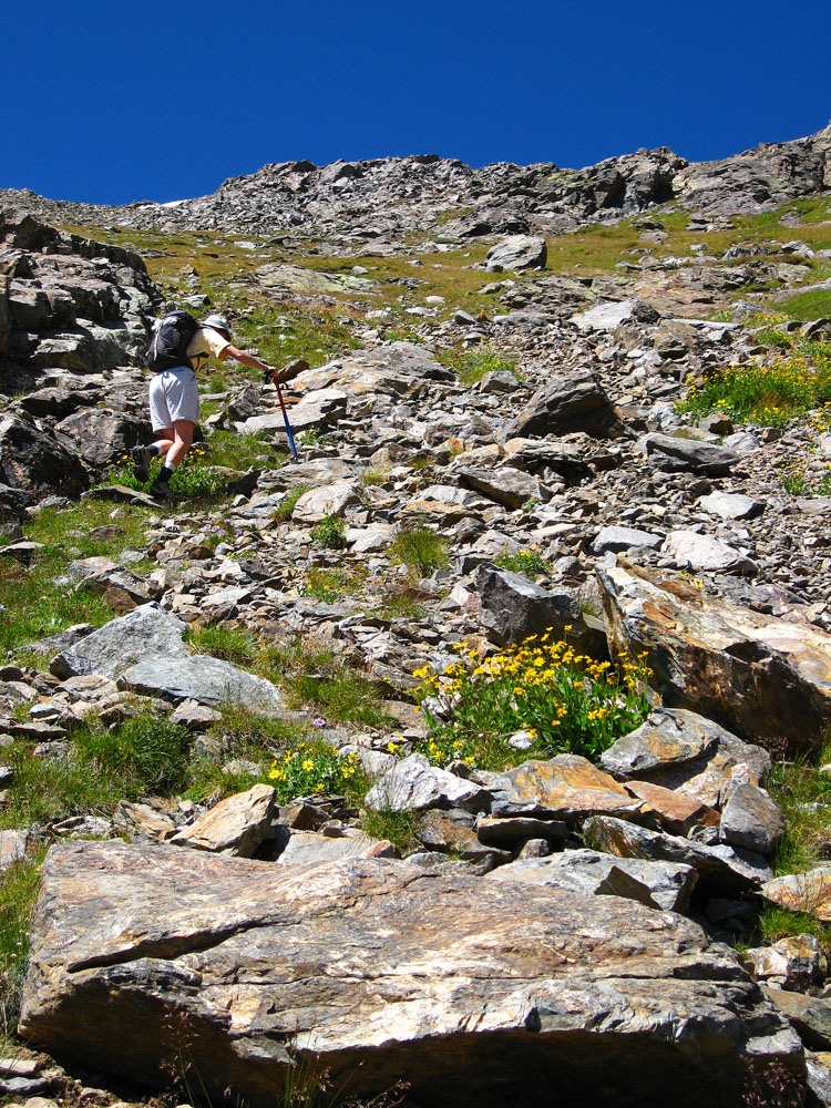
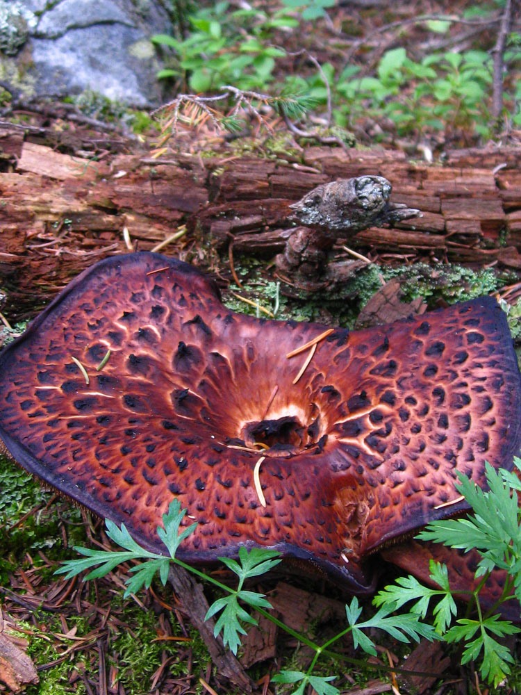
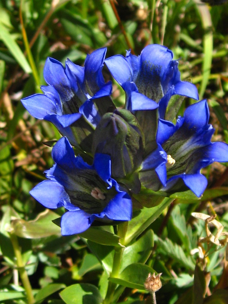
Stroll on past the lake, (stopping for numerous pictures along the way because there are some nice areas of wildflowers to photograph). From the lake, head south and then gradually turn southwest up a broad gully that leads to a saddle north of the Homestake summit which is clearly in view from the lake. There will be some willows to work through lower down. For about half the distance up, you can walk on nice tundra which eventually will give way to the more rocky summit area. Overall, it is easy going with no real obstacles. At the time we hiked this peak, there were abundant wildflowers in this area.
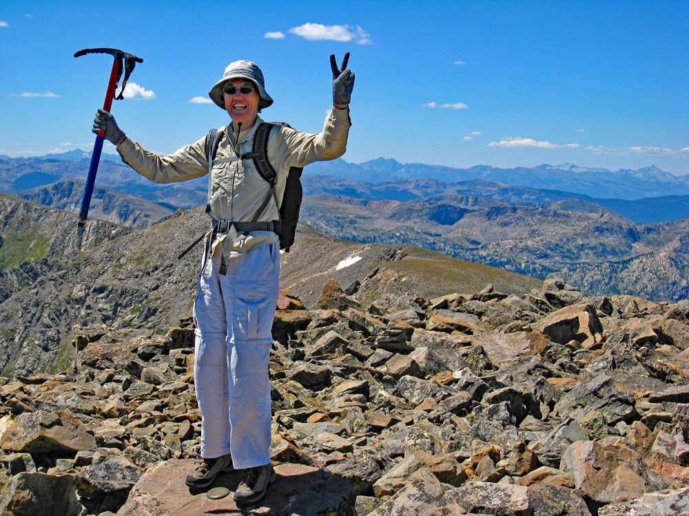
The summit of Homestake is a rocky place (small to medium rubble) with a small protected area built up with rocks that multiple hikers have piled up over the years. A considerable amount of wind was building up the day we climbed so we took shelter in the rocks after marking the event with photos. From the summit, the peaks of the Holy Cross Wilderness are visible to the west including those around the Missouri Lakes. More to the south are the mighty Sawatch summits of Massive & Elbert.
For a descent: Instead of going down exactly as we had gone up, we took a different path and began walking down the very broad east ridge of the peak. This was a nice, typical, Colorado alpine slope of rock and tundra and wildflowers. About half way down this slope, we left it and headed north down a tundra filled trough that led back in the direction of Slide Lake. At the bottom of the trough, we walked on down and dropped into a broad bowl of tall grass and headed more easterly again, hoping to come out on the south side of the 10th Mountain Division Cabin. We passed through some nice forest and meadows that would be excellent skiing with adequate snow and then emerged close to the cabin. Some people were there so we walked on up and asked if we could look around. It was a very nice facility with enough sleeping space to handle 16 people and some upstairs rooms that would offer some privacy. We looked at some of the printed material, talked to the people staying there some and then departed. From there, it's a short jaunt back to the road and wherever you may have left your vehicle.
Additional BETA
Links to other information, routes & trip reports for this peak that may be helpful. -