LoJ: #195 (Pre-LiDAR #193) / 13,590' Matterhorn Peak

Peak Summary
Matterhorn Peak is an often ignored 13er summit while peakbaggers aim for bigger game with two 14ers located so close by - Wetterhorn & Uncompahgre. Matterhorn pairs nicely with Broken Hill for an easy day of Class 2 hiking with just a little scrambling near the summit of Matterhorn. The trailhead is best accessed by stock 4WD, but that's really only the last .6 mile where a secondary road turns off to lead to the trailhead parking area on Matterhorn Creek. Vehicles with better clearance driven carefully should be able to at least make it to the turnoff for that last .6 mile.
Matterhorn Peak SSE Slope Route
-
-
Matterhorn Creek TH
Directions begin from Lake City. From Gunnison, go west on SH50 to the intersection near the beginning of Blue Mesa Reservoir with SH149 and turn south. From Montrose, drive east on SH50 to the east end of Blue Mesa Reservoir for the same turnoff on SH149. Drive west and south on 149 to Lake City, just over 45 miles from the previous intersection. Once in Lake City, watch for either 3rd or 2nd street. Turning west on either will take you to Bluff St. in two blocks and a left turn (south). 2nd St. is considered the "official" access to CR20 which heads west following Henson Creek, but if you take 3rd St., it passes by a nice city park with restroom and picnic tables for those who need a break before proceeding further.Once on CR20, drive 9.1 miles west to Capitol City on a graded, gravel road passable to passenger vehicles. On the Gunnison National Forest map, this road is labelled as BLM3303. At 5.2 miles into this drive, you'll pass the Nellie Creek Road (FR877) which accesses Uncompahgre Peak and several 13ers located in that area. At Capitol City take the right fork and continue NW on FR870 (aka: CR24) to the Matterhorn Creek trailhead turnoff at 11.1 miles from Lake City. The road becomes rougher but higher clearance SUV's and cross-overs should be able to handle. Coordinates for the turnoff are: N 38° 01' 22.65" W 107° 29' 31.09". Many vehicles will choose to park here. If you have better clearance, drive north on rougher road (FR870.2A) for just over .6 mile to the trailhead parking area. See coordinates below. There's a small parking area with a gate. Best to have at least stock 4WD for this last section.
Camping
There are no forest service campgrounds along CR20. All camping is in primitive sites which can be found along CR20 and the best location is in the vicinity of Capitol City, but be careful about private property in that area and be aware of weekend, large group incursions if you're looking for peace and quiet. There are also a few other primitive sites at the turnoff for the trailhead both before and beyond.
Click thumbnail to view full-size photo + captionRoute Description
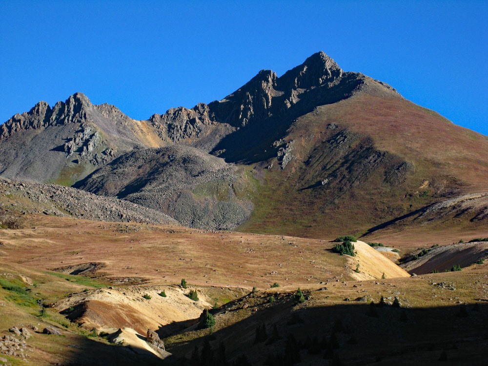
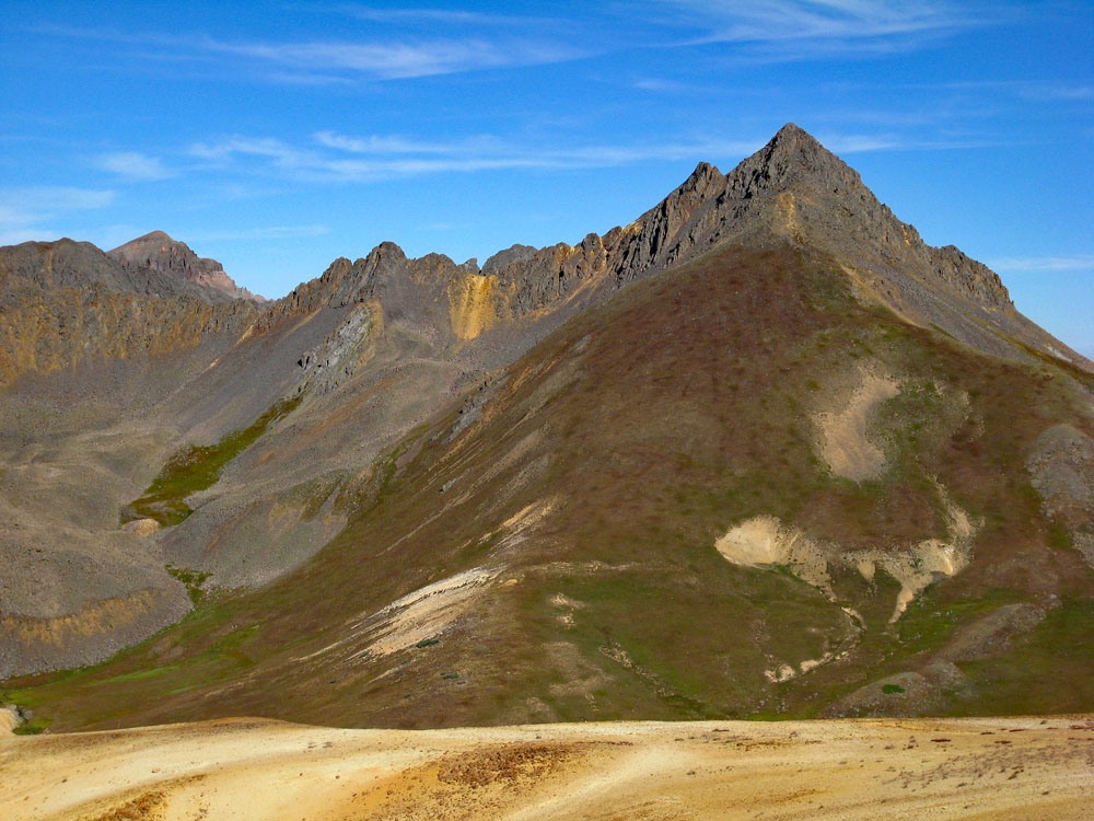
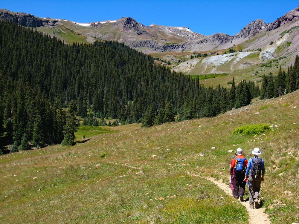
Year Climbed: 1993From the trailhead, hike north on Trail #233. In .75 mile, there's a trail junction. Turn right and follow a set of switchbacks up the mountainside. Soon you'll enter the wilderness boundary for the Uncompahgre Wilderness. After that will be the last trees. Once past these last trees, matterhorn will dominate the view north with Wetterhorn to the left. We don't know if this area is still open to sheep grazing, but in prior years we have encountered a herd up here, so if obtaining water from the creek, filter it. Continue north past the trail that turns off for Wetterhorn Peak and keep hiking all the way to near a saddle at 12,458 ft. marked on the USGS map. Every time we have hiked in this area, we have enjoyed the opportunity to see and watch a golden eagle or even a pair at times. We don't know if they still occupy this region, but keep an eye out for them. They are enjoyable to watch as they soar on the thermals created by the high peaks.
The real climb of Matterhorn now begins. Work you way west and then NW onto the SSE facing slope of Matterhorn. This large slope will be laden with wildflowers in mid-July into August. Tundra terrain will dominate all the way to about 13,300 ft. Impressive views of Uncompahgre Peak will unfold to the east and Wetterhorn to the west as you hike higher. Around 13,300 feet, leave the tundra behind for the most part and finish the summit ascent on embedded rocks/boulders and boulder talus which will require light, 3rd class scrambling. In early season, some of the last 150 feet below the summit may involve navigating a couple of steep snowbanks. Ice axes could be handy. Otherwise, there's just a little bit of hand-over-hand scrambling on the boulders which make you feel a little more deserving of the summit. Have some fun with it. That summit will appear abruptly as a small rocky area with no comfortable flat spots for sitting. The summit affords an amazing view. From it hikers can see much of the Uncompahgre Plateau, the LaSal Mountains in Utah, the Grand Mesa, the San Luis group of peaks, many of the Collegiate/Sawatch peaks, the Elk Mountains, all the summits around Lake City and toward the south, a glimpse of Arrow and Vestal peaks.
For the descent, return as you came or, continue on to Broken Hill.
Additional BETA
Links to other information, routes & trip reports for this peak that may be helpful. -