LoJ: #378 (Pre-LiDAR #384) / 13,319' Mount Alice
Peak Summary
Mt. Alice is a Class 2 ascent by its easiest route with a six mile approach just to get to Thunder Lake, where we started our climb from. Mt. Alice also presents one of the largest technical walls in RMNP. The peak can be done as a long day-climb. The RT mileage would come in at over 17 miles from the Wild Basin TH - a hefty day for most mortals. So we did it as part of a backpack trip that also included Isolation and Ogalalla Peaks from Bluebird Lake. Camping in this area requires a backcountry permit and must be obtained months in advance. The Wild Basin trailhead is accessible to any passenger vehicle. While presenting a formidable east face, Mt. Alice has a much gentler side to her. Pre-Lidar elevation was 13,310 ft.
Mt. Alice South Ridge Route

-
-
Wild Basin - Bluebird Lake RMNP TH
For Front Range residents, there are several ways the Wild Basin TH can be accessed. Perhaps the most direct and easiest is from Longmont to Lyons on US 36. At Lyons, take CO7 to Allenspark. The Wild Basin turnoff is about 2.4 miles north on CO7 from Allenspark. Watch for signs for the turn to the west off the highway. There are turn lanes at this intersection. You will then be on CR84 West. Follow the paved road to a right hand turn onto the road leading to Wild Basin. The road becomes graded gravel and you immediately come to an entrance station and small parking area for the Sandbeach Lake TH. After the entrance station, the road passes by Copeland Lake. It's about 2 more miles to the parking area for the Wild Basin trails. There is a ranger station here, picnic tables and vault toilets. While there are plenty of parking spots, weekends can see this fill up so earlier arrival is advised. Carpooling is advised.
Other ways to access: From Estes Park, drive south on CO 7 to the same turnoff for Wild Basin. From Nederland, drive north on CO 72 past Ward, Peaceful Valley and Raymond to the intersection with CO 7. Go left on there to Allenspark and then north 2.4 miles form Allenspark for the same turnoff.
Camping
There is no campground at the Wild Basin TH area. There are fee-based campgrounds located at "Olive Ridge," between Allenspark and the Wild Basin turnoff and the "Meeker Park Overflow" north of the Wild Basin turnoff by about a mile and a half. There is little if any at-large camping anywhere close because of all the private property.
-
From Wild Basin - Bluebird Lake RMNP TH via Thunder Lake
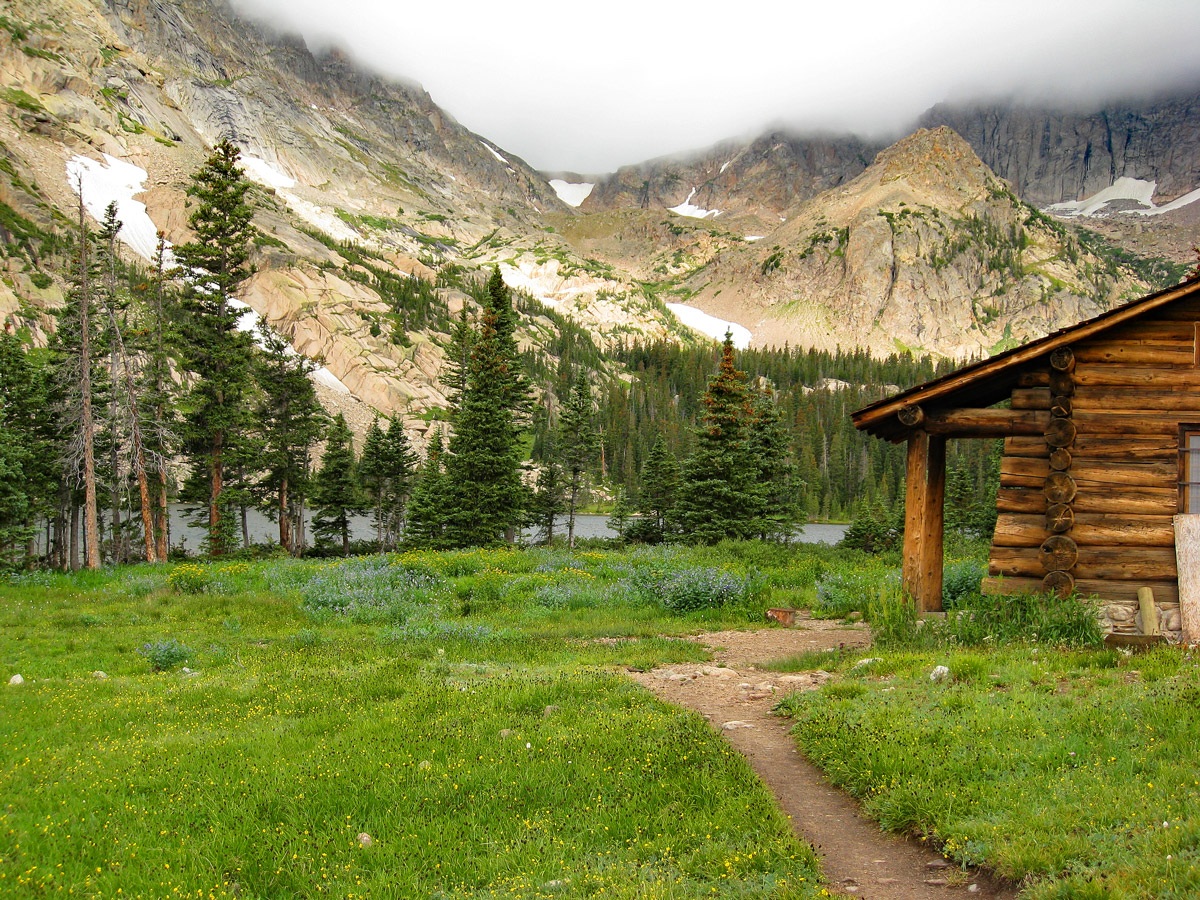
From the Wild Basin parking area, head out west on the trail on the north side of North St. Vrain Creek, called the "Wild Basin Trail." The trail passes Copeland Falls after .3 mile and continues another 1.2 mile to an intersection. This first section of trail has little elevation gain on a wide and heavily used trail. At 1.5 mile from the TH, continue on the "hiker only" trail that heads on up to Thunder Lake (right fork), now gaining more elevation. In another 1.3 miles a trail joins in from the left. (That trail leads up to Ouzel and Bluebird Lakes.) Just beyond this intersection is one of the designated backcountry campsites called the North St. Vrain, because it's located near that creek. It has two tent sites, each of which can accommodate a couple tents and there's a backcountry toilet. It's located in a section of lodgepole forest. Another .2 mile farther is the Siskin campsite. It has one tent site and no toilet. From the prior trail intersection for Ouzel Lake, an additional 1.3 miles brings you to yet another trail intersection. The right fork goes up to Lion Lake. Take the left fork here for Thunder Lake, which will be another 1.8 miles. There is another backcountry camping site here that accommodates horses. There are three sites and a backcountry toilet. The trail all the way to Thunder Lake is well-used, easy-to-follow and fairly gradual considering it gains over 2,000 feet in elevation over nearly six miles. At Thunder Lake, there is a maintained patrol cabin. The overall location is quite scenic with Mt. Alice and Pilot Mountain dominating the view to the NW. The following link will take you to a RMNP website that provides most of the information you will need to plan a backpack trip into this area.
Camping
See description above for backcountry campsite locations.
Open This Approach in a New Window
Click thumbnail to view full-size photo + captionRoute Description
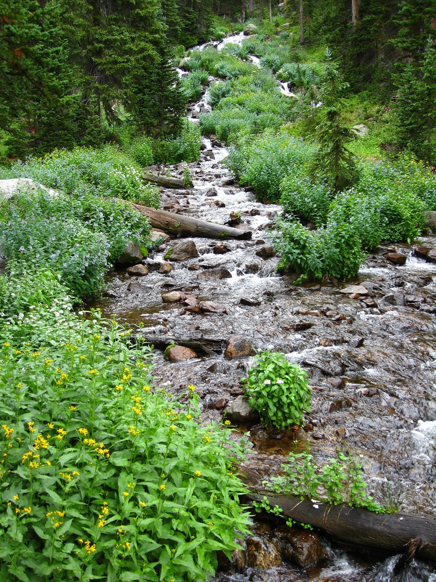
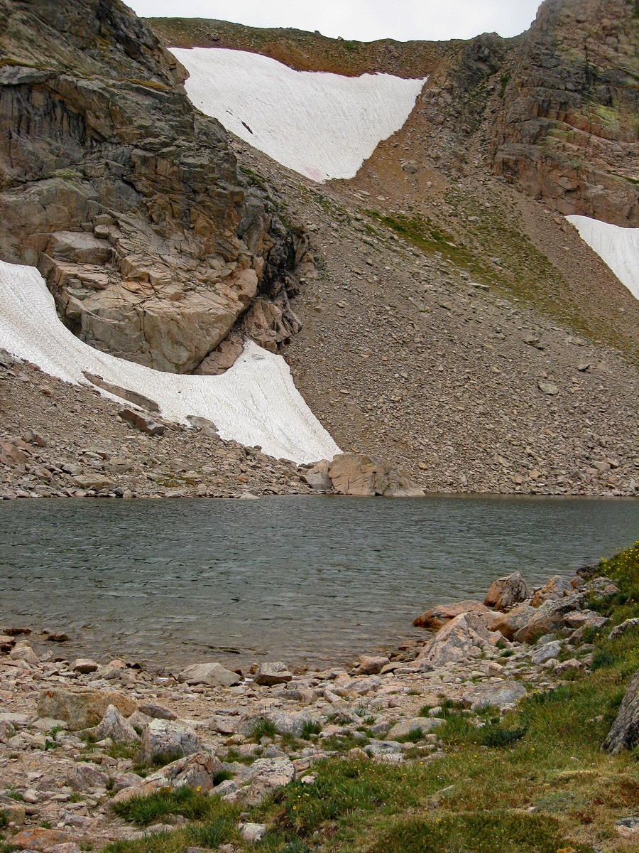
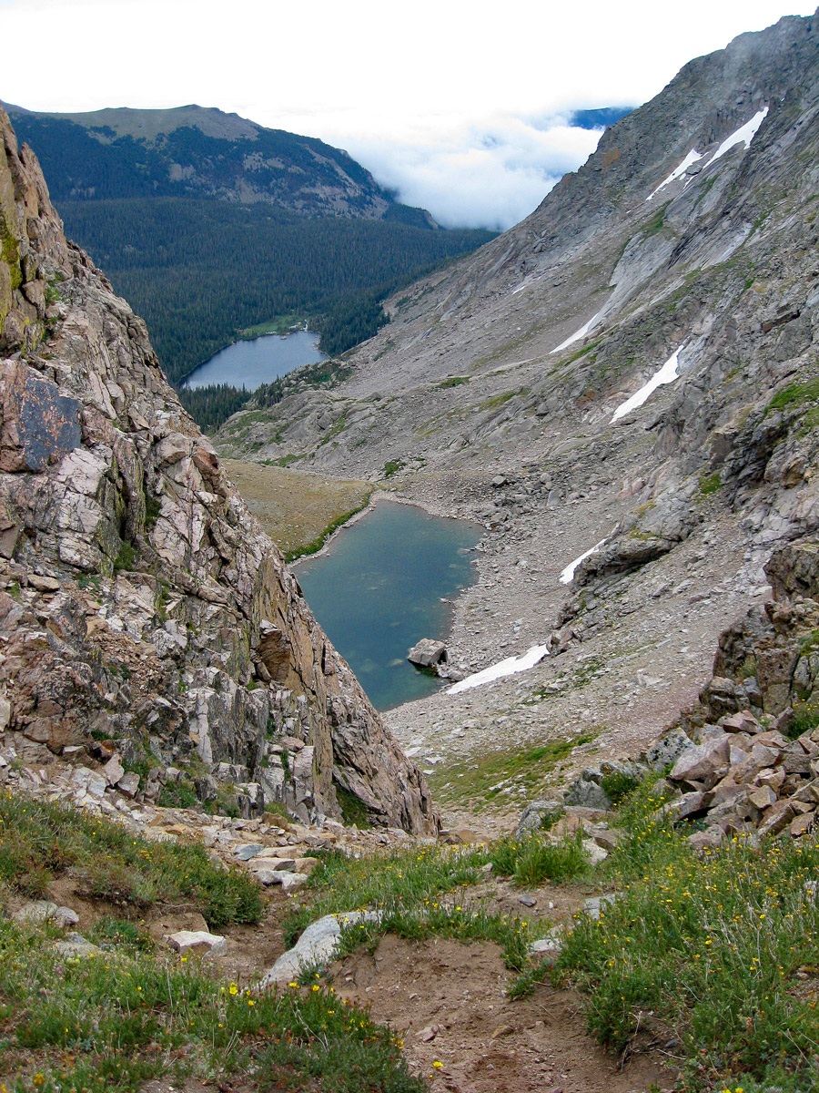
Year Climbed: 2007The route for Mt. Alice begins at the patrol cabin at Thunder Lake. There is a designated backcountry campsite there if you're lucky enough to get a permit. Otherwise, if backpacking in, you may have to stay back at the Siskin or North St. Vrain campsites. At the cabin, you may want to pause for several pictures of the lake, cabin and abundant wildflowers. Begin hiking west from the cabin on a trail that follows along the north shore of the lake and cross the northern of the two feeder streams into the lake. If you're a camera bug, you'll still be snapping numerous pictures. The easy-to-follow trail will lead around the north shore and westward into the forest and up towards the “Boulder-Grand Pass.” You can follow this unmarked trail all the way up to “Lake of Many Winds,” (a very appropriate name). As we stood at this small lake, winds assailed us from above and caused some concern for what we might encounter once on the ridge above. Clouds swirled around the sheer cliffs of Tanima Peak
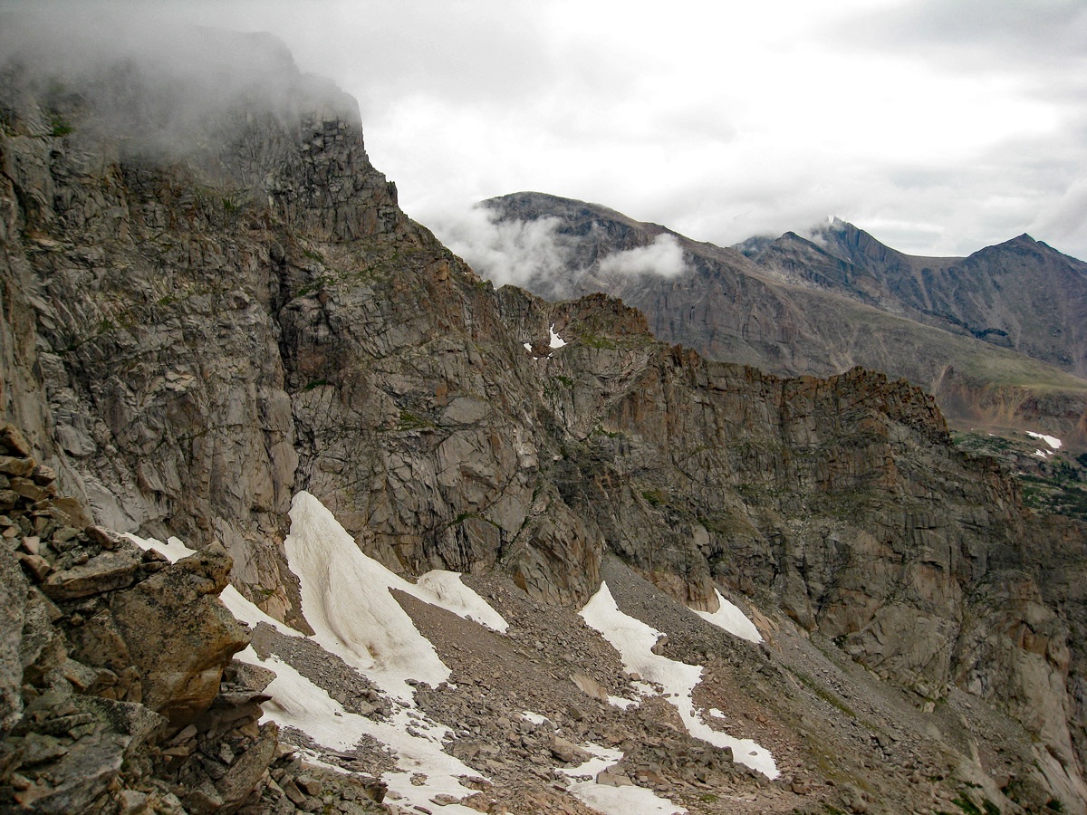
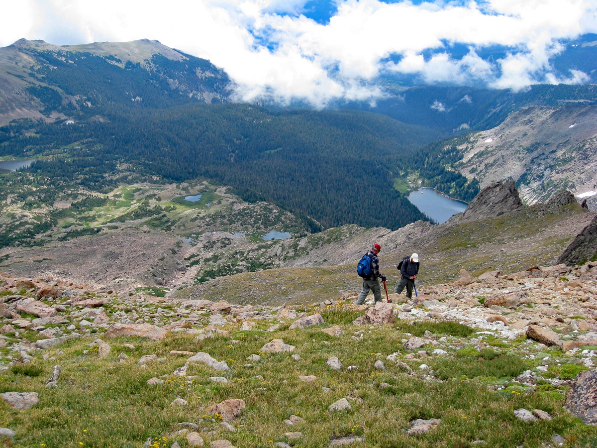
From the lake, it is a steep ascent on tundra, rock and scree to the "Boulder-Grand Pass" with a good 500 feet of stiff gain. We found it windy at the saddle, but once we headed north along the ridge, it wasn’t quite so bad. From the pass/saddle, it's about 1.25 miles to the summit of Mt. Alice by just following the ridge. The hiking is mostly easy across rock embedded tundra. The last few hundred feet to the summit is on larger boulders. Continue to the eastern most of the two summits, but you may want to tag the western summit for good measure. If weather permits you can see over to Chiefs Head, Pagoda and McHenry’s.
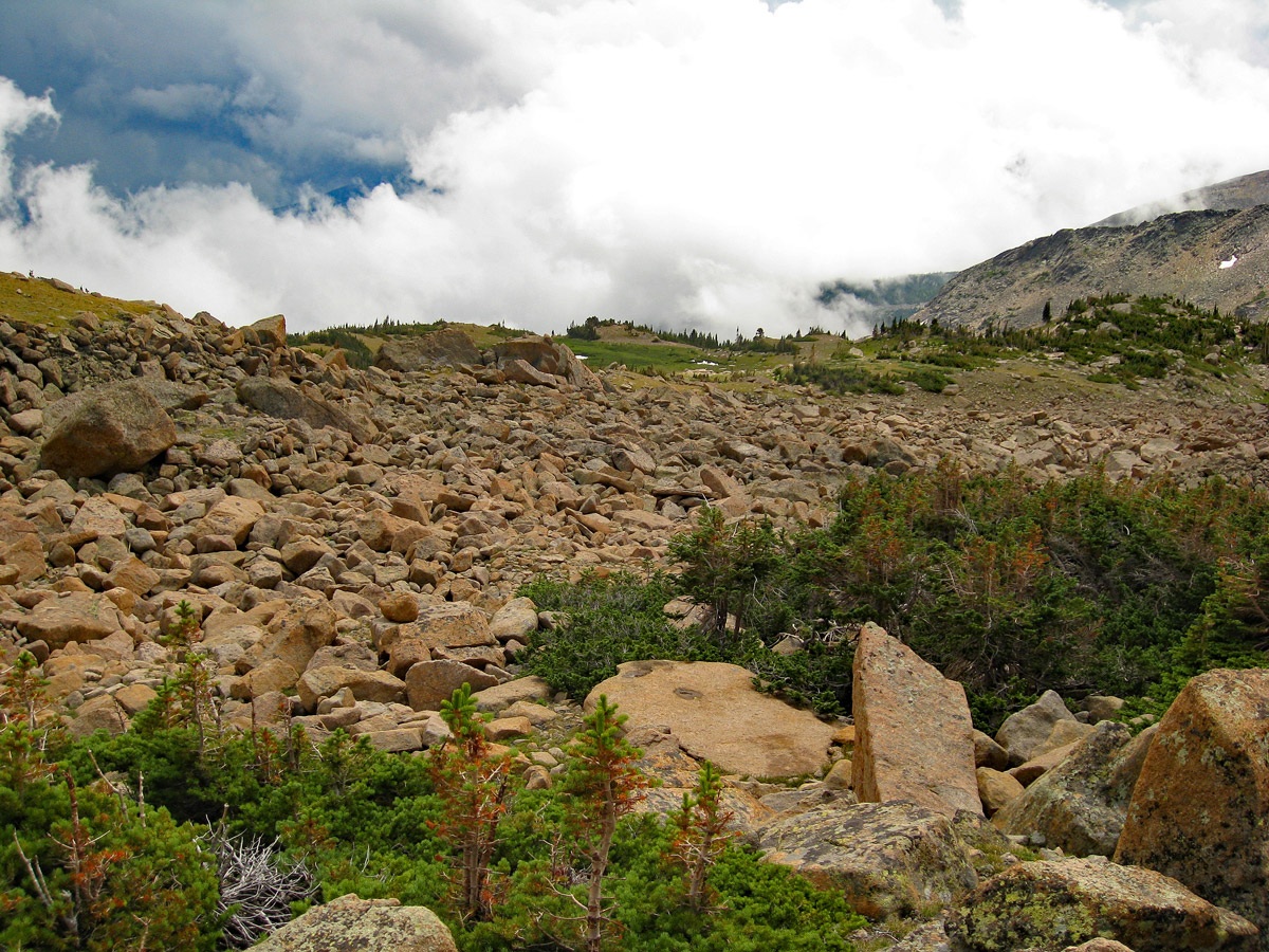
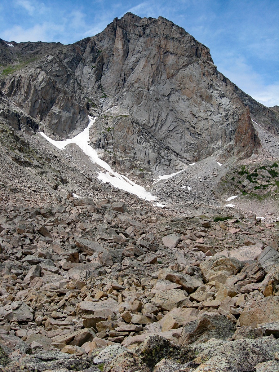
For our return route, we decided to go a different way rather than retrace our route back. If you use this descent route, the Class rating will go to 2+. We headed back down the south ridge of the peak, but after a short distance, veered southeast and descended a moderately steep slope of loose rock and tundra. For a while, we followed a broad ridge that descends east into the large basin east and south of the peak, but then we dropped off the north side and into a rocky basin. Here, we encountered huge boulders that consumed a lot of time to cross over. We paused a few times to admire and photograph the 1,200 foot sheer, east face of Mt. Alice. This expanse of rock looks every bit as challenging as the Diamond on Longs Peak. After much tedious boulder hopping and clambering, we eventually cleared this hazard and began a descent down the main drainage for this basin. The route we followed led us into a forest that was not too hard to negotiate. We were a little off on our expectation of exactly where we would come out. We thought we would emerge out of the forest directly north of Thunder Lake, but actually found ourselves on the Thunder Lake trail, east of the cabin and well on to beginning it’s descent down the valley. The boulder talus made this way down less than thrilling. Also, earlier in the season, you may encounter snow so ice axe could be handy. This descent route does have the merit of giving you a close up view of the impressive east face.
Additional BETA
Links to other information, routes & trip reports for this peak that may be helpful. -