LoJ: Not Ranked / 13,054' Mount Chiquita
Peak Summary
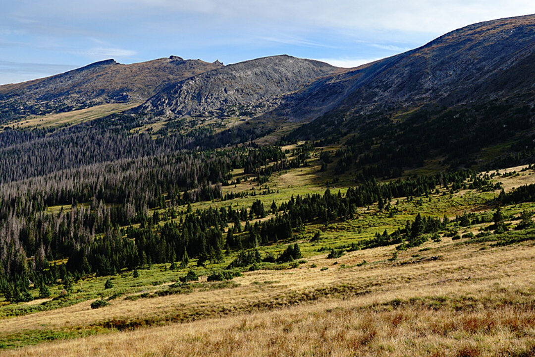
An easy out-and-back day hike from Chapin Pass; a longer and much more strenuous day hike from the Lawn Lake TH and following the trail to Ypsilon Lake; or combine with Ypsilon, Fairchild, Hagues and Mummy as a two-vehicle shuttle for an extremely long day clean out of the Mummy Range covering a wide variety of terrain. USGS map shows the elevation of Chiquita to be 13,069 ft. Lidar has reassigned it as having 13,054 elevation. In either case, it still remains an unranked summit with a 266 ft. prominence above the saddle.
Mount Chiquita/Mummy Range Clean Out Route
-
-
Chapin Pass TH - RMNP
Please Note: The description provided here requires a two-vehicle shuttle. You will begin at the Chapin Creek Trailhead and come out at the Lawn lake TH. The Old Fall River road, is a graded dirt road. Though many if not most passenger cars can negotiate this road successfully, you'll be more comfortable in a higher clearance vehicle.
The Chapin Creek TH is located on the "Old Fall River Road" in Rocky Mountain National Park. This road is One Way, uphill from the access point. From Estes Park, follow HWY 34 or the bypass west to the Fall River Visitor Center and entrance station. Continue west on HWY34 about 2 miles to an intersection just past Sheep Lakes. Turn right onto the Fall River Road and almost immediately right again into the Lawn Lake Trailhead parking area. Leave one vehicle here.( If coming from Grand Lake across Trail Ridge Road, at Deer Ridge Junction, turn left onto HWY34 and drive under two miles to the intersection with the Fall River Road where you will turn left, then right into the parking for the Lawn Lake Trail.)
From the Lawn Lake TH, continue driving west to the end of the pavement at the Endovalley picnic area, another 2 miles. Continue almost another 8 miles on the graded, single lane dirt road to the Chapin Creek trailhead. There is very limited parking here. This is where your very long hike will begin. When you finish you day at the Lawn Lake TH and retrieve your second vehicle at the end of the day you will have to drive west again on the Fall River Road, pick up your other vehicle at the Chapin TH, then continue on to the toTrail Ridge Road Visitor Center. Then, drive back down to Estes Park on Trail Ridge Road, assuming you came from the Front Range. If coming from the west slope, you can continue west on HWY 34 to Grand Lake and beyond.
Camping
There is no "at-large" camping allowed within RMNP, neither can you camp overnight at any of the trailheads. If within park boundaries, you must camp in the designated campgrounds. The nearest park campground is the "Aspenglen." Check the park website for additional information about which campgrounds allow advance reservations and how to obtain those.
Route Description
Year Climbed: 1997Please Note: This peak is included as part of a sequenced, two-vehicle shuttle route description for the Mummy range, including Ypsilon Mountain, Fairchild, Hagues and Mummy. See those peaks for further details if needed. All-aboard for a mega peak day.
From the Chapin Pass TH, head NE on the Chapin Creek trail toward Chapin Pass and then turn east on another trail that leads to Mt. Chapin. This trail does not show on the USGS map but the lower portion of it is indicated on the park brochure map and the NFS map for Arapaho/Roosevelt. Those maps only show it as far as a little above treeline. Since Mount Chapin is a ranked 12er, you might consider tagging it as you pass by, but for the approach to Chiquita, Ypsilon, Fairchild and Hagues, the goal is to reach the saddle between Chapin and Mount Chiquita. To reach that saddle, follow an easy trail that contours upward across easy tundra terrain bedecked with alpine wildflowers.
From the saddle between Mount Chapin and Mount Chiquita, hike NE along a very broad ridge to the summit. You'll be hiking on mostly tundra that will give way to more embedded rocks and some rocky talus. Enjoy the wildflower display.
Additional BETA
Links to other information, routes & trip reports for this peak that may be helpful. -