LoJ: #84 (Pre-LiDAR #83) / 13,860' Mount Edwards
Peak Summary
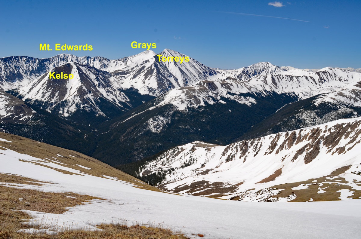
Mt. Edwards makes a very nice, short day-hike for Front Range peakbaggers. An easy Class 2 summit with fairly quick and easy access if you have a vehicle with above average ground clearance. The summit of Edwards offers an impressive view of the 14ers, Grays and Torreys.
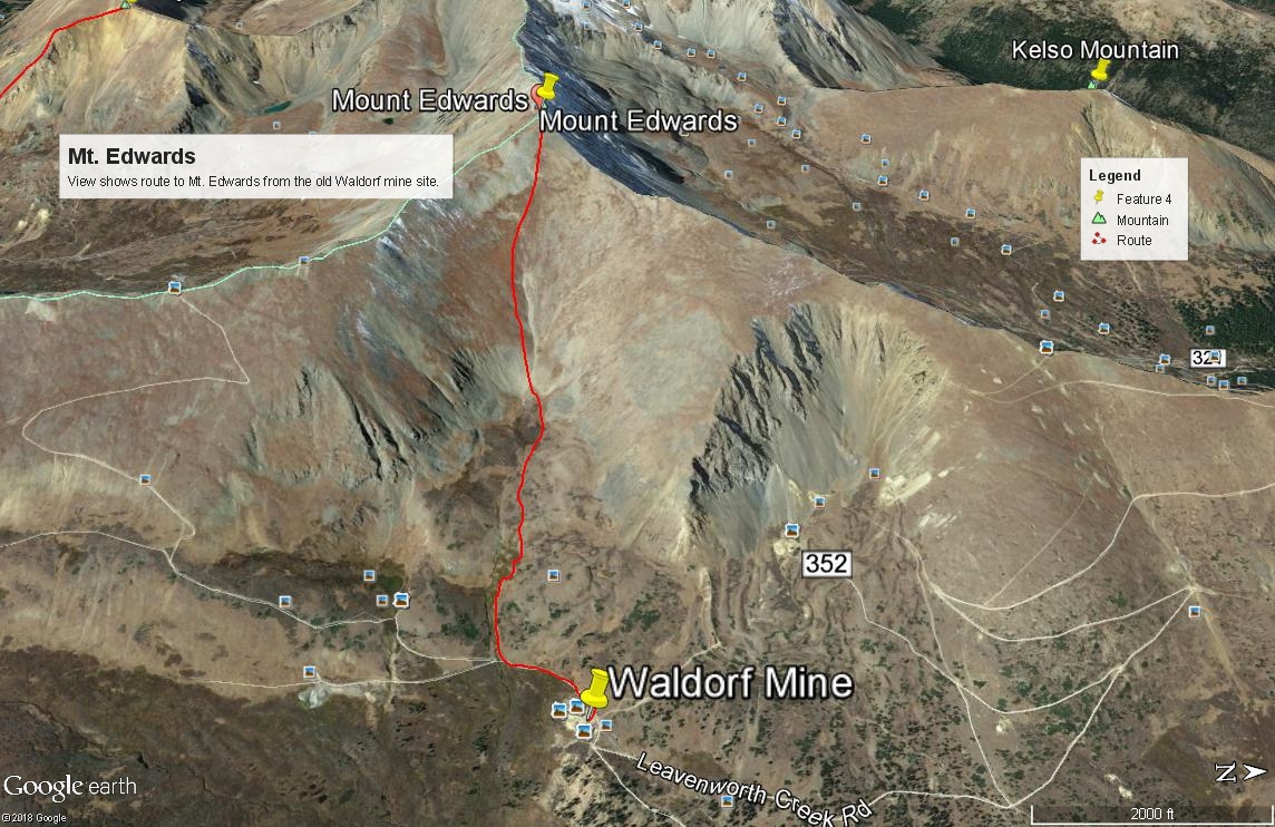
Mt. Edwards East Drainage Route
-
-
Leavenworth Ck - Waldorf TH
From I-70, take the Georgetown Exit 228 and drive east on 15th St. to a traffic circle. Proceed 1/4 of the way through the circle and exit south onto Argentine St. Drive south on Argentine then turn left onto 11th St. Turn right onto Rose St. and head south into the main part of town. Continue all the way to 2nd St. where you'll turn left and will be on SH 381. This is the Guanella Pass Road. Follow it south for 2.7 miles to the turnoff for the Leavenworth Creek Road #352 (aka: FS 248.1). The turnoff is at the sharp curve of a second sharp switchback south of the Georgetown Reservoir by about .7 mile. If you come to Green lake, you have gone too far. The elevation at this turnoff is 9,520 and coordinates are: N 39° 40' 59.55" W 105° 42' 09.83". The road will initially parallel above the highway, then make a sharp switchback to head up to a crossing of Leavenworth Creek. After that crossing, there will be three more sharp switchbacks before the road joins the old railroad bed and stays on it all the way back to Waldorf. The most difficult & rockiest part of this road occurs before joining the railroad grade. If you make it to that point in whatever vehicle you're driving, you can likely make it to Waldorf. 4WD is not necessary for a railroad grade road, but good clearance is helpful.
It's about 5.6 miles up the Leavenworth Creek Road to the old site of Waldorf. The road is dirt/gravel and is best driven in at least a higher clearance vehicle. This area is very popular for weekend visitors in ATV's and various 4WD vehicles. When we lived on the Front Range prior to 1990, visiting up Leavenworth Creek was one of our favorite places to go for a quick mountain getaway. As you head up this road toward Waldorf, there will be several at-large primitive campsites if needed, most of them located well up canyon, but expect most all to be occupied on summer weekends. Park at the old mill site at Waldorf at the coordinates provided above the map. Many vehicles will stop here during the course of the day, so if you would like to park your vehicle a little more out of the way, continue south up the road another half mile to a small pond where you can park at: N 39° 37' 59.26" W 105° 46' 11.15". (A report provided to us in 2020 indicated confusion with the roads beyond this point and difficulty in locating the "pond.") Beyond the Waldorf mine area, the road begins to deteriorate & become rockier. Parking at either of the two locations makes a good start location for Mt. Edwards, Wilcox, Square Top or Argentine.
The townsite of Waldorf was established in 1867, three years after a large silver vein/deposit was found in this area. John Edwards Wilcox, a Methodist minister, had much to do with the development of Waldorf. You can read more about the history of this area at: https://www.summitpost.org then search for Mount Wilcox under "Climbing, Hiking and Mountaineering."
Camping
The closest National Forest CG is further south on the Guanella Pass road. There are two: the Clear Lake and the Guanella Pass CG's. Otherwise, you can hope to get lucky and find a primitive site as you head up Leavenworth Creek. One of the best possibilities appears to be here: N 39° 38' 41.64" W 105° 45' 17.62".
Click thumbnail to view full-size photo + captionRoute Description
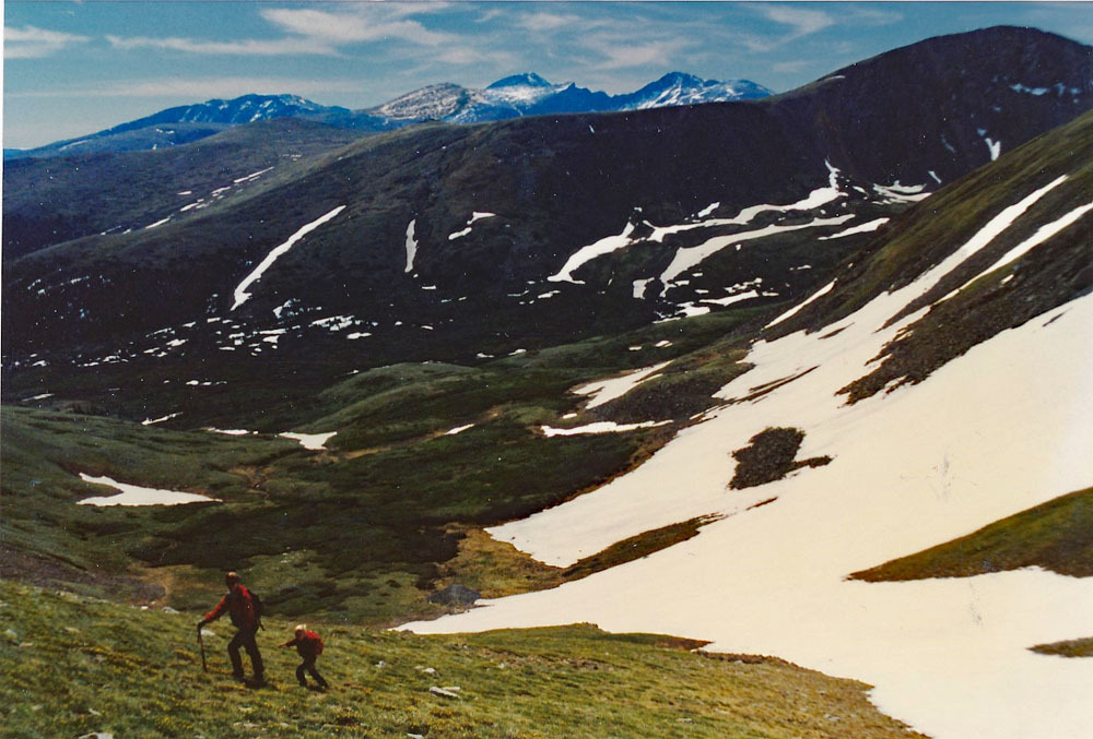
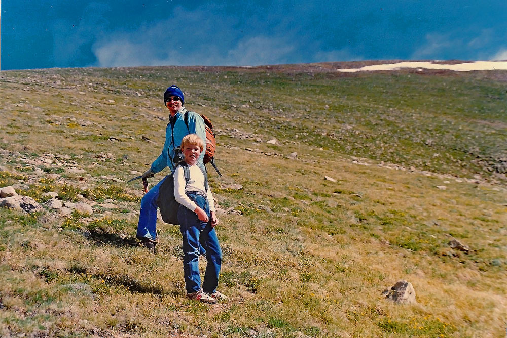
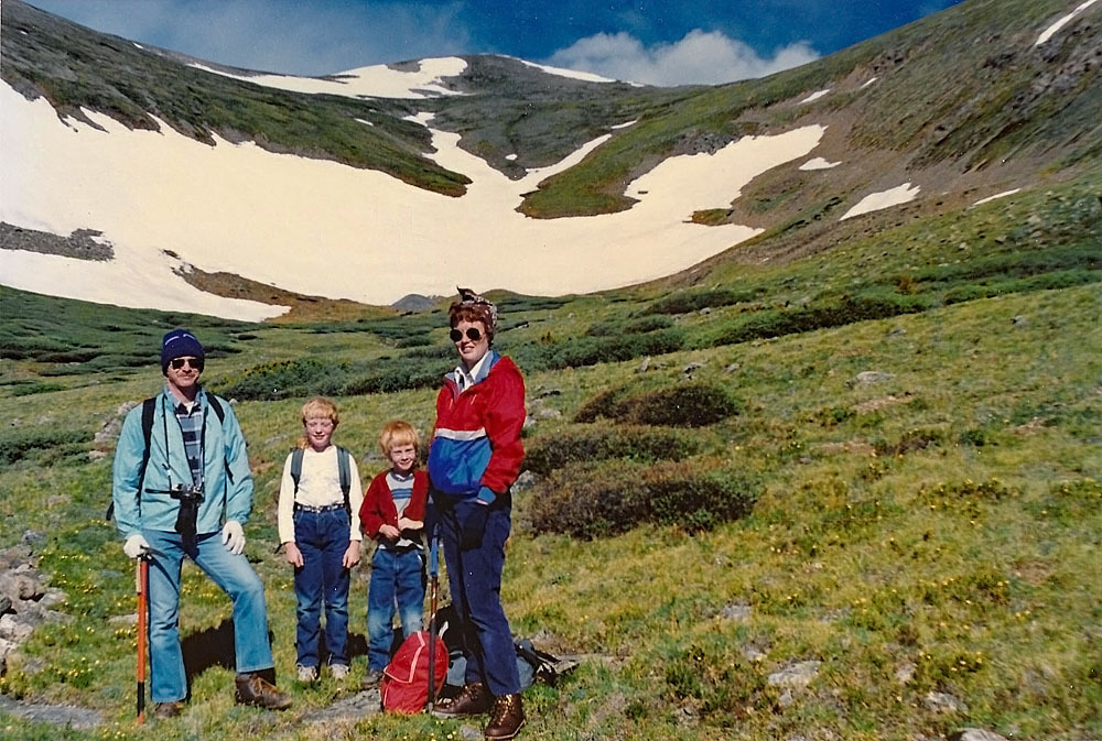
Year Climbed: 1988This is considered the "classic" approach route for Edwards. It can also be used as a route for Grays Peak. From the Waldorf Mine site, walk along the main road to the south until you come to the crossing of the unnamed stream that drains the eastern slope of Mt. Edwards. It's about .3 mile. No need to cross the stream if it is flowing. Turn right (west) and begin heading up the drainage. A trail leads west for a little while then fades. Watch carefully for an old mining road that has become somewhat obscured that works up the drainage, staying on the north side of the stream and well away from it. This track will help you skirt the willows found along the stream. Pick up a second track that will lead west even farther, again, skirting willows on the north side of the stream. These tracks can be faintly seen on GE.
At 12,300 feet, you'll be past the willows. The basin in late June and July holds many wildflowers. For the next 250 vertical feet, the slope will steepen and become rubbly. In the earlier summer season, the main drainage may be filled with snow and offer both a snow climb and nice glissade descent if you like. Above that section, the slope angle relents a little and the terrain becomes mostly tundra with embedded rock and minor scree. Take the path of least resistance all the way to the summit ridge. The south side of the center drainage seems to have more tundra. If interested in tagging McClellan, you can veer right to the saddle between it and Edwards. The ridge connecting them holds no problems. The FSTopo map 2016 shows that a few hundred feet below the summit, you should intersect a portion of the Continental Divide Trail. Since we have not been here since 1988, before this stretch of trail was put in, we cannot verify that you will encounter the trail as the map shows. There is no evidence of it on GE that we can find and it seems a little strange that the trail would swing out onto this east face. The Trails Illustrated map seems to indicate it stays on the ridge south of Edwards. If anyone has a report regarding it, please send it to us.
From the summit you may enjoy a spectacular view of Grays, Torreys and Kelso, and Stevens Gulch far below. Return as you came or it is possible to ridge hike south to Argentine Pass, then on to Argentine Peak with little difficulty. Overall, we rate this hike an easy Class 2 mainly because of the steepness. Some may consider it a Class 1 hike.
For other route and approach ideas for Mt. Edwards, see "Colorado's Thirteeners" by Gerry and Jennifer Roach.
Additional BETA
Links to other information, routes & trip reports for this peak that may be helpful. -