LoJ: #550 (Pre-LiDAR #572) / 13,122' Mount Kreutzer

Peak Summary
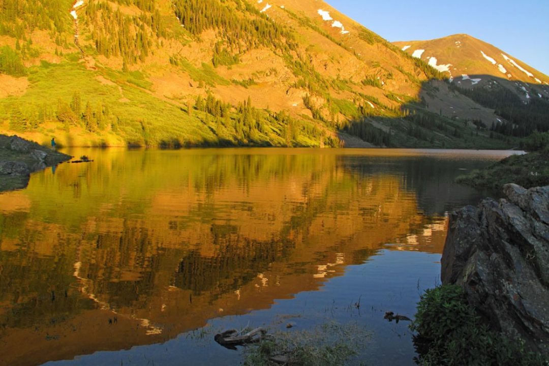
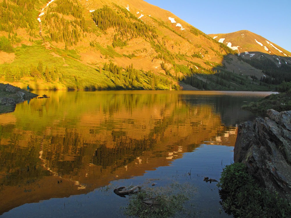
Mount Kreutzer is a relatively easy Class 2 summit, typical of the Sawatch Range and accessible by passenger vehicle from Tincup, CO, on graded dirt roads and a short, 3-mile drive on a rougher dirt road. We have sequenced Kreutzer with Chalk Rock Mountain (13,055) and an unnamed 12er (12,730) located close by that left little sense in bypassing. This combination makes an easy day hike that can get you back to your vehicle by early to mid-afternoon. The nearby Mirror Lake is a beautiful and scenic mountain lake that's worth the side trip. Lidar measurements increased elevation from 13,095 to 13,122 ft.
Mt. Kreutzer West Ridge Route
-
-
Garden Basin Trailhead
From Gunnison, drive north on CO135 to Almont. Turn right (east) onto CR742 for Taylor Park Reservoir. The road winds up canyon for what seems like a long time (about 20 miles) to the reservoir. Along the way, it passes several Forest Service campgrounds, none of which are very large. In order from Almont, these are: Taylor Canyon, One Mile, North Bank and Rosy Lane - all within a couple miles of each other, followed by Lodgepole, Cold Spring, Lottis Creek and Lake View on the south side of the reservoir.
At the SE end of the reservoir where there's a couple stores and a number of cabins, veer right onto FR765 for Tincup. The road changes from paved to good quality gravel all the way into Tincup. In the middle of town, turn left (east) onto FR 267. The road becomes rockier and dusty from traffic, but when we last visited, most passenger cars could make it to the Mirror Lake area. At 3 miles from Tincup, there's a turnout on the left (north) side of the road. A short road loops through this turnout and there's a toilet there. This is the trailhead parking.
An alternate route that may prove a little shorter if coming from Monarch Pass toward Gunnison: Turn north from US50 at the little town of Parlin which is about 11miles east of Gunnison onto CR76. Follow this paved road NE to the little village of Ohio and continue on to Pitkin. The road turns to graded gravel here and remains in that condition as it continues north past the Quartz Creek CG and switchbacks to climb to the top of Cumberland Pass. On the north side of the pass, the road drops down on a series of switchbacks to the valley bottom and continues into Tincup. Once in Tincup, follow the directions above.
Camping
The closest camping to the trailhead is the small campground at Mirror Lake. The campground is about a half mile past the trailhead, continuing to Mirror Lake or 3.5 miles from Tincup. The last few yards up the road are steeper and rougher. There are ten sites here that cost $12 per day and there is one vault toilet and no water supply. The lake is within a short walk (under 5 minutes) of the campsites. This is a very popular area, especially on summer weekends, so don't plan on the first-come-first-served campsites being available. But, we would add that the year we visited here was over the 4th of July weekend and were very surprised to find two site open. We grabbed one and enjoyed a splendid evening. The only drawback was the myriad mosquitoes one may typically encounter this time of year around a large body of water.
For other national Forest campgrounds, see the list above in the driving directions. There is all kinds of at-large camping north of Taylor Park Reservoir.
Campsite Locations
Mirror Lake › N 38° 44' 51.60, W 106° 25' 54.83"11,000 ft. elevation
Click thumbnail to view full-size photo + captionRoute Description
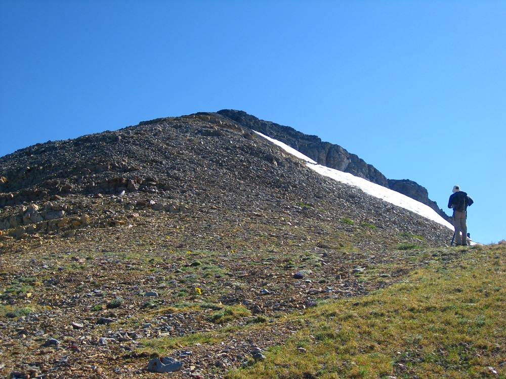
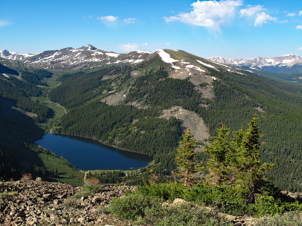
Year Climbed: 2011The Garden Basin Trail is also a part of the Continental Divide Trail. That trail is labelled as #414 on the FS map, but the original old road that starts up into this basin is 267.1AB. From the parking area follow the trail NW, which is really more of an ATV track, up for a mile to the creek crossing in Garden Basin. This is only about ¾ mile and 500 feet in elevation gain. Instead of crossing the creek, which would have required a brief wade, we decided to turn east and head up along the south side of the creek towards the upper basin. Initially, we hiked through forest with downed timber, but after a while, we broke out into a clearing and the bottom of a rubble pile. Instead of heading directly up the basin and the west face of Kreutzer, we elected to ascend SE, up through boulders and rubble to the west ridge of the peak intersecting it at about 12,200 ft. Once on this prominent ridge, enjoy a spectacular view of Mirror Lake far below and the valley of east Willow Creek that leads to Tincup Pass. You may intersect a cairn-marked trail coming up out of the forest below on the south face of the ridge, so perhaps there is an access from closer to the lake, but from the Mirror Lake CG, a hike up the south face of this west ridge looked dauntingly steep.
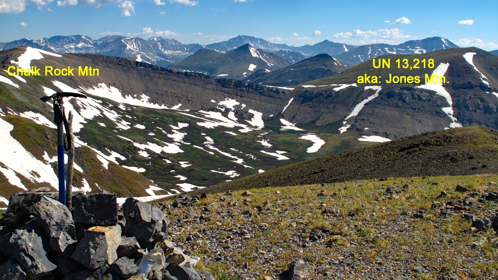
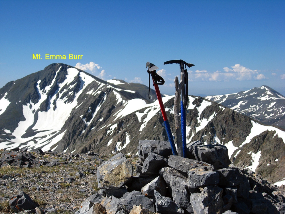
Once on the west ridge, continue hiking along the broad slope walking on mostly broken, medium-sized rubble with some intermittent tundra. The faint trail that had come from the south side of the ridge provided some guidance. Another 900 feet of gain will deliver you to the rocky summit area with a cairn. It took us about 2:20 from the trailhead. From this summit, there's a good view of Emma Burr to the south and Jones Mtn. to the NE. If you have not climbed Jones, you may want to consider heading over to it next, but this would require a 1,200 foot loss in elevation which you would have to regain and also finding passage through low to medium height willows in the upper Mineral Basin. We elected not to do this and continued north from here to Chalk Rock Mtn.
Additional BETA
Links to other information, routes & trip reports for this peak that may be helpful. -