#114 / 13,789' Rinker Peak

Peak Summary
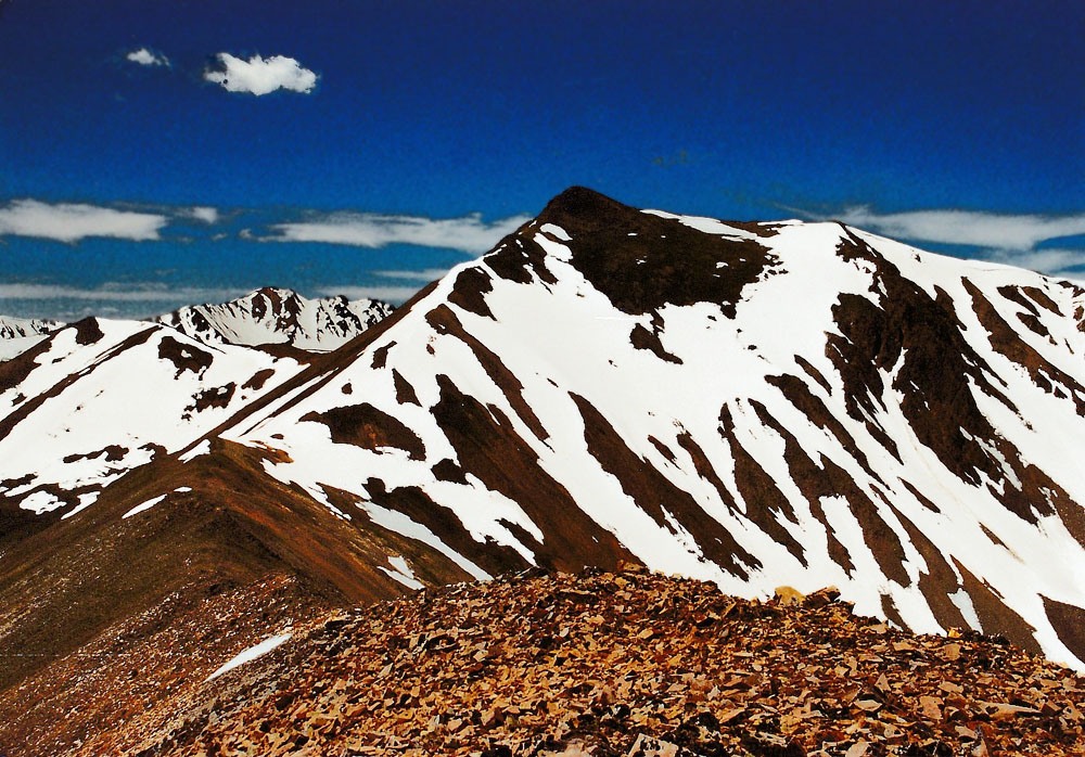
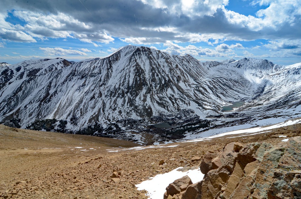
Rinker Peak is a moderate Class 2 ascent with a trailhead that is passenger car accessible. Much of the hike can be on trail, but there is also a ridge route that can be followed for more adventure and steeper ascending. This hike is basically kid-friendly if they can handle the fairly-substantial elevation gain. The summit provides expansive views of the Twin Lakes section of the Sawatch Range.
Rinker Peak NE Ridge/Willis Gulch Route
-
-
Willis Gulch/Lake TH
Access for the Willis Gulch TH is on SH 82 from either the east or west. On the east side, turn west onto SH 82 for Twin Lakes from US 24 between Leadville and Buena Vista. The trailhead is about 2.2 miles west of on the south (left) side of the road. The TH is marked for Willis Gulch. It's easiest to use the coordinates we provide which are below. The road you turn in on leads down to the Lake Fork and a newer bridge that crosses the river.
If approaching from the west, we're assuming hikers will be coming from/through Aspen. Take SH 82 east from Aspen all the way over Independence Pass. Drop on down the east side of the pass into the Lake Creek valley heading south, then east. From the turnoff for the Parry Peak Campground, drive another .65 mile. The turnoff for the trailhead will be on the right.
Camping
There are several Forest Service campgrounds in this area. West of the trailhead are the Twin Peaks CG and the Parry Peak CG. East of the TH and a little east of the village of Twin Lakes, there's the White Star CG on the south side of the highway and on the lake shore, and on the north side of SH82 is the Lake View CG. There's also Dexter Point, east of Twin Lakes Village. Dexter, Parry and Twin Peaks CG do not take reservations. White Star and Lake View do. The Twin Lakes area is one of the most popular weekend destinations so campgrounds fill up rapidly.
In addition to national forest campgrounds, there's also numerous at-large camping possibilities along the Lake Fork west of Twin Lakes. One of our favorite spots is called "Graham Gulch." See coordinates below.
Campsite Locations
Graham Gulch › N 39° 04' 54.99", W 106° 32' 21.86"10,500 ft. elevation
Click thumbnail to view full-size photo + captionRoute Description
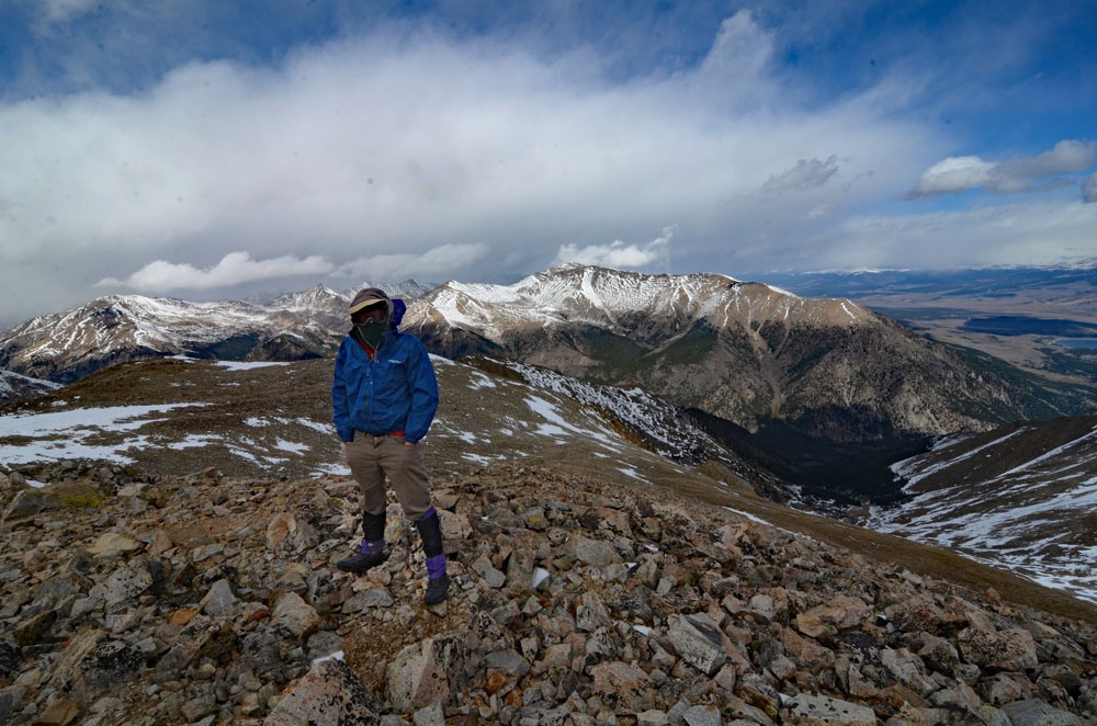
Year Climbed: 1993We have treated Rinker Peak as a "stand-alone" summit though there are some other 13ers in the area it could be paired up with. From SH82, north of the summit, there are two good possible routes to use. We actually went up one and down the other. Our ascent route followed the NE ridge of the peak for a somewhat difficult late-June hike, made slower by the fact that the snow had not yet melted out of the trees in the higher forest section of the ridge. This was a route suggested by G&M. Our return route was by Willis Gulch. At the end of this description, we'll provide additional directions on how to reach Willis Gulch from the trailhead.
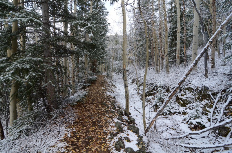
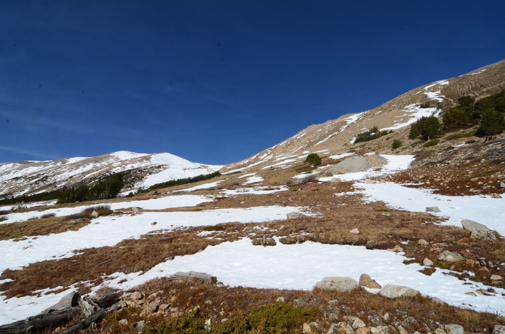
From the trailhead and the newer bridge that crosses the Lake Fork, walk south and across on the bridge and follow the main trail (ignoring several others) to some beaver ponds. Follow the trail east as it contours along the base of Twin Peaks NE ridge. In a little over a quarter mile, the trail forks - stay right on #1471 and begin an angling ascent ESE and intersect the Arlington Ditch, an abandoned diversion project. After intersecting the ditch, follow it a couple hundred yards then head south up the broad, forested, NE ridge of Twin Peaks. Bushwhacking now begins, in fact, if you find that beetle-kill has hit this area, this route may become almost impassable. For a while, it will not matter which side of the ridge you hike on, but farther up, the east side of the ridge is a little more open and the ascending through trees more tolerable. In 1993, from about 10,500 feet on up, we had snow to contend with.
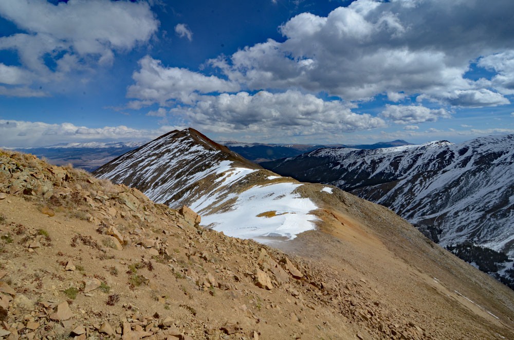
At 13,000 ft., the NE ridge converges with a more northerly ridge, above treeline. Continue walking SW on more level terrain now to the unranked summit of Twin Peaks. Continue hiking SW along the ridge crest over low tundra and mostly smaller scree-like rubble over Pt. 13,333 and then down to a saddle at 13,100 ft. Make the final 600 foot ascent to the summit of Rinker. This entire ridge route only had minor rock obstacles and in 1993, we found numerous patches of snow and some snow cornices. The mile-long distance from Pt. 13,333 to Rinker will visually seem a long distance, but goes quickly. If you find a snow cornice on the final ascent, it will likely be best to stay on the north side of the ridge and cornice lest you find yourself later trapped below the cornice.
For the descent, we walked back NE along the same ridge to the saddle between Rinker and Pt. 13,333. At the saddle, turn down to the east and descend the slope to all the way to Willis Gulch passing by the old mine and intercepting the Willis Gulch trail a little NE of a pond at 11,060 ft. The initial descent we made was on something of a minor ridge that was scree-covered and made for quick descending. Farther down, we entered a shallow gully filled with snow for an even quicker glissade. Once on the trail, there will be several avalanche runouts to cross and a large talus field of big boulders. After about 2 miles, the trail will intercept the Cache Creek Ditch - another diversion channel. Stay on the trail and in another .75 mile, it will intercept the Continental Divide/Colorado Trail descending from a pass between Mt. Hope & Quail Mtn. In another half mile, the trail intercepts the Willis Gulch Access Trail that is following the old Arlington aqueduct at this point. Bear left and follow the aqueduct trail for a few hundred yards before leaving the aqueduct and continuing down on the access trail back to the beaver ponds and the bridge across the Lake Fork. If you choose to climb Rinker via Willis Gulch, just reverse these directions.
Additional BETA
Links to other information, routes & trip reports for this peak that may be helpful. -