LoJ: #151 (Pre-LiDAR #153) / 13,697' Rolling Mountain
Peak Summary
Rolling Mountain is a good family-type hike in the South Mineral Creek drainage. The trailhead is accessible to 4WD. If you don't have access to 4WD, the overall walking mileage will be extended another 5 miles round trip. Done with 4WD, the hike is an average day hike that utilizes maintained trail for about half the distance. Expect to encounter typical trail conditions. Off trail expect willows, creek crossings, tundra and talus. The summit views are quite impressive with many of the Ice Lake Basin and Lake Hope peaks visible along with an excellent view into the upper portion of Cascade Creek. Lidar increased elevation from 13,693 to 13,697.
Rolling Mtn - via Rico-Silverton Trail Route
-
-
South Mineral Creek South Fork TH
Use this trailhead for: Rolling Mtn., The Twin Sisters, V.9, V.10, and as a secondary access to V.8 and Beattie.
From the Town of Silverton and the US 550 intersection on the west side of town, drive north on US 550 and in a little over 2 miles turn west onto FR585. If coming from Ouray, drive south on US 550 over Red Mountain Pass and watch for the FR585 turnoff on your right before reaching Silverton. Drive west on this graded dirt road to the campground and trailhead parking appx. 4.7 miles in. The last mile of road gets a little rougher but should still be navigable by passenger cars.
When you reach the campground, there will be trailhead parking on the right for the trail that accesses Ice Lake Basin and the Island Lake area. On the left will be the entrance to the CG. To continue to the South Fork of Mineral Creek TH, do not turn into the campground. Just continue straight and the road will bend to the left and will continue in a SW direction gaining elevation above the campground. The road will quickly change over to much rougher. This is where we recommend the 4WD. We have seen this road in better shape but it does receive a lot of day use during the summer months and that contributes to the wear and tear. This is FR585 on the San Juan NF map and Trails Illustrated. It usually has not been too rough or slow. Soon after exiting the trees, the road cuts across the open flank of Fuller Peak and the high tundra ridge that divides this drainage from Ice Lake Basin. Continue to the coordinates provided which will be just below the Bandora Mine and where the road divides. The right fork is closed but there's room for a couple vehicles to park. If there's no room, you may have to take the left fork down a bit to find a parking spot. Use this location if planning on doing V.9, V.8, Beattie or even V.10 (a very long haul form here.) Elevation is 10,700 ft.
If you're wanting to do Rolling Mountain or the Twin Sisters, drive on down the left fork, cross some mud puddles and make a low water crossing of the main creek The road cuts through a swath of willows then comes to an end in a beautiful meadow (or what was if beetle kill got into here). The Rico-Silverton Trail begins here. The coordinates are: n 37° 46' 49.53" W 107° 48' 10.72". There are some good campsites right here. Elevation is 10,685 ft.
Camping
All along FR585, once you turn off US550, there are numerous at-large, primitive sites. Upon turning off US 550 and driving less than a mile, there's a large open area on the left with a vault toilet. There are usually a large number of RV's here. There is also the South Mineral Creek Campground and before arriving at the campground, you will see a number of other camp spots. Expect fierce competition on summer weekends for sites. This is a very popular area. There is no "allowed" camping at the trail head parking area.
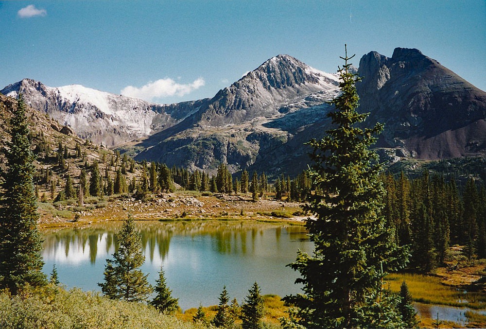
Directions for South Mineral CG per San Juan NF: South Mineral Campground is accessed by turning off U.S. Highway 550, about 3 miles west of Silverton, onto Forest Rd. 585, which heads west along South Mineral Creek. The campground is 4 miles off the highway and has 26 mostly level sites. Several camping loops and well-spaced sites are mostly shaded, but some are sunny. A few are next to the creek, and some have large parking areas. The Ice Lake Basin Trail, a strenuous, steep, and popular hike, begins across the road from the campground. It leads up above timberline to high alpine lakes surrounded by meadows of wildflowers and rocky peaks. South Mineral Campground does not take reservations. All sites are first come first served. There are an assortment of designated areas along South Mineral Road where dispersed camping is allowed so there is plenty of camping in the canyon on all but the busiest days.
Picnic tables, composting vault toilets, fire grates, trash disposal, potable water. No electricity. Operated by concessionaire. The campground has 26 sites that are mostly level, at 9,800 feet. Some sites are handicapped accessible. Several camping loops and well-spaced sites offer plenty of privacy. Spruce and fir give lots of shade, but there are some sunny sites. A few sites are along the creek, and some have large parking areas.
Dispersed camping along Forest Rd. 585 is allowed only in designated camping areas. Please follow posted directions and instructions.
Campsite Locations
South Mineral CG › N 37° 48' 22.08", W 107° 46' 27.25"Elevation 9,855
Click thumbnail to view full-size photo + captionRoute Description
Year Climbed: 1994From wherever you may park up the South Fork of Mineral Creek, (hopefully in the open meadow that we use for the trailhead at about 10,680 ft.), hike south on the Rico-Silverton trail #507 . Be aware that the 1955 USGS map and the Trails Illustrated #141 do not show an adjustment that has been made to this trail. The trail now crosses to the west side of the unnamed creek at a lower elevation that previously shown., perhaps a third of a mile earlier.
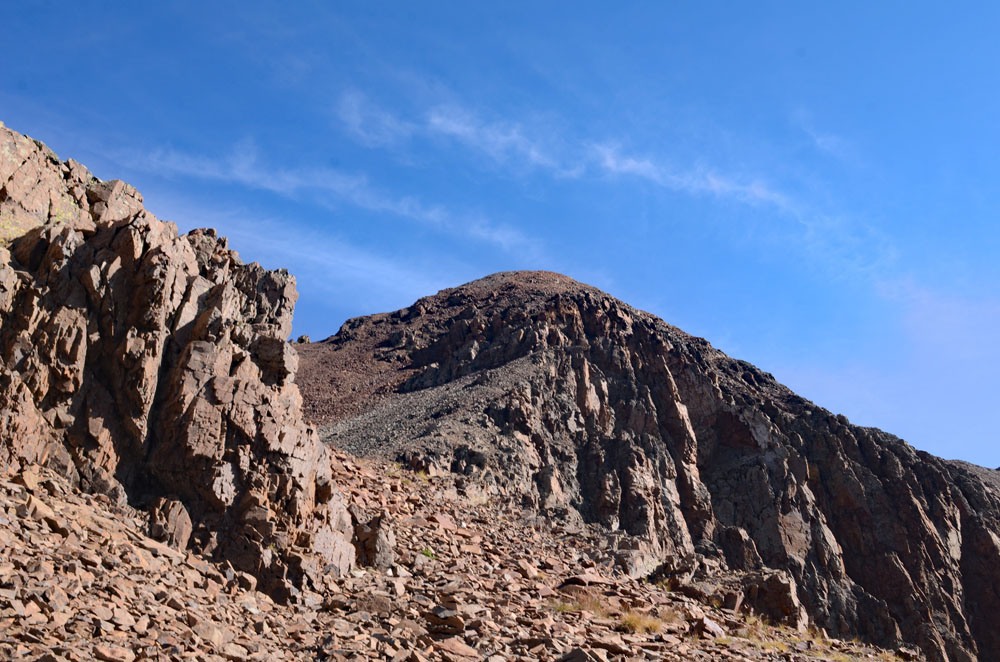
Initially the trail crosses the creek on what use to be a a well-worn log, which may or may not be there any longer. For the next 400 vertical feet in elevation, the trail heads up among the evergreens. In 1994, what we found was the trail veered down to the right after that initial elevation gain, crosses the creek, at about 10,880 ft., then immediately climbs again on a set of switchbacks, breaking out into the edge of a meadow called "South Park" on the USGS map. For a while, the trail moderated as it cut through the meadow on the west side. After the meadow the trail climbs taking a higher path than originally shown as it pushes through willows. From this section, you can look directly up the ENE bowl of Rolling Mtn. and find going up that way an enticing possibility. We chose to continue south some more. It would be steeper than our route here, would have some bushwhacking through willows and difficult rock toward the summit.
We continued on until we came to a crossing of the main west fork of the unnamed creek. There are some nice falls and pools here with the rocks lined with a whitish substance. After enjoying the waterfall and pools, head west up the valley toward the saddle south o the Rolling summit. This large, east-facing basin is filled with willows. From the creek crossing we found something of a trail that led up through the willows. Some times it would seem to play out only for us to find it again. As per G&M. we stayed o the south side of the creek to find easier going. After a few hundred feet of gain in a SW direction, we came to a small bench area that was out of the willows and well above the creek. We then began to work back toward the creek in a contouring fashion crossing tundra sections followed by areas of loose talus. We often found a trail crossing the talus. There's another nice waterfall up this west fork where the channel narrows. The creek eventually leaves its narrow channel to flow out from a bowl like area. Cross the creek here, then follow in the drainage before climbing out onto a steeper slope of loose, small rock at about 12,500 ft. Above this loose section, the angle of ascent lessens some and you'll be able to ascend on a more tundra-covered slope. The final section to the saddle had a path leading through some cliffs. Looking north, you'll be able to see a formidable deep cleft in the south face of the mountain.
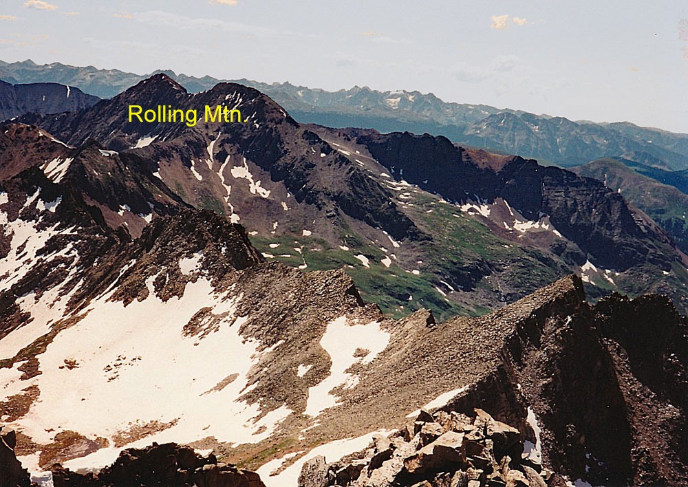
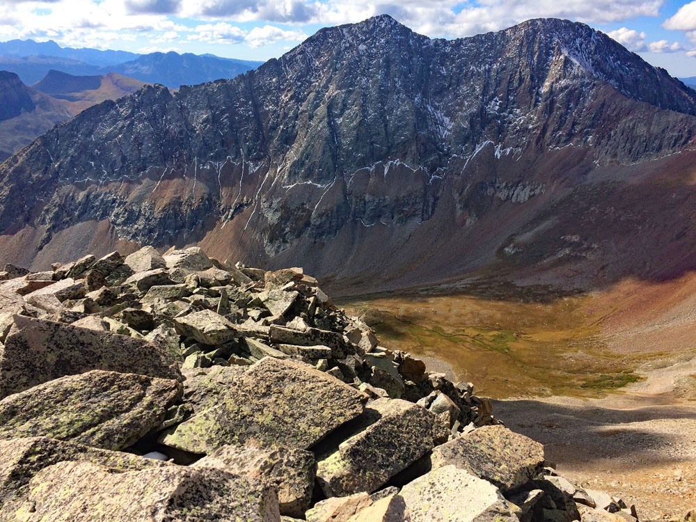
We came out on the south ridge a little above the saddle at about 12,260 ft. To the west lies a pleasant, isolated and inviting looking valley of tundra and farther below, clumps of trees and a small pond along Cascade Creek. From this location, you'll enjoy a nice view of Grizzly Peak B across the way and also be able to see a lot of the road that accesses Grizzly from out of the Durango Mountain Resort. From this point on, there will be no more tundra, but there should be a clear trail through all the talus which will makes things considerably easier. Instead of gong directly north up the ridge, we contoured over to the saddle between the two summits of Rolling, then finished the walk to the eastern and higher summit. From this summit view, you'll be able to see V.10 to the west and it may leave you scratching your head trying to figure out a route on it. This is not the best angle to view it from. It took our family about 2.5 hours to hike all the way to this summit from the trailhead. The summit offers an excellent view of the many peaks in this area.
For the descent, basically return as you came, but some sections of scree can expedite your progress if you're not intimidated by sections of small, loose scree on a steeper slope. Plunge-stepping can get you down quickly. If there is snow in the eastern basin, that too can expedite your progress down. An ice axe would be handy then.
Additional BETA
Links to other information, routes & trip reports for this peak that may be helpful. -