LoJ: #417 (Pre-LiDAR #418) / 13,278' Ruby Mountain

Peak Summary
Ruby Mountain is an easy Class 2 walk-up summit located up the Peru Creek drainage east of Keystone. The trailhead is accessible to higher clearance vehicles. This summit is very accessible to Front Range hikers & peakbaggers as a day hike, and the overall area offers several more 13er routes. Pre-Lidar elevation was 13,277 ft.
Ruby Mtn SSE Ridge/Flank Route
-
-
Peru Creek - Shoe Basin Mine TH
From the exit on I-70 for Silverthorne, (#205) head south on US HWY 6 (aka: Blue River Parkway). The highway north of the interstate becomes State Highway 9, but south of the interstate it's US 6. Drive south and east along US 6 to Keystone, passing several arms or bays of Lake Dillon. As you come to the Keystone Ski area, watch for a right hand exit/turn onto Montezuma Road. This will be the last turn possible, before the highway begins the climb to A-Basin and Loveland Pass. It's between mile markers 216 and 217. If coming from Loveland Pass and /or A-Basin, you will have to go past this exit, turn around at the first possible opportunity (Godola Road for Keystone), then drive back east to the exit. Measure distances from the stop sign once you exit. The Montezuma road goes briefly south, passing by some of the parking for the ski area, then heads east and follows along the Snake River. At about 4.3 miles from the turn off from US 6, watch for the road to make a sharper left, then right turn. At that right hand turn, make a left turn onto FR 260. This is the Peru Creek Road. There is a large staging/parking area here. Coordinates for the turnoff are: N 39° 35' 31.28" W 105° 52' 15.66". In 2021, we found this road in relatively good shape. There were no clearance issues, just a lot of shallow potholes to slow you down. In our opinion, many passenger vehicles could make it all the way up to the Cinnamon Gulch trailhead. Certainly, most modern SUV type vehicles, like Honda's, Subaru's etc. could make this drive. Along the first mile, there are a few camp spots, but many others have been closed by the Forest Service. This pattern continues all along Peru Creek. In 1.0 mile, the road crosses Peru Creek. At 1.5 miles, there is a good campsite on the right. At 1.6 miles is the Lewanee TH with limited parking on the right. At 1.8 miles is another primitive camping area. At 2.1 miles is the turnoff for Warden Gulch. The road makes a low-water crossing of Peru Creek. Immediately after crossing is a good, large camp area in some tall trees. There are also a couple other campsites a few tenths of a mile up the Warden Gulch road, before it becomes quite rough.
Continuing on the main Peru Creek road, at 2.2 miles is the turnoff for Chihuahua Gulch. The Chihuahua Gulch road starts out rough and narrow. We recommend only 4WD, short-bed vehicles go up this side road. There is some limited roadside parking where the road turns off and back just a short distance on a road that turns south and goes back down across Peru Creek. Coordinates are: N 39° 36' 01.55" W 105° 50' 17.15". 10,475 ft. This is where the route for Lewanee Peak begins. 4WD vehicles may continue up the road into Chihuahua Gulch. There are two places that afford some parking off the road. The first is at 11,170 ft: N 39° 37" 10.03" W 105° 50' 23.02". It may be possible to camp here and at some other primitive sites along this 4WD road. Further on is the end of any vehicle traffic at 11,240 ft: N 39° 37' 22.23" W 105° 50' 22.75". The one time we used this road, we found it to have some large potholes filled with rainwater. The following link is to a NF Service description of this 4WD road up Chihuahua Gulch: https://www.fs.usda.gov/recare...
Continuing on the main Peru Creek road, at 2.9 miles is another good campsite followed by yet another at 3.0. For Ruby Mountain, continue another .7 miles to the turnoff for Cinnamon Gulch and go straight at the intersection. If still looking for some camping, there is some good camping off this Cinnamon road after crossing Peru Creek and taking the first right. Moderately higher clearance vehicles can continue up the Cinnamon Gulch road which is in very good shape. Stay right at two other intersections. In the upper basin below Revenue Peak are some more campsites.
Again, back on the main Peru Creek road, after the turnoff for Cinnamon Gulch, the road deteriorates and becomes more rocky, but still, carefully driven SUV's with better clearance may be able to continue all the way to roads end near the parking area at the Shoe Basin Mine. This is the Ruby Mtn. trailhead. Shortly beyond here, the road is usually gated. The main coordinates posted for trailhead on this page are for this upper access to Ruby.
Camping
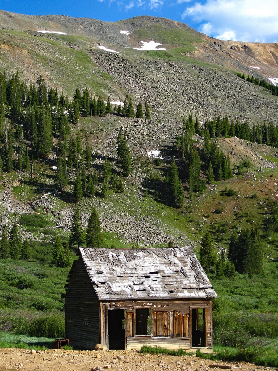
As you drive up the Peru Creek road, there are several primitive camping sites to choose from on generally National Forest land. You may also be able to get away with a car camp at the parking area for the trailhead. However, there are a large number of old mining claims and private property in-holdings and cabins, so be respectful of any private property postings. There appears to be a good primitive campsite area where FR 263 turns off FR 260 to the south and immediately crosses Peru Creek. See coordinates below. If you need additional ideas about camping, try visiting this website: http://www.townofdillon.com/visit/camping-info. Most Front Range hikers will likely do this as a day hike.
Campsite Locations
Primitive camp › N 39° 36' 00.20", W 105° 50' 22.95"Elevation 10,440 ft.
Click thumbnail to view full-size photo + captionRoute Description
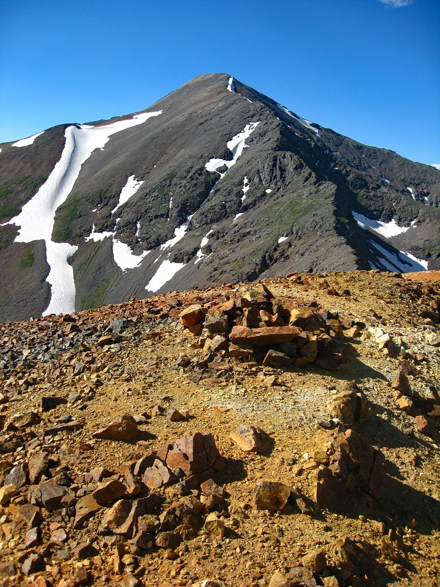
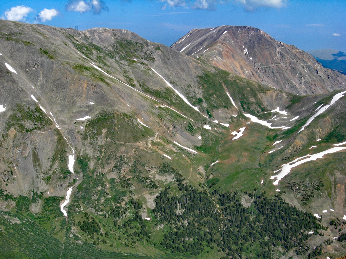
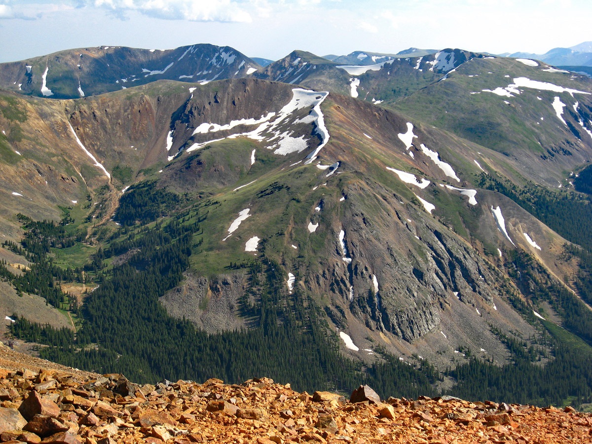
Year Climbed: 2008Ruby Mountain is really nothing more than the southern terminus of the long south ridge coming off Grays Peak. Since it happens to rise over 300 feet above a saddle along that ridge, it counts as a ranked 13er. While the upper portion of the south ridge coming off Ruby is more "ridge-like," the ridge gradually devolves into a wide, southern-facing flank. Much of this entire flank is tundra covered except the last few hundred feet near the top, where it is more of a ridge. Up there, we ran into a lot of loose chiprock. The hike up is moderately steep, but never difficult. From the parking area, we suggest heading in a somewhat westerly, uphill direction to find the easiest path through some willows. One possibility will be in a shallow, dry drainage. Once past the willows, begin a NW ascent more in earnest and staying close to the SE ridge-line. At the summit you can enjoy a great view of Lewanee to the west – and even study the route we propose for that peak if you've not already climbed it. Grays Peak looms what seems like a distance far above and you'll also have a bird’s eye view of the old Argentine Pass route. We completed this hike, round-trip in under four hours easily. We started in the later afternoon and enjoyed a sunset view from the summit, lingering there for a half hour. We easily negotiated the scree and then tundra back to the parking area in a short amount of time.
Additional BETA
Links to other information, routes & trip reports for this peak that may be helpful. -