LoJ: #436 (Pre-LiDAR #445) / 13,256' S 4

Peak Summary
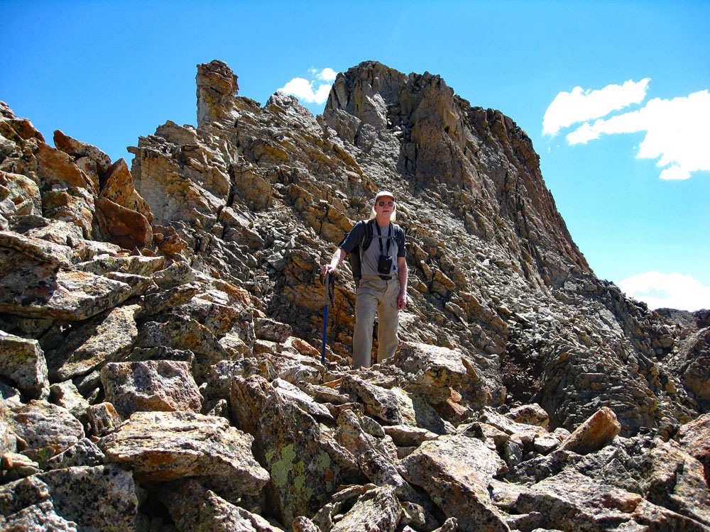
S.4 is a summit typical for this area - rough, rocky & rotten. The Blue Lakes trailhead on the north side of the Sneffels range makes this hike/climb easily accessible even to passenger vehicles. The hike up to Blue Lakes takes visitors into some outstanding scenery with an abundance of wildflowers. The climb, beyond the lower lake also accesses an area with an outstanding display of wildflowers and rugged mountains offering an impressive, photographic backdrop. The Class 3 ascent involves some talus scrambling followed by a brief ridge section with some modest 3rd class scrambling to finish the climb. Lidar increased the elevation of this peak from 13,242 to 13,256 ft.
S.4 South Face-W. Ridge Route
-
-
Blue Lakes TH - Mt. Sneffels
Click thumbnail to view full-size photo + caption
Measure from the intersection of US550 and CO62 on the east side of Ridgway, turn west onto CO62, drive across the bridge over the Uncompahgre River, continue through town and go up the hill and continue for about 5.5 miles total to the turnoff for County Road 7 which will be on the left (or south side of the highway). Drive appx. 9 miles on this road to the trailhead. The road follows East Fork of Dallas Creek. The road is graded gravel and suitable for most all passenger vehicles, though there will be some rough spots to take it more slowly. About 2.3 miles in on CR7, the road forks. Be sure to take the right fork to continue on CR7. Do not take CR7A. The drive in is very scenic with views of Mt. Sneffels and the range of peaks on either side of Sneffels. In the fall, when the aspen are turning, this is a local favorite for beautiful photography. Shortly before arriving at the trailhead, there is an open filed on the right (west) side of the road where there is some primitive camping opportunities if you find the trailhead too crowded, which is often the case on summer weekends. The trail not only provides access to the Blue Lakes, but is also a popular route for Mt. Sneffels. There are no designated campsites at the trailhead, but several open spots alongside the road become impromptu camps and many visitors will car-camp here. Don't expect privacy.
Camping
As mentioned above, there is an open meadow area shortly before arriving at the trailhead where there is room for a number of primitive campsites. See coordinates below. It will be on the west side of the road. Otherwise, there is no forest service campground nearby and the only other option is at the trailhead. Most of the land you'll be driving through to reach the trailhead is private.
Campsite Locations
East Dallas Camp Area › N 38° 02' 31.22", W 107° 48' 28.53"9,215 Ft. elevation
Click thumbnail to view full-size photo + captionRoute Description
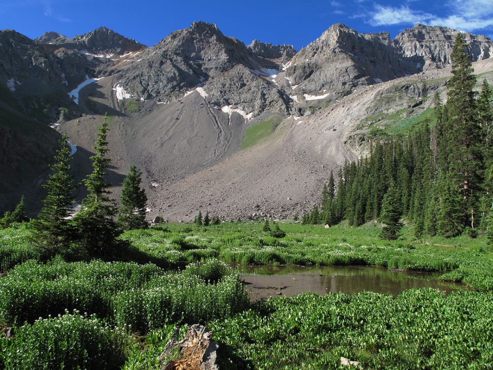
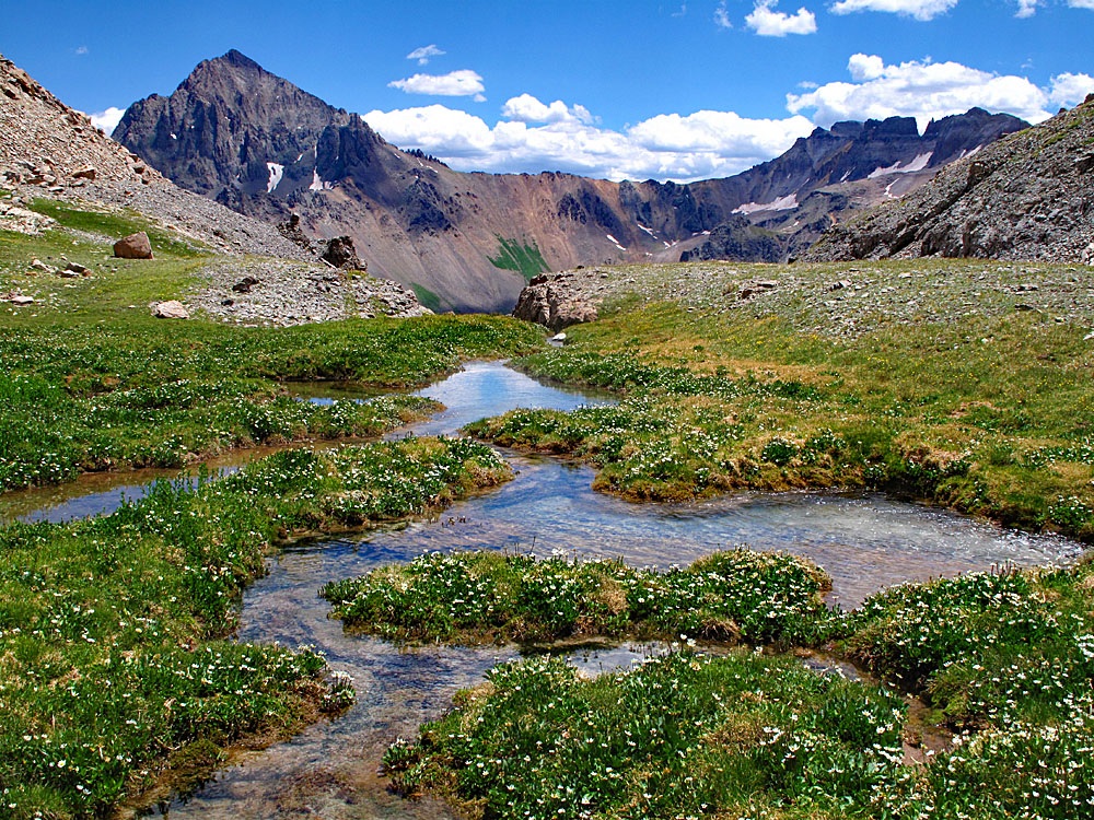
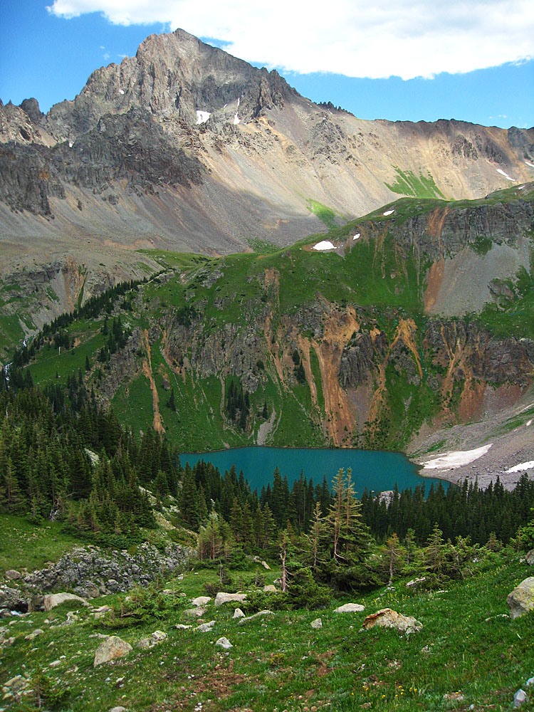
Year Climbed: 2010Begin by following the Blue Lakes Trail south. The trail heads up at a regular but not too steep rate of ascent through typical forest. Make sure you do not turn off to the left onto the trail into Blaine Basin, which will drop down to cross the creek, shortly after beginning this hike. As the Blue Lakes trail climbs, it veers west, away from the main drainage of the East Fork of Dallas Creek. At about 10,400 ft., the trail turns through the bottom of some avalanche slopes and opens up some as it climbs the last mile and a half to Blue Lake. For the last mile to the lower lake you should begin to encounter some nice flowers so stop for photos if you have the time, especially for a couple of clumps of columbine right off the trail on a switchback with a waterfall in the background. It takes about 3.5 miles of hiking to reach the lake, so well over an hour and a half. The lake itself has a beautiful color, somewhat turquoise. There will usually be more than one group camped there. Most of the attractive campsites are located on the northwest shore of the lake and over toward the west side. This location makes a good, short backpack to a beautiful campsite, however, many day-hikers visit here as well, so it won't have a strong "wilderness" feel.
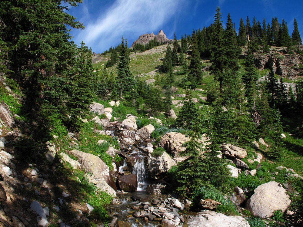
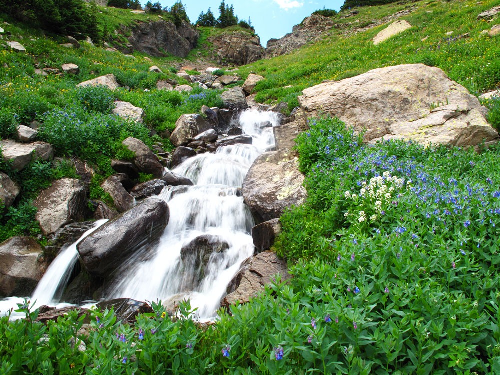
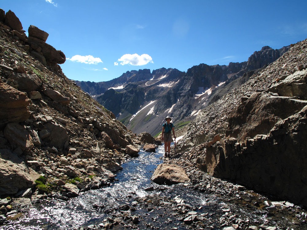
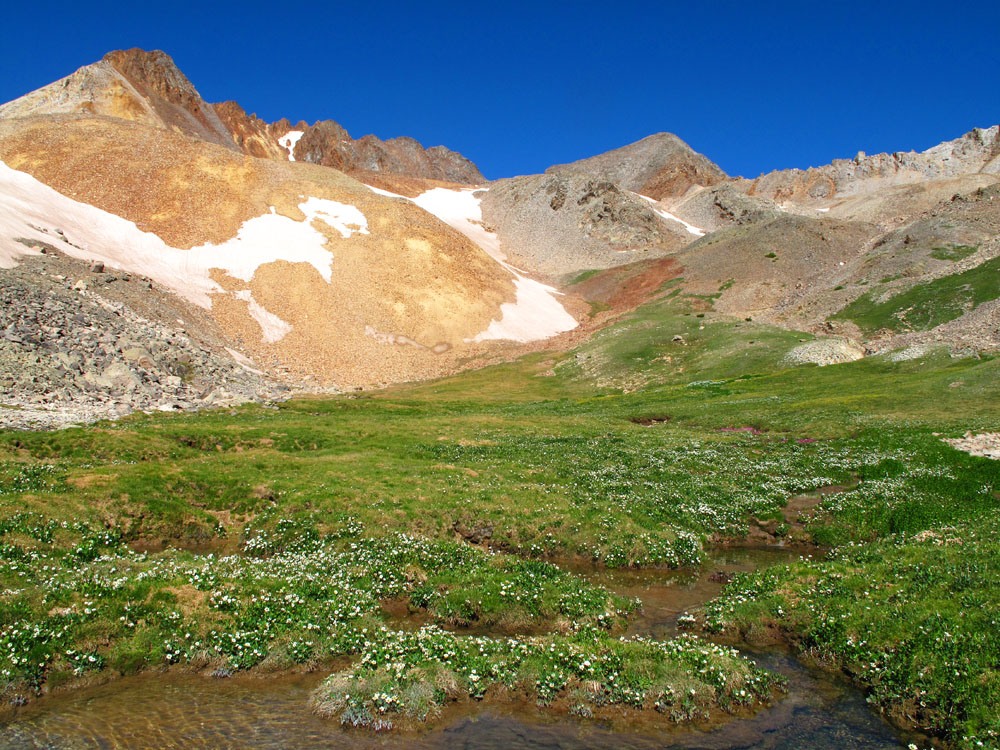
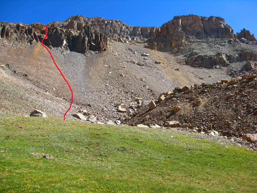
From the lake, walk along the western shore along several paths until you come to the creek that drains the basin south of S.4. Head steeply up through forest for a ways following a slight path that eventually plays out as you enter more open meadows above. After hiking up for some time through lush, flowering undergrowth and a beautiful cascading stream section, the creek will lead through a narrow, rocky section and then the drainage will open up into a broader basin with a flat bottom almost directly below and south of the summit of S.4. You may find yourself pausing all along the way for photos. This upper basin has some boldly colored rocks that even without trees and shrubs, lend themselves to colorful photos. There's some lush vegetation with an abundance of Parry's Primrose here along with Marsh Marigolds. From the well-watered, flat meadow area, look north for the "yellowish-orange" colored talus slope that leads up to the west ridge of S.4. One internet account we found indicated that “an orange colored couloir” would lead us up to the summit ridge, bringing us out a little west of the summit. This orange colored couloir is easy to spot. It is directly north of the flat meadow area. The couloir spills through cliffs and then fans out onto a talus slope. The lower fan section has some tundra so begin walking up that progressively steeper slope. As you enter the couloir section that leads between steep cliffs, the tundra will give way to rock and slope angle will steepen considerably. The footing will become very loose and you will struggle to make progress upward through all the loose rock. The best path is to stick close to the rock walls on either side so you have something to grab onto if needed.
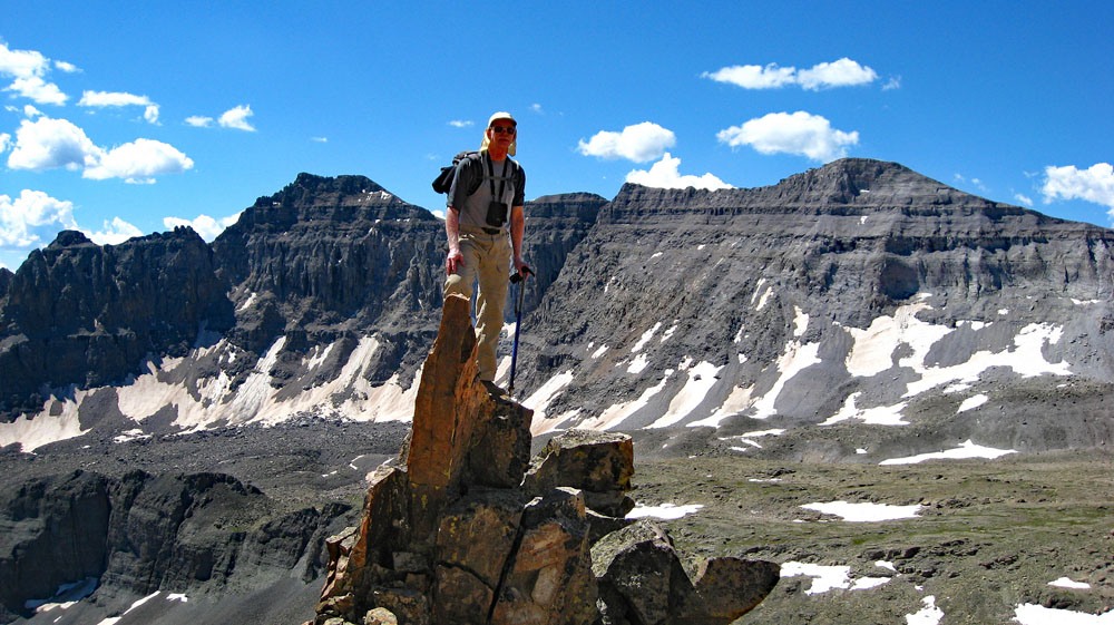
After about 600 vertical feet, you will intersect the western ridge of S.4. From here, even though the ridge is a rocky affair, you will see it's easily negotiated to the summit. There are some good photo ops here. A rock pinnacle about 8 – 10 feet high affords an opportunity for a unique photo with one of us atop it and with Dallas Peak and T.0 as a spectacular backdrop. Hike on up the ridge which requires nothing more than a little scrambling every now and then to the rocky summit. The view is outstanding and impressive. We were able to scan the entire headwall of this valley complex which is dominated by Dallas Peak. Mt. Sneffels towers above all else to the east. We could see the trail up and over Blue Lake Pass that drops into Yankee Boy Basin and we could even see hikers on it. We also spotted climbers on the summit of Sneffels. To our west, we could clearly see S.6, Mears and S.7. The connecting ridges looks impressive. Enjoy the impressive summit scene and then descend by simply following your ascent route back down. Watch your footing on the talus/scree descent back down the couloir. Take plenty of photos. Columbine and lupine abound in this location.
Additional BETA
Links to other information, routes & trip reports for this peak that may be helpful. -