LoJ: #508 (Pre-LiDAR #543) / 13,169' S 9
Peak Summary
S.9 is a Class 2 hike with a lengthy trail approach, followed by some sketchy trail and a steep scree ascent. The trailhead is near the Telluride Regional Airport and is accessible to most all types of passenger vehicles. The approach we suggest goes up the main fork of Deep Creek which leads into an upper basin that feels quite isolated. We have sequenced this summit with S.8, and S.10 (UN 13,020) can also be included, but our route for that summit comes in from north of the divide. Lidar added 35 feet of elevation to this summit.
S.9 13,134 South Ridge Route
-
-
Sheep Ck-Deep Ck Trailhead
From SH145 at "Society Junction," 4 miles west of Telluride, drive on 145 just a little east past the junction and turn left (north) onto "Airport Road." On Trails Illustrated #141, this road is labeled the "Last Dollar Road," #638. The Uncompahgre NF map labels it similarly. Follow the road uphill and around a sharp turn at the head of a drainage. The road continues west past the Aldasoro Ranch entrance. Bear right when the Airport Road turns off for the Telluride airport. Continue NW and in under a mile, park at the coordinates provided on the right in a trailhead parking lot with a small corral. The Uncompahgre NF map indicates that this is the beginning for trail #418.1B. There is some private property across from the trailhead parking.
Camping
As with all peaks in the Telluride area, camp sites are at a premium. Because of the private property close by, trying to car camp at the trailhead is not advisable and not allowed anyhow. The closest designated campgrounds are the "Town Park" on the east end of Telluride and the "Sunshine" CG south of Society Junction on SH145. (Good luck trying to find an open site.) For anything else, your best bets will be back west on SH145 near the Silver Pick Road turnoff (CR60M); and south on CR63L/J several miles past Illium.
-
From S 8
Click thumbnail to view full-size photo + caption
Open This Route in a New WindowThe best map we have found that indicates this trail is "Map of the Mountains of Silverton, Telluride and Ouray" by Drake Mountain maps; reprinted in 2002. The FS Topo 2016 also does a good job, but the multiplicity of trails around Sheep Creek can make things confusing. Please note that this report is from a 2007 trip. Once you head north up the main fork of Deep Creek, things may have changed substantially - especially 2019 avalanche damage.
Take the road to the Telluride airport and continue past the airport turnoff to park at the Deep Creek/Whipple trailhead at about 9,060 on the Gray Head quad. The trail makes a few switchbacks up the open hillside before intersecting an old irrigation ditch which it follows north to where it crosses Sheep Creek. The trail number is 418. After crossing Sheep Creek (a rather minor flow) the trail heads due west still following the ditch. You will come to an intersection where a sign indicates the turnoff for the "Whipple" trail and provides a mileage of 2 miles. This trail departs the ditch and heads downhill along the crest of a gambel oak covered ridge. After losing some elevation, it begins contouring north again and gradually drops to cross the main east fork of Deep Creek that drains the valley below Mears Peak. A log footbridge provides access across the creek. The trail then climbs uphill a little before continuing west. It then drops along an old roadbed before reaching a sign marking private property. At this point, the trail departs the roadbed and begins heading in a more northerly to NW direction and well above the main fork of Deep Creek on the east side.
Follow this trail north until it passes the wilderness boundary sign (so worn it can't be read) and finally crosses the main fork of Deep Creek to the west side and then climbs uphill. The trail will take you through an open, grassy meadow (passing two old signposts) and switchback up an open, aspen covered hillside to emerge onto a nice sloping meadow. A trail sign here indicates the junction of trail 418 (the Deep Creek trail) and 419 (the Whipple Mtn. trail). Head straight ahead from this sign and enter a forested area. (From this point on, the trail is fairly visible, but there are places farther up where it will become more difficult to follow. It is frequently marked by cairns though to help you get back on track.) The trail will cross a minor creek in the forest, come to a small open area and then begin a steep climb up a hillside where several shortcut trails head off to the right. Stay on the most used path which climbs up the hill, then switchbacks right to head back toward the bank of Deep Creek. The trail then contours north, staying well above the creek for a while before dropping down to cross it at a place where it is open and there is some visible flood damage.
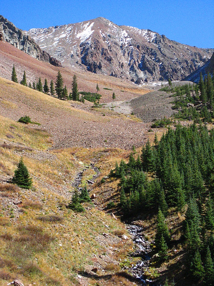
Cross the creek to the east side and continue north watching for cairns in the generally open terrain. The trail follows some rivulets coming down from the mountainside which probably represent the stream that shows on the map that flows off the western flank of Ruffner Mtn. After crossing these rivulets, the trail angles northeast and ascends through another forested area and a nice glade of low aspen. It emerges into another meadow area where two large cairns right across from each other and another cairn farther away indicate where the trail will climb steeply up the hillside and then into a deeply forested section, east of and well above Deep Creek by more than 100 feet. Continue up and stay away from the slope down to the creek. The trail gets a little sketchy in here, but just keep pressing on north and you will emerge from the forest and walk down toward the side creek coming in from the east that drains the basin between the west flank/ridge of Ruffner and the west ridge of S8. A cairn marks the crossing point of this creek. This area marks the end of the main trees in this valley. From here, you can either begin an ascent of S8 by going up the steep, grassy slope and ridge ahead, or you can continue on up the main drainage. The trail plays out or degenerates into a multitude of domestic sheep trails that climb uphill through tall grass.
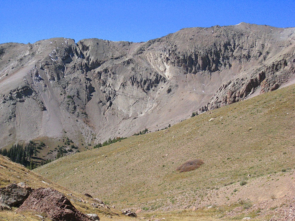
For the west ridge, hike up a moderately steep and grassy slope, passing through a small, rocky cliffband and work your way up on much steeper slopes toward the ridge, finally gaining it well along in elevation. The higher you hike, the more the ground cover deteriorates from grass and tundra to small, loose rock. Footing becomes increasingly difficult. The steepness of the ridge does not lessen for some time and you will continue to struggle until reaching the summit.
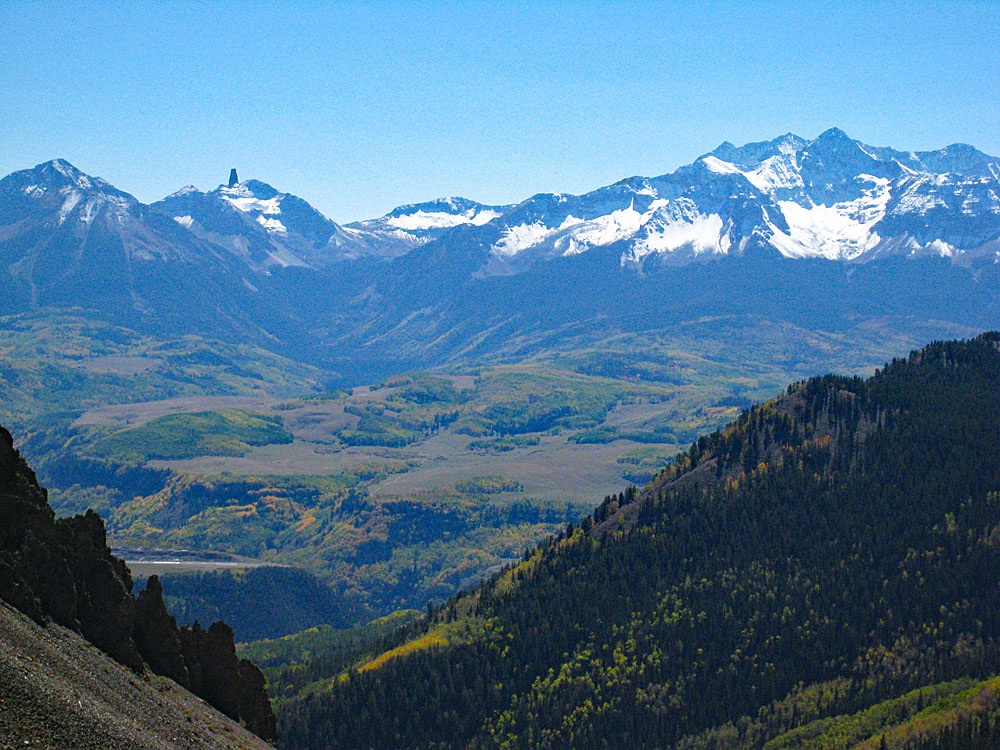
If you continue into the upper basin for access to S9, you will pass a nice grove of last trees and turn eastward toward another basin that lies west of and between S.8 and S.9. Take your pick as to which peak to ascend. We offer this warning: an ascent from here of either summit (S8 or S9) will involve a very difficult hike up small, loose scree of more than 1,000 feet in elevation. This is the kind of stuff that's "two-steps-forward, one-step back." We recommend going up the grassy slope mentioned before to the S.8 west ridge, but even this ridge is comprised of similar stuff. The view from this summit of the peaks to the east and the sheer cliffs and rocky faces is quite spectacular.
From S.8, return as you came or continue to S.9.
Click thumbnail to view full-size photo + captionRoute Description
Year Climbed: 2007S.9 (UN 13,134) is sequenced with S.8 (UN 13,252). One-way mileage and elevation gain are measured from the summit of S.8. Round-trip mileage and elevation gain assume completion of the sequence.
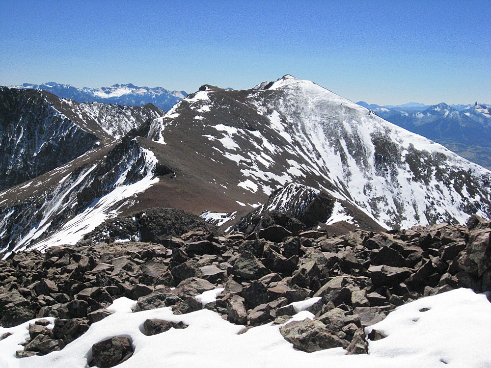
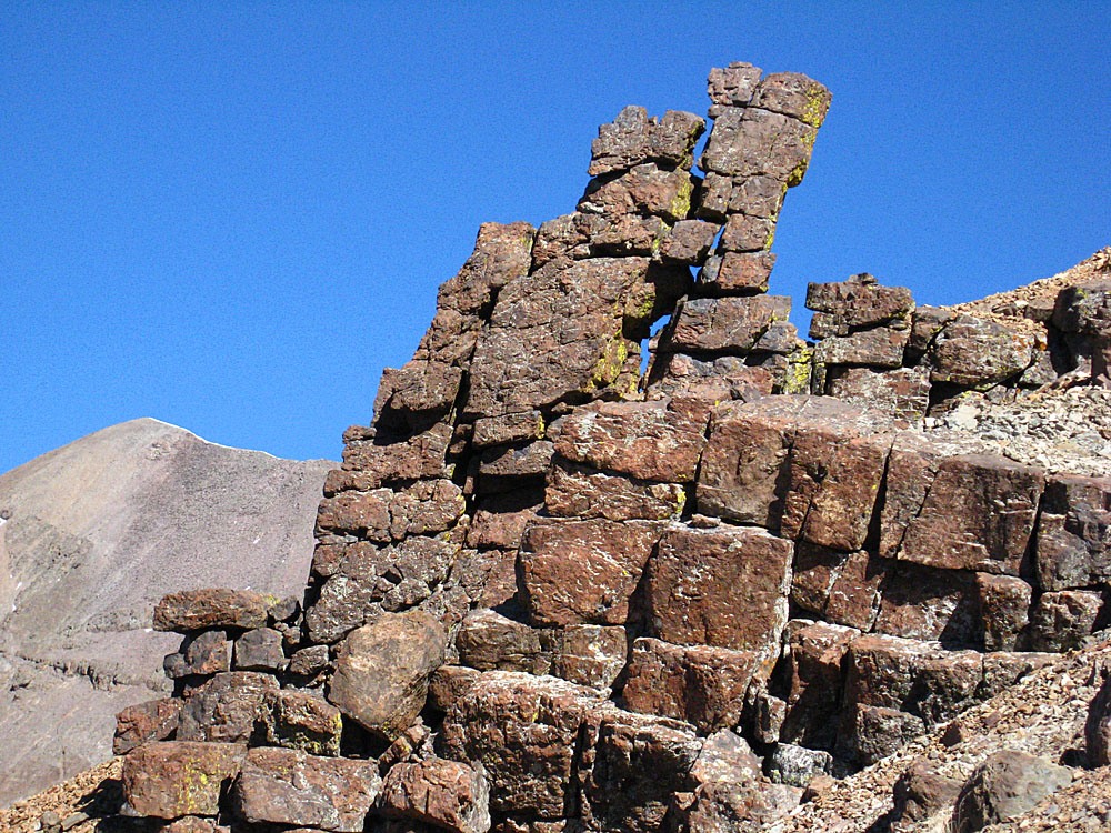
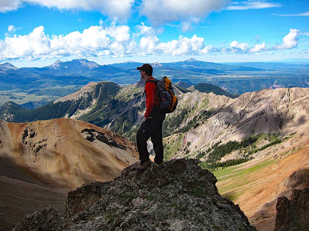
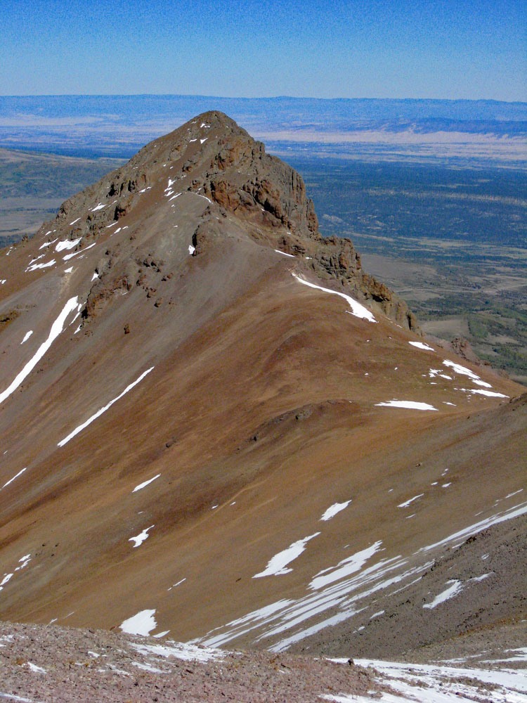
From the summit of S.8, head north following the ridge that connects over to S.9. The traverse will only require a drop of little more than 300 feet and then regaining about 350 ft. However, the summit block of S.9 holds a small surprise. It is guarded by rocky cliffbands and so you can enjoy a little entertainment as you scramble through and work your way up to the rocky little summit, coming up mainly from the southwest side.
Once atop this second summit of the day, your climbing work is done, (unless you continue on to S.10 which remains easily possible at Class 2) but many more hiking miles await. You may wish to take quite a few pictures, especially of the front side of the divide. For the trip back, once you have rested, descend the summit block by a similar route and then head southwest into a huge, rock filled slope that drops directly into the upper eastern drainage of Deep Creek. This small, very loose rock is relentless in its efforts to throw you off balance. We would certainly not recommend going up this way. It would be a two-steps-forward, one-step-back kind of ascent. So we were quite relieved to get off all that rock after making one small wrong turn.
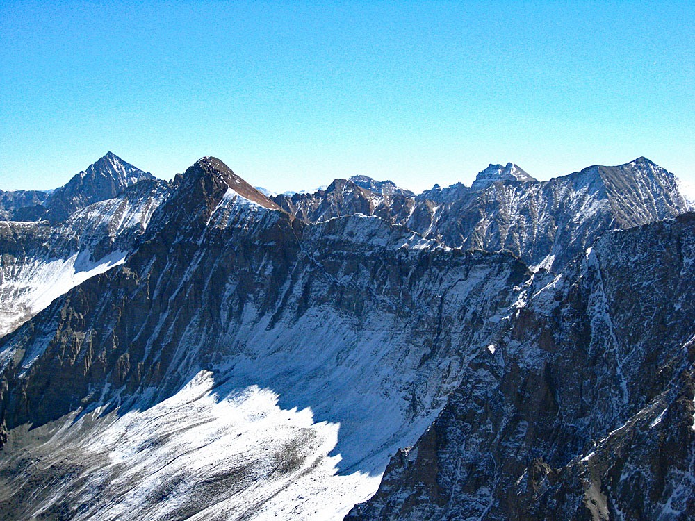
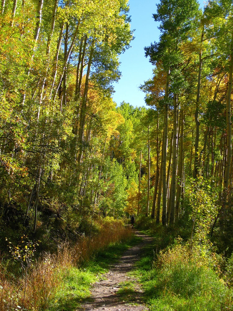
Once back down onto firmer ground, begin hiking back down the drainage to the west finding some faint trail activity, probably from game, and descending past a nice camp area in a small grove of last trees. In a short while and with not much difficulty you should return to the earlier creek crossing just before beginning the west ridge ascent of S.8 and pick up the trail you followed in along Deep Creek. From this point on, it is just a long hike back to the trailhead. At one point, we followed a wrong branch of the trail in an nice aspen bench area where we should have stayed on the upper trail. We lost a little time here, but eventually got back on the proper trail and continued the long hike out. Since we did this hike late September, we enjoyed the turning aspens and took more photos in the later afternoon sun. There are some great views of the Wilson group, Sheep Mountain, Sunshine and Lizard Head.
Additional BETA
Links to other information, routes & trip reports for this peak that may be helpful. -