LoJ: #125 (Pre-LiDAR #124) / 13,756' San Miguel Peak

Peak Summary
San Miguel Peak can be accessed from Telluride and Lizard Head Pass via the Lake Hope trail. The last two miles of the road to the TH may require a vehicle with higher clearance, but some of the crossovers may be able to make it to the TH if the road has been cared for recently. The peak is rated a Class 2+, the main difficulty lying along the summit ridge. It's a little difficult to stay on route and you could find yourself dealing with some 3rd class & a little exposure. This is a beautiful, colorful hike with abundant wildflowers in July.
San Miguel NE Ridge Route
-
-
Lake Hope TH
The following directions are provided from the National Forest Service: "From Telluride: Travel west on State Highway 145 for approximately 3 miles. Turn left at the first highway intersection, continuing south on State Hwy 145 for approximately10.1 miles. Turn left onto County Road 63A (signed as "Trout Lake"). Proceed on CR 63A for approximately 1.7 miles to Forest Service Road #627. Stay to the left on FSR #627 and continue for approximately 2.5 miles to the Hope Lake Trailhead. A high clearance vehicle is recommended for the last two miles of rough forest road that leads to the trailhead."
Our note: Measuring the distance to the trailhead on FSR #627 using the map program, we came up with 2.9 miles. The trailhead is located on a sharp switchback that will be turning back to the left.
The Forest Service site also offers this description of the trail to Lake Hope: "The Hope Lake Trail #410 begins at the Hope Lake Trailhead and ends at the forest boundary with the San Juan National Forest. This is a favorite hike for viewing wildflowers and is one of the most popular trails in the Telluride area. The trail begins to gently ascend through spruce-fir forests until it crosses rock slides and meadows filled with wildflowers. As it climbs, openings in the trees provide nice views of Trout Lake and the nearby mountain peaks. There is an elevation gain of about 800 feet in just 0.6 miles which gives way to alpine meadows where wildflowers often abound. To the east, spectacular Vermilion Peak rises 13,894 feet. As the trail tops a grassy slope between two rocky hills, Hope Lake will come into view. About 0.8 miles beyond the lake, the trail crosses into the San Juan National Forest where it continues for about a mile before intersecting with Forest Service Road #585 (South Mineral Creek Road)."
Camping
Trout Lake, where you turn off from the main highway to access the Lake Hope TH, is largely surrounded by private property so few at-large camping places exists. It has been a number of years since we have visited this area and back then, FSR #627 did not extend as far as it does now and the trailhead was found at a lower elevation. (See the old USGS map). It appears that there may be a couple spots along FSR #627 as you drive to the TH, but there is also clearly private property along this route as well, so be careful and respectful. There is a pullout just back down the road from the TH where one could perhaps car-camp overnight.
The nearest National Forest Campgrounds are: Matterhorn and Sunshine, north of Lizard Head Pass on the way in from Telluride; and Cayton on the south side of the pass toward Rico. In addition, there are two other trailhead turnouts/parking areas: one at the summit of Lizard Head Pass and the other south of the pass at the Cross Mountain TH. In general, the closer you get to Telluride, the more difficult it is to find a legal place to camp.
Campsite Locations
Matterhorn › N 37° 50' 49.19", W 107° 52' 57.49"Campground elevation 9470 ft. Well-developed campground with 28 campsites, hookups and even showers.Can be reserved.
Click thumbnail to view full-size photo + captionRoute Description
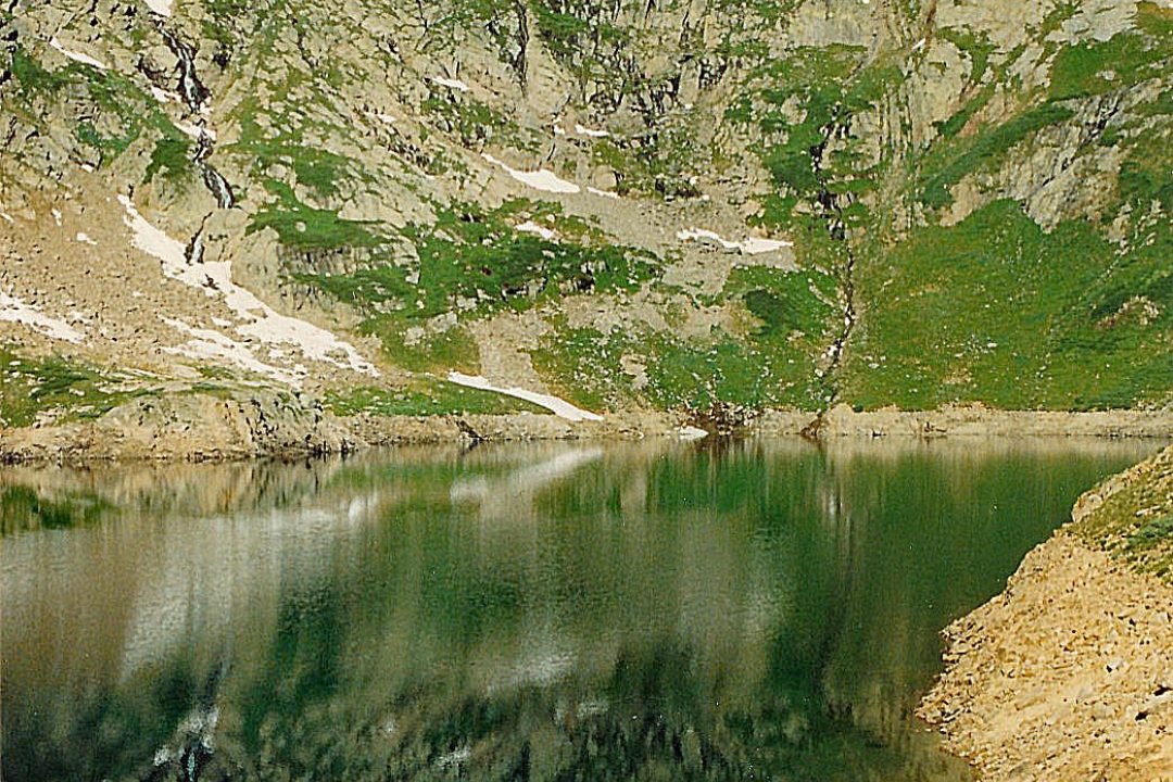
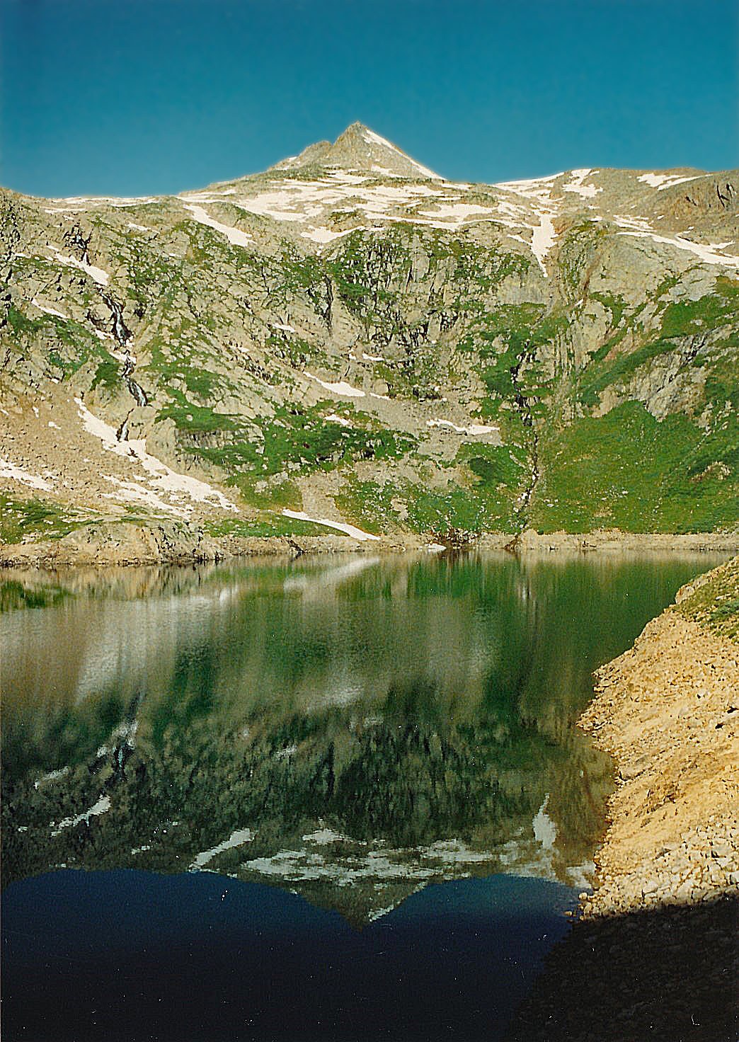
Year Climbed: 1992The official Forest Service TH now lies close to Poverty Gulch, so the trail now leads east initially, gaining a little elevation to cross Poverty Gulch. Once across, the trail loses a little elevation before gaining more steeply. As the trail steepens, it gains elevation on several switchbacks. As the trail nears the lake, you can continue on the trail until you have a beautiful lake view, but it's best to find a place to cross the creek below the lake outlet on its north side. From the lake, San Miguel appears as a rather nondescript summit that lies to the west and appears to be so small, you may not believe that is the summit you've come thus far to climb. It will take about an hour to reach the lake.
As mentioned before, cross below the lake outlet passing through a ravine and an old dam. Begin working uphill along a broad slope that extends south of the main NE ridge of the peak. We followed below and on the south side of that NE ridge heading generally WSW to finally gain and intersect the NE ridge at 13,100 ft. The terrain to this point was mostly tundra with embedded rocks and patches of snow still showing this July 31 - August 1 weekend. Once on the NE ridge, continue on increasingly rocky rubble to the false summit. The last 400 feet of elevation to the false summit will be entirely on rubble.
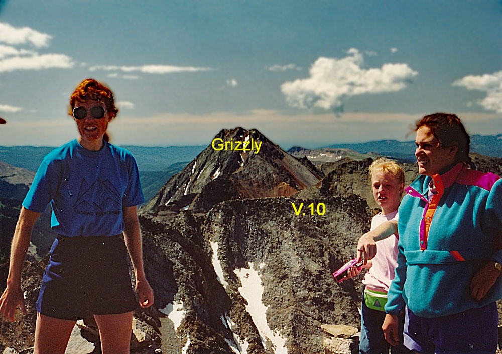
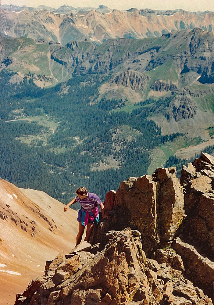
As you close in on the false summit, turn more to the west and follow the summit crest to the true summit. This is the more entertaining part. The entire distance is on large, fragmented boulders, many of which seem to be aligned vertically and will keep you hopping around looking for the best and easiest way across. Just before the summit is a large gash which requires a steep descent to the north side of the crest of about 100 feet. Once across the head of the couloir, which may still be snow-filled, ascend steeply up a gravely slope and back through more large boulders along the ridge crest again. You may need to cross to the south side of the crest, then regain the ridge farther on. As you reach the true summit, it will be separated from the main ridge by another smaller gash. On this final section, we had a friend with us who had a fear of heights and found herself somewhat intimidated, but eventually we coached her over. This summit ridge proved to be a challenge to our kids, ages 9 & 11, but they made it with the approval of proud parents.
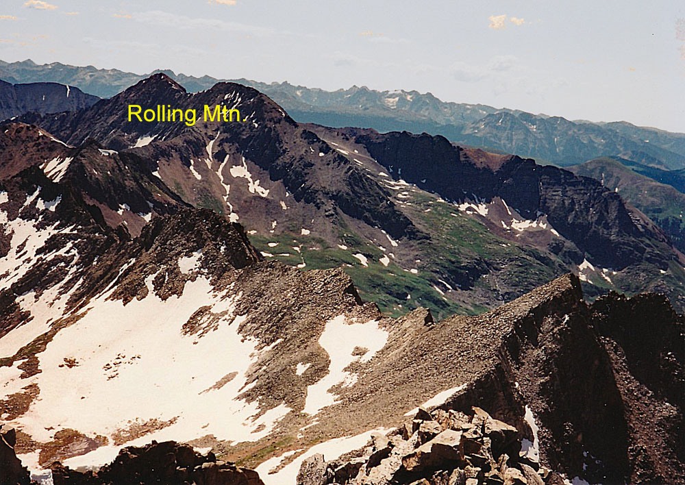
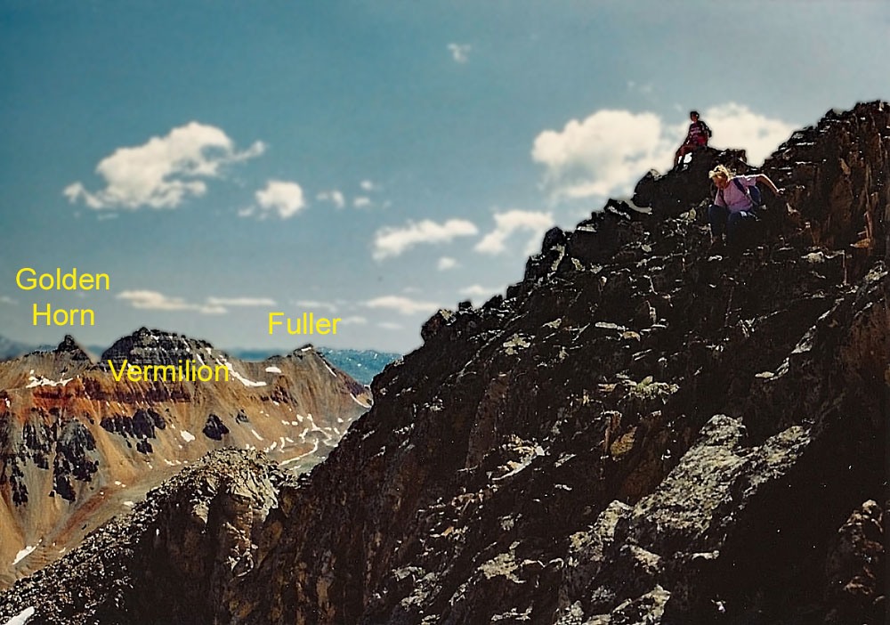
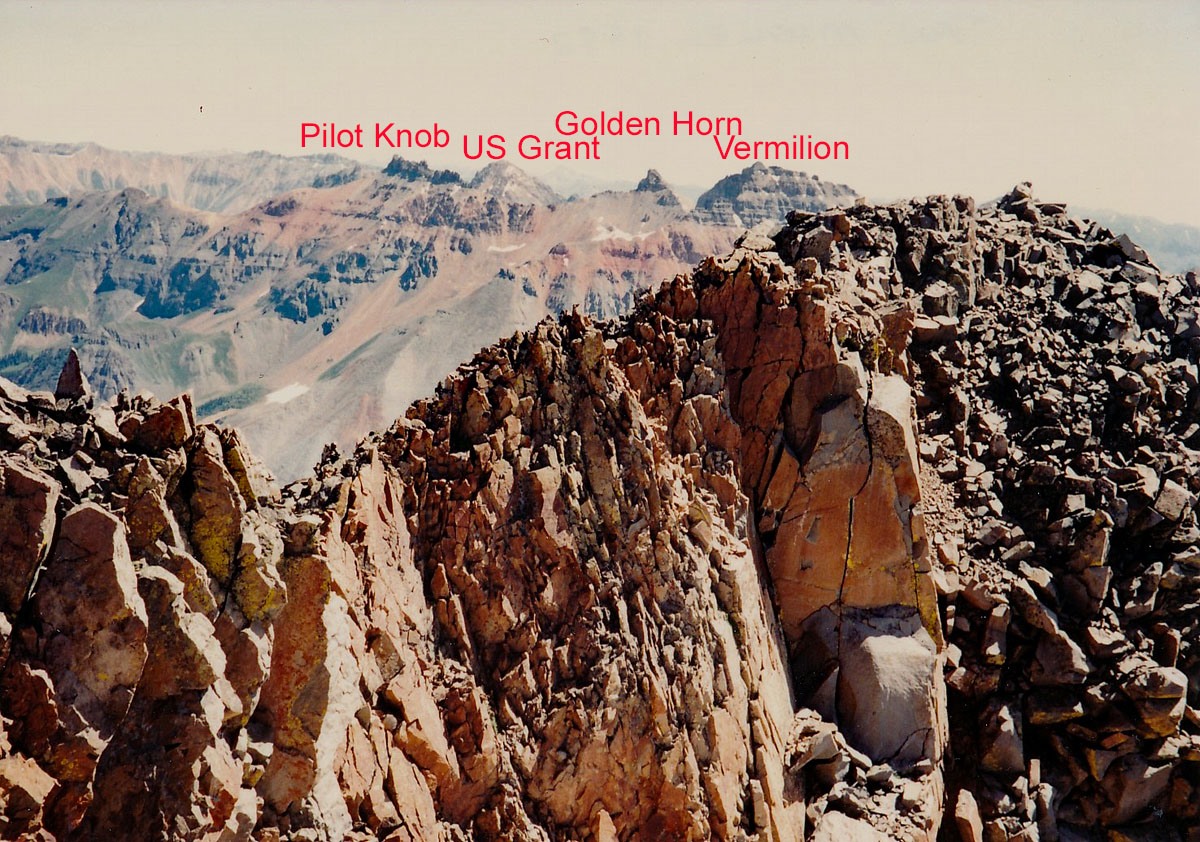
The summit affords little comfortable place to sit and eat lunch and enjoy the view. To the NE, you'll enjoy a spectacular view of Vermilion, Golden Horn & Pilot Knob. You'll also be able to view far down the valley of the Lake Fork Creek back toward Trout Lake & the many cabins & homes in the area.
Additional BETA
Links to other information, routes & trip reports for this peak that may be helpful. -